Via Flaminia – All the Way (Part 3)

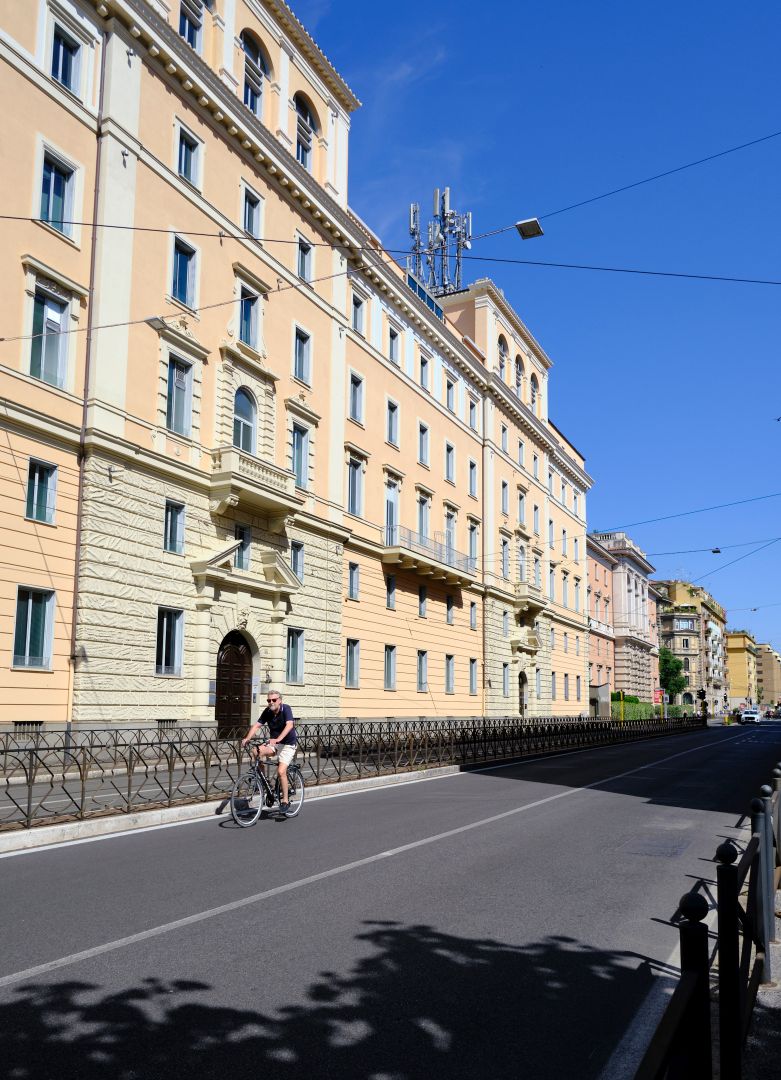
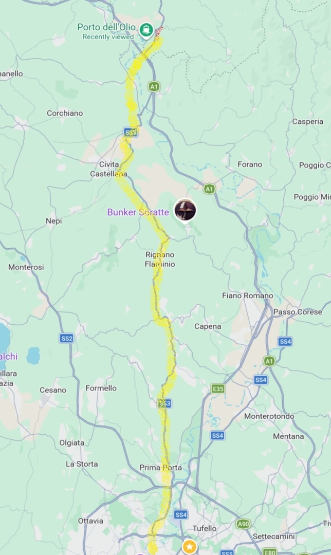
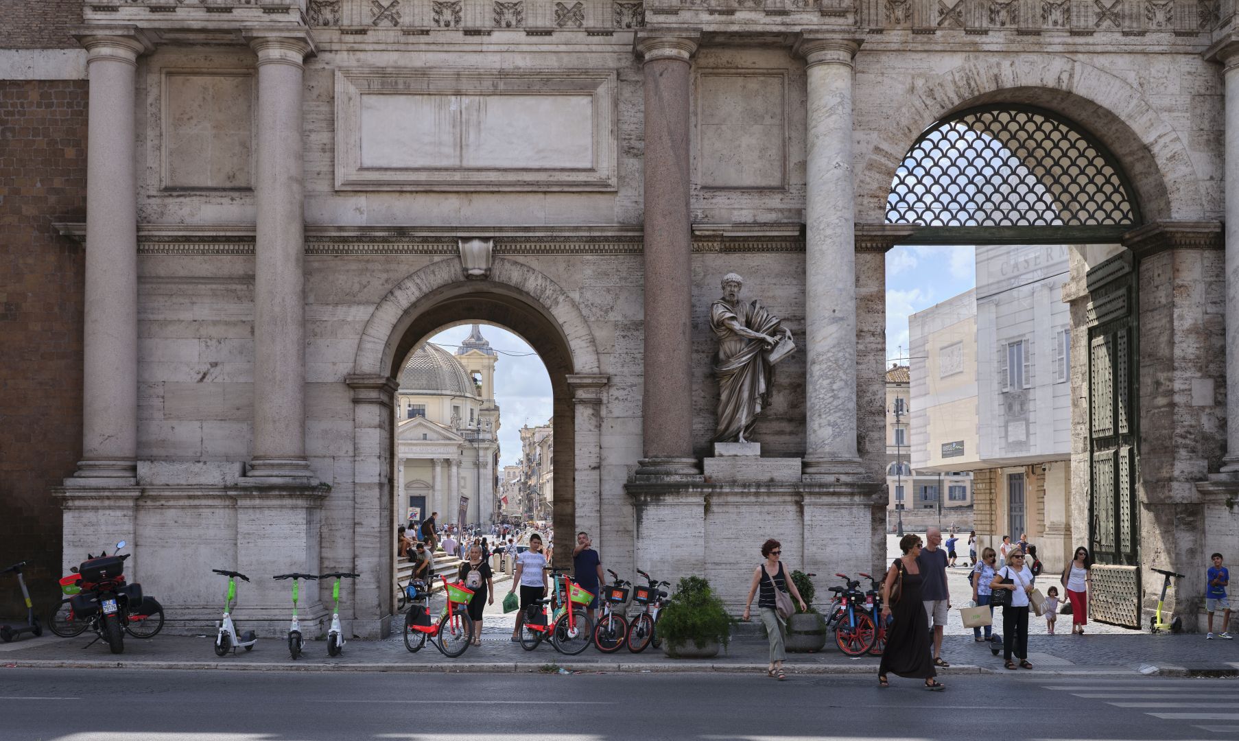
Welcome to the last of three articles following the ancient Roman road called the Via Flaminia from its start in Rome to its finish in Rimini. If a web search has led you directly to this article, I do recommend you read them in order. You can find the first one here, and the second one here.

The first article discussed the origins of the Roman military roads called “consular roads”, and followed the Via Flaminia from its start in Rome, as far as the ancient town of Carsulae in Umbria.

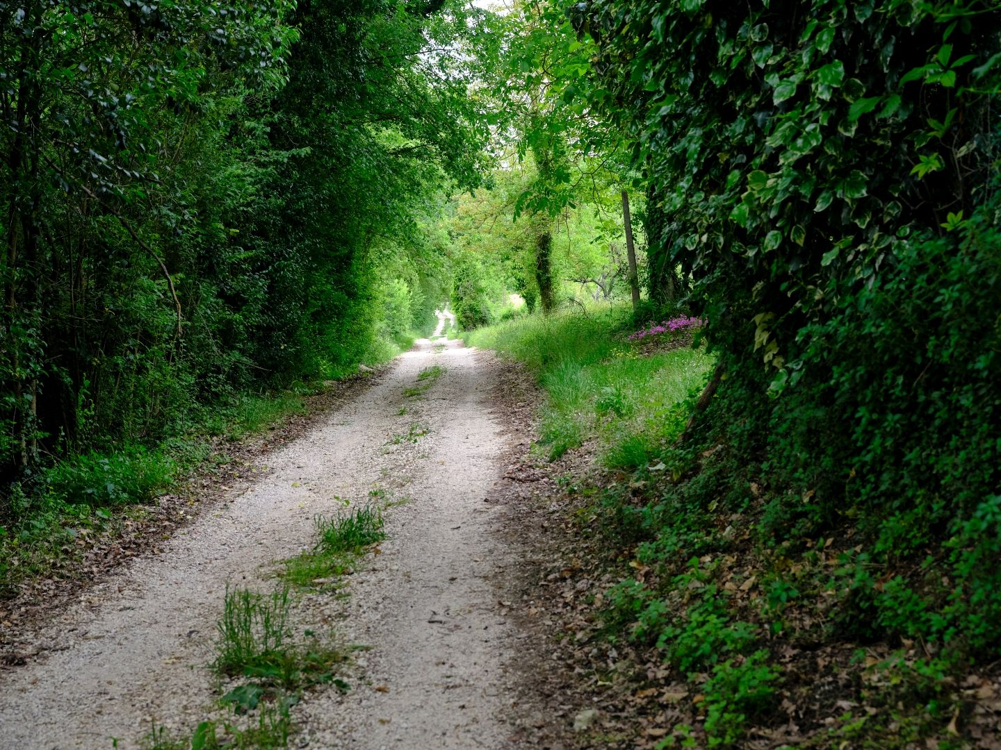
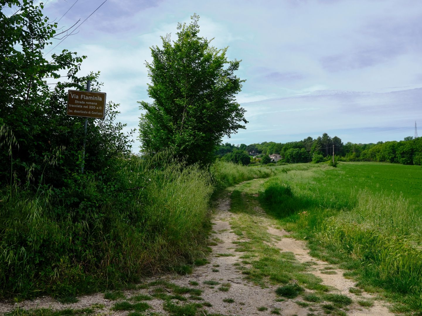
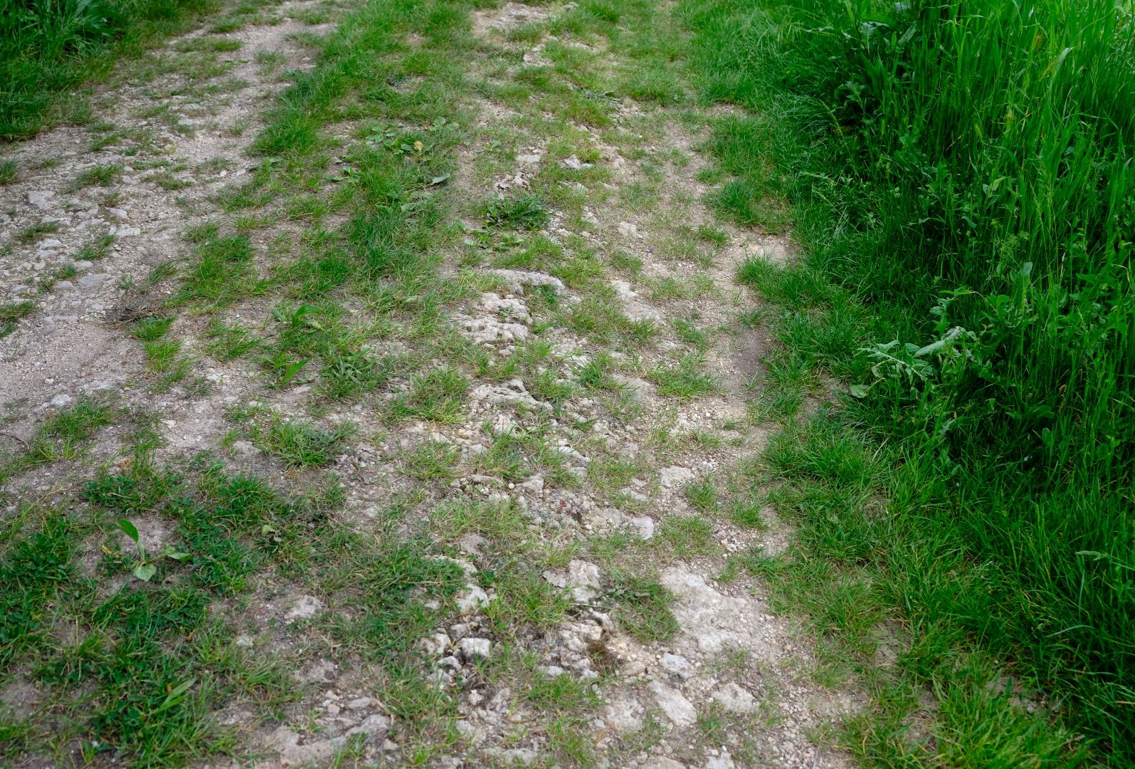
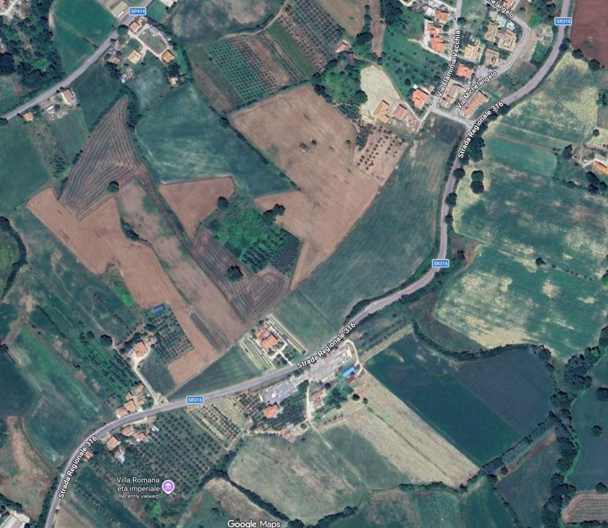
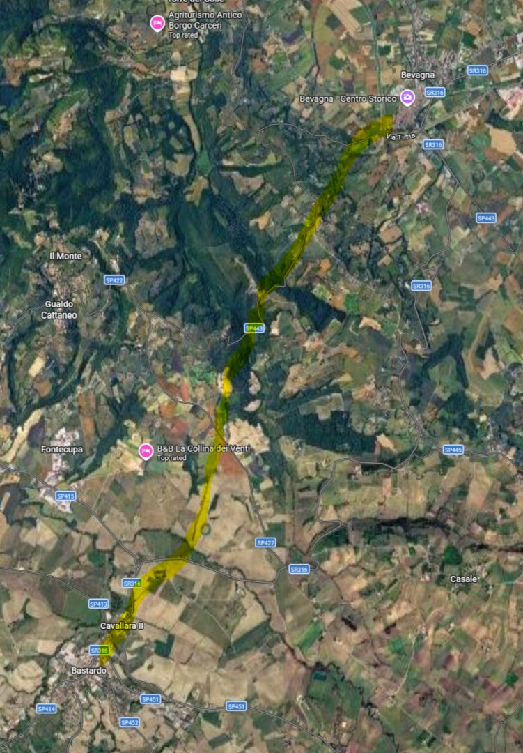
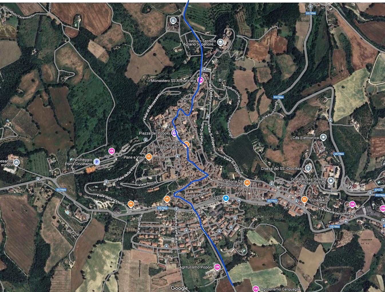
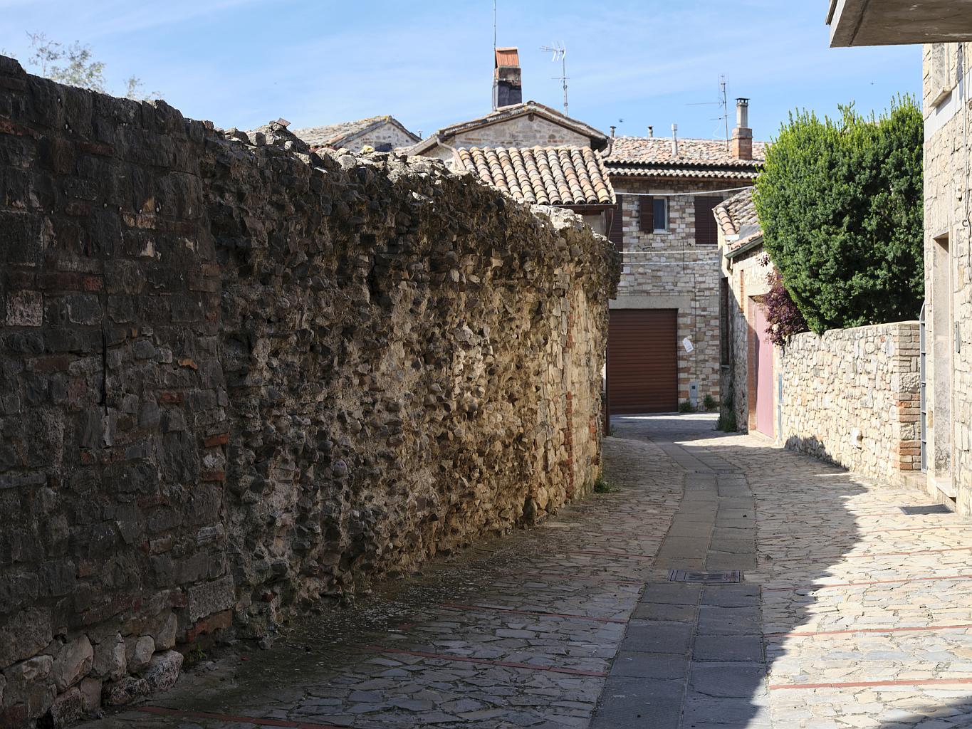
The second started with a discussion of how the roads were built, and what that means when one is looking for remnants. It then continued with a detailed itinerary through Umbria, including a walk along one of the sections, and a look at the town of Bevagna (ancient Mevania) where the Via Flaminia is the main street. On the way I had some fun using Google Maps satellite imagery to try and find traces of the road that are not obvious at ground level.

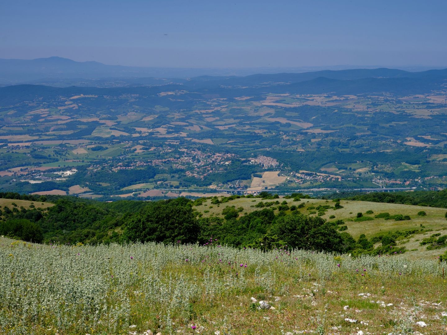
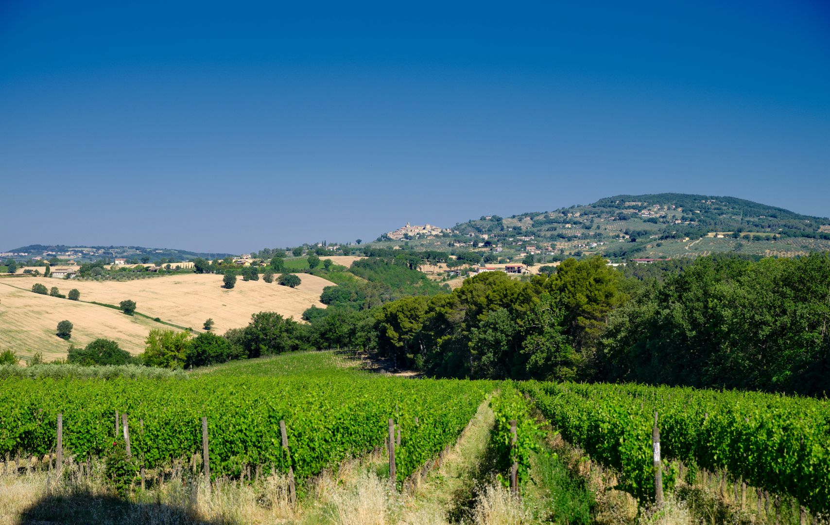
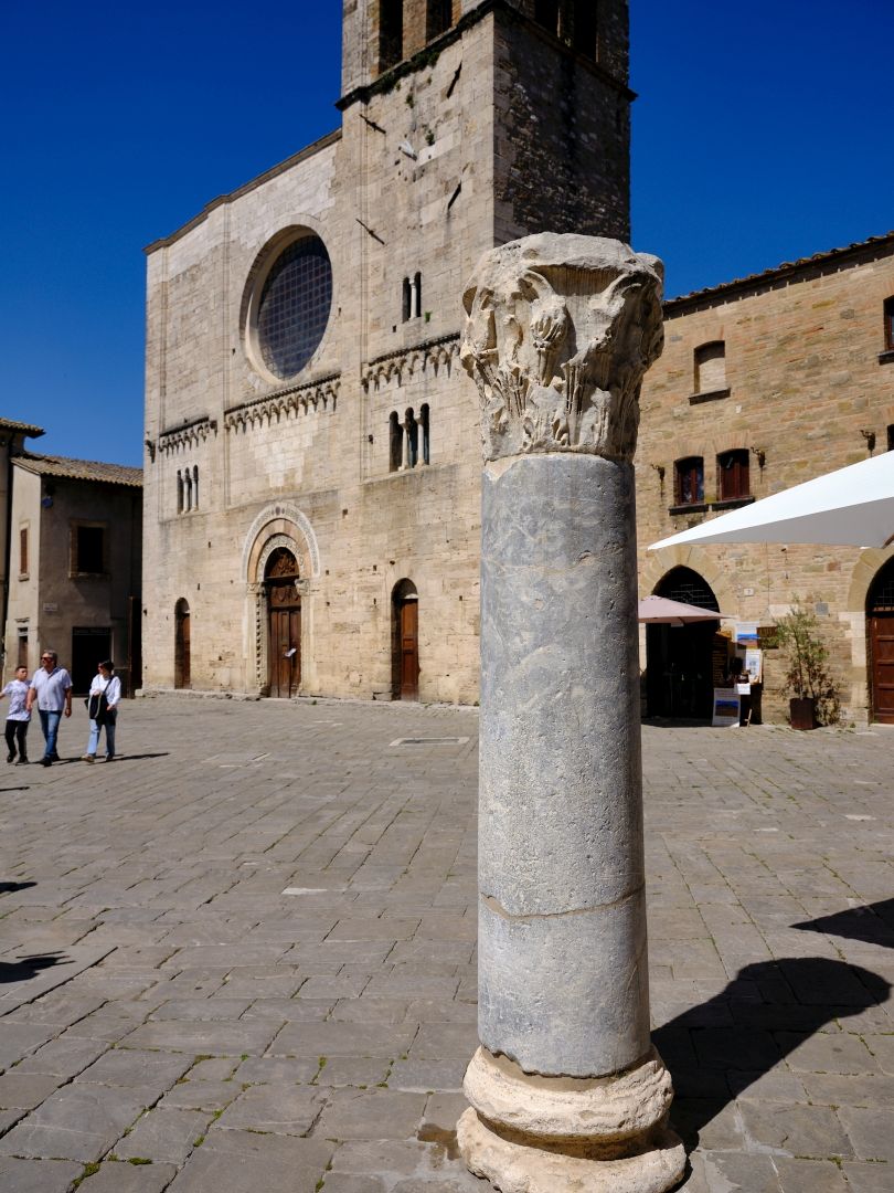
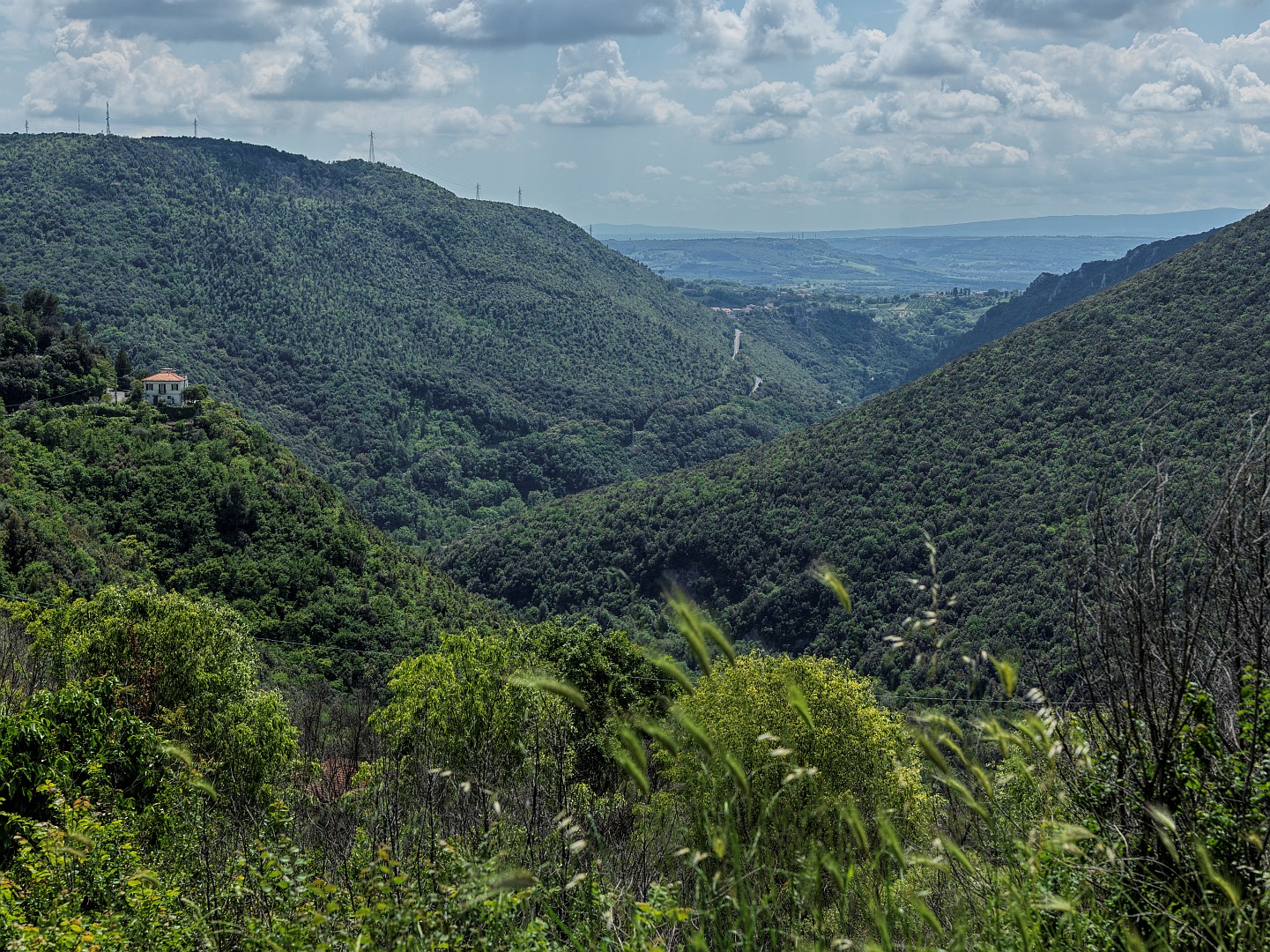
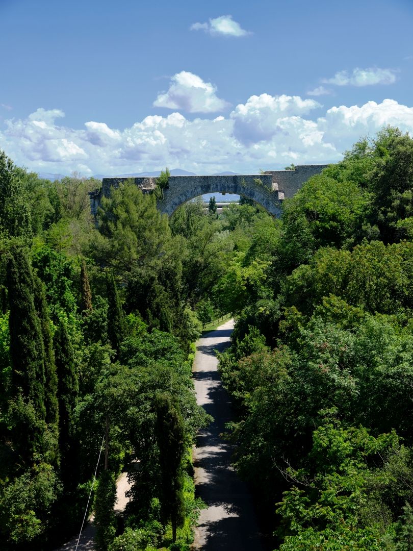
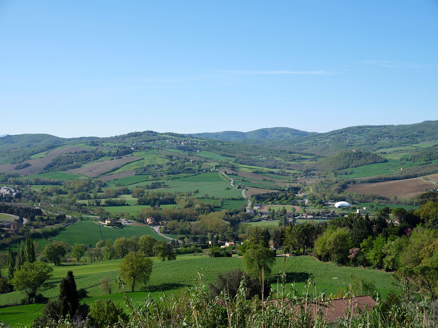
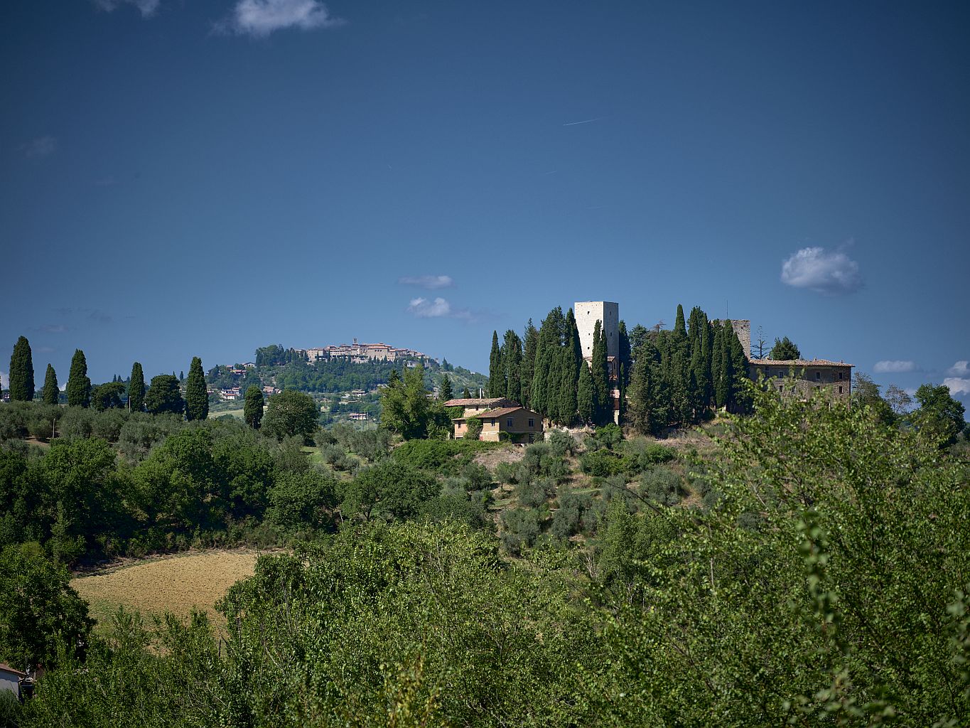
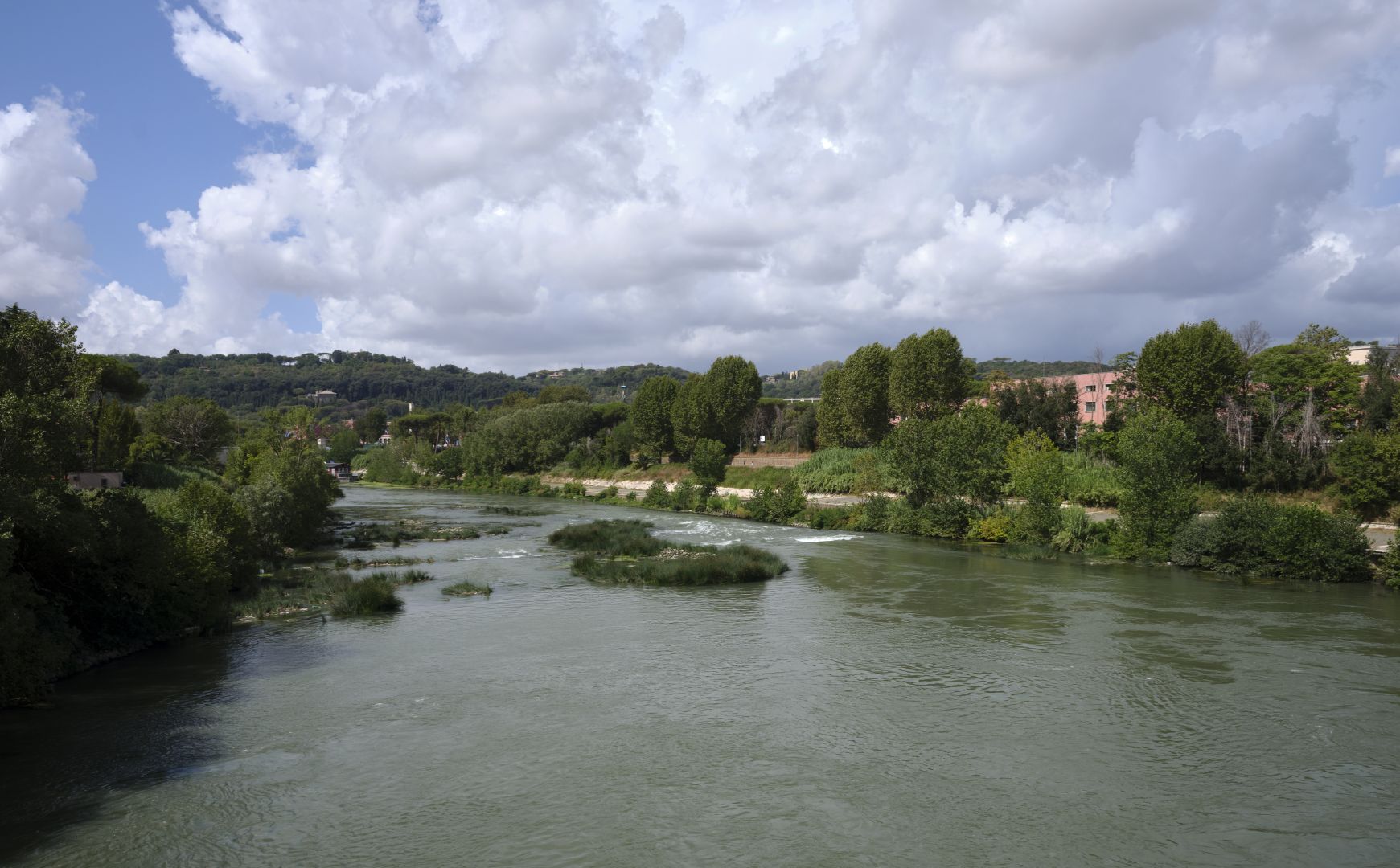
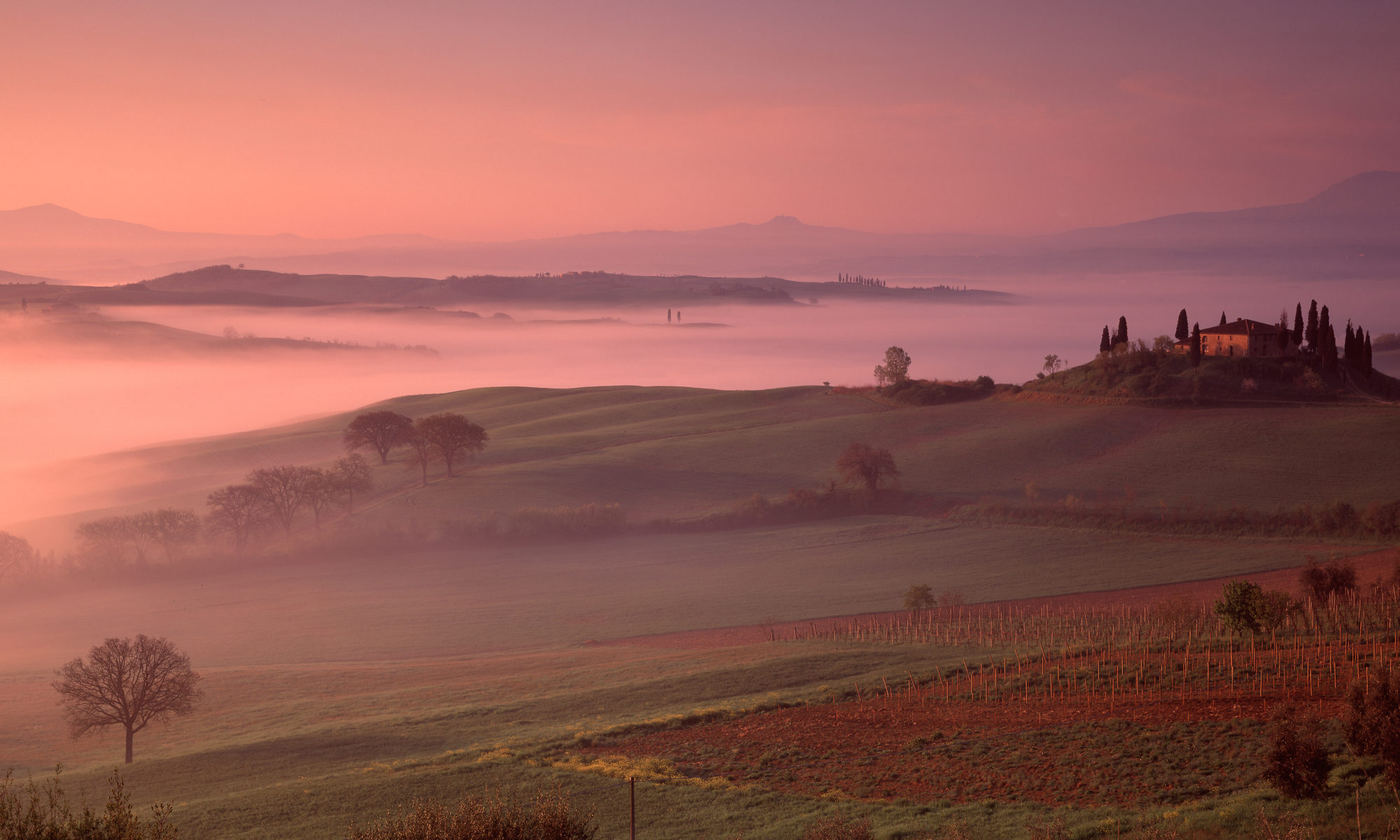
So let us continue, but first a look back at where we have come from. The photograph below taken from the hill behind Spello (ancient Hispellum) looks west across the Valle Umbra towards the Monti Martani. The Via Flaminia came up behind the mountains, then, as they turned into mere hills, the road turned right near the modern town of Bastardo and headed for Bevagna.

From Bevagna the road crossed the valley to a place called Forum Flaminii, where the eastern branch of the Via Flaminia rejoined the western.

The Valle Umbra from Spello
Looking west from Spello, across the Valle Umbra towards the Monti Martani. Fujifilm GFX-50R medium-format digital camera, 32-64mm lens (click to enlarge).

Into the Mountains

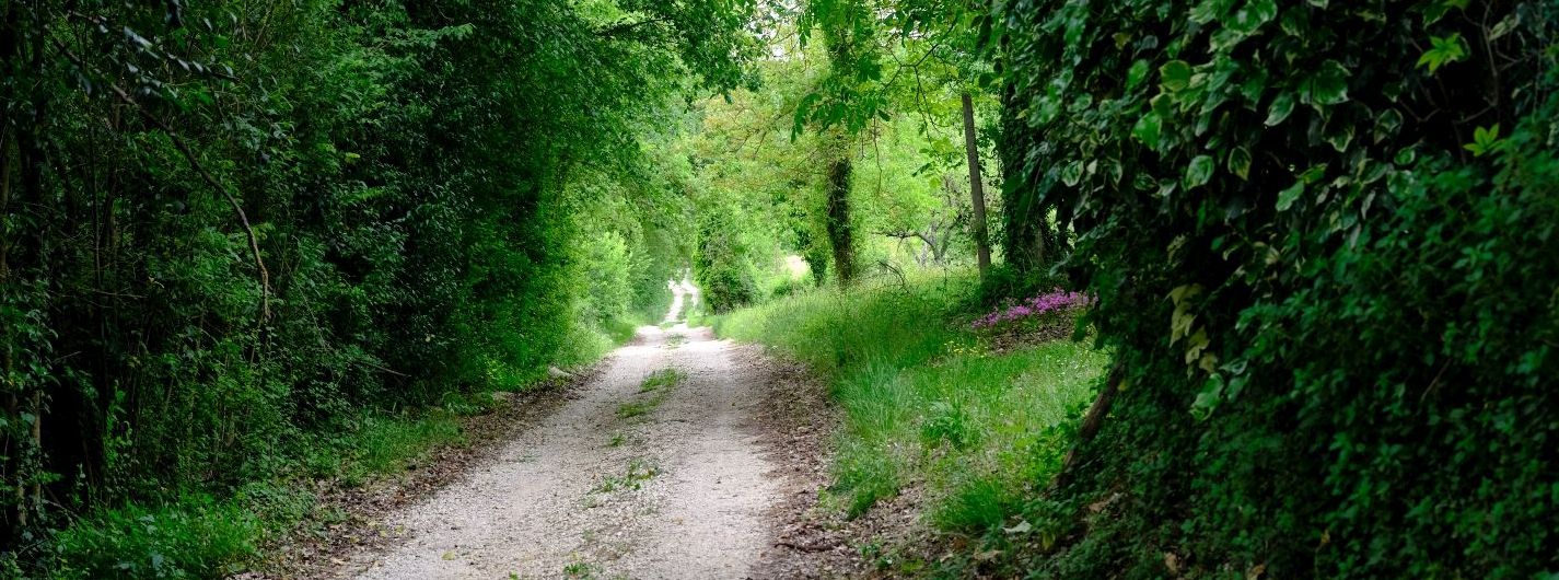
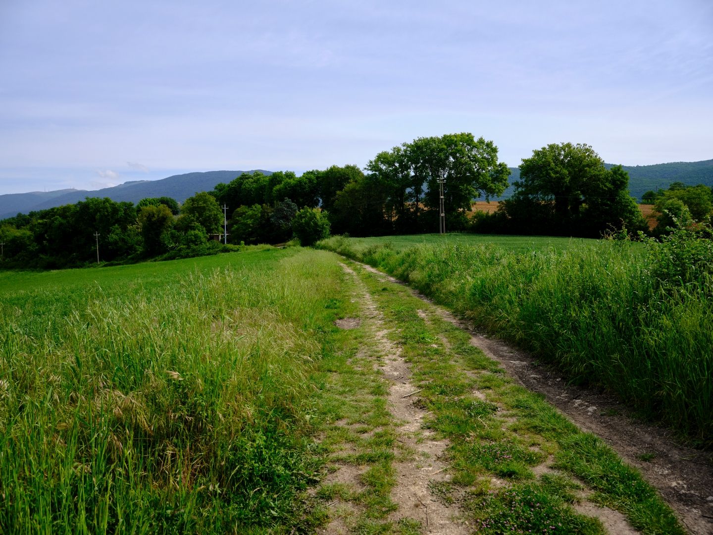
After Forum Flaminii we must hope that our legionaries were by now feeling fit, because that was the end of the flat territory for a long time. Between Spello and Trevi a gap in the mountains leads to a long valley, heading due north and rising steadily up into the Apennines. A New Zealand friend who understood these things once told me that when you see a long straight valley in a mountain range, you are probably looking at a fault line. The number of earthquakes over the years in this part of Italy suggests that is true here as well.

Passing through the town of Nuceria Camellaria (modern Nocera Umbra), the road climbed into territory that was more and more wild and rugged, eventually crossing the watershed at a place called the Scheggia pass, about 600 metres above sea level. Shortly after this, at a place called Cales (Cagli), the road turned abruptly right, and started on a direct line to the sea, following the valleys of mountain torrents, firstly the River Burano, which flowed into the River Candigliano at a place now called Acqualagna.

I do not yet have any photographs which can give any sense of this, so here is a screenshot from Google Earth, looking north from Scheggia, with the probable course of the Flaminia highlighted to the point where it turns northeast towards the sea.

Google Earth Scheggia Pass to Cagli
Screenshot from Google Earth, showing the probable course of the Via Flaminia at its highest point in the Apennines. Source: Google Earth (click to enlarge).

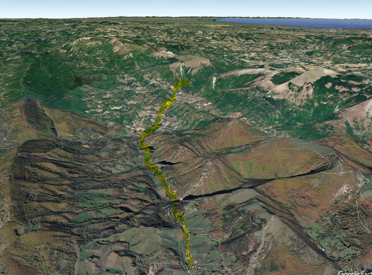
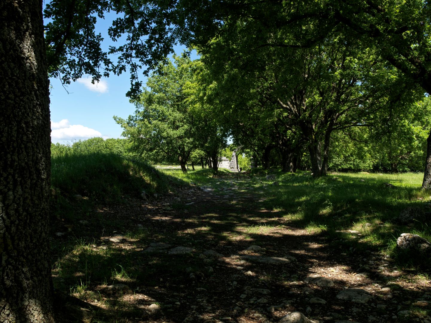
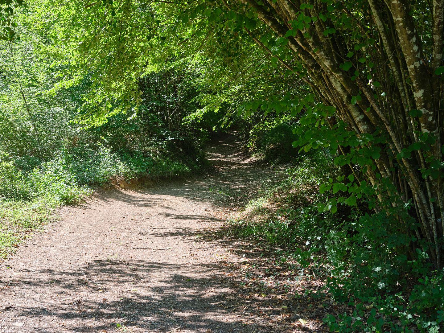
The Flaminia was now descending quite steeply through a series of narrow valleys and gorges, and it was by no means the first road to follow this very ancient route – the Etruscans, the Umbri and their Neolithic predecessors had all traded salt from the Adriatic into central Italy this way.

Mountains, Tunnels and Bridges

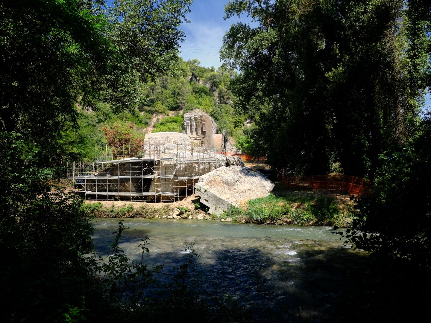
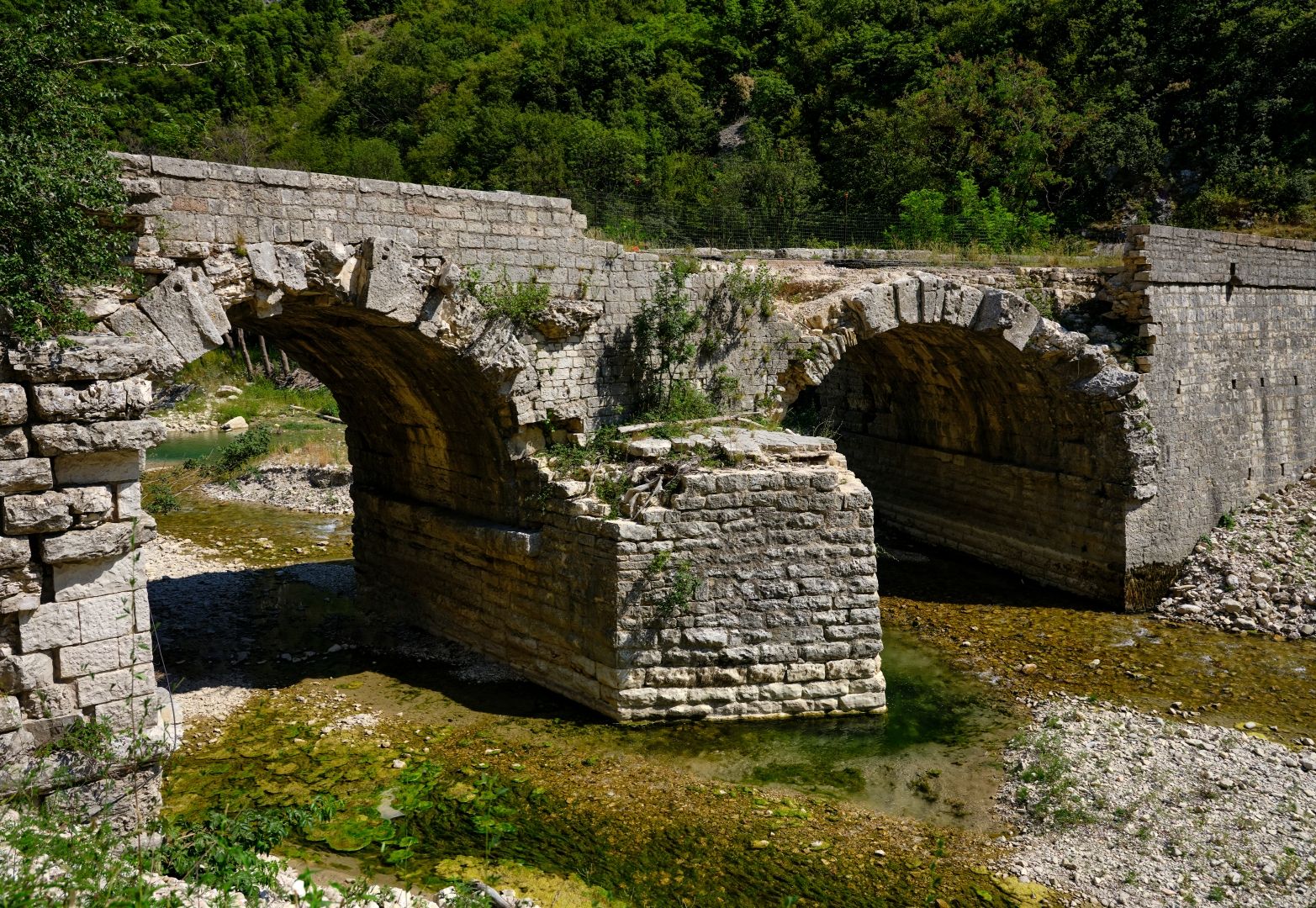
On this stretch, one is struck by the number of ancient survivals there are. Near Cagli, there is a Roman bridge (now called the Ponte Grosso) over the Burano River. I took photographs of this in June 2008 and it was in remarkably good condition, still carrying local traffic.

Ponte Grosso at Cagli in 2008
The Ponte Grosso in Cagli in 2008, still in excellent condition for something two thousand years old. Horseman 45FA large format camera, Fujinon-W 125mm lens, 6x12cm rollfilm back, Fujichrome Velvia 50 film, scanned on a Flextight Precision II film scanner (click to enlarge).

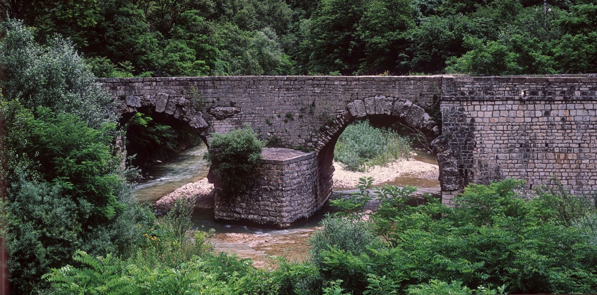
Unfortunately, floods in 2022 caused significant damage, which was unrepaired on a visit in 2024 and remains so still (in 2026), which is the cause of some local concern. Let us hope that the authorities do something about it before another flood or an earthquake makes things any worse.

Ponte Grosso at Cagli in 2024
The Ponte Grosso at Cagli in 2024, showing damage from the 2022 floods. Fujifilm GFX-50R medium-format digital camera, 32-64mm lens (click to enlarge).

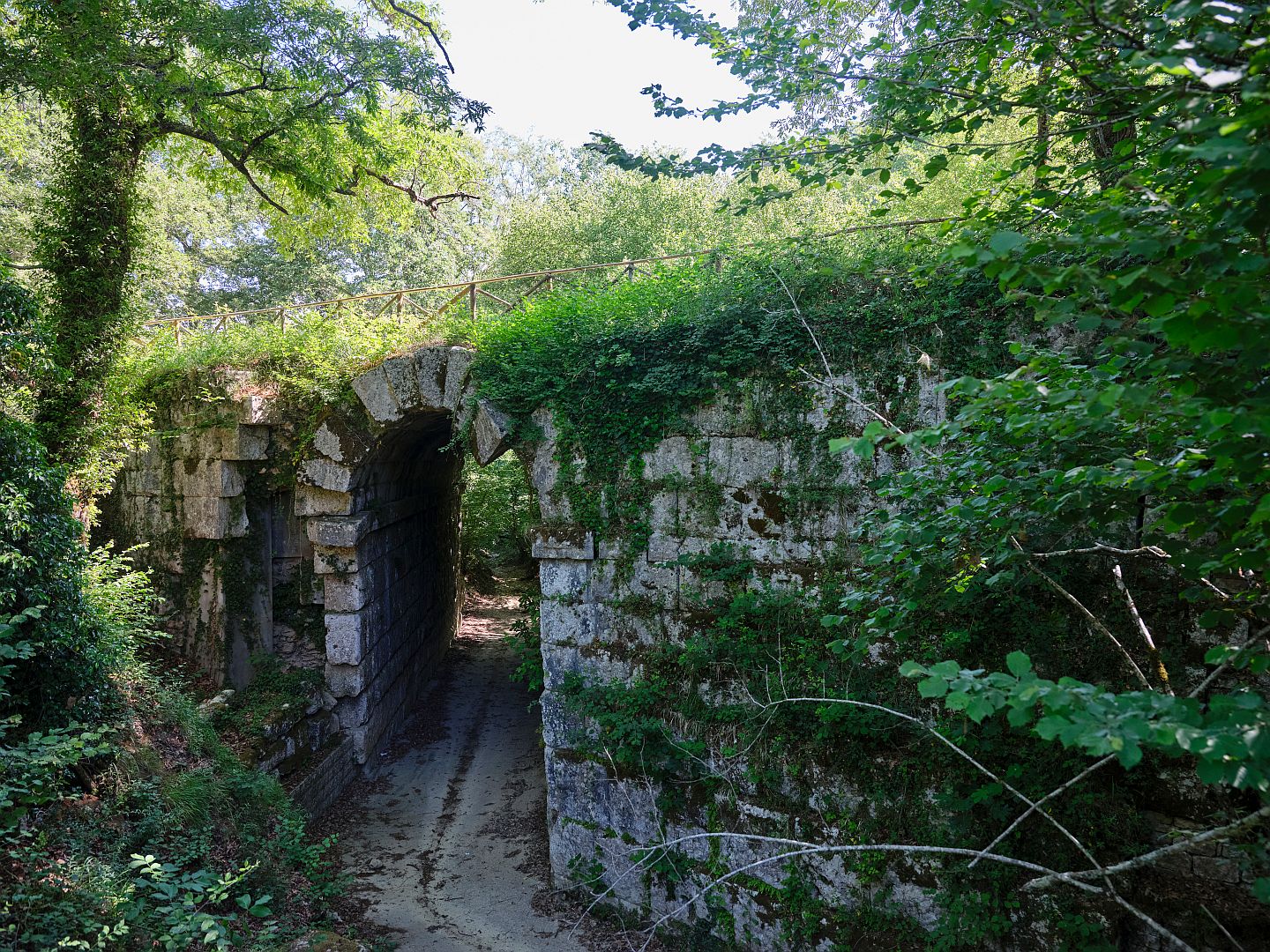
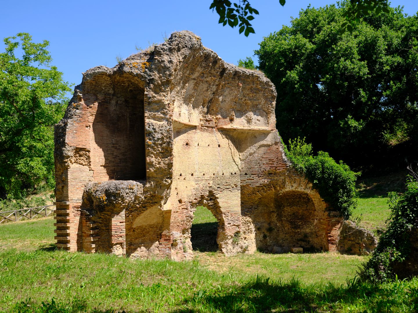
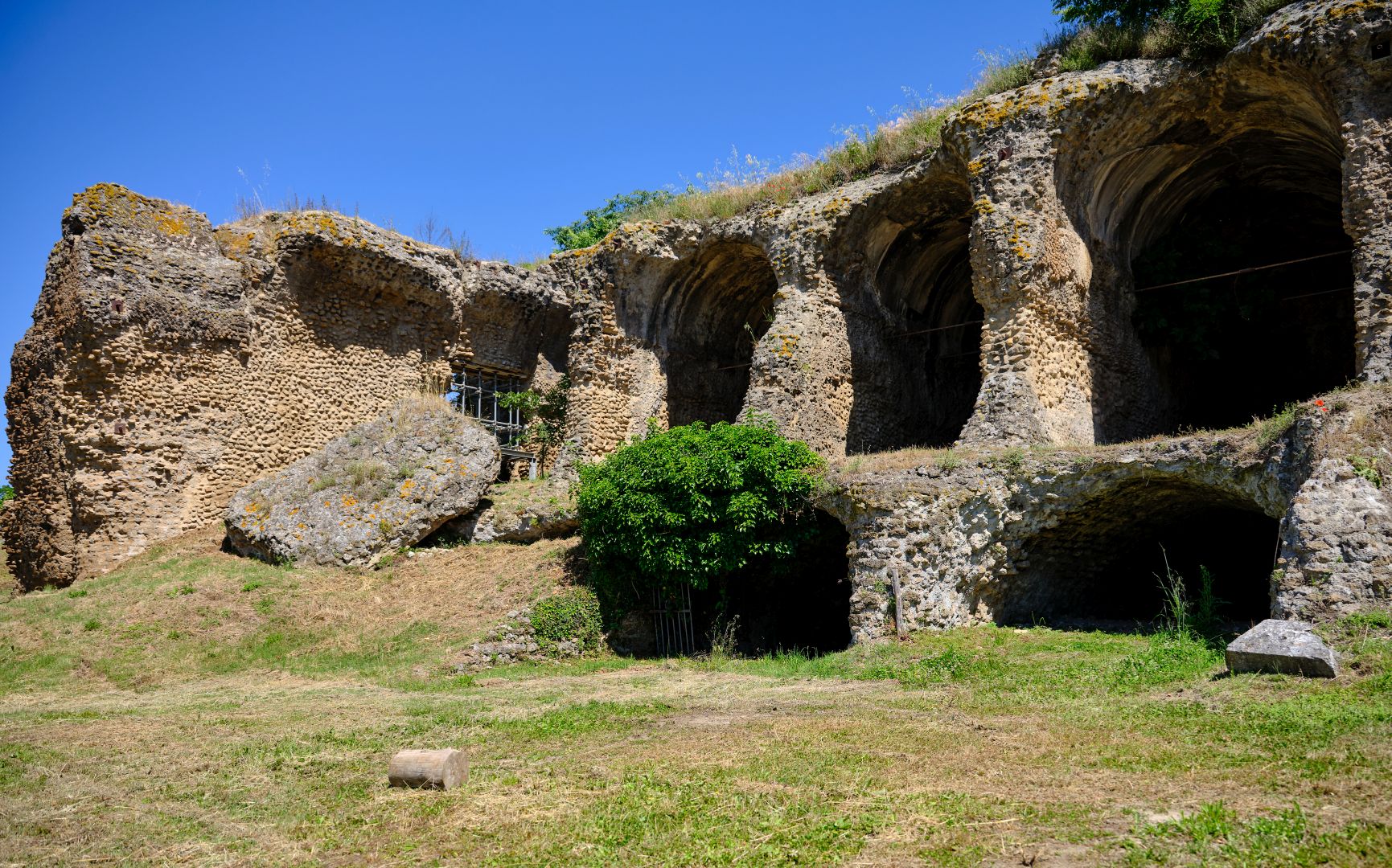
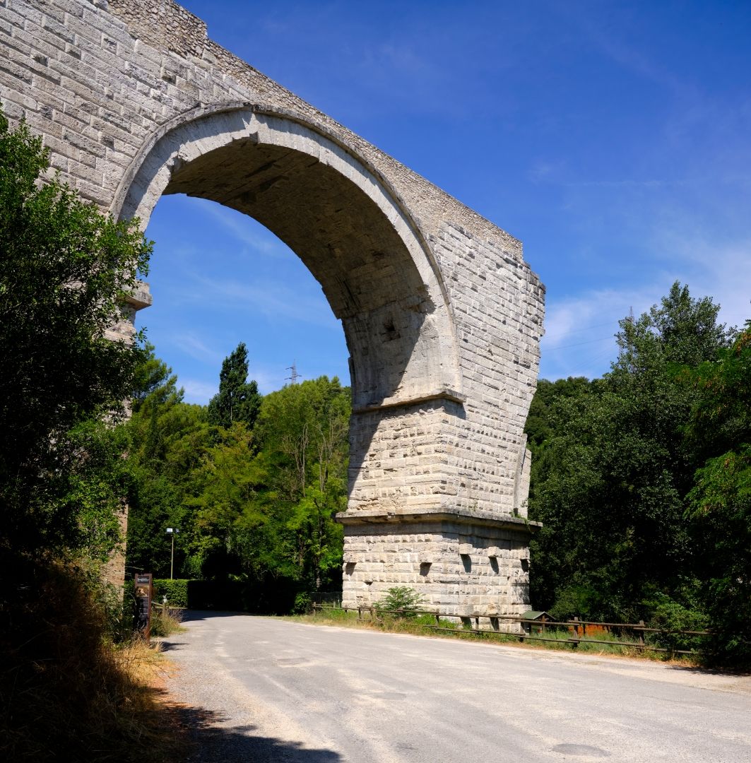
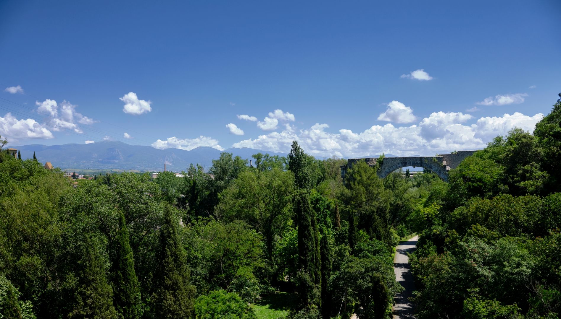
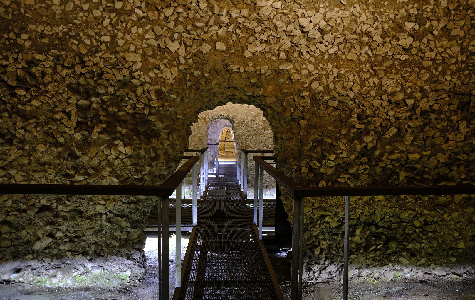
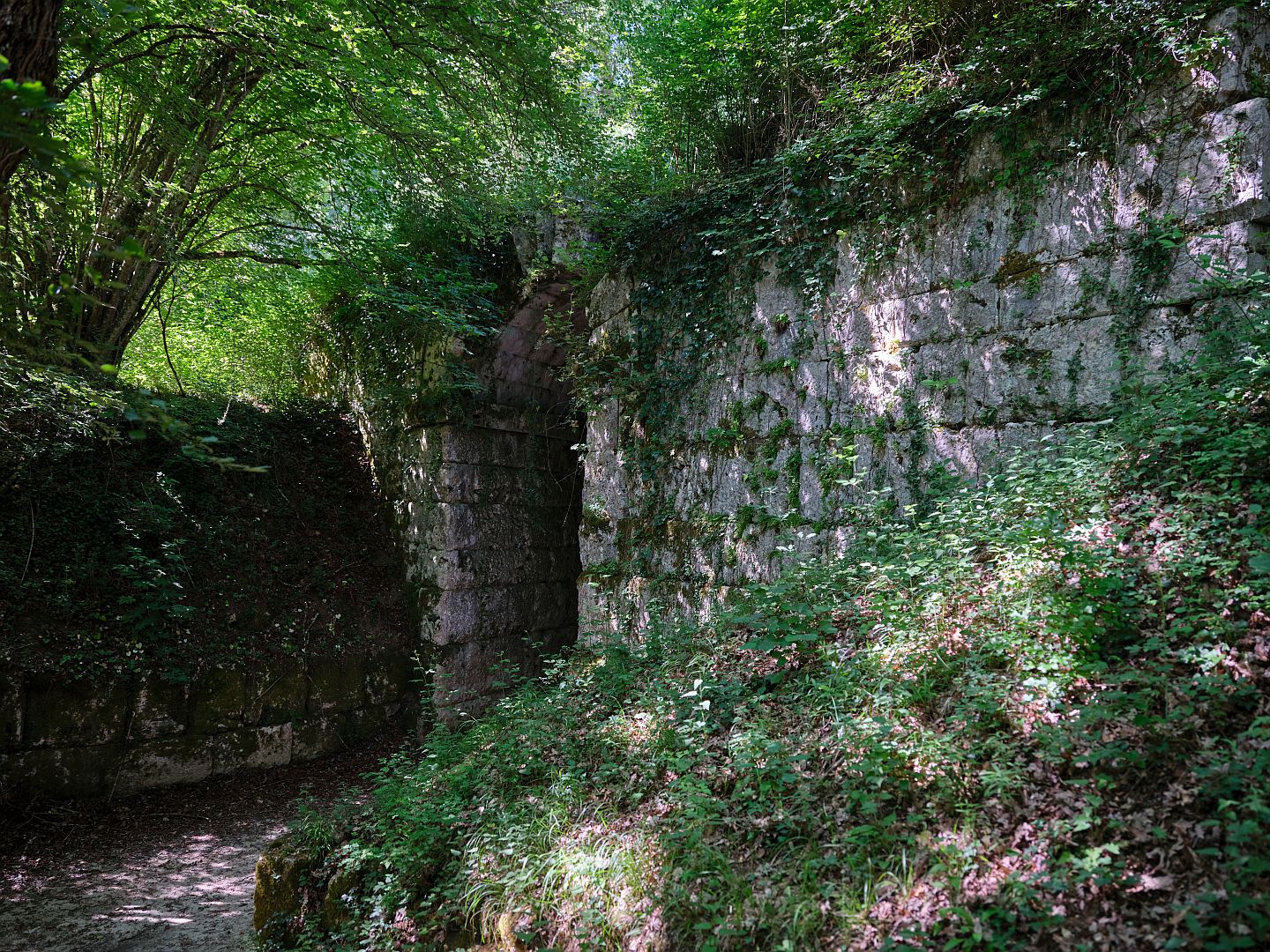
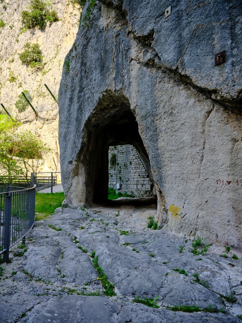
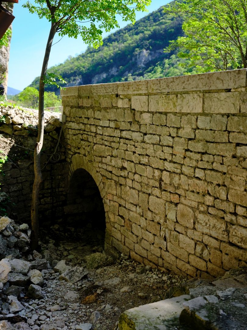
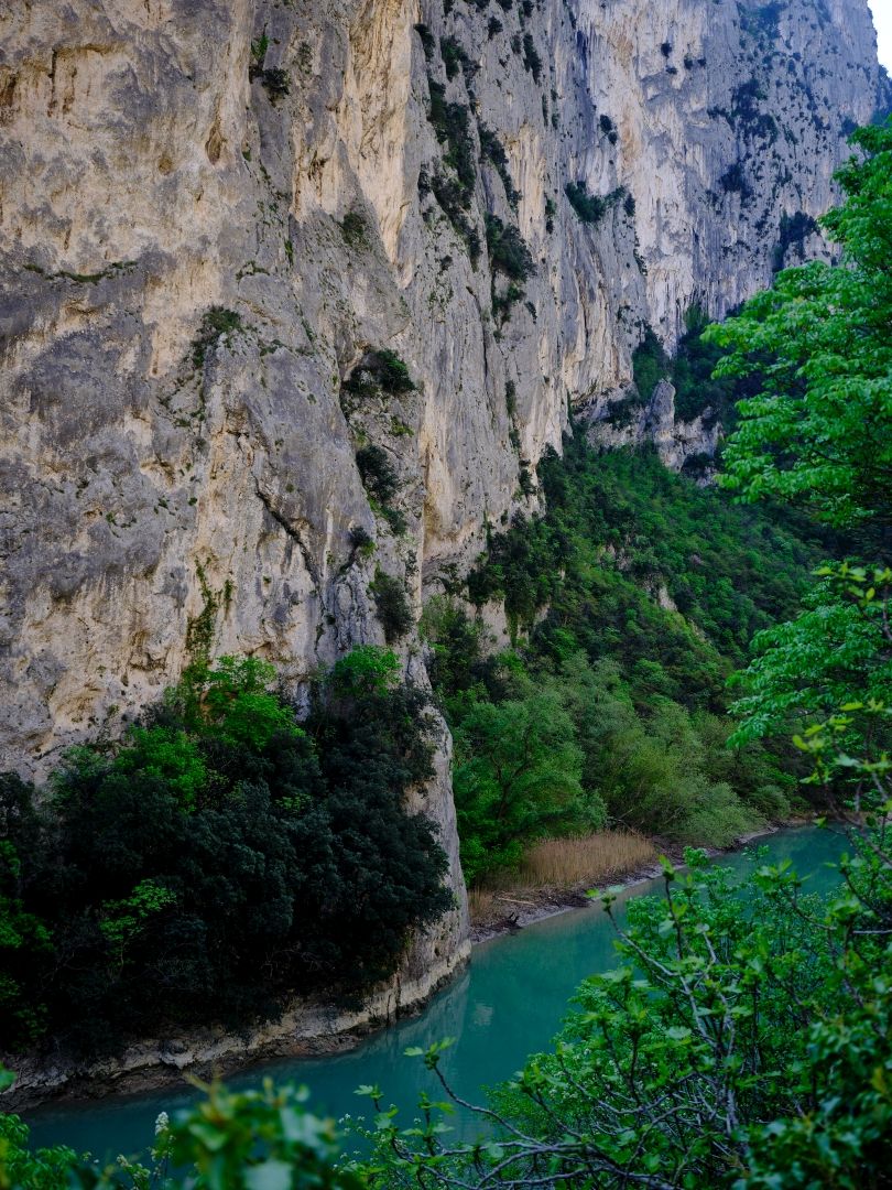
After the Burano flows into the Candigliano the river passes through a narrow gorge – the Gola del Furlo – and it is here that one of the most remarkable survivals of the Via Flaminia can be found.

Gola del Furlo
The Gola del Furlo – the road follows the ancient Via Flaminia. Fujifilm GFX-50R medium-format digital camera, 32-64mm lens (click to enlarge).

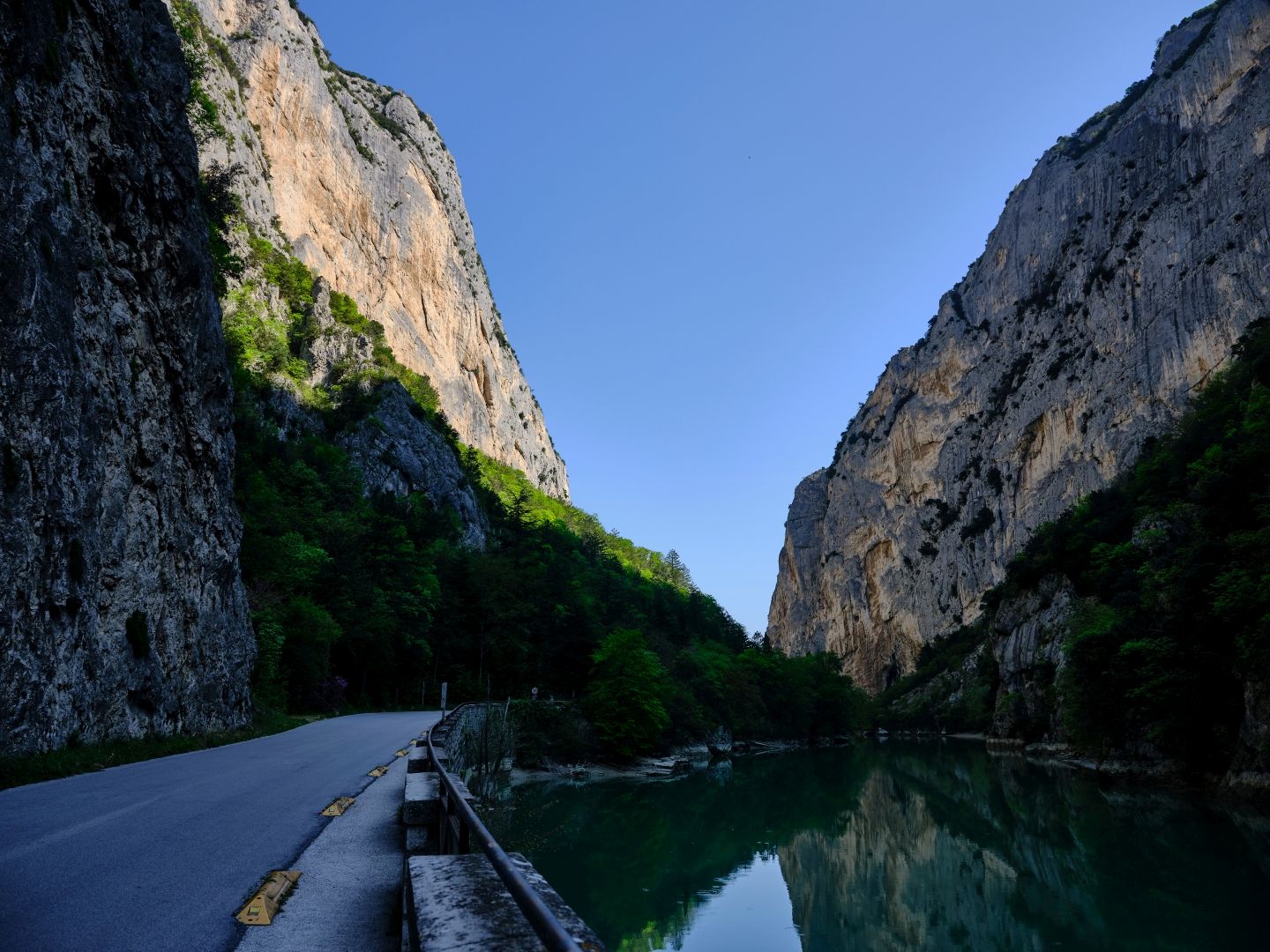
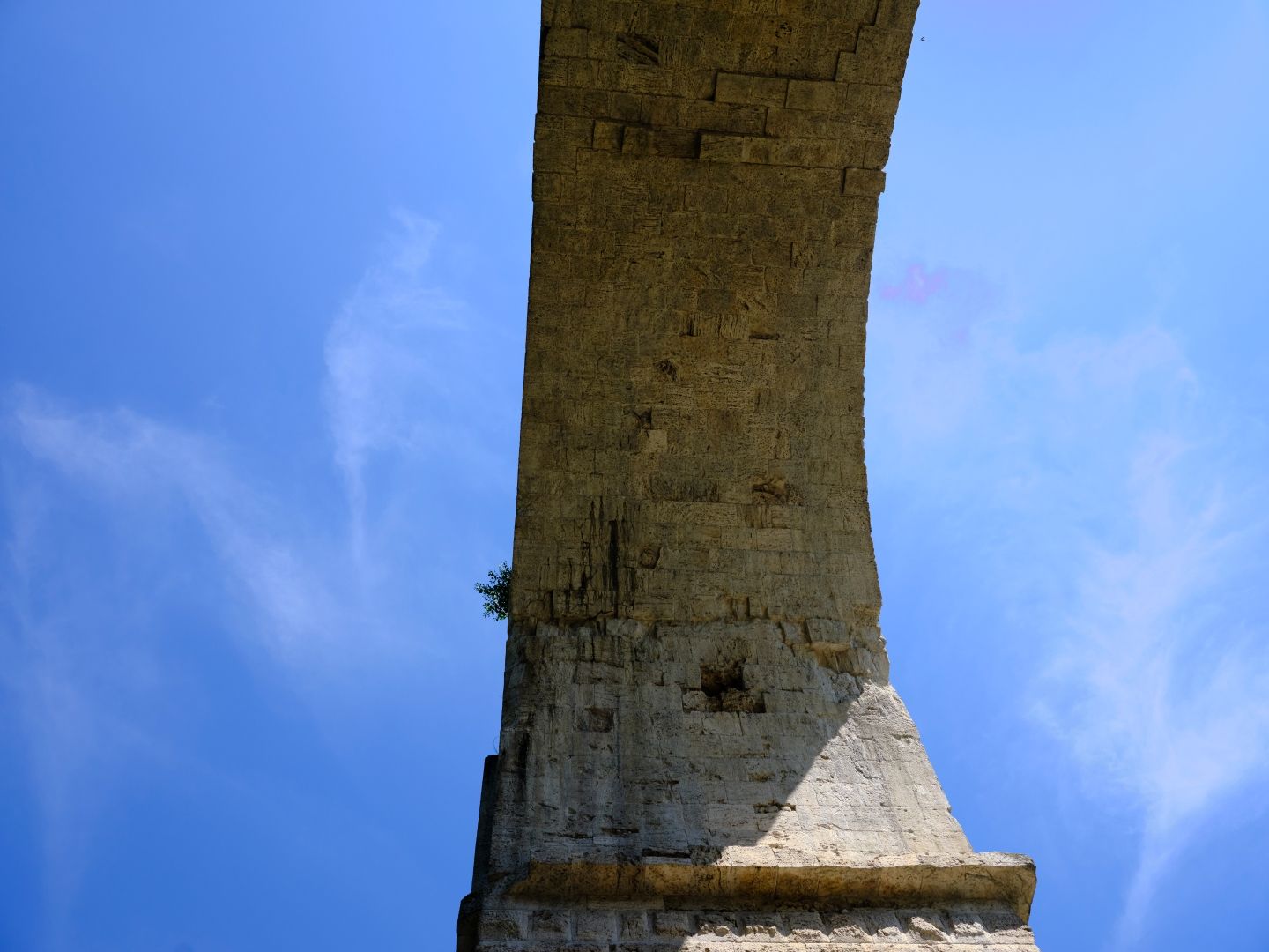
A narrow lake runs through the gorge, but this would not have been there in ancient times; it is the result of a dam built for a hydro-electric power station in 1922, which is still operating. Above the lake, on a nearly-vertical slope, can be found three parallel passages.

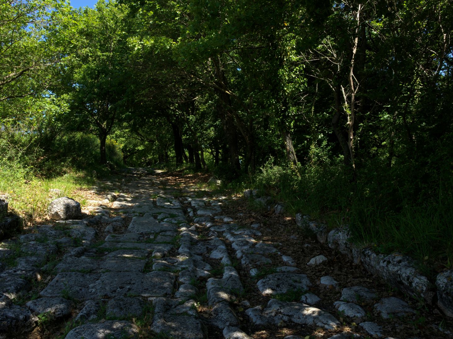
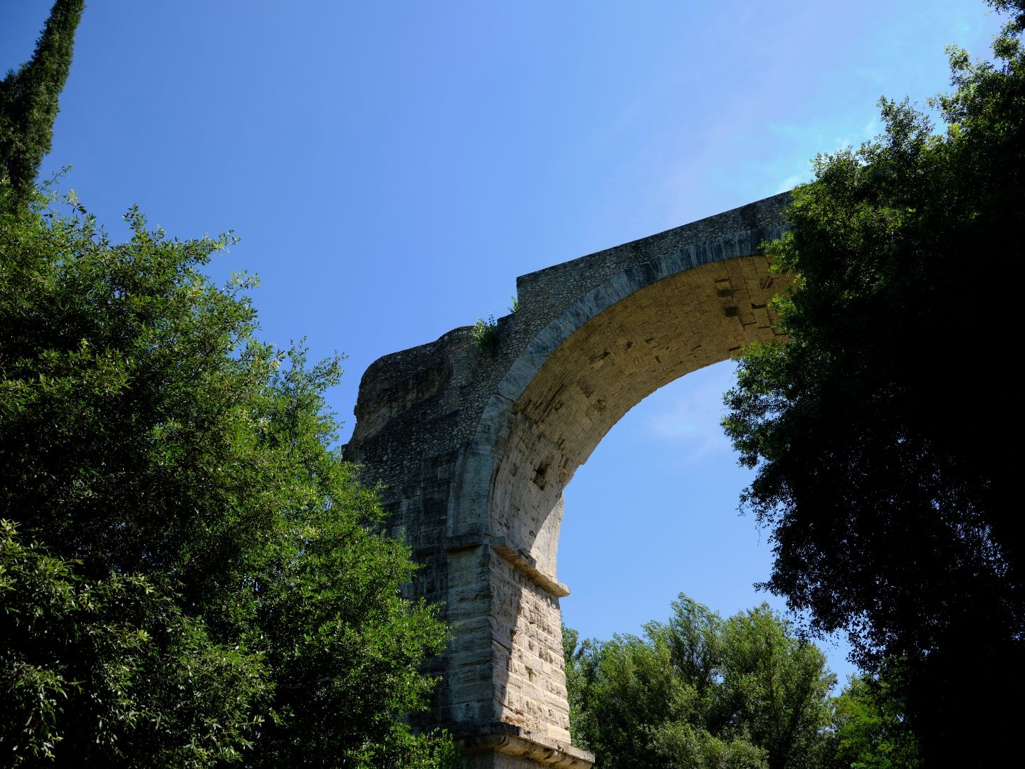
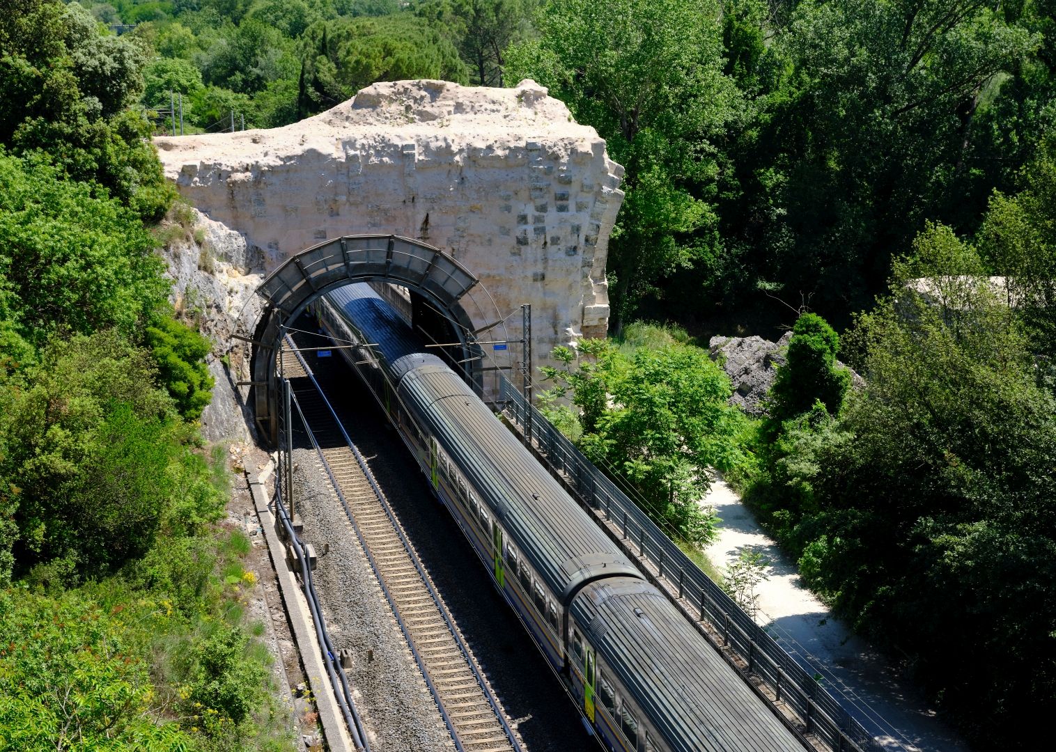
Starting from the outside, the first passage is a ledge cut into the rock, allowing the Flaminia to pass around the outside of a massive outcrop.

Via Flaminia at Gola del Furlo
The ledge at the Gola del Furlo, cut into the rock to create a space for the Via Flaminia. You can see grooves worn into the rock by wheeled traffic. Fujifilm GFX-50R medium-format digital camera, 32-64mm lens (click to enlarge).

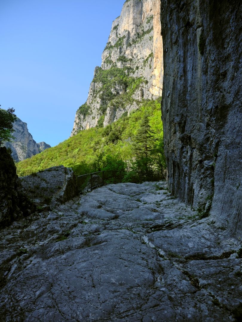
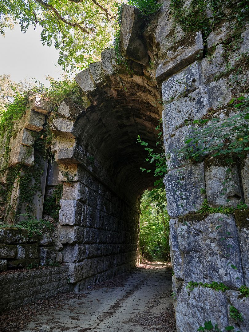
Just next to the ledge, you can see a small tunnel, about 8m long.

The "Etruscan" passage
The entrance to the small tunnel. Fujifilm GFX-50R medium-format digital camera, 32-64mm lens (click to enlarge).
The "Etruscan" tunnel from the other end.
The small tunnel from the other end, showing how short it is, and how its purpose is simply to allow better access to the rock ledge. Fujifilm GFX-50R medium-format digital camera, 32-64mm lens (click to enlarge).

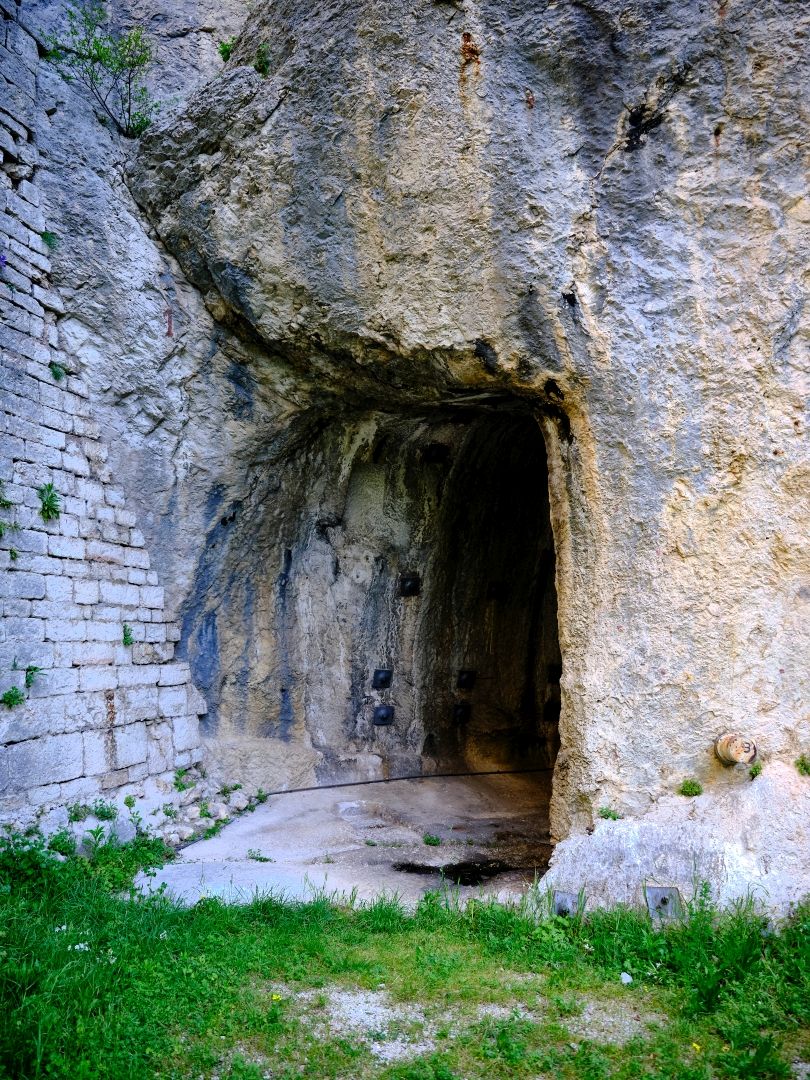
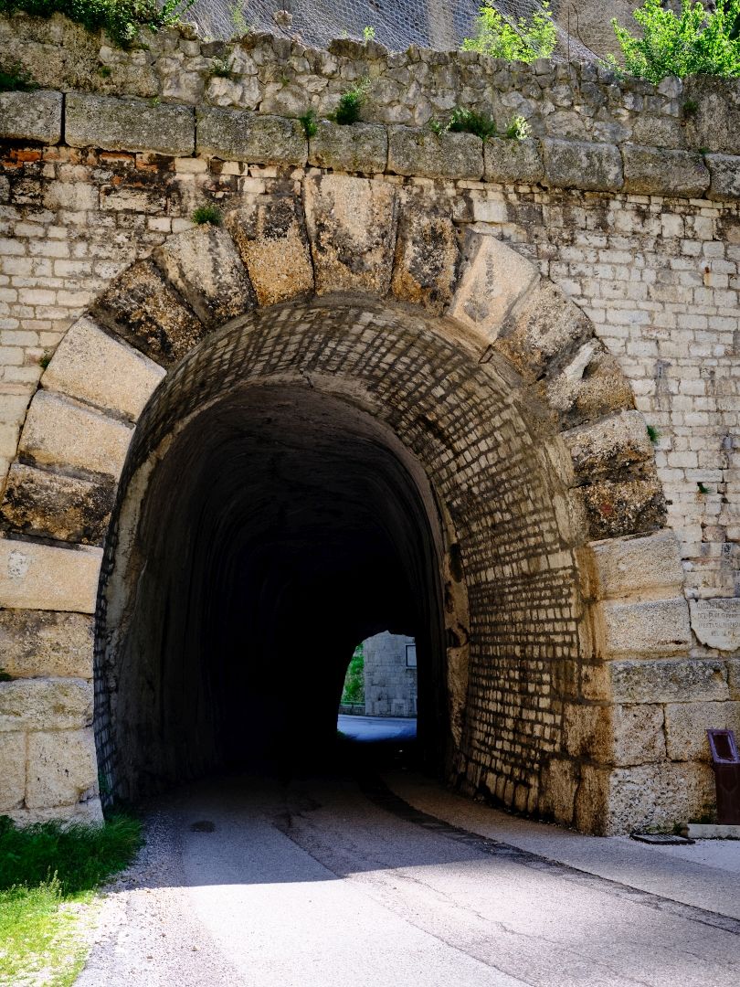
And then, furthest from the gorge, is a large modern-looking road tunnel, about 40m long and 6m high.

The large tunnel
The largest tunnel, with the modern road going through it. Fujifilm GFX-50R medium-format digital camera, 32-64mm lens (click to enlarge).

While many of the historical details of these three passages are clear, some things are less so and sources can be a little contradictory. Here is what I think is a plausible sequence.

Firstly, there must have been some way around the outcrop in the very earliest days of salt trading – the Bronze Age or even Neolithic – otherwise there would not have been a road here at all. This would presumably have taken the form of a narrow natural ledge.

At some point the smaller tunnel was cut, to get past a particularly difficult section. Some sources say this was Umbro-Etruscan (perhaps 4th Century BC), while others date it to the initial construction of the Flaminia in the 3rd Century BC. However signage at the site suggests that it was a temporary fix made during the upgrade of the Flaminia during the reign of Augustus (27 BC – 14 AD).

Then Roman engineers widened the existing narrow path by building retaining walls to extend it out from the cliff edge, and laying flagstones to protect the softer limestone of the mountain from being worn away by the road traffic. This extension would have needed constant maintenance. If the small tunnel dates from the Augustan period, perhaps the extension of the external path does as well.

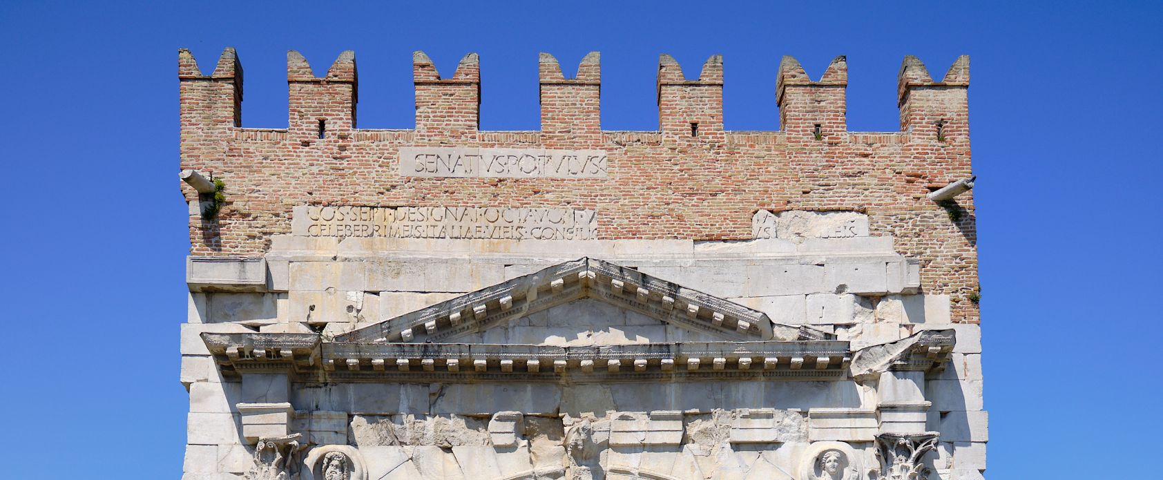
Finally, in the years 76-77 AD, in the reign of the Emperor Vespasian, the largest of the three tunnels was built. Go back and look at the photograph of that tunnel again – that’s right, that modern-looking tunnel that you can drive through today (I have done so) is 1,949 years old as I write this in 2026.

Inside the Tunnel of Vespasian
Inside the tunnel of Vespasian. A close inspection of the wall reveals the marks made by the picks of the builders. Fujifilm GFX-50R medium-format digital camera, 32-64mm lens (click to enlarge).

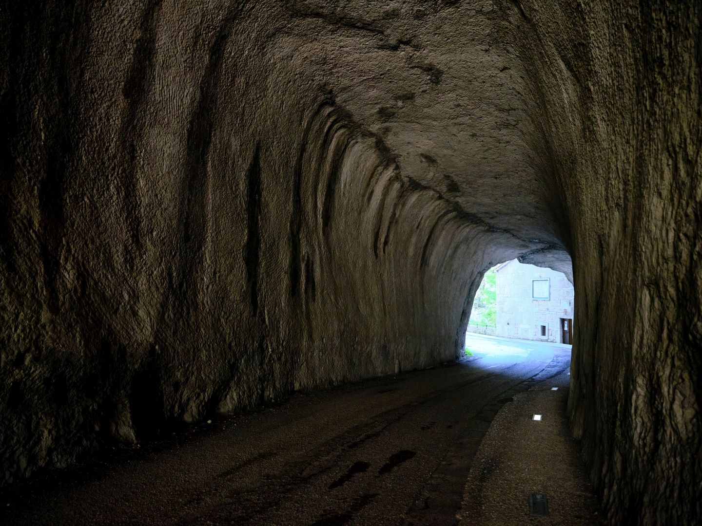
As remarkable, perhaps, is the fact that until construction of the nearby autostrada in the 1980s, this road, now mainly used by sightseers, cyclists and the occasional history blogger, was the main road between the coast and the area of Umbria around Gubbio. Ordinary cars and trucks would have used this ancient tunnel every day.

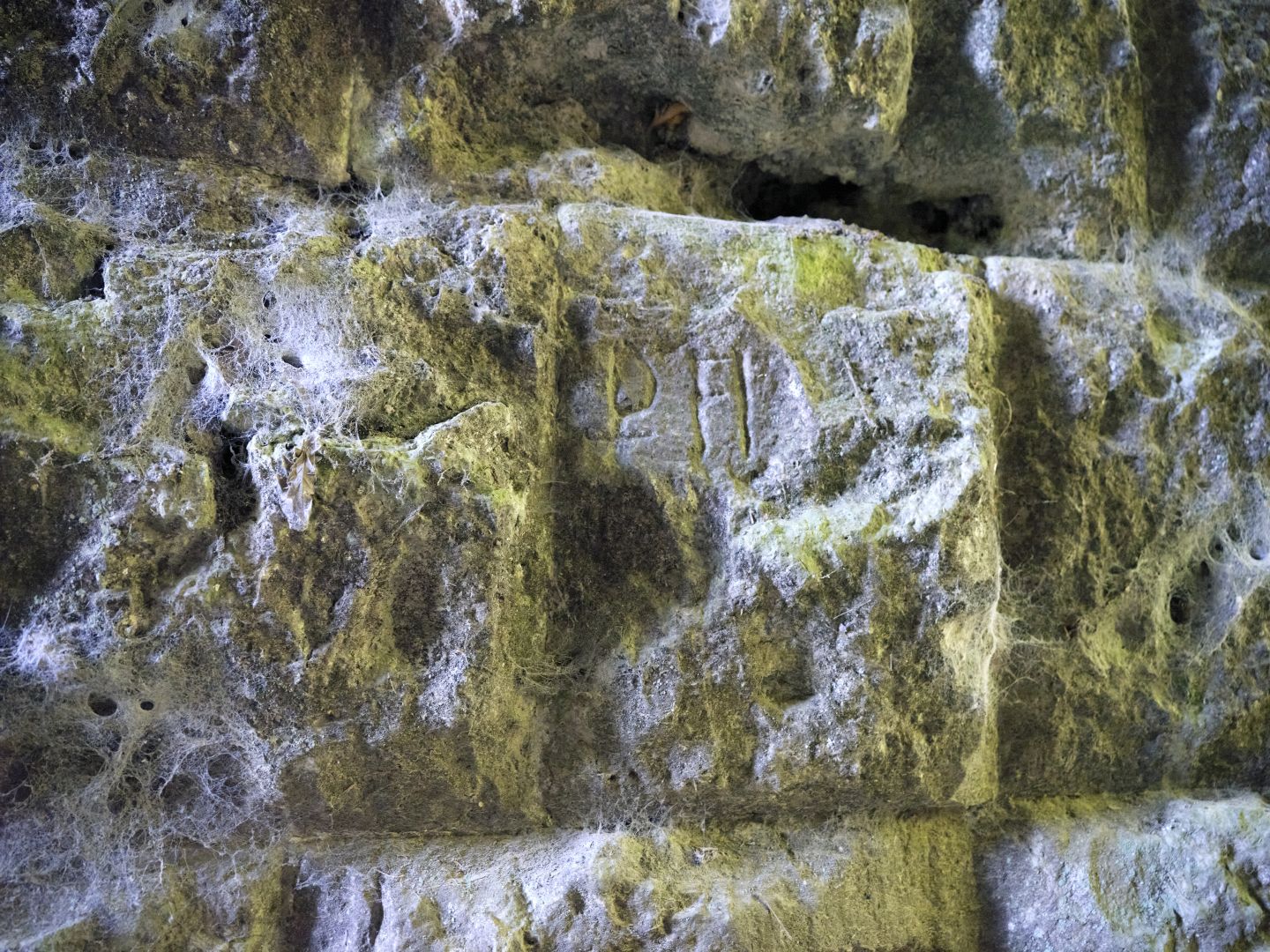
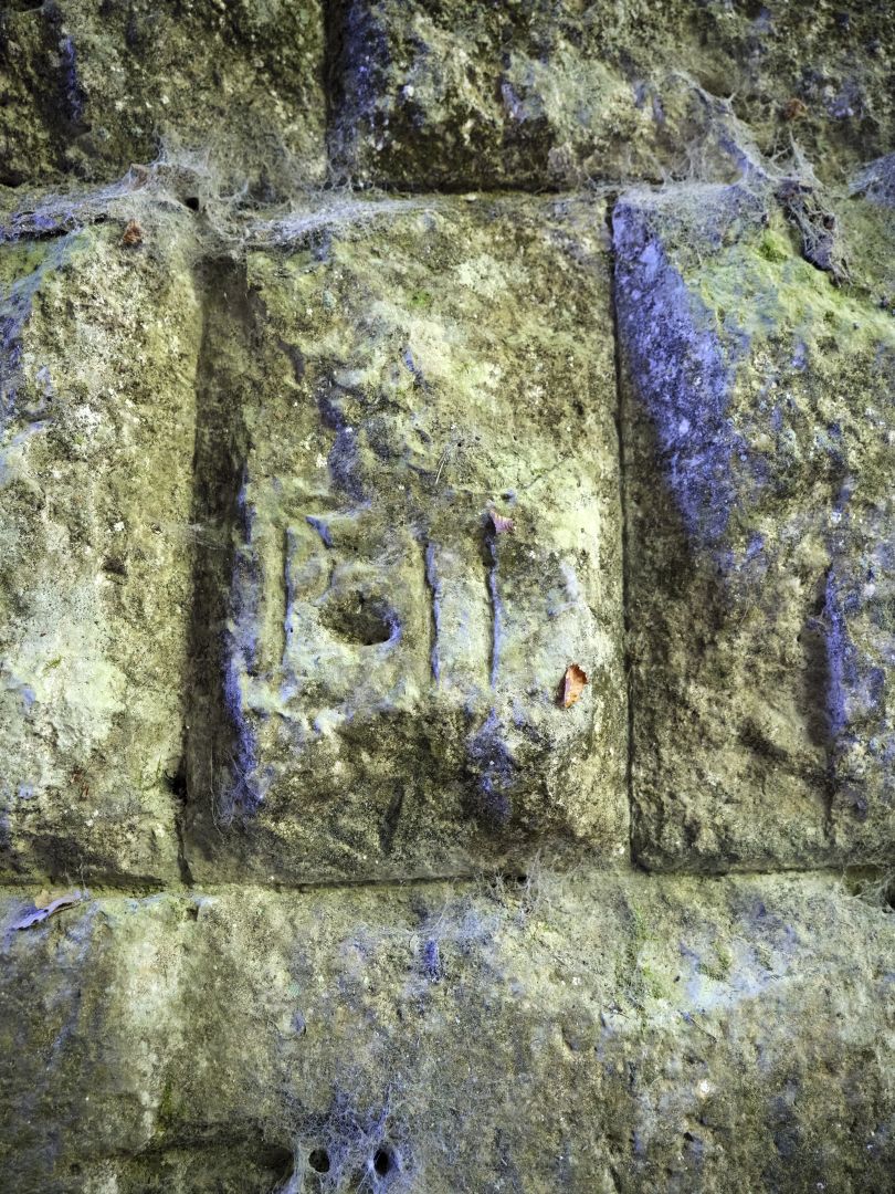
There is no argument about the origins of this tunnel: near the northern entrance is the following inscription:

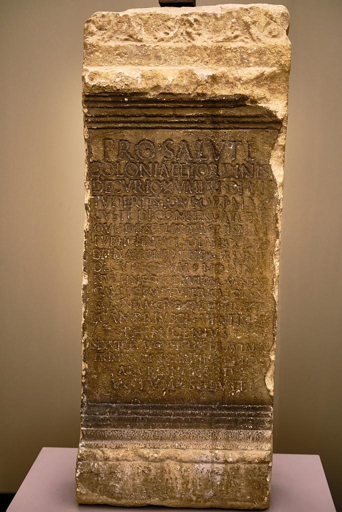
‘IMP(erator) CAESAR AUG(ustus) / VESPASIANUS PONT(ifex) MAX(imus) / TRIB(unica) POT(summer) VII IMP(erator) XVII P(ater) P(atriae) CO(n)S(ul) VIII / CENSOR FACIUND(um) CURAVIT’ (source: Wikipedia, quoting the Corpus Inscriptionum Latinarum).

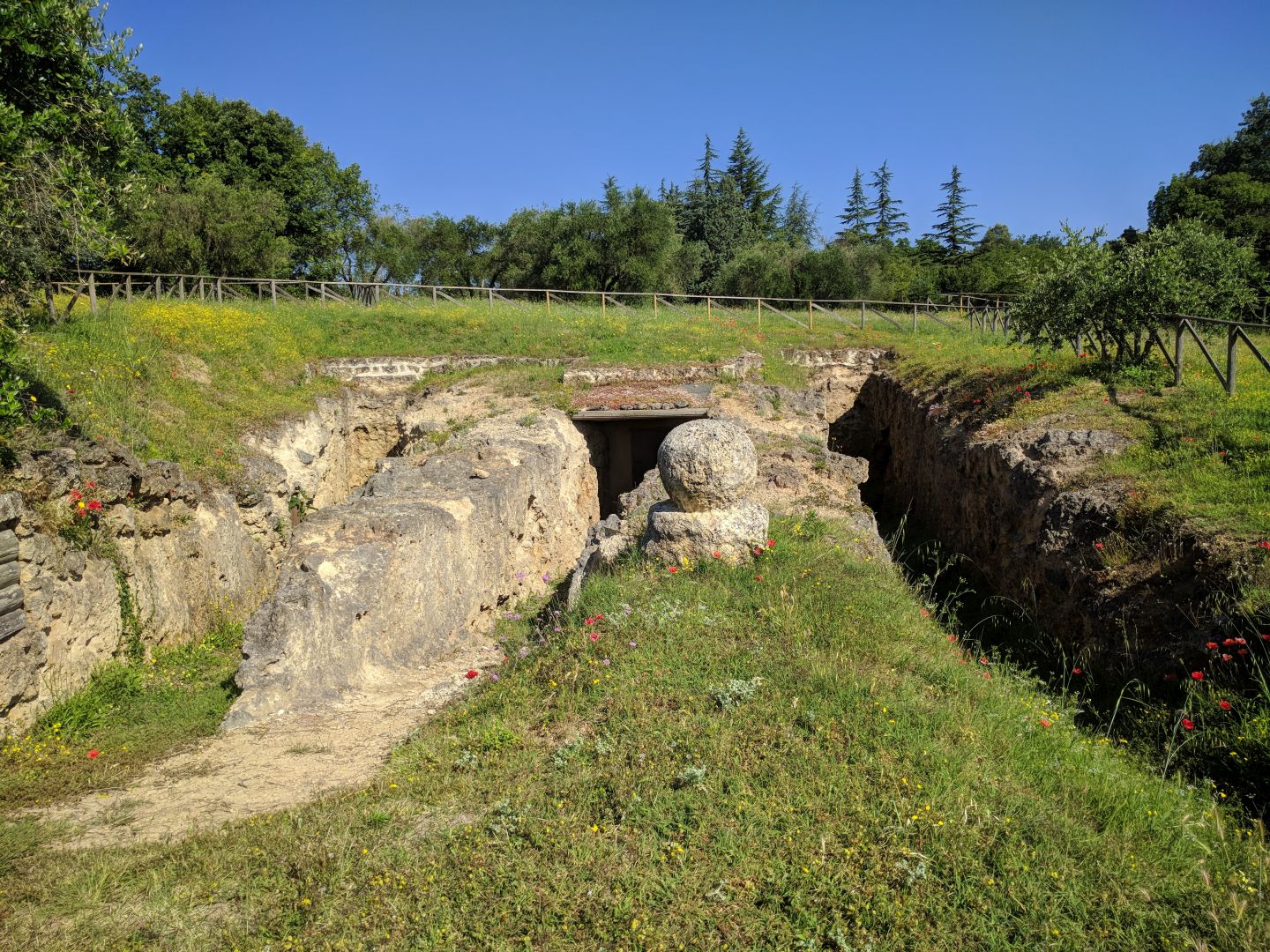
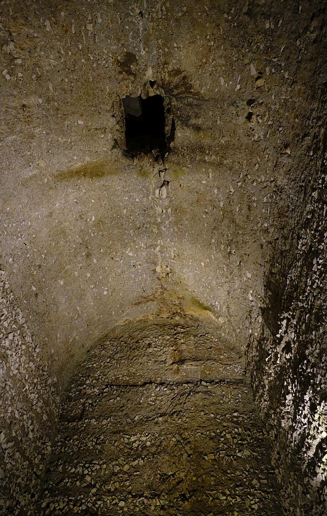
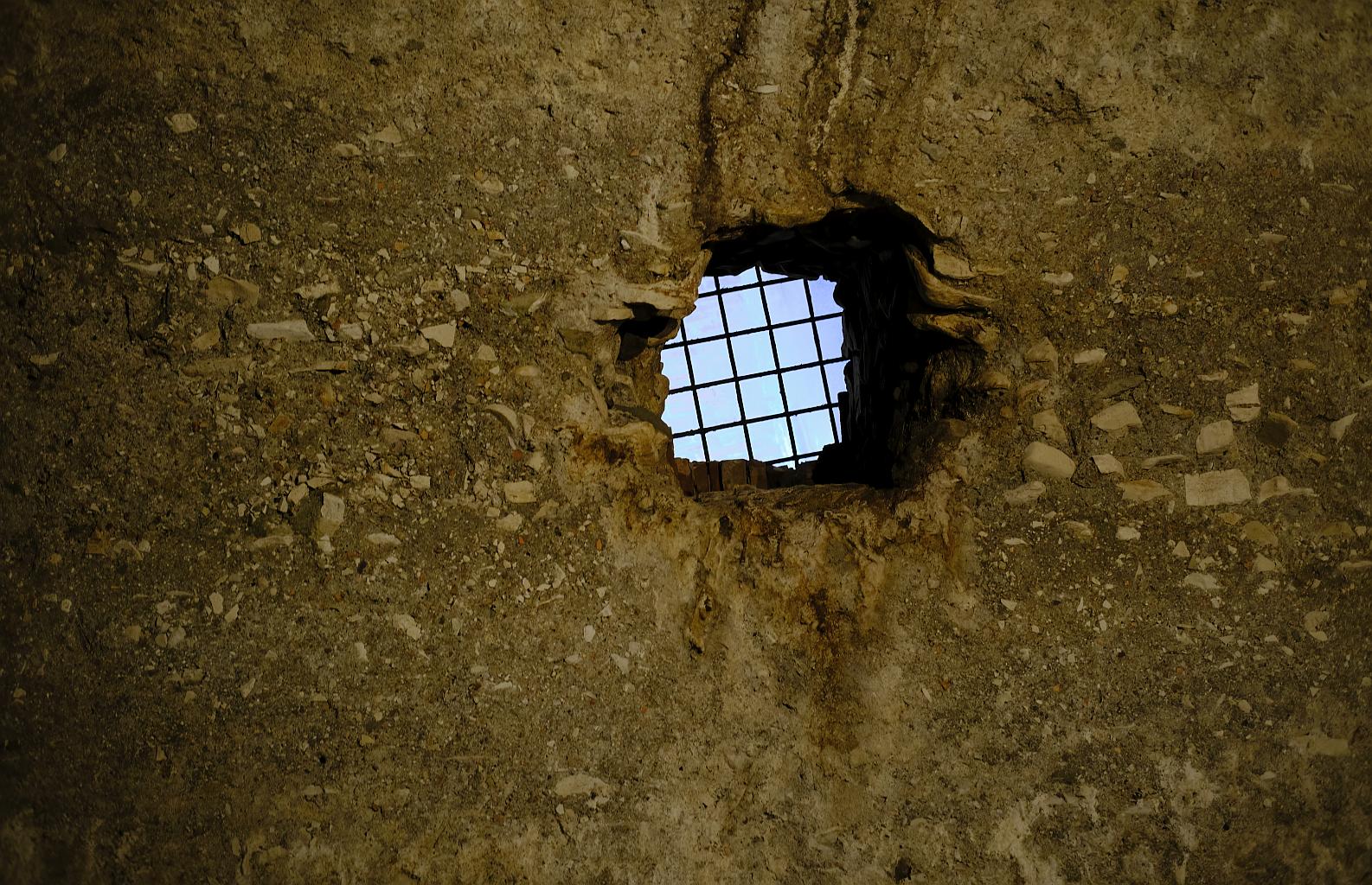
In country like this, one risk to the road would be washouts caused by meltwater torrents in spring. Doing things properly as always, the Roman engineers built drains and culverts to divert the water under the road.

Drainage channel
A drainage channel near the Gola del Furlo. Fujifilm GFX-50R medium-format digital camera, 32-64mm lens (click to enlarge).

Bandits

Where there is difficult terrain, and a road carrying tempting trade goods, you are likely to get bandits. There are records that one of the duties of the small Roman army detachment here, in addition to keeping the road maintained, was suppression of banditry. At various times since, over the centuries, distant authorities have either sought to exert control over the road, or largely abandoned it. As a strategic route, it was fought over, and fortified, during the Gothic Wars of the 6th Century, and afterwards taken by the Lombards.

While there were some famous travellers over the road in the Renaissance (Lucrezia Borgia, and Pope Julius II, both doubtless with substantial military escorts) it was only towards the end of the 18th Century that the road was properly re-opened, and policed.

One 20th-Century set of “bandits” – at least that is how the government would have referred to them – was made up of anti-fascist partisans. In the 1930s this road was sometimes used by Benito Mussolini when travelling between Rome and the north. The local Forest Guard, in a gesture of loyalty, carved a large profile portrait of the dictator on one of the cliff faces. During the war some of the partisans partially destroyed it, and apparently traces can still be seen, but I didn’t manage to identify it. Or more precisely, I saw several sections of the cliff that might have been the portrait of Il Duce, but might have just been random bits of rock – the mind is good at interpreting random bits of rock face as a human face, particularly when looking for a jutting rock-like fascist chin.

Mussolini, or just rocks
Can you find a portrait of Mussolini in this picture? Fujifilm GFX-50R medium-format digital camera, 32-64mm lens (click to enlarge).

Getting to the End of The Road

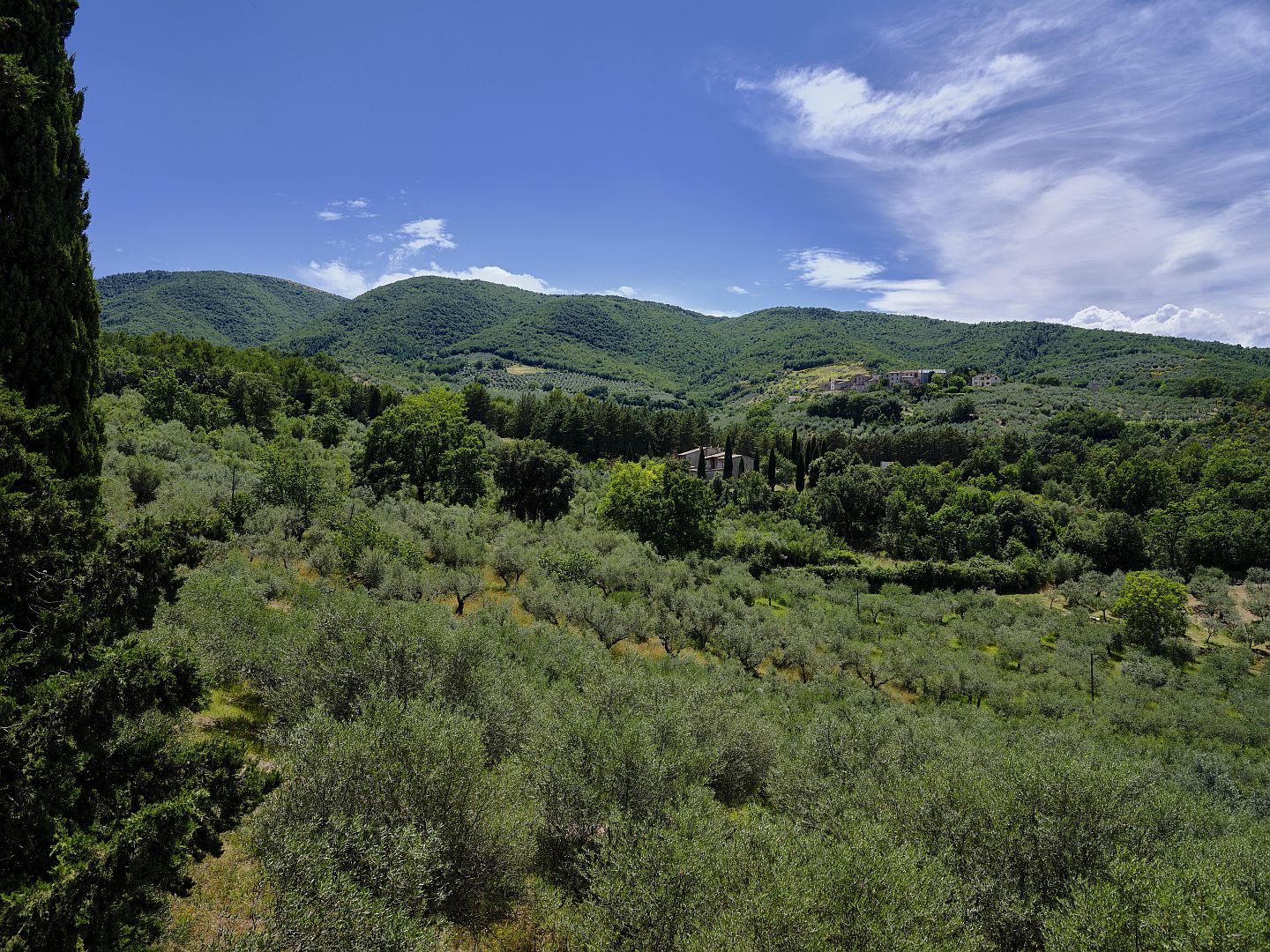
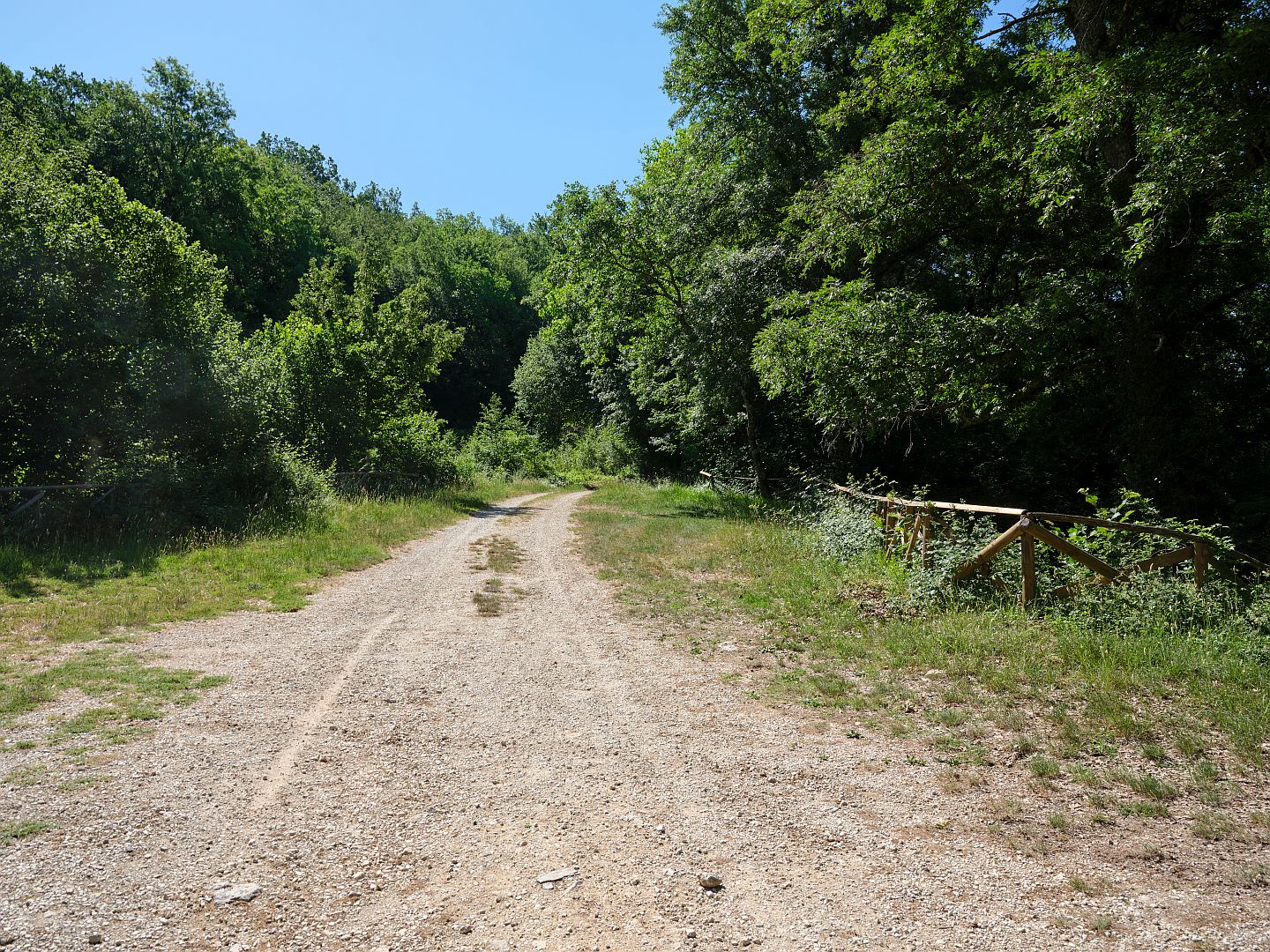
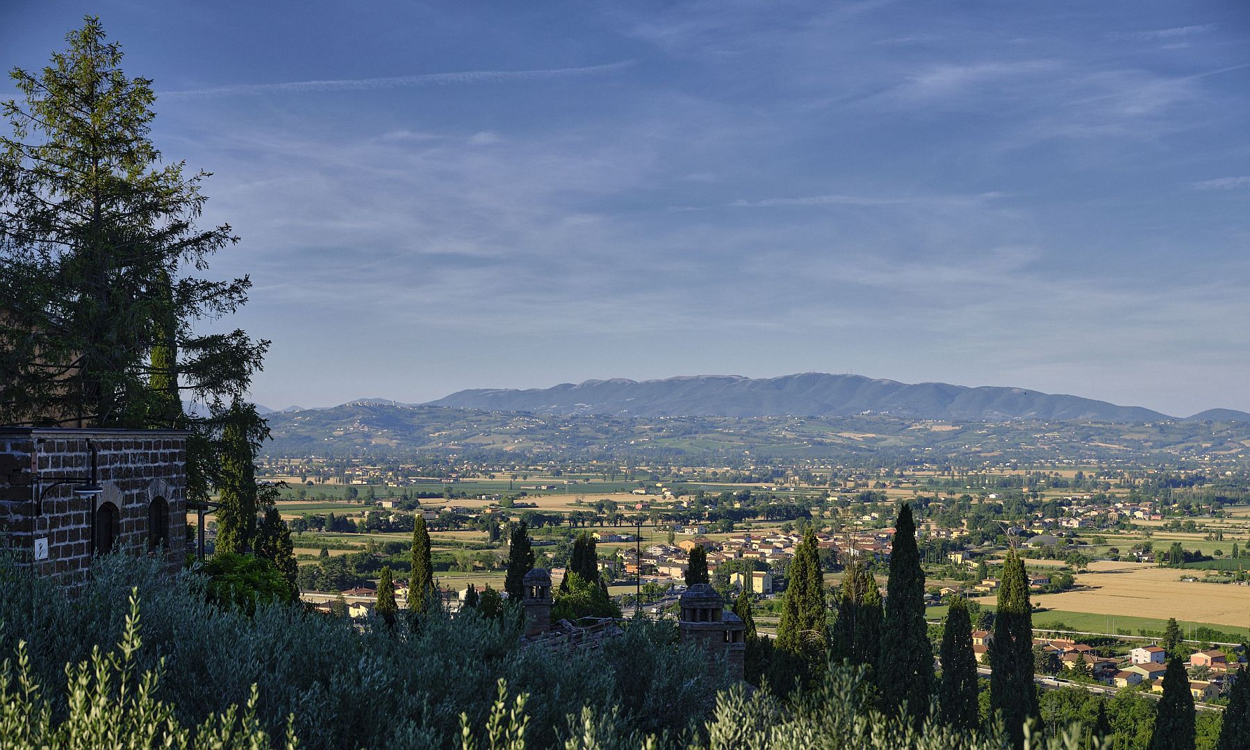
After the Gola del Furlo, the road becomes less steep and the valley widens out as the river – by now the Metauro – starts to wind from side to side as it approaches the Adriatic. The mountains are now rolling hills and the river flows not between canyon walls but, increasingly, between floodplains.

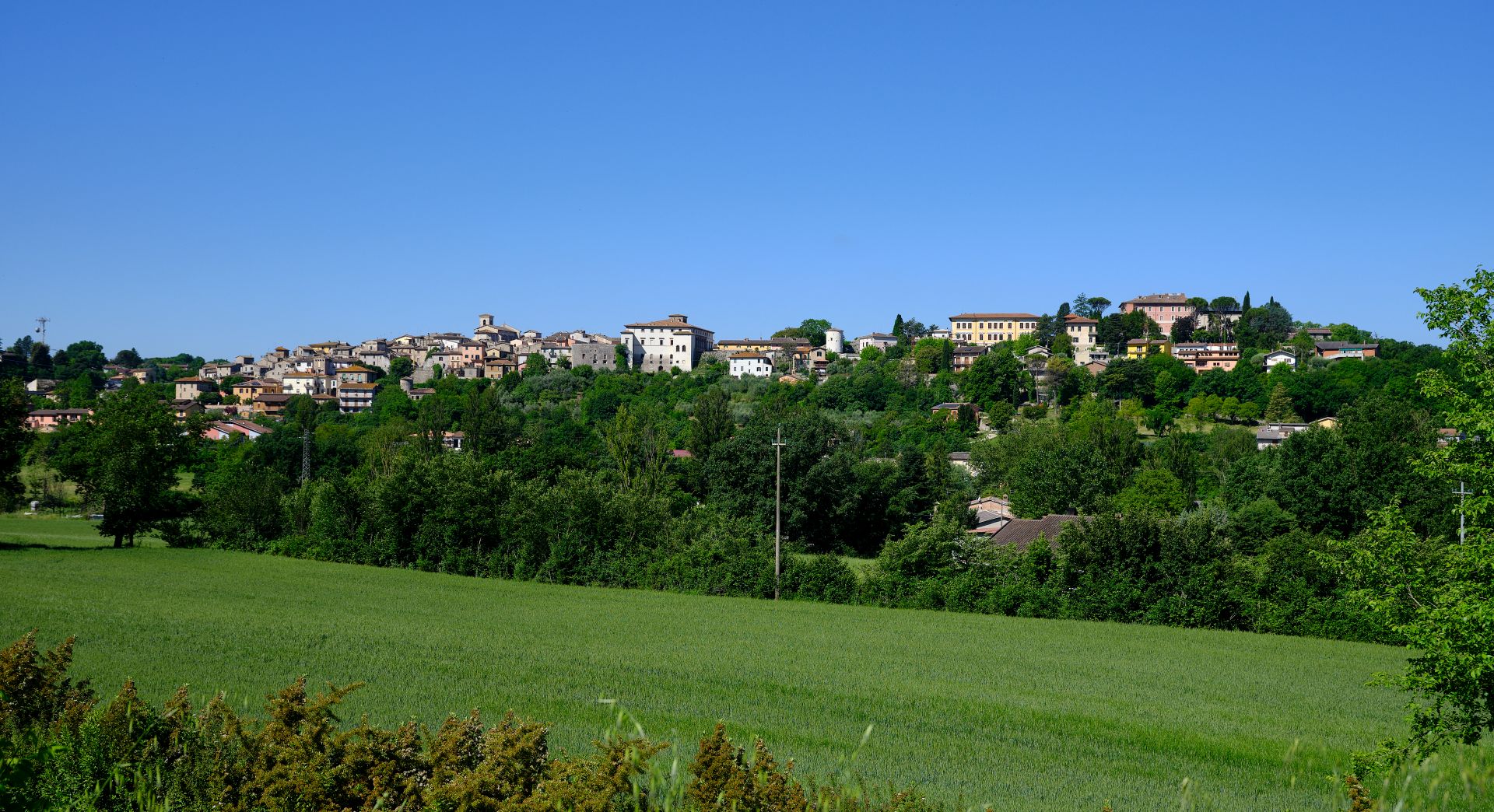
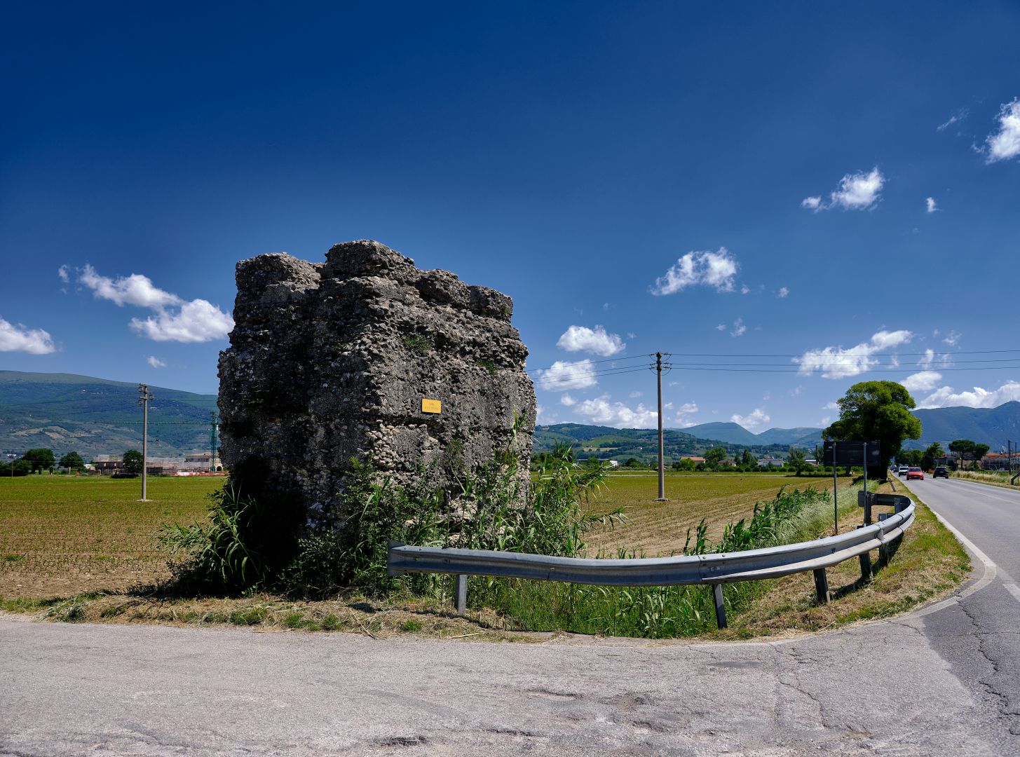
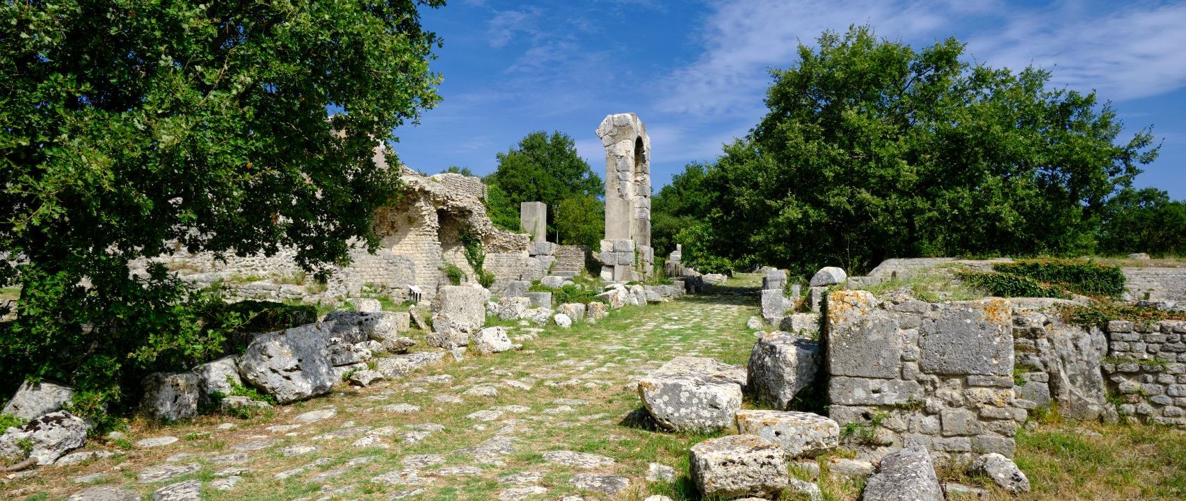
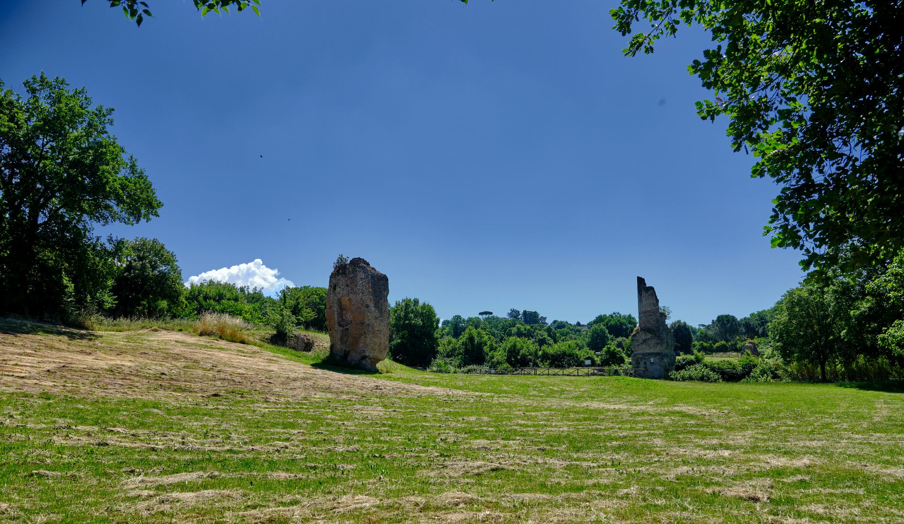
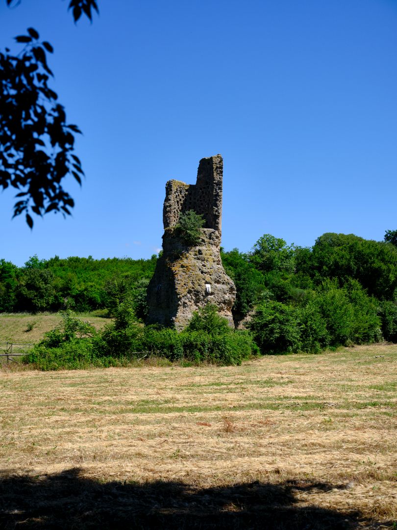
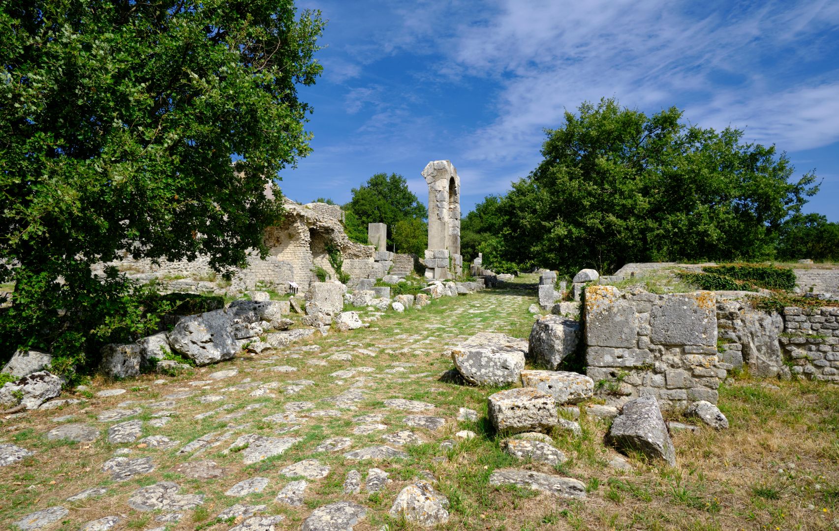
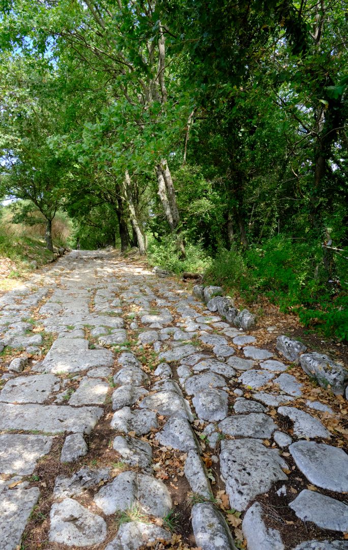
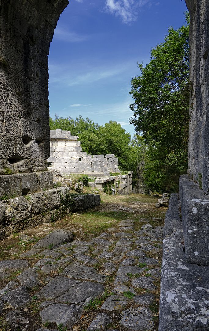
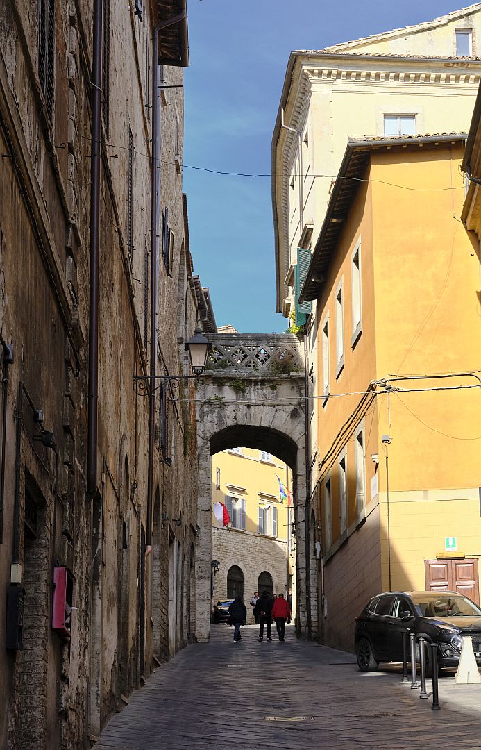
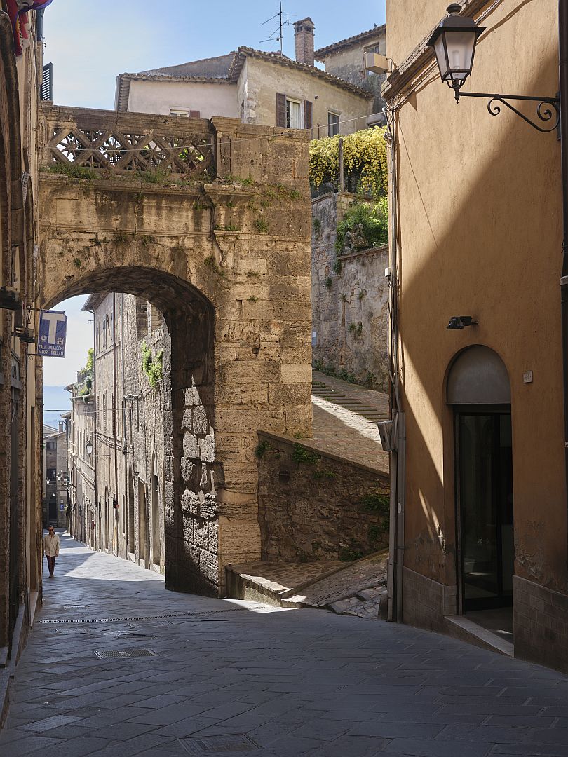
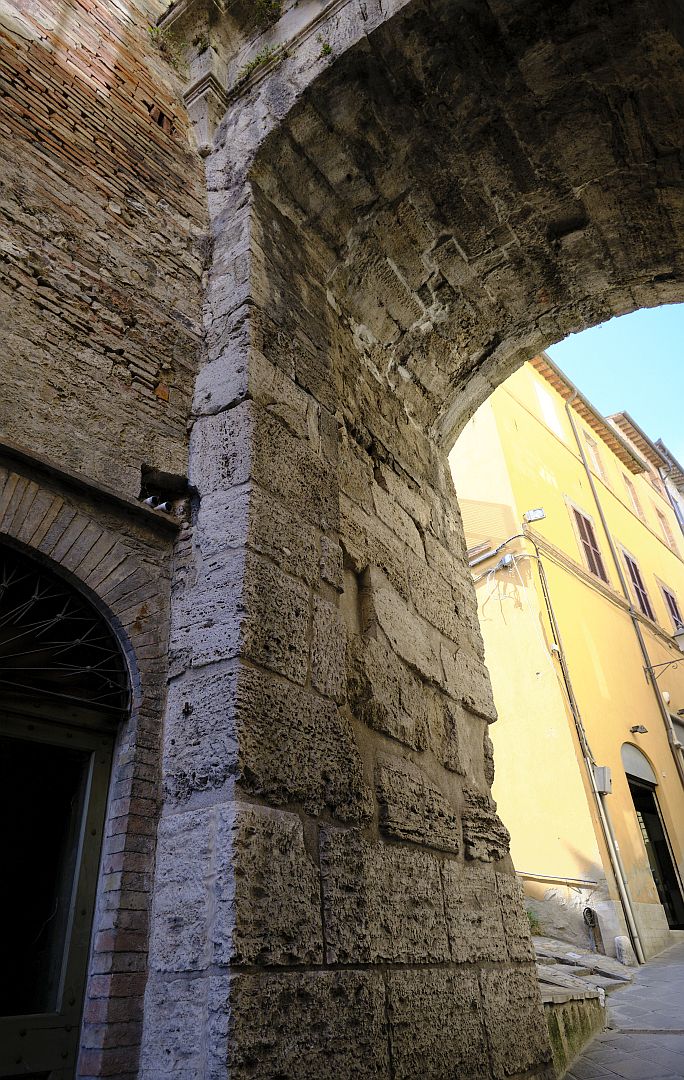
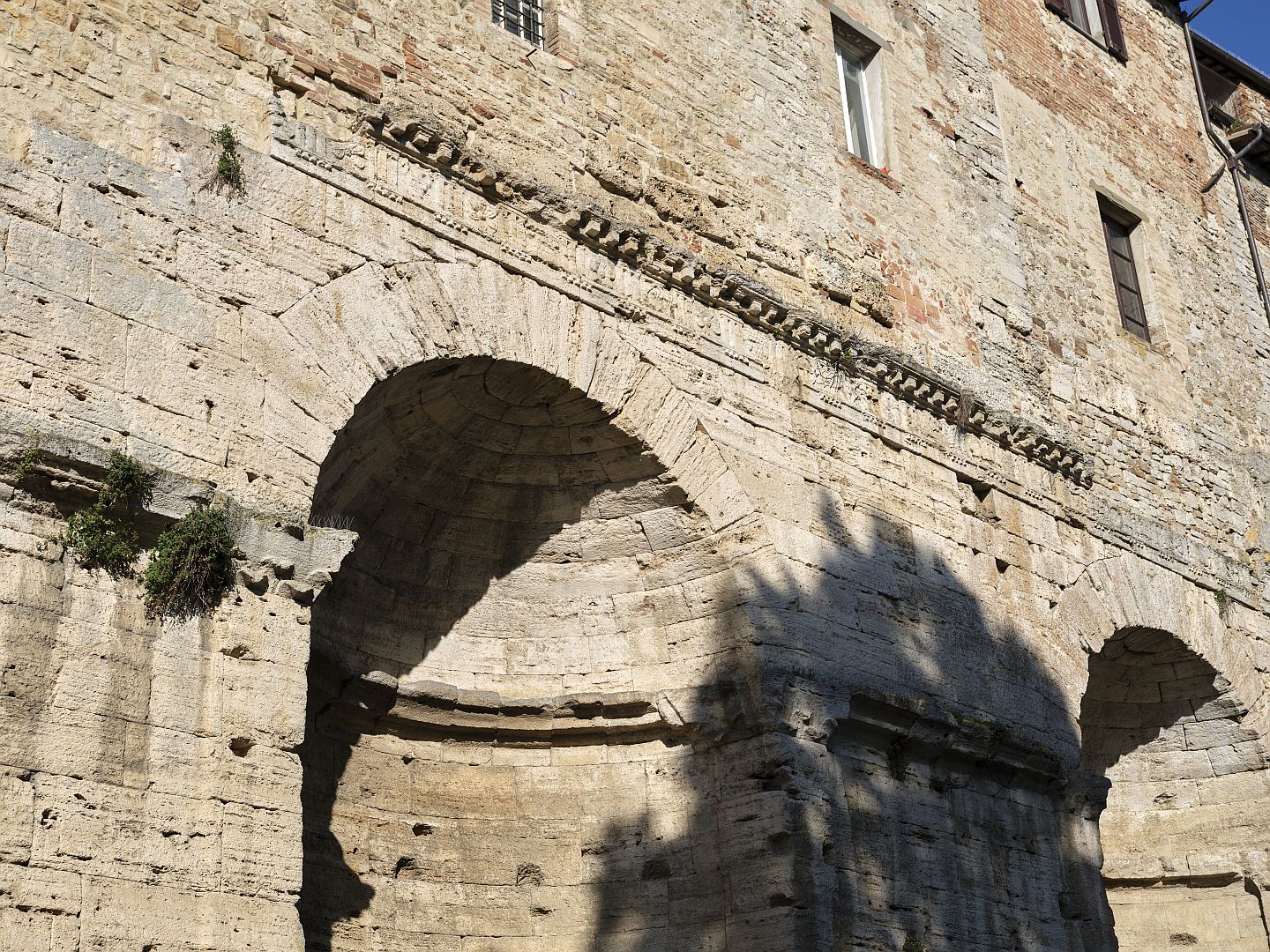
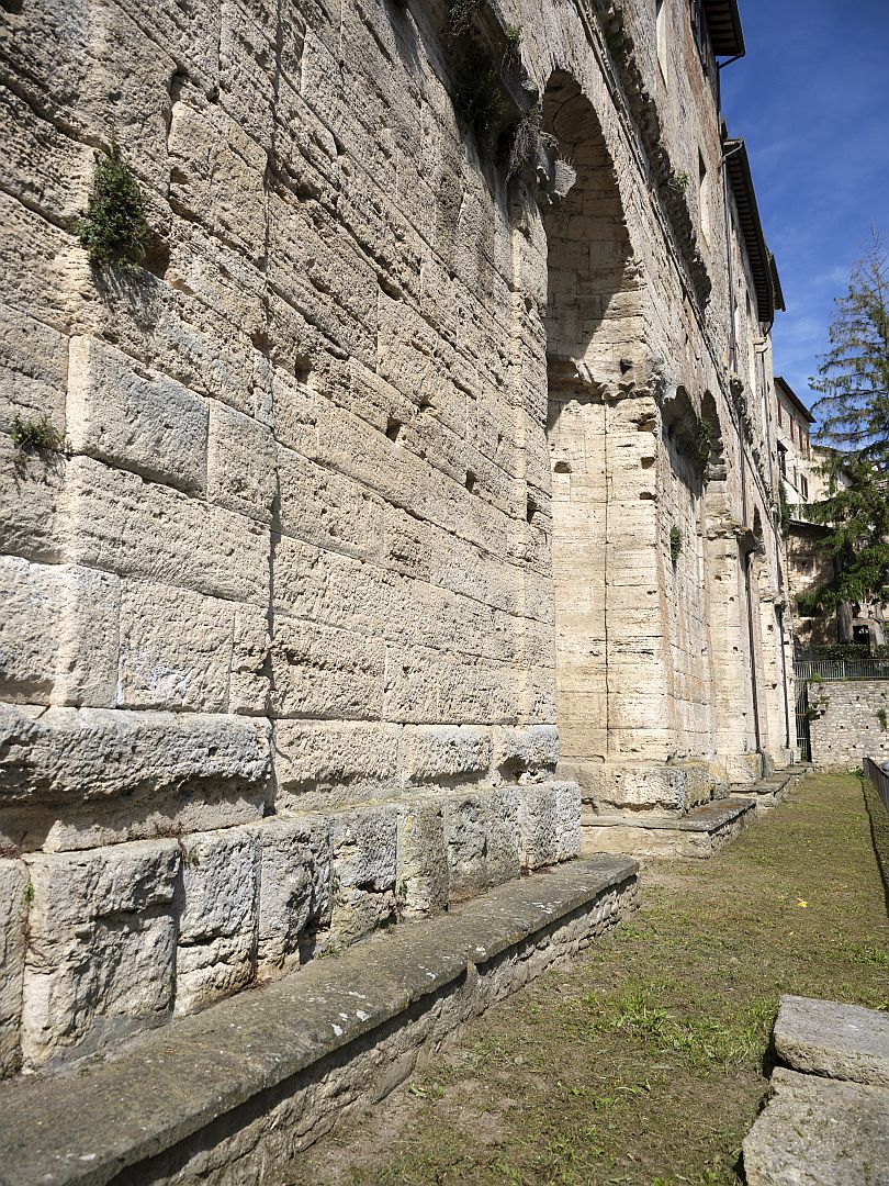
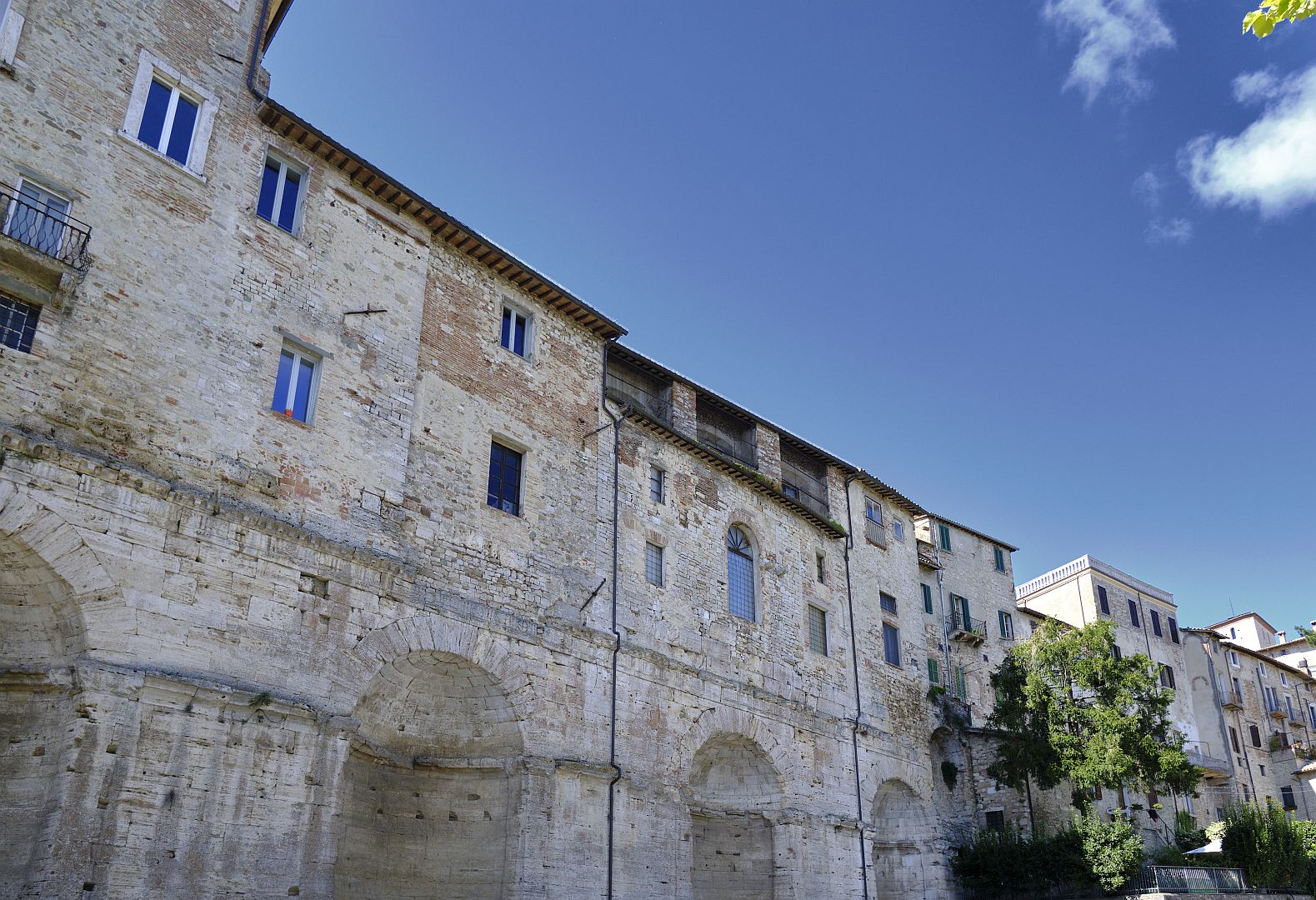
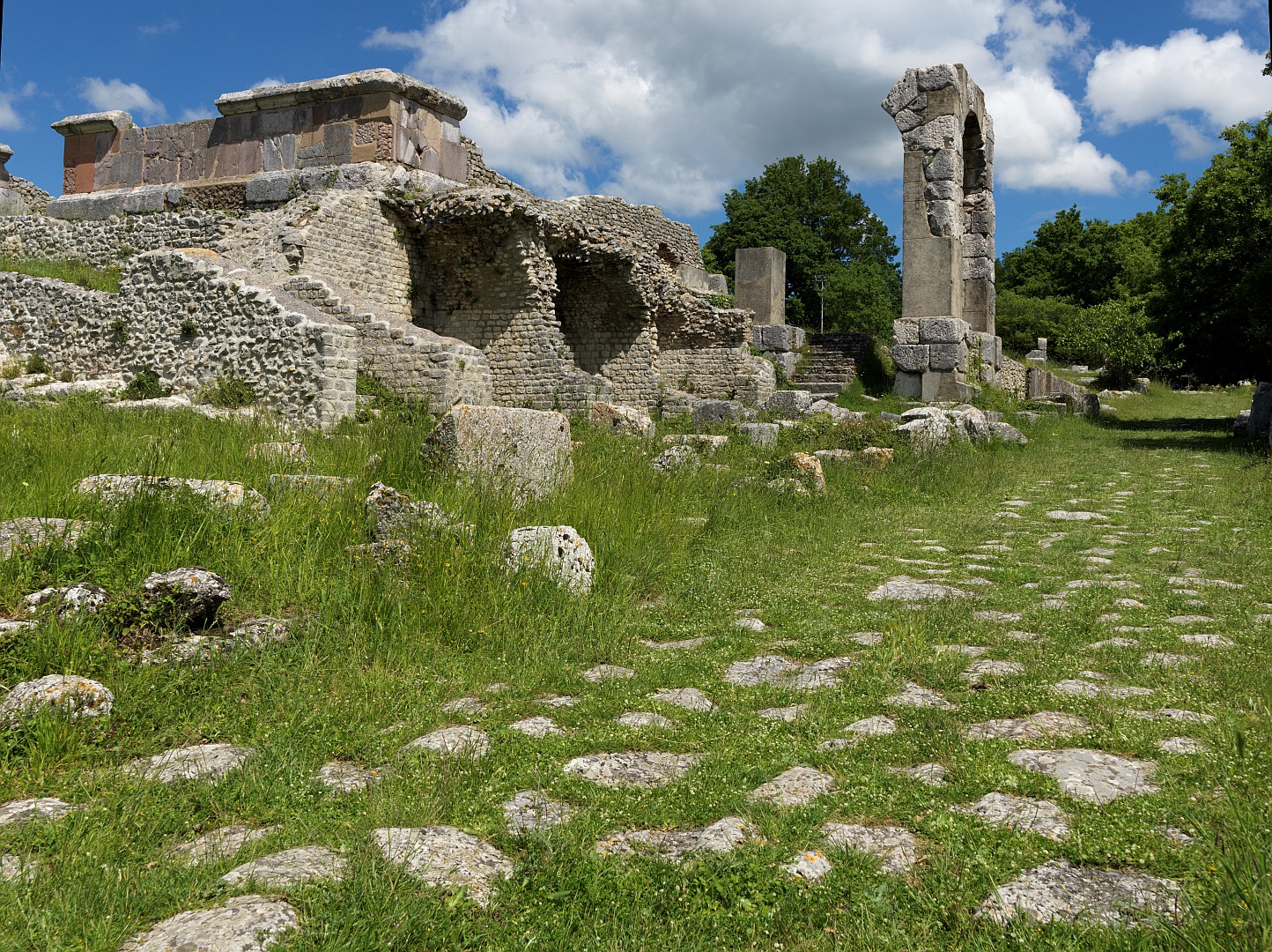
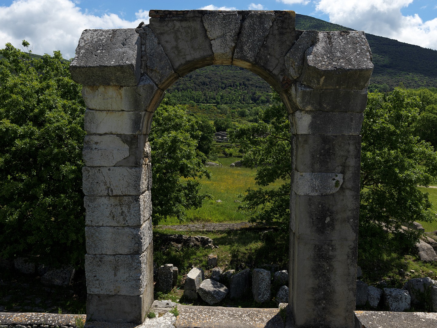
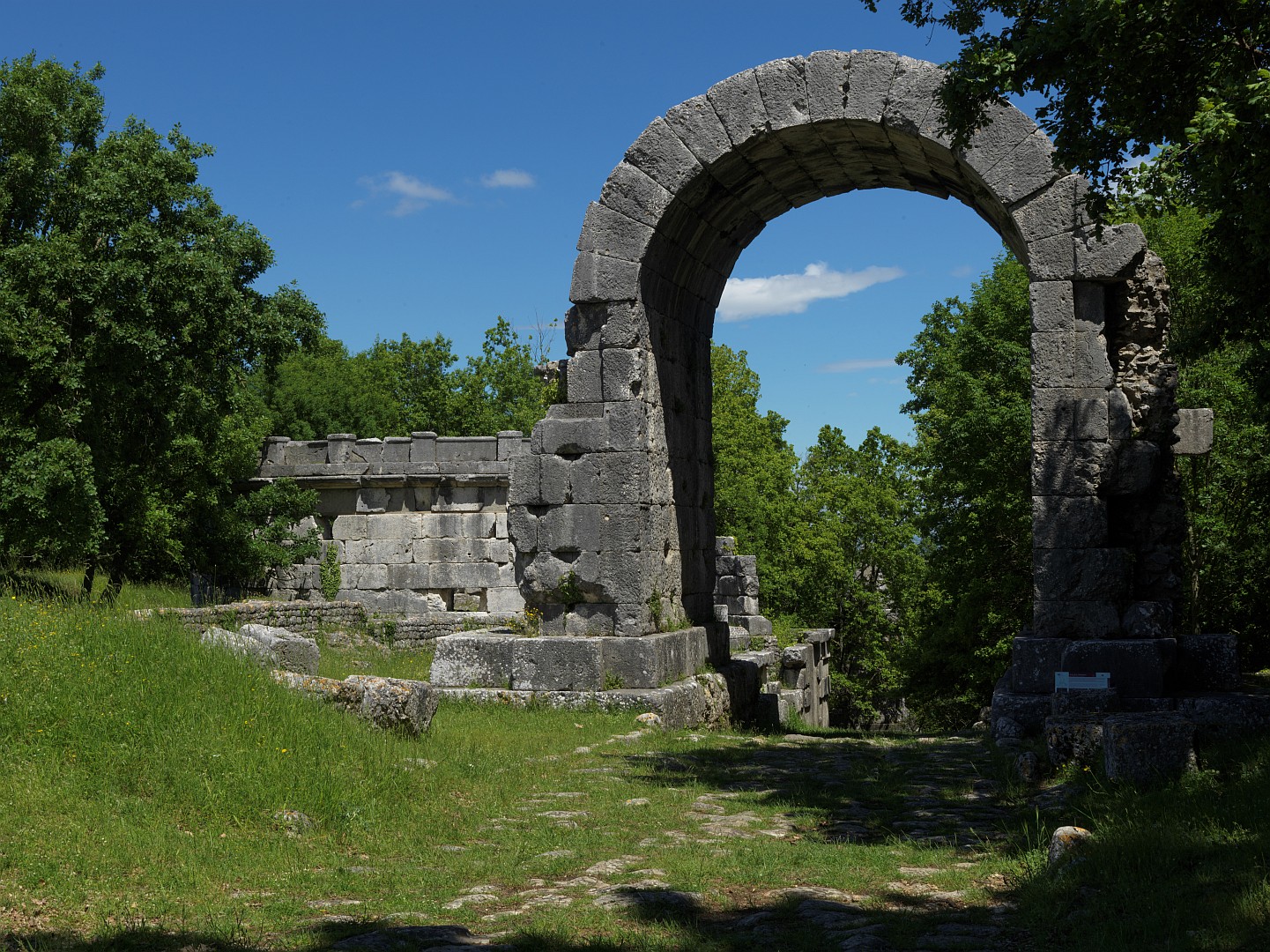
The Flaminia is now mostly underneath several layers of later road, but there is at least one more place where you can see the original. Just as the ancient road came out of the mountains it came to a prosperous town called Forum Sempronii, a name which over the centuries has been transmuted into the modern Italian Fossombrone.

Forum Sempronii was named after Gaius Sempronius Gracchus (154-121 BC), a soldier and politician in the late Republican era who with his brother has been either reviled as a dangerous demagogue or celebrated as a pioneering social reformer. Retelling his career here would take the article off in the wrong direction, but it is worth recording that his reforms, especially land ownership reforms, must have been influential if they named a town after him.

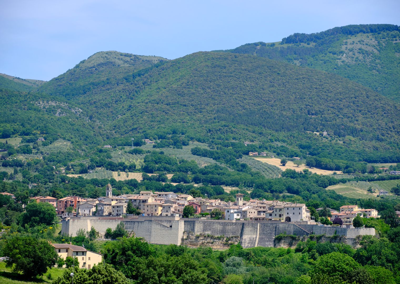
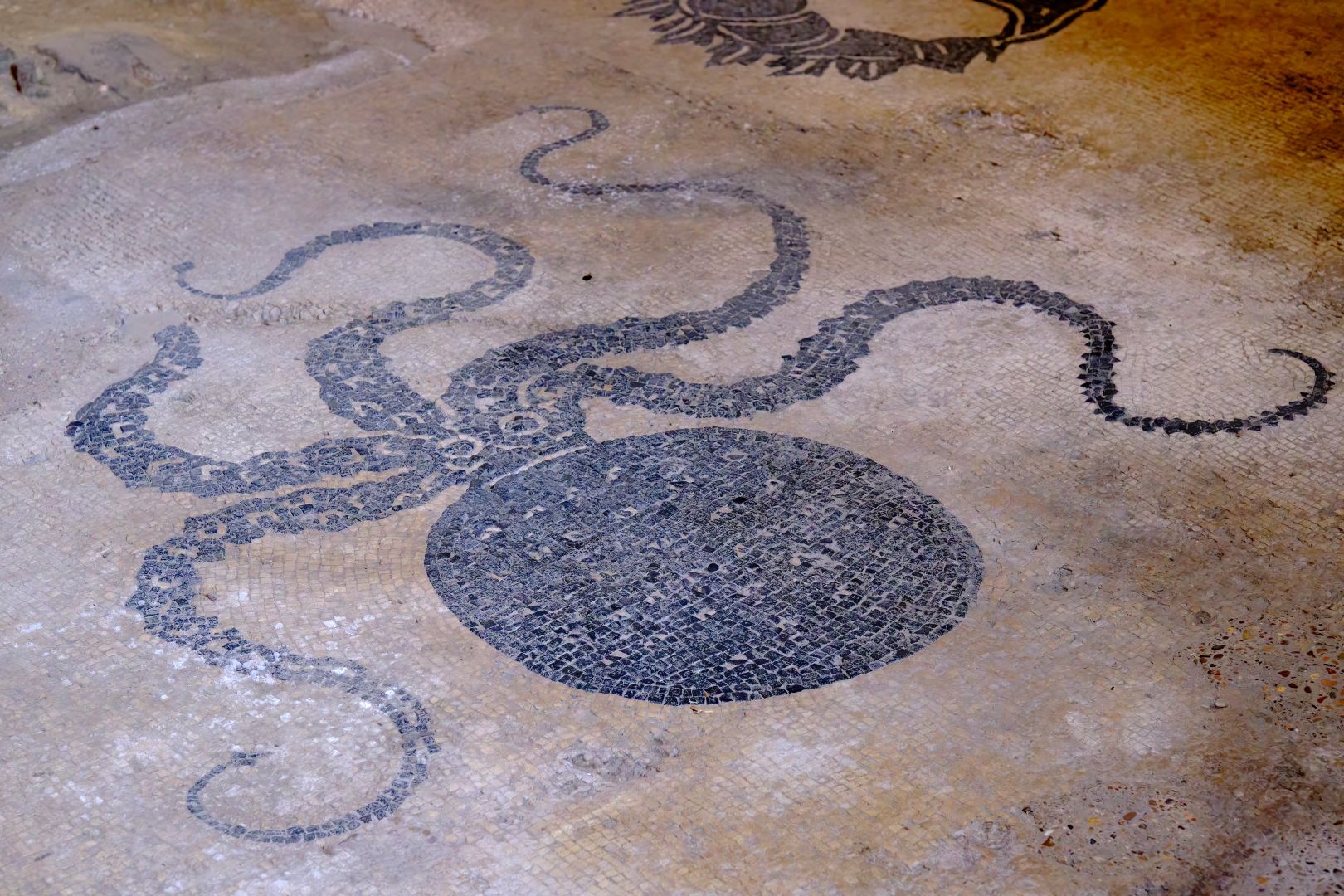
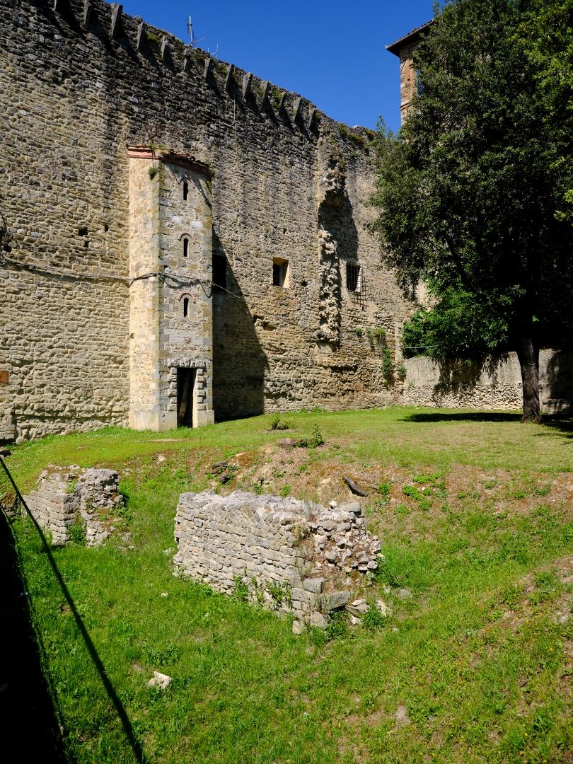
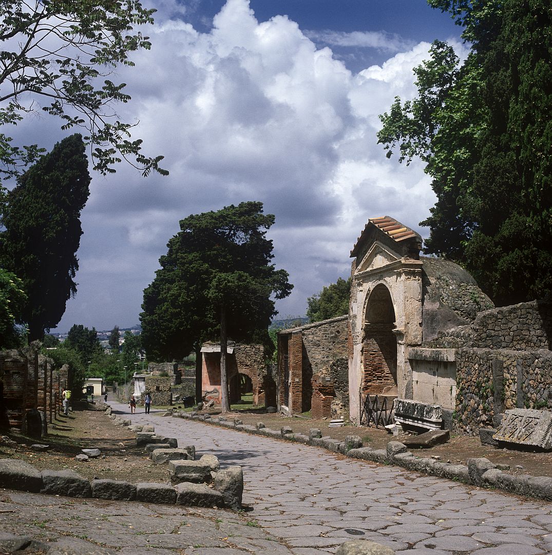
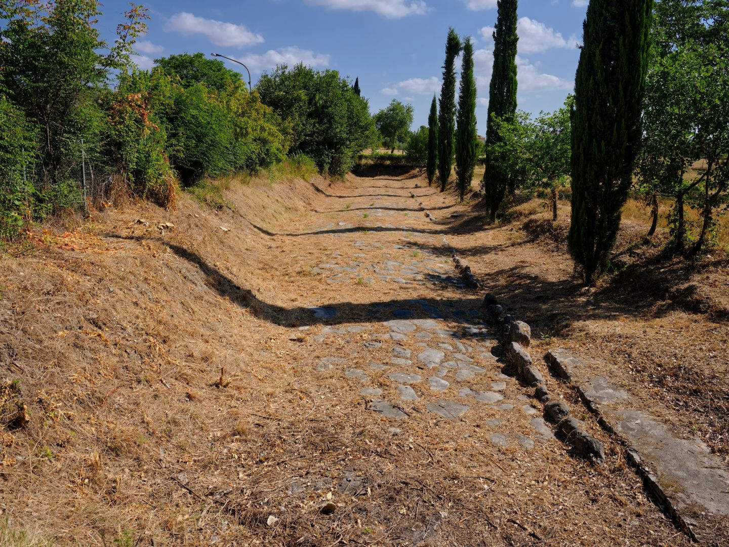
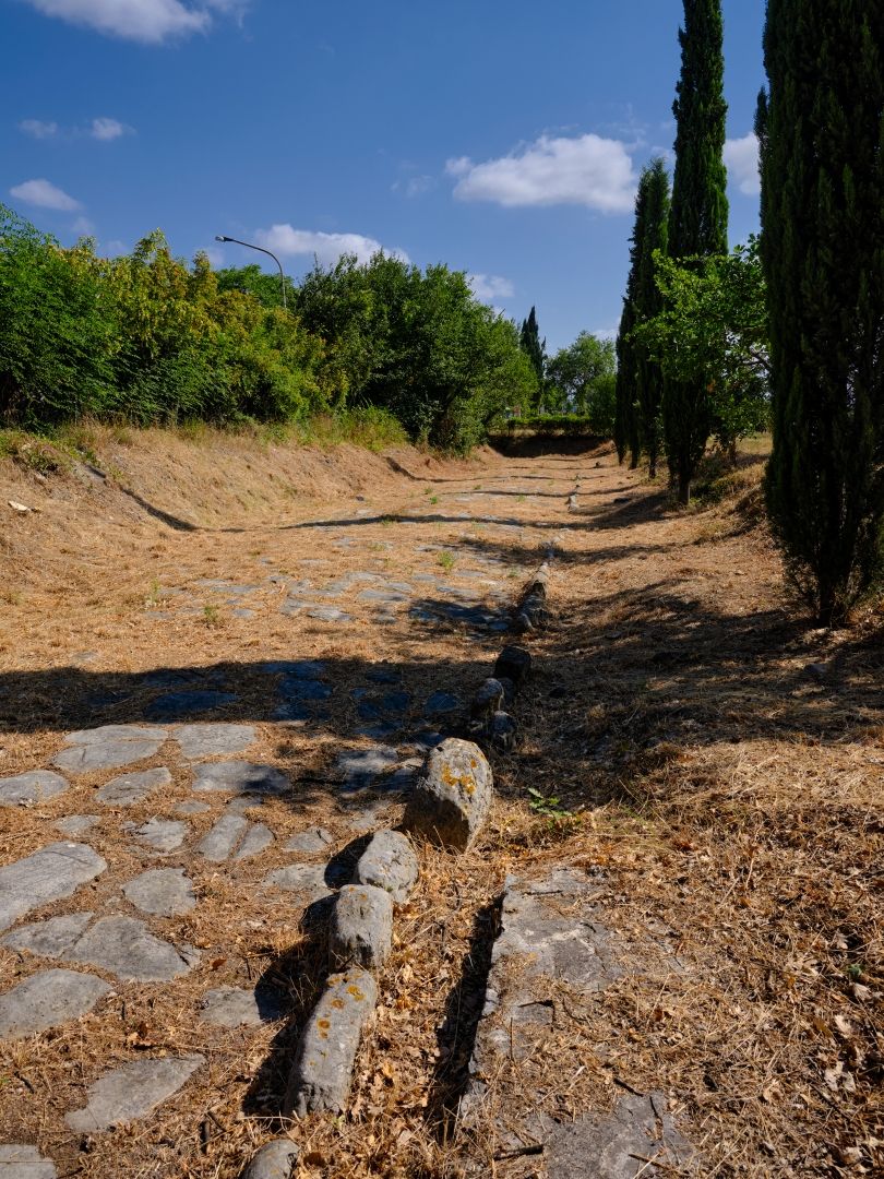
Fossombrone is an attractive town in its own right, but one of its attractions to the history enthusiast is that the modern  town does not sit on top of the ancient one but just west of it, which has allowed the latter to be subject to proper archaeological investigation. We were there on a very hot day in July 2024, and I did feel a bit sorry for the couple of archaeologists who were working in the heat.

Archaeological excavation of Forum Sempronii
Forum Sempronii archaeological excavation. The road in this picture is not the Flaminia, just one around the edge of the forum. Fujifilm GFX-50R medium-format digital camera, 32-64mm lens (click to enlarge).
Forum Sempronii
Exposing the foundations of a large building at Forum Sempronii. Fujifilm GFX-50R medium-format digital camera, 32-64mm lens (click to enlarge).

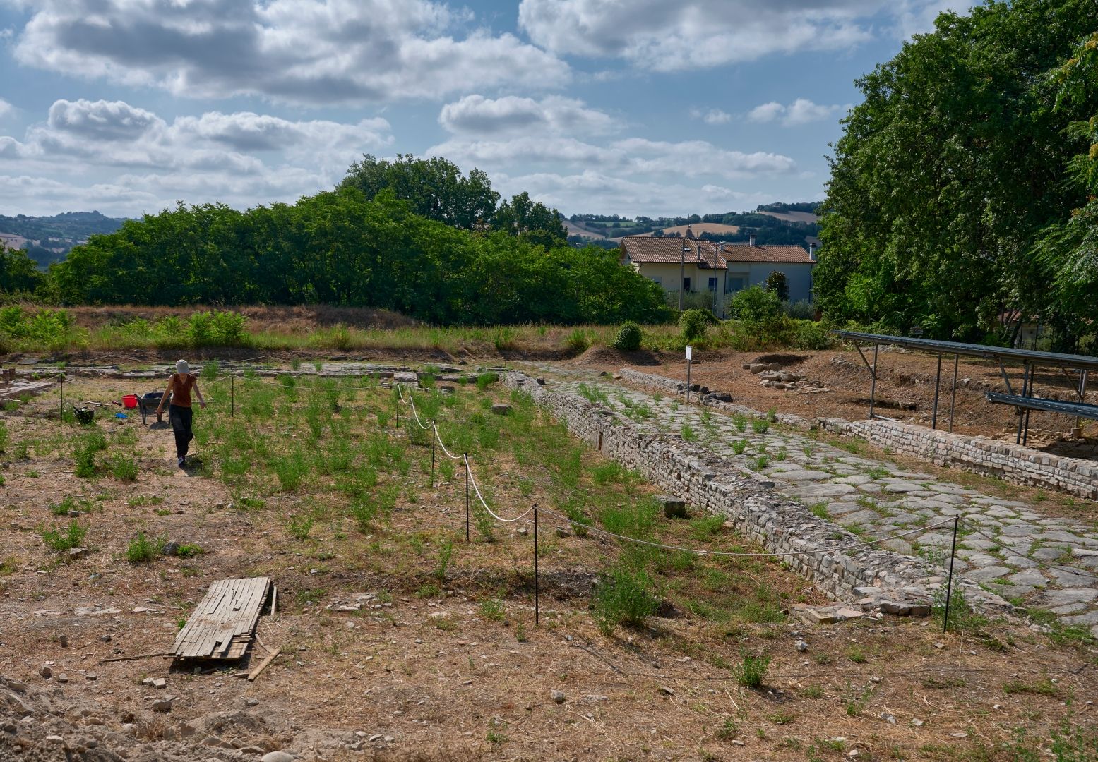
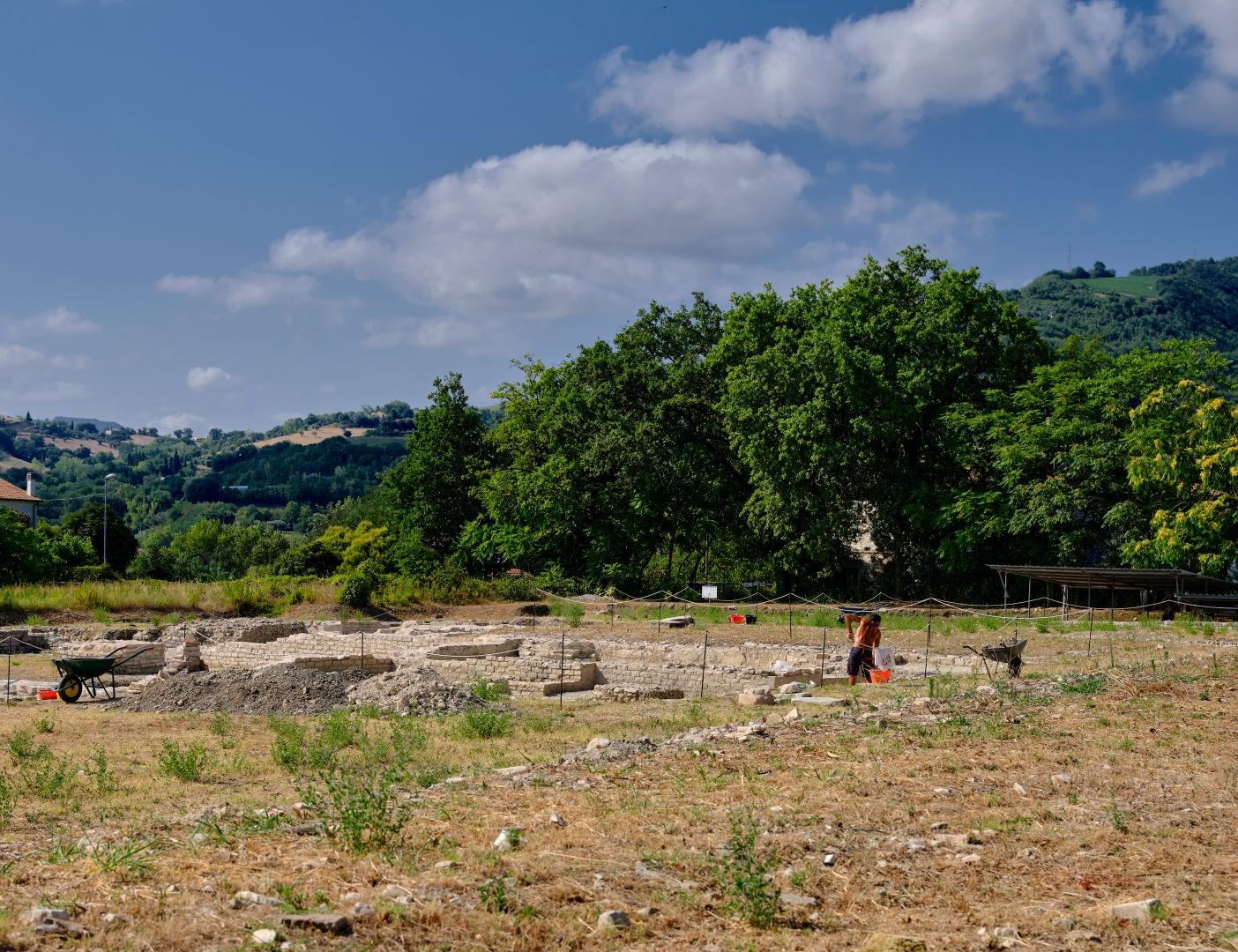
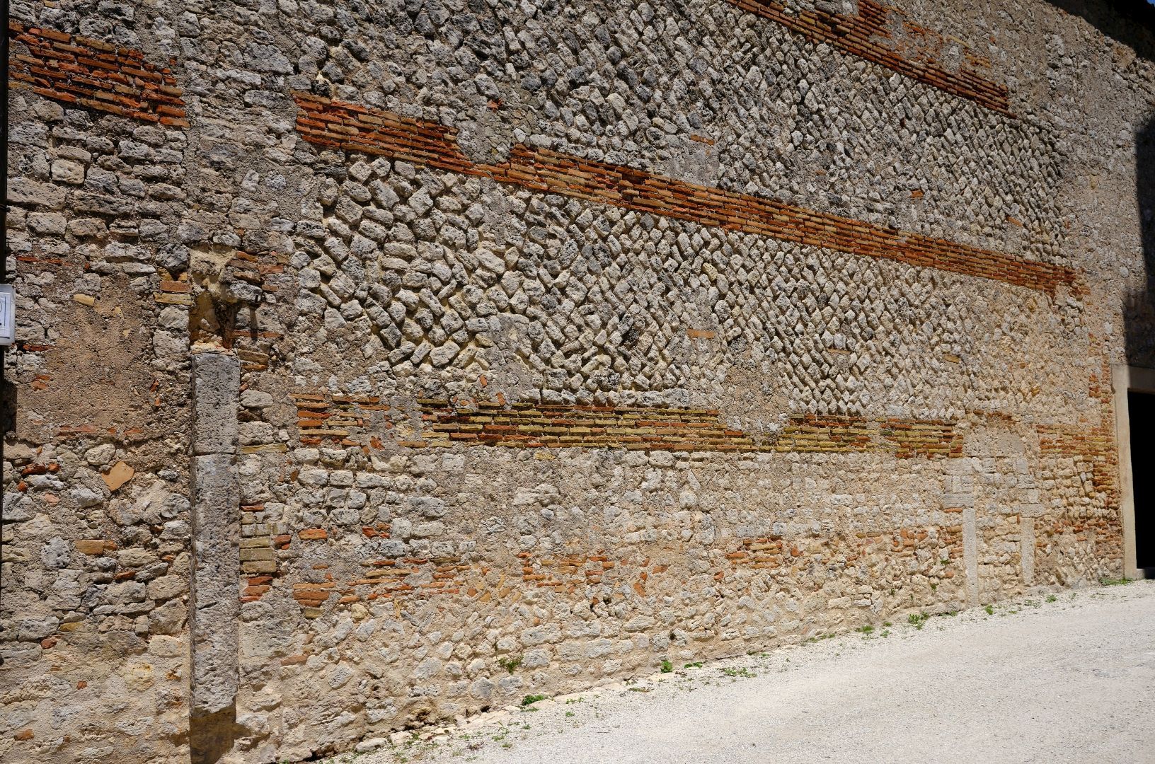
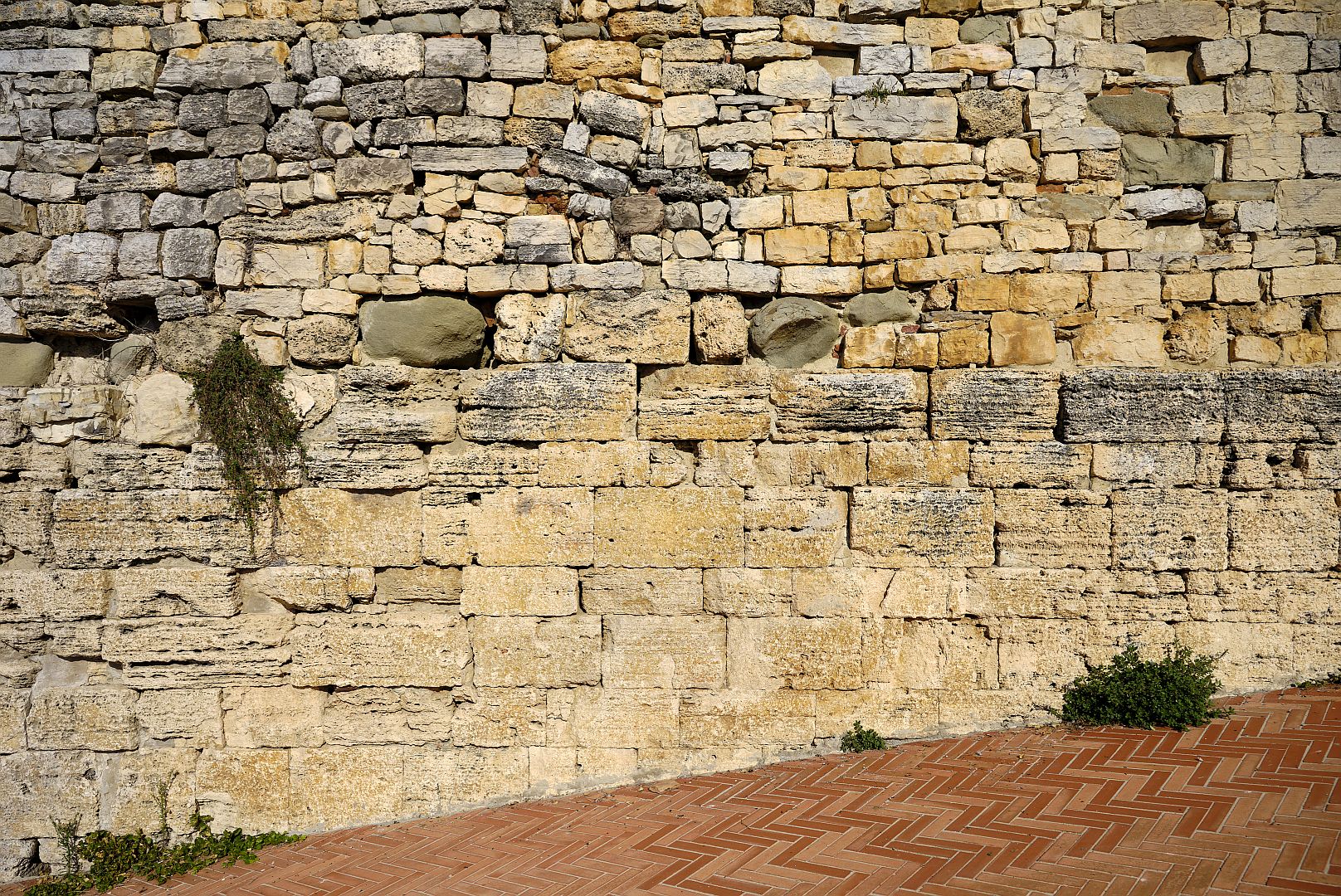
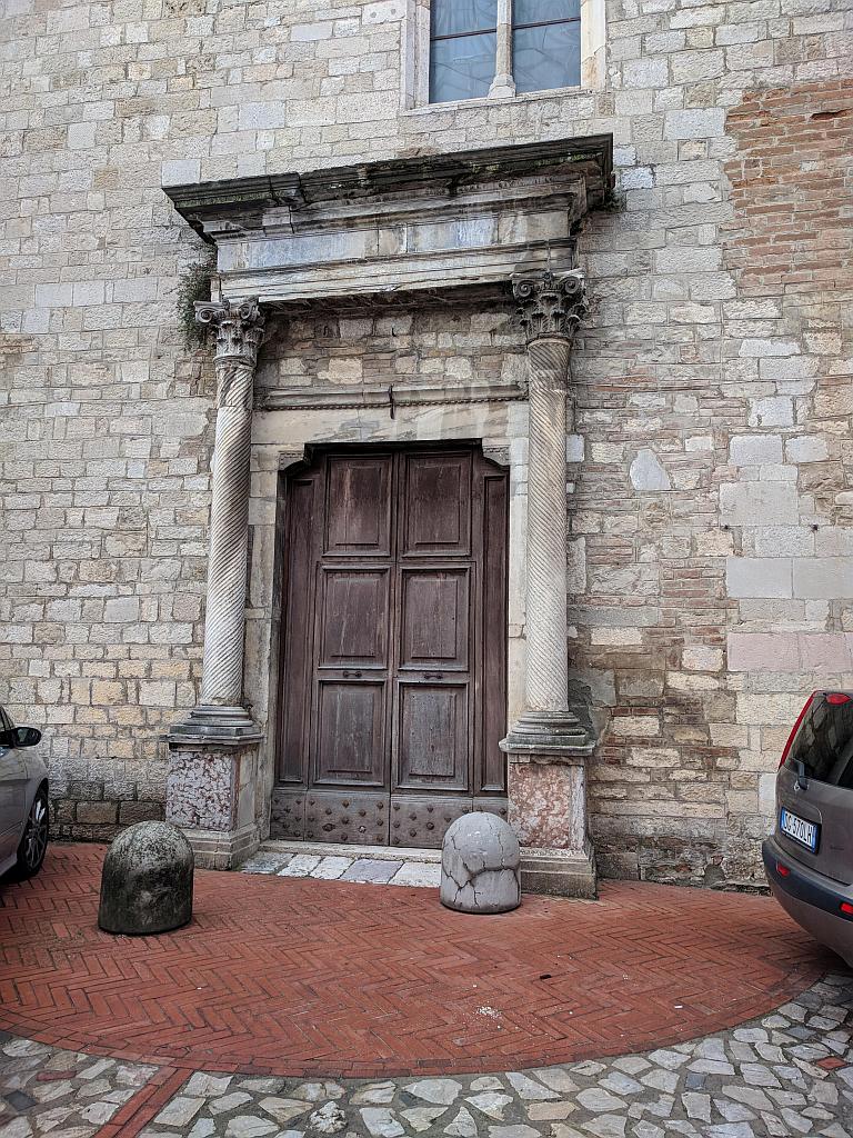
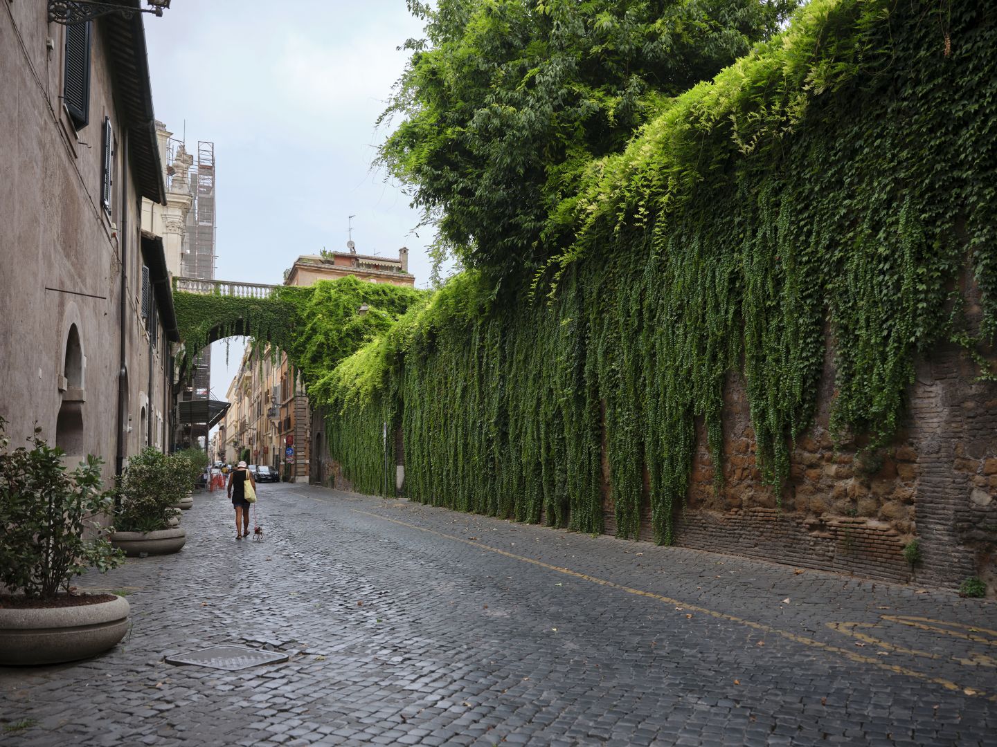
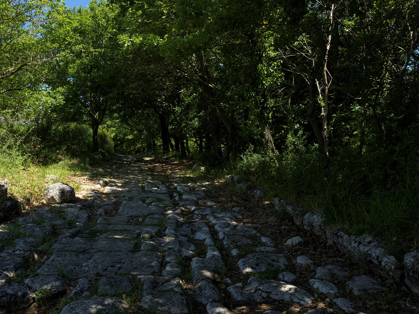
And from my point of view, the big thing is that there is a surviving stretch of the Via Flaminia that you can go and look at, and walk along. This is because for some reason the SS3 deviates a few metres to the north, revealing the ancient road. Here as in Carsulae the Flaminia is an urban road, so it gets the full treatment – basalt paving stones, with drains and footpaths at the edges.

Via Flaminia at Forum Sempronii
The old Via Flaminia at Forum Sempronii. Fujifilm GFX-50R medium-format digital camera, 32-64mm lens (click to enlarge).
Via Flaminia at Forum Sempronii
Drain and footpath beside the Via Flaminia at Forum Sempronii. Fujifilm GFX-50R medium-format digital camera, 32-64mm lens (click to enlarge).

Before long the Adriatic comes into view up ahead and the long descent from the mountains is over. On reaching the coast at Fanum Fortunae (modern Fano) our legionaries would then have swung left up the coast, arriving quite shortly at Pisaurum (Pesaro).

After Pesaro the ancient route is a little unclear for a while – there is a line of hills quite close to the coast and the modern main roads, both the SS16 and the E55 Motorway, follow the inland edge of those hills. I have seen suggestions that the Flaminia tracked close to the coast, but these have a slightly speculative tone.

Screenshot from Google Earth, with hypothetical coastal and inland routes of the Via Flaminia marked in orange and yellow respectively. Source: Google Earth (click to enlarge).

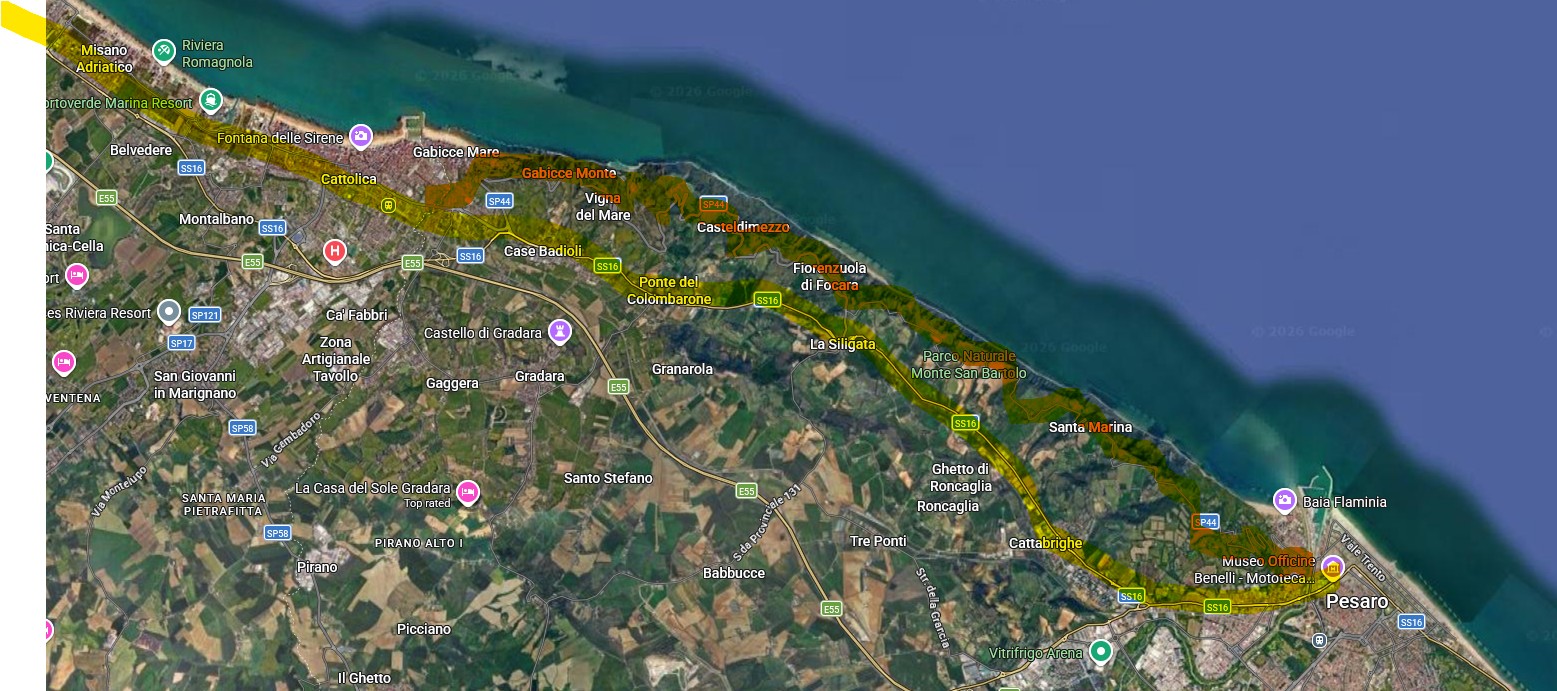
 However in the next town up from Pesaro, now the seaside resort of Cattolica, the renovation of a house in 2020 revealed remains of a Roman road, probably the Flaminia. Here is an article (in Italian) about the rediscovery. So whether the road hugged the coast or went inland, it seems likely that it was definitely at the coast at what is now Cattolica.

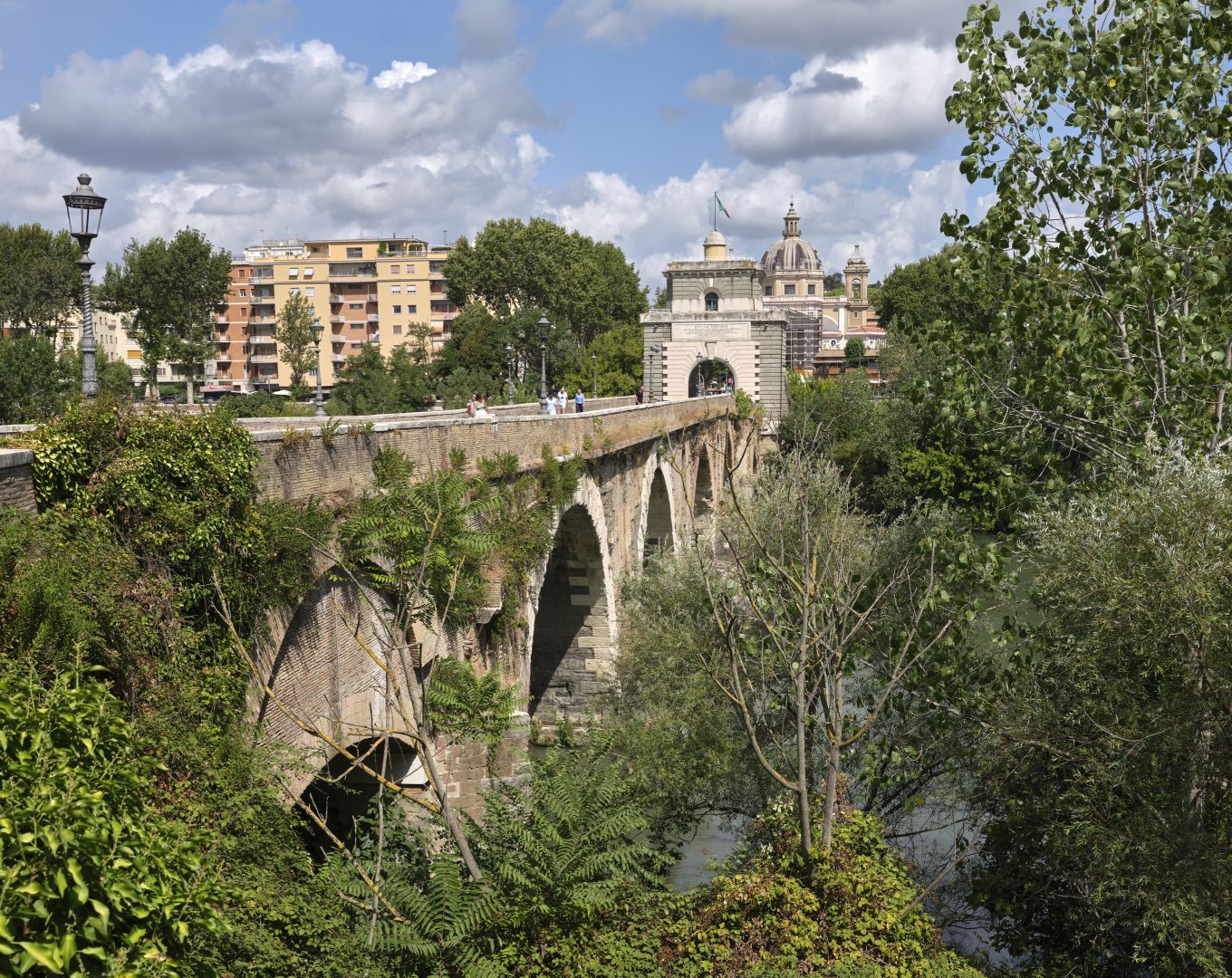
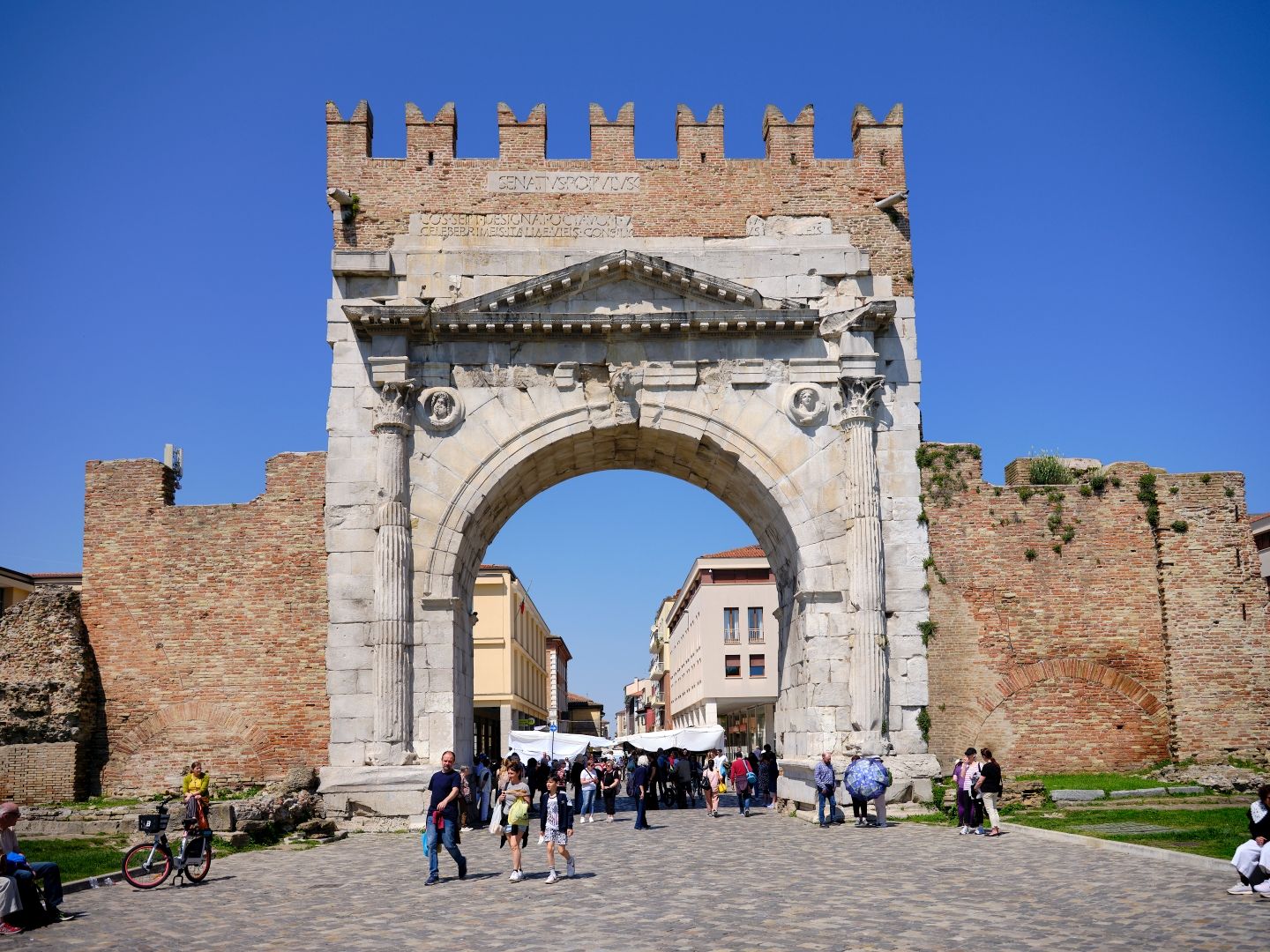
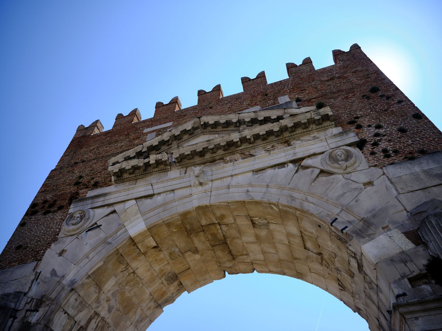
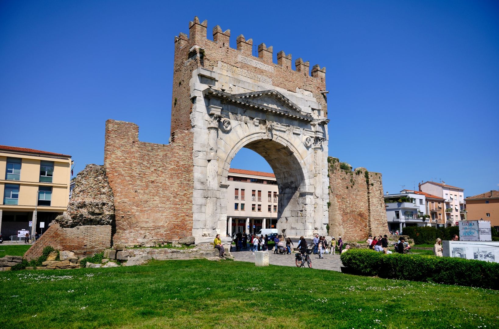
Which is where I rejoined it, for the final run into Ariminium (Rimini) where it ended. And as in Rome at the Porta Flaminia, here there is no doubt at all, because when the renovation of the road under Augustus was complete, they erected a big ceremonial arch where the road entered the town.

The Arch of Augustus at Rimini
The Arch of Augustus at Rimini. Fujifilm GFX-50R medium-format digital camera, 32-64mm lens (click to enlarge).

Thanks to the re-use of the name where the modern road follows the ancient one, I also had the pleasure of hearing my satnav say things like “at the next roundabout, take the second exit and continue on the Via Flaminia”.

If you drive around here you might notice other road signs with classical associations. I went past a sign pointing to the “Rubicone Industrial Zone”. Yes, the Rubicon. Ariminium was one of the northernmost cities in what the Romans in the Republican period considered to be Italy. Beyond that (the Po Valley) was Cisalpine Gaul, with a substantially Celtic population. The boundary was the little river Rubicon. Roman generals were not allowed to bring their armies into “Italy” without the permission of the Senate, and so when Julius Caesar famously crossed the Rubicon without authority, it was an act of defiance. “Crossing the Rubicon” therefore became a common metaphor for passing a point of no return. “Alea iacta est” (the die is cast) said Caesar as he crossed, thereby coining two common metaphors in a single action.

Until 1933 no-one could really agree where the Rubicon was, other than just north of Rimini. This close to the Adriatic, and before artificial canalisation, rivers changed course frequently when they flooded, and the name “Rubicon” had fallen out of local use. So the Fascist government decided to rename a river called the Fiumicino (“Little River”) as the Rubicone. Not everyone agrees, but the modern Rubicon is probably not far from the ancient one. It enters the sea at the modern beach resort of Cesenatico, if you want to find it yourself.

Arch of Augustus from the outside
The top of the Arch of Augustus from the outside, showing medieval repairs. Fujifilm GFX-50R medium-format digital camera, 32-64mm lens (click to enlarge).

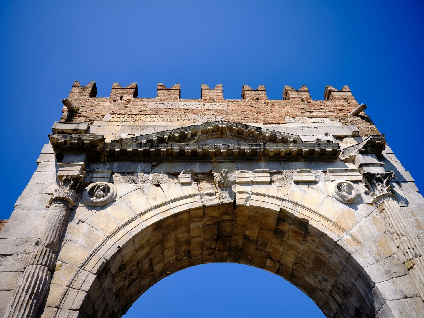
In Rimini, the Arch of Augustus now stands alone, but was a gate in the town walls until the 1930s when the structures either side were demolished. It is also obvious that the top of the arch has been repaired and is of medieval construction, thanks to the characteristic Ghibelline “swallowtail” crenellations. This section does however incorporate part of the original Latin dedicatory inscription.

Arch of Augustus from the inside
The Arch of Augustus from the inside. Fujifilm GFX-50R medium-format digital camera, 32-64mm lens (click to enlarge).

From Ariminium another major consular road – the Via Emilia – continued towards the northwest, which even more than the Flaminia is quite faithfully represented in the modern road system. Another road – not a consular road – ran up the coast through the marshlands of the Po Delta, but this only became important later.

The Arch of Augustus
The end of the Via Flaminia, showing clearly how much of it is the medieval reconstruction. Fujifilm GFX-50R medium-format digital camera, 32-64mm lens (click to enlarge).

And that is the end of my (reconstructed) journey along the Via Flaminia from Rome to Rimini. Although I have written it as if it were a single journey, the photographs were taken over a period of 20 years or more. I have no idea whether anyone else will enjoy reading this, but as the idea of the project grew, I had a lot of fun working on it. I have no doubt that I will acquire more photographs and information that will add to the story, and will update things as needed. If you are one of the many people who know more about this subject than I do, please use the comments to advise me of any errors.

Via Flaminia – All the Way (Part 2)

Welcome to the second of three articles following the ancient Roman road called the Via Flaminia from its start in Rome to its finish in Rimini. If a web search has led you directly to this article, I do recommend you read them in order. You can find the first one here.

The first article discussed the origins of the Roman military roads called “consular roads”, and followed the Via Flaminia from its start in Rome, as far as the ancient town of Carsulae in Umbria.

Via Flaminia leaving Carsulae
The Via Flaminia heading north out of Carsulae, with the town gate in the distance. Hasselblad 501 C/M camera, CFV-50c digital back, Zeiss Distagon CF 60mm lens (click to enlarge).

A Note on Road Construction

Before rejoining the Flaminia at Carsulae, let us pause for a moment to think about how these roads were built, and what that means for us looking for the remnants a couple of millennia later.

My first detailed look at a Roman road was during a visit to Pompeii, and like many visitors I was impressed by the advanced construction, with pedestrian pavements at the sides, gutters and drains, and raised flat blocks at the intersections to allow pedestrians to cross with dry feet while leaving gaps for cart and chariot wheels. I was also struck by the ruts worn by those wheels in the basalt paving stones. (It is, unfortunately, a myth that the standard railway gauge of 4’ 8½” is based on the spacing of those Roman chariot wheels).

Via Flaminia in Carsulae
The Via Flaminia in Carsulae, showing the flagstones, raised pedestrian pavement, and the grooves worn by cart and chariot wheels. Hasselblad 501 C/M camera, CFV-50c digital back, Zeiss Distagon CF 60mm lens (click to enlarge).

So road construction in urban areas was quite sophisticated. I had not given much thought to how the roads were made in rural areas, but had I done so it would have been obvious that it would be unnecessary and uneconomical to put the same amount of effort into them as in the towns.

Instead it seems that the rural roads were constructed like a modern well-made rural gravel road. First they would have dug down to get to rock or solid earth, then they would have filled it with rubble or coarse gravel to provide both firmness and drainage, then covered it with a top layer of finer gravel and compacted earth, raised in the centre, again to aid drainage. The result, as a sign at the bridge at Ponte Fonnaia explained, would have been something that looked very much like a modern Italian unmetalled strada bianca. This was great news for a history nerd, as it meant that when walking along such a road it would be much easier to imagine what it would have been like for our legionaries.

Between Acquasparta and the Ponte Fonnaia

And with that in mind, a month or so ago two friends and I decided to walk along the surviving stretch of the Flaminia between the town of Acquasparta and the Ponte Fonnaia, the Augustan bridge which I wrote about in my post on The Ponte Fonnaia on the Via Flaminia.

Acquasparta
Acquasparta today, an elegant town dominated by the Renaissance Palazzo Cesi. The Via Flaminia ran along the foot of the hill on which the town now stands. Fujifilm GFX 50R medium-format digital camera, 32-64mm lens (click to enlarge).

At the tourist office in Acquasparta a couple of years ago I acquired a map of the route of the Flaminia as it passes through the area of Massa Martana and Acquasparta, and a sunny Umbrian spring day seemed a very good reason to get out and see the Flaminia on foot, as the legions did.

Actually, we did it the other way round, parking the car at the Ponte Fonnaia and walking down to Acquasparta, but for consistency with the rest of the article I will describe it on our way back, from south to north.

The Flaminia’s route was determined by topography and the need to get military force north from Rome as efficiently as possible, and around here that meant following the lower slopes of the Monti Martani. That took it through a region where there are plenty of warm springs coming out of the limestone, and so a chain of towns sprang up along the road servicing the spa trade.

These springs still exist, but although it is still apparently possible to bathe in some of them, the principal economic activity is bottling and selling the water, before anyone has bathed in it. The largest such operation is at San Gemini, and having tried their stuff, I have to say that it manages the difficult job of making Umbrian tap water taste decent by comparison. Their business model must be based on the assumption that anything which tastes so horrible must be good for you. We have a book on Umbria from the 1930s that even claims that the stuff is radioactive! Presumably the modern bottlers avoid those sources; at any rate the two unopened bottles I have had downstairs for six years do not glow in the dark.

San Gemini
San Gemini from halfway up Monte Torre Maggiore, the highest peak in the Monti Martani. The Via Flaminia ran parallel to, and just beyond, the modern E45 motorway which you can see in the valley. Fujifilm GFX 50R medium-format digital camera, 32-64mm lens (click to enlarge).

Our route north from Acquasparta took us at first along paved urban roads, but before long there was a sign saying “Via Flaminia Antica” which led us onto roads which became progressively narrower, and eventually unmetalled.

Via Flaminia near Acquasparta
The “Via Flaminia Antica”, heading north from Acquasparta. Fujifilm GFX 50R medium-format digital camera, 32-64mm lens (click to enlarge).

According to the map the road took us over another ancient bridge, but we didn’t notice it on the way down and it took a bit of finding on the way back, due to its being very overgrown. The Wikipedia article on the Via Flaminia says that this bridge is rare in preserving construction techniques from the original 3rd-Century-BC road rather than from the Augustan rebuilding, but under all those blackberry bushes, your guess is as good as mine.

A hidden bridge on the Via Flaminia
There is an ancient bridge under here somewhere. Fujifilm GFX 50R medium-format digital camera, 32-64mm lens (click to enlarge).

Once onto the gravel section of the road it became possible, with a bit of imagination, to see traces of that Roman substructure where bits of the rubble layer had been exposed by erosion. Like elsewhere, where possible the road builders had kept to the ridgeline where it would be passable in all seasons. That in turn meant that we often had good views of the surrounding country.

Via Flaminia with sign
Keeping to the high ground again, the Via Flaminia here is just a track across some fields. Fujifilm GFX 50R medium-format digital camera, 32-64mm lens (click to enlarge).
Ancient road bed
In several places where the top layer of dirt had washed away, more substantial layers could be made out. Fujifilm GFX 50R medium-format digital camera, 32-64mm lens (click to enlarge).
The Via Flaminia crossing farmland
Crossing between fields of barley. Again, one wonders how different this scene would have been in the 3rd Century BC. We can assume the road surface was in better condition, and that there were no power poles. Fujifilm GFX 50R medium-format digital camera, 32-64mm lens (click to enlarge).

Somewhat relieved to find that the car was still parked at the Ponte Fonnaia, we had a look at the bridge. As I mentioned in the original article, it dates from the 1st Century AD Augustan reconstruction of the Flaminia, and you can make out letters and Roman numerals on some of the stones. This, supposedly, is because they were made to a standard pattern and the blocks would be labelled at the quarry, so that when they arrived at the site they could be more easily assembled according to the intended design, like an IKEA bookcase. I don’t know if that is really true.

The Ponte Fonnaia
The Ponte Fonnaia, which dates from the Augustan restoration of the Via Flaminia, when the road was already a couple of hundred years old. Fujifilm GFX 50R medium-format digital camera, 32-64mm lens (click to enlarge).
Letters and numbers incised on the stones of the Ponte Fonnaia
Letters and numbers incised on the stones of the Ponte Fonnaia. Were these part of the assembly instructions? Fujifilm GFX 50R medium-format digital camera, 32-64mm lens (click to enlarge).

From the Ponte Fonnaia to Bastardo

Continuing north from the  Ponte Fonnaia, the road continued due north at the foot of the Martani Mountains, to a place called Vicus Martis Tudertium (the Village of Mars of Todi). This was where another road from Tuder (Todi) came in from the west and joined the Flaminia, and it seems from the name that there was a temple of Mars here. Sources suggest that this is the origin of the name “Monti Martani” (mountains of Mars) but I wonder about that. Could it have been the other way round? Were the mountains already sacred to Mars?

In my post on The Temple on the Mountain I described the pre-Roman temple there, and also how it was standard Roman practice to appropriate local deities into their own pantheon. The Umbri were a warlike people: was that forgotten Umbrian deity a god of war like Mars, and did he continue to be worshipped beside his mountains in his new guise?

Votive offerings of Martial figures
Pre-Roman votive offerings of martial figures in the Civic Museum of Todi. Fujifilm X-Pro 3 digital camera, 35mm lens (click to enlarge).

Such amateur speculation aside, we can say that virtually nothing remains of Vicus Martis Tudertium today, it having been abandoned after major earthquake damage in 306 AD. The stone of which it was built was all scavenged for reuse in other buildings including a local church, which certainly looks as if it contains older material.

Vicus Martis Tudertium
The site of Vicus Martis Tudertium today, beside the Via Flaminia. The medieval church of Santa Maria in Pantano was not here in ancient times, but the road was. Fujifilm GFX 50R medium-format digital camera, 32-64mm lens (click to enlarge).
Santa Maria in Pantano
Santa Maria in Pantano from the front, with the adjacent building, both showing signs of having been built with stones scavenged from the temple of Mars which once stood here. Fujifilm GFX 50R medium-format digital camera, 32-64mm lens (click to enlarge).
Santa Maria in Pantano
Inside the church of Santa Maria in Pantano. The column capital certainly isn’t Roman – Lombard, perhaps – but could the column itself have started its life as part of the temple of Mars? Fujifilm GFX 50R medium-format digital camera, 32-64mm lens (click to enlarge).
Santa Maria in Pantano
One of the external walls of the church, again showing stones reused from the the ancient site. Fujifilm GFX 50R medium-format digital camera, 32-64mm lens (click to enlarge).
Vicus Martis Tudertium
A final picture of the site of Vicus Martis Tudertium, showing the proximity of the Monti Martani. I was standing on the route of the Via Flaminia when I took the photograph. Fujifilm GFX 50R medium-format digital camera, 32-64mm lens (click to enlarge).

The nearest modern town is Massa Martana, which was not there in antiquity – originating as a 7th-Century Lombard frontier post, it is a comparative newcomer. It was originally called just “Massa” but the new Italian government renamed it Massa Martana in 1863 in an explicit reference to Vicus Martis Tudernum (although the locals still call it “Massa”).

Massa Martana
The town of Massa Martana, looking very nice after its extensive rebuilding following the 1997 earthquake. The ancient Via Flaminia passed just to the east (ie on the far side, in this photograph). Fujifilm GFX 50R medium-format digital camera, 32-64mm lens (click to enlarge).

Beyond what would one day be Massa Martana, the route of the Flaminia is a bit unclear for a while, but eventually it gets to a point where the mountains, now descending into hills, were low enough to allow the road to cross from west to east.

Near Torre
Looking south from near the village of Torre, not at the Martani Mountains any more, but the Martani Hills near the modern town of Bastardo. The Via Flaminia crossed from west to east (right to left in the photo) near here. The actual route is a bit vague, probably because it lies under one of the modern roads. The existence of the medieval castle suggests that the road may have passed quite close. Fujifilm GFX 50R medium-format digital camera, 32-64mm lens (click to enlarge).

As I described in my post on A Town Called Bastard, the modern town of Bastardo is only three or four hundred years old, but it too grew up on what had been the Via Flaminia. Just before you get to Bastardo there are the remains of a Roman villa, and somewhere nearby are the remains of another bridge, which I have yet to find.

Now for some extremely amateurish amateur archaeology. The two screenshots that follow are from Google Maps, of the area just south of Bastardo where the Roman villa is located. In the first, the “Roman Villa from the Imperial Age” is at the lower left, while the “Old Via Flaminia” comes in from the upper right, but then just seems to peter out.

Via Flaminia in Bastardo
Screenshot from Google Maps of an area on the southern side of Bastardo. Source: Google Maps (click to enlarge).

Now let us look at the same area in Google Maps, but with satellite view enabled. The “Via Flaminia Vecchia” comes in from the top right again, but this time you can clearly see that it continues, marked by the long curving field boundary. No doubt this is already well-known to experts, but I felt quite pleased to have noticed it. And the Roman villa can be seen to be at the back of an olive grove, which explains why I didn’t find it when I came looking for it.

Bastardo satellite view
The same area in Google Maps with satellite view enabled. Source: Google Maps (click to enlarge). Or click here to open in Google Maps and explore for yourself.

A friend who lives nearby tells me that recent excavations suggest that the “villa” was actually a mansio or road station for troops on the march, with a kitchen, mess hall and so forth. As far as I know the name of that place is lost. Every now and then civic-minded locals talk about changing the name of Bastardo to something a bit more dignified, but it never quite takes off. I’m sure that if they knew the name of the ancient predecessor they might have picked that.

I like the idea that there was a kind of ancient Autogrill there – after all, Bastardo started out as a coaching inn and stables to cater to the needs of travellers, but it seems that the “bastard” who opened that establishment was by no means the first to do so.

To Bevagna and Across the Valley

Heading away from the place whose ancient name we don’t know and which is now called “Bastard”, our legionaries would have descended slowly through rolling hills towards the plain now known as the Valle Umbra, and the town of Mevania (modern Bevagna).

Gualdo Cattaneo
A photograph taken just east of Bastardo, looking towards Gualdo Cattaneo. Once again, I am not quite certain of where the Flaminia ran here, but it is either somewhere in this photograph, or I was standing on it. Fujifilm GFX 50R medium-format digital camera, 32-64mm lens (click to enlarge).

I haven’t been able to track down any maps of where the Flaminia ran here, but looking again at the satellite view of Google Maps, I see a few straight stretches of road that don’t seem to start or end anywhere in particular, so here is a highly speculative possible route.

Google Maps Bastardo to Bevagna
Screenshot from Google Earth satellite view with a hypothetical route of the Via Flaminia between Bastardo and Bevagna highlighted in yellow. I based this on looking for straight stretches of road or field boundaries that don’t seem to start or end anywhere, but which nonetheless seem to form a continuous line. Once you get down into the Valle Umbra that doesn’t work any more because all the roads are straight there. (click to enlarge, or click here to open in Google Maps and explore for yourself).

Mevania was an important Umbrian town in pre-Roman days, but after its incorporation into the Roman imperium it thrived even more due to its position on the Flaminia, where it too hosted a mansio, and on a river which was navigable down to the Tiber near Perugia.

Bevagna
Bevagna today, with Assisi in the distance. The Via Flaminia entered the town from the left and left it from the right. Fujifilm GFX 50R medium-format digital camera, 32-64mm lens (click to enlarge).

Although the Bevagna we see today is mostly medieval, it nonetheless preserves its ancient past authentically in its road map, and the Flaminia runs the length of the town.

Bevagna Piazza Filippo Silvestri
A Roman column in Bevagna’s main square, the Piazza Filippo Silvestri. Sources suggest – plausibly – that this was the forum of ancient Mevania, and the Via Flaminia came through here. Fujifilm GFX 50R medium-format digital camera, 32-64mm lens (click to enlarge).
Bevagna Corso Matteotti
The main street of Bevagna, now the Corso Matteotti, once the Via Flaminia. Fujifilm GFX 50R medium-format digital camera, 32-64mm lens (click to enlarge).

Bevagna preserves other ancient remains as well. On a side street which leads to the medieval gate at Piazza Garibaldi, you can see substantial parts of a 2nd-Century temple (to which deity it was dedicated is unknown). It survived through being incorporated into a Christian church.

Bevagna Roman Temple
The remains of the Roman temple in Bevagna. Fujifilm GFX 50R medium-format digital camera, 32-64mm lens (click to enlarge).

There was a theatre, the shape of which is preserved in the medieval houses built on its remnants.

There are also the mosaic remains of part of a bath complex from the Second Century AD, which came to light during the 1600s. They are just down a street next to the remains of the temple described above. The mosaics – on a marine theme as befits a bath – are very well-executed. You can gain entry by booking a time at the town hall. Or you can peer through the dirty windows, which is what most people seem to do.

Roman bath mosaics at Bevagna
Bevagna, the mosaics in the bath complex. Fujifilm X-Pro 3 digital camera, 35mm lens (click to enlarge).
Roman bath mosaics at Bevagna
Bevagna, the mosaics in the bath complex. Fujifilm X-Pro 3 digital camera, 35mm lens (click to enlarge).

Leaving Bevagna by the medieval Porta Foligno, you can see the remains of Roman walls in a small park.

Roman and Medieval walls in Bevagna
Two small sections of Roman walls outside the medieval walls of Bevagna. They are clearly Roman, firstly because of the characteristic “diamond brick” pattern in places, and secondly because the wall was built hollow, then filled with concrete. What sort of structure they were part of, I don’t know. Fujifilm GFX 50R medium-format digital camera, 32-64mm lens (click to enlarge).

Down in the valley now known as the Valle Umbra, the Via Flaminia headed northeast in its habitual straight line. It did not lead to either of the nearby towns of Hispellum (Spello) or Fulginiae (Foligno) but to a spot between the two called Forum Flaminii, where it was rejoined by the eastern branch, coming up from Spoletium (Spoleto).

Frieze from Forum Flaminii
Fragment of a frieze found at Forum Flaminii, on display at the Palazzo Trinci in Foligno. Fujifilm GFX 50R medium-format digital camera, 32-64mm lens (click to enlarge).

These days the valley is dead flat, and very fertile (the onions of nearby Cannara are prized locally) but when the road was first built in the 3rd Century BC, the valley was swampy and flood-prone. The Roman engineers would therefore have had to build a causeway of sufficient height to allow the road to be usable in all weathers.

During the Roman period, the valley was drained and turned into productive farmland. Then after the fall of the empire the constant work needed to maintain the drainage system ceased, and nature reasserted itself. Before long it was once again mostly swamp. Small-scale and uncoordinated efforts were made in the Middle Ages, but the canals and dykes we see today mostly date from the 19th Century.

Despite the rising and falling water levels over the centuries, the modern Flaminia (here called the SR316) still follows the old route across the valley, on a causeway which, no matter how many times it has been repaired, must sit on the original Roman foundations somewhere beneath the surface. As elsewhere on the road, on the outskirts of towns our legionaries would have marched past large monumental tombs, the remains of a couple of which can still be seen.

Roman tomb next to the Via Flaminia
The remains of a monumental tomb beside the Via Flaminia between the towns of Bevagna and Foligno. The causeway on which the modern road runs must be on the same foundations as that built by the Romans. Fujifilm GFX 50R medium-format digital camera, 32-64mm lens (click to enlarge).

I frequently take this road when heading to Foligno, Spello or Assisi from Bevagna, and enjoy pointing out to passengers that we are travelling on the Flaminia, possibly with a bonus lecture on the consular road system or ancient water management. There is nothing like a captive audience.

That is the end of the second article in this series on the Via Flaminia. It will shortly be joined by the final instalment, in which we cross the Apennines and head up the Adriatic coast to the end of the road in Ariminium (Rimini).

Edit: You can find the final part of this series here.

Via Flaminia – All The Way (Part 1)

Welcome to the first of a series of articles describing the ancient Via Flaminia, from its origin in Rome to its terminus at Rimini on the Adriatic coast.

A few years ago in 2019 I wrote about a visit to the ancient Roman town of Carsulae, on the Via Flaminia as it passes through Umbria, and – inspired by my realisation that the “Legions’ Road to Rimini” that Kipling wrote about in Puck of Pook’s Hill was in fact the Via Flaminia, I indulged myself in some flights of fancy about the legions marching along the Flaminia on their way to conquer distant lands to the north. That original post is here.

Since then I have visited parts of the road several times, and have written about it again in my posts on The Ponte Milvio in Rome, A Town Called Bastard, A Visit to Narnia and The Ponte Fonnaia on the Via Flaminia.

Over time I started to think about the possibility of a post describing the entire 300km or so, from Rome to Rimini, and I think I have enough material now to give it a try. Obviously this can by no means cover every part of it – that would take a substantial book. Nor did I take all of these photographs in sequence, but I have assembled them in order, from south to north, to give an idea of the journey that those marching legions took.

There is more detail on the parts where the road passes through Umbria, because that’s where I live when I am in Italy, and a bit lighter on the later parts where it heads up the Adriatic coast, but I don’t think that is inappropriate; the history of the region and the history of the road are very much intertwined, and there do seem to be more remnants of the ancient road in its central sections in Umbria and Marche. I really don’t know how interesting people will find this, but I have to say that I had a lot of fun researching it, taking the photographs for it, and writing it.

This article grew in the writing, partly because researching it alerted me to new places to visit and photograph, so it became clear that I would need to split it into three parts. This is the first.

But first, a brief historical recap.

A Consular Road

The Via Flaminia is what is known as a “consular road”, built around 220 BC. These were military roads that were built during Rome’s expansion in Italy, in the period of the Republic (509-27 BC). Their purpose was power projection – the ability to get an armed force quickly to where it was needed.

Map of the Via Flaminia
Map of the Via Flaminia. The principal route is shown in blue, with the later alternative route via Interamna and Spoletium in purple. The orange route is a later road. Source: Wikimedia Commons (click to enlarge).

Under the Roman Republic, the Senate made the laws, but administration was undertaken by various types of elected magistrates, of whom the most important were the consuls. These were elected in pairs, and each could veto the other. They led both the civil administration and the army, and were expected to take the field and lead the army in time of war.

The consular roads were an important part of how Rome projected power; the Via Appia, the Via Flaminia, the Via Cassia, the Via Emilia, these main ones took their names from the consuls who commissioned them – in this case Gaius Flaminius – and each had a dedicated office in the Roman bureaucracy responsible for its maintenance.

Posterity remembers Gaius Flaminius for another reason as well – he fell in battle leading the Roman Army at Lake Trasimene against Hannibal of Carthage. But while historians remember his defeat and death, each year millions of drivers still take some part of the Via Flaminia, which is a more positive sort of immortality, I suppose.

Gaius Flaminius’s road heads due north from Rome, a direction it mostly maintains except where it has to get through or around mountains. Where the topology allows, it is as straight as Roman Roads famously were, and that is in fact a good clue that you are on it, when a country road suddenly becomes dead straight for a while. It seems that a Roman surveyor’s most useful tool was a ruler.

The Via Flaminia, heading north-east out of Bevagna in Umbria. Fujifilm GFX 50R medium format digital camera, 32-64mm lens (click to enlarge).

The original route of the Flaminia took it to the west of the Martani Mountains in Umbria, through Carsulae. Later, an alternative route was opened to the east of the mountains, joining the towns of Interamna (modern Terni), Spoletium (Spoleto) and Trebiae (Trevi), as well as the sacred springs of Clitumnus. The two branches rejoined at a place called Forum Flaminii, just north of Fulginiae (Foligno) before leaving the Umbrian valleys and heading into the mountains.

A couple of centuries after Gaius Flaminius, the road received a major upgrade during the rule of the new emperor, Augustus. Most of the remains we can see today probably date from that Augustan restoration.

A couple of millennia after Gaius Flaminius, the Fascist government of Italy regularised the road system, introducing the categories of strada provinciale (SP), strada regionale (SR) and strada statale (SS) that are still used today, based on who pays for their upkeep (or in Umbria, the lack thereof). In their enthusiasm for ancient glories, when a route largely followed an ancient consular road, the Fascist government gave it that name, so in 1928 the road officially became the “SS3 Via Flaminia”, as it remains. I love the fact that the modern road system preserves the ancient names, so I am prepared to forgive the Fascists for that – as I also do when seeing “SPQR” on a manhole cover in Rome.

Leaving Rome

The traditional start of the Via Flaminia is at the gate in the Aurelian Walls known as the Porta Flaminia, still standing next to the Piazza del Popolo, although now much altered since the Renaissance and known as the Porta del Popolo. But the Aurelian Walls were built four centuries after the Flaminia, so as far as its builders were concerned, it probably started at the Capitoline Hill, on the road called the Via Lata (now the Via del Corso).

Start of the Via Flaminia
The traditional start of the Via Flaminia in Rome – the tram stop outside the Porta del Popolo, with the Piazza del Popolo beyond. Fujifilm GFX 50R medium format digital camera, 32-64mm lens (click to enlarge).
Looking north from the start of the Via Flaminia
Looking north from the start of the Via Flaminia. Fujifilm GFX 50R medium format digital camera, 32-64mm lens (click to enlarge).

From the Porta Flaminia the road heads straight northwards, now a major urban thoroughfare passing fancy apartment blocks and buildings housing Italian government ministries, towards the Milvian bridge (Ponte Milvio).

The Via Flaminia in Rome
Grand apartment blocks on the Via Flaminia heading towards the Milvia Bridge. Fujifilm GFX 50R medium format digital camera, 32-64mm lens (click to enlarge).

The Milvian bridge is remembered for the pivotal battle which saw the pagan emperor Maxentius defeated by Constantine, leading to the establishment of Christianity as the state religion. At least, that’s the story that Constantine and the Church told afterwards – I’m of the view that this was one of the most Stalin-like rewritings of history in, well, history.

The Milvian Bridge
The Milvian Bridge from the southern bank of the Tiber. The tower at the other end was erected in 1805 during the rule of Pope Pius VII. Fujifilm GFX 50R medium format digital camera, 32-64mm lens (click to enlarge).

The bridge itself has been damaged and repaired many times since – at one point one of the thuggish noble families of Rome destroyed it in order to force traffic to use the Ponte Sant’Angelo – a bridge they controlled (and for which they charged tolls). However some of the surviving stonework looks as if it might have been Roman.

Looking south on the Milvian Bridge
Looking south, back towards Rome, from the northern end of the Milvia Bridge, under the Pius VII tower. Fujifilm GFX 50R medium format digital camera, 32-64mm lens (click to enlarge).

When driving out of central Rome to return to Umbria I generally start the journey on the SS4 (Via Salaria – not named after a consul but so-called because it was the ancient salt-trading road to the Adriatic coast near Ascoli Piceno). However on the occasions I took the SS3 through the northern suburbs I can say that I saw no traces at all of ancient remains – except that the route itself is a sort of ancient artefact, of course.

North of Rome

A famous location near the Flaminia on the northern outskirts of Rome is the “Villa of Livia”, which I have yet to visit, although we have seen the frescoes that were recovered from that site and are now displayed at the Museum of the Palazzo Massimo alle Terme, as I described in my post on The Garden of Livia Drusilla.

I thought I had an opportunity to visit the Villa of Livia recently, but alas as so often happens in Italy, it was temporarily closed. So instead, when returning to Umbria after dropping visitors at the airport in Fiumicino, rather than taking the A1 motorway I took an earlier exit from the Rome Ring Road and headed north on the modern SS3 Flaminia. Online searches had suggested that there were several places on the SS3 north of Rome where I might find remnants of the ancient road, but I didn’t really find anything apart from the remains of one monumental tomb in a field by the road, and small sections of country lanes with signs saying “Via Flaminia Antica”. Such roads look like modern dirt roads, and there is a good reason for that – that’s pretty much what they are. I was keeping my eyes peeled for the brown roadside signs that the Italian authorities use for historic and cultural sights, but these all pointed to medieval attractions like monasteries and castles.

Despite failing to find any interesting archaeology, it was an opportunity to take note of the route that the Roman military engineers chose, and speculate as to why. The obvious reason is that it was the famous Roman straight line, but I also noted that the road follows the ridge-line of a low range of hills, with the Tiber Valley down to the right. In antiquity the lower Tiber Valley was a marshy floodplain, so the engineers would have taken advantage of the high ground when available, and when forced down to the river, would have needed to spend time and money building and maintaining causeways and drains.

The elevated route made for a pleasant drive, at first in dormitory suburbs of Rome where modern housing developments sit next to ancient farms, but becoming increasingly rural as I continued northwards, with pockets of woodland separated by fields of green young barley edged by bright red poppies. I know they grew barley and similar grains in Roman times, so would the scene have been all that different for our marching legionaries?

A rural section of the Via Flaminia
A rural section of the Via Flaminia, in Umbria. Did the countryside look anything like this when the legions marched along here? Fujifilm GFX 50R medium format digital camera, 32-64mm lens (click to enlarge).

As I mentioned in my post on Carsulae, Roman Legions famously marched a predictable distance a day (although not quite as predictable as Kipling said), and on a good road like the Flaminia, this would have been about 20-30 kilometres, so our legionaries would have stopped for the night at somewhere like Morlupo, after leaving Rome at the Porta Flaminia. I had assumed that on the Via Flaminia there would have been barracks for the troops to sleep in overnight, but online sources suggest that they might have been expected to pitch tents outside towns, even those which had a mansio or road station. I suppose it would have been good training for when they eventually found themselves beyond the frontier.

Map of the Via Flaminia from Rome to Ocriculum
Screenshot from Google Maps of the area north of Rome, with the Via Flaminia highlighted in yellow. The course of the Tiber can be identified because the E35 and A1 motorways largely follow it here, while the Flaminia keeps to the high ground to the west. Where the Flaminia crosses the A1 is roughly where it crossed the Tiber in antiquity, and where it says “Porto dell’Olio” is near the town of Otricoli. Source: Google Maps (click to enlarge).

Crossing the Tiber Again at Ocriculum

After leaving Rome and crossing the Tiber at the Milvian Bridge, our legionaries, like me in the car, would have had been on the western side of the Tiber as they headed north, and the builders of the Via Flaminia would have had to find a place to get them back across to the other side. As I descended down towards the Tiber, I wondered just where that was.

This, it seems, was near a place called Ocriculum (modern Otricoli), just across the present-day border between Lazio and Umbria. Apparently the piles of a stone bridge were still visible in the river until the 18th or 19th Centuries, but I gather that few traces remain today. These days the Tiber near Otricoli has seen canalisation and hydro-electric dams, and the river will also have changed course many times for natural reasons like flooding, so the disappearance of the bridge remnants is not that surprising. Looking at the area of the supposed crossing point on Google Earth, I see a truck parking area on the A1 motorway, something that looks like a quarry, and a depot for the regional bus service. 

But I did visit the archaeological area at Otricoli, and it was well worth it.

As is so often the case, the modern (ie medieval) town is up on a hill, for defence and to reduce the risk from malaria, while the ancient town is in the valley, because in antiquity the risks of invasion and infection were both much lower.

Ancient Ocriculum was an established Umbrian settlement before the Roman road builders appeared on the other side of the Tiber, but its location on the new highway must have accelerated the process of Romanisation. Certainly the traces remaining today – all from later periods than the building of the Flaminia – suggest a substantial and prosperous place.

Roman remains at Ocriculum
Roman remains at Ocriculum. If I read the signage correctly, this modern road follows the Via Flaminia. Fujifilm GFX 50R medium format digital camera, 32-64mm lens (click to enlarge).

It was a sunny weekday morning in late spring. There were a few other visitors on a guided tour but they were some distance off and it felt as if I had the place to myself. I had parked the car near the main road, and walked several hundred metres to the site, which was a good opportunity to try and get a feel for the lie of the land. The first structures I came across were the remains of tombs. The ancients had a very sensible ban on burying the dead inside town boundaries, so time and again, one finds that there were monumental tombs belonging to wealthy families lining the roads just outside the city walls – some of the best examples are in Pompeii, and in Rome itself, along the Via Appia Antica (to be the subject of a future post).

Remains of Ocriculum
Ocriculum. The two structures are the remains of monumental tombs, and according to signage at the site, the Via Flaminia passed between the two, so the photograph was probably taken from the position of the road. Fujifilm GFX 50R medium format digital camera, 32-64mm lens (click to enlarge).
Tomb at Ocriculum
Remnants of a tomb at Ocriculum. The Via Flaminia would have passed directly in front of it. Fujifilm GFX 50R medium format digital camera, 32-64mm lens (click to enlarge).

Modern Italians also maintain municipal cemeteries outside towns and villages, and some of the family tombs therein look quite monumental. It would be nice to think that this was a survival from antiquity, but not really – the practice dates from public health reforms during the period of Napoleonic rule. However it is very likely that the architects of those laws were aware of classical models.

Except in special cases like Pompeii, when one sees a Roman tomb the original monumental marble or travertine facades have long since been robbed away, and what remains is the internal brick and concrete. So it takes a bit of imagination to try and visualise what the originals may have been like.

Pompeii, Via delle Tombe
This view of the “Street of the Tombs” outside Pompeii gives us some idea of what the Via Flaminia just outside Ocriculum might have looked like. Hasselblad 501 C/M camera, Zeiss Planar C 80mm lens, 6x6cm film back, Fujichrome Velvia 50 film, scanned on a Nikon LS-9000ED film scanner (click to enlarge).

Ocriculum was located near some hot springs, and the Romans certainly knew what to do with those – the archaeological site contains some impressive remains of a bath complex. No doubt weary travellers on the Flaminia would be glad to soak away the aches of the journey.

Ocriculum: remains of the baths complex. Fujifilm GFX 50R medium format digital camera, 32-64mm lens (click to enlarge).
Ocriculum Forum
Ocriculum: the forum. Fujifilm GFX 50R medium format digital camera, 32-64mm lens (click to enlarge).

Narnia and The Bridge of Augustus

Having crossed the Tiber and left Ocriculum, our legionaries would have left the river valley quite soon, and climbed into rolling hilly country much like that coming out of Rome. The difference here is that up ahead were looming the mountains of Umbria, and some serious uphill marching.

San Felice
The Martani Mountains, near the Abbey of San Felice. Fujifilm GFX 50R medium format digital camera, 32-64mm lens (click to enlarge).

The natural and obvious place for the road to get through the first of these obstacles was the gorge of the River Nera, below the town of Narnia (modern Narni). Also an ancient Umbrian town, Narnia’s position on a choke-point made it strategically important, and its absorption into the Roman imperium was not peaceful. Its original Umbrian name was Nequinum, but the Roman Senate renamed it Narnia from the River Nera (ancient Nar).

C.S. Lewis almost certainly chose the name of the town for his fictional world – among his effects is a classical atlas with the name circled. There is no reason to assume he did so for any reason other than that he liked the sound of it, but that has not stopped the locals from claiming to have been Lewis’s inspiration and laying on some dubiously appropriate Narnia-themed tourism.

In 2019 I wrote about Narni in my post A Visit to Narnia.

Narni from the Nera Gorge
Modern Narni, seen from below in the gorge of the River Nera. These days there is a dam and a small hydro-electric power station, creating a narrow lake here. Fujifilm GFX 50R medium format digital camera, 32-64mm lens (click to enlarge).

Below the gorge the river was navigable, and in recent years the remains of a shipyard (probably for building barges to take grain down to Rome) has been discovered next to an artificial channel, now dry, cut next to the river.

Nera Gorge from Narni
The Nera Gorge from the Narni “Fortezza Albornoz”, looking back down the gorge towards Ocriculum and Rome. Hasselblad 501 C/M camera, CFV-50c digital back, Zeiss Distagon 60mm lens (click to enlarge).

The big challenge for the Roman engineers was to get the road across the Nera here. I assume that a bridge of some sort was built during the construction of the original road in the 3rd Century BC, but it was during the Augustan upgrades that they built the massive bridge – one of the largest such structures known – called appropriately, the Bridge of Augustus (Ponte di Augusto).

Bits of it have been collapsing since the Middle Ages, and the most recent serious damage was during the 2000 earthquake, so a lot of work is going into strengthening what remains. But what does remain is very impressive.

Ponte di Augusto
The Ponte di Augusto from below, showing signs of multiple repair jobs over the years. Fujifilm GFX 50R medium format digital camera, 32-64mm lens (click to enlarge).
Ponte di Augusto
The Ponte di Augusto from below, showing what I think is original stonework.. Fujifilm GFX 50R medium format digital camera, 32-64mm lens (click to enlarge).
Ponte di Augusto
Another view of the Ponte di Augusto from below, this time showing what look like medieval repairs at the top left. Fujifilm GFX 50R medium format digital camera, 32-64mm lens (click to enlarge).
Ponte di Augusto restoration work.
Remains of the collapsed portion of the bridge, seen from across the river Nera. The scaffolding is associated with work to stabilise the structure after the 2000 earthquake. Fujifilm GFX 50R medium format digital camera, 32-64mm lens (click to enlarge).

Millions of people who have never been to Narni are familiar with the bridge, thanks to the famous 1826 painting The Bridge at Narni by Jean-Baptiste-Camille Corot, now in The Louvre.

The Bridge at Narni by Corot
The Bridge at Narni by Corot. Assuming Corot was accurate in his depiction of the bridge, the earlier photographs of the eastern (right-hand) arch show that there has been a quite a lot of repair and restoration work since Corot’s time (public domain; click to enlarge).

Getting a picture of the bridge now from anything close to Corot’s angle is challenging. There are no parking spots anywhere nearby, and what was once a viewing area is fenced off and choked in undergrowth. Eventually I parked in a supermarket car park in the modern industrial town of Narni Scalo and walked a kilometre or so back, passing through a short tunnel and hoping that the drivers could see me as they whizzed past.

Photograph of the bridge from the same direction as Corot
My best attempt to photograph the bridge exactly two hundred years after Corot painted it, from the same angle. Obviously the modern road bridge is a bit lower down than Corot’s easel was, and the vegetation is much thicker than in 1826. And he didn’t have to dodge road traffic. The mountains in the distance are the Monti Martani, where the Via Flaminia was headed. Fujifilm GFX 50R medium format digital camera, 32-64mm lens (click to enlarge).

The first thing you notice about the bridge is that the smaller western arch (on the left in Corot’s painting) has been repurposed as a short tunnel for the Rome-Terni railway, which also follows the gorge.

The railway passing under the western arch
The Rome-Terni railway line passing under the western arch of the Ponte di Augusto. Fujifilm GFX 50R medium format digital camera, 32-64mm lens (click to enlarge).

It is also a bit harder than in Corot’s day to pick out the massive eastern arch from all the trees that have grown up around it. But it is still very impressive.

The eastern arch of th ePonte di Augusto
The eastern arch of the Ponte di Augusto. Fujifilm GFX 50R medium format digital camera, 32-64mm lens (click to enlarge).

Carsulae and the Western Branch

The next stop for our military, government or commercial travellers would be Carsulae, if taking the original western branch of the Flaminia, or Interamna (Terni) if on the newer eastern branch. We will take the western.

Monti Martani at sunset
The Monti Martani at sunset after a spring thunderstorm, taken from Todi, a few kilometres away. The western branch of the Flaminia runs along the base of the mountains. Fujifilm X-Pro 3 digital camera, 56mm lens (click to enlarge).

I have already published a separate quite detailed article on Carsulae so I will restrict myself to publishing a few more pictures, and noting that it was obviously a substantial and prosperous town, and that its decline was either because it was not situated in a defensible position, or that its reason for existence disappeared with the decline of road traffic after the fall of the Empire.

Carsulae
The Via Flaminia as it passes through the ancient town of Carsulae, with the forum to the left of the picture. Fujifilm X-Pro 3 digital camera, 16mm lens (click to enlarge).
Via Flaminia in Carsulae
The Via Flaminia in Carsulae, showing grooves worn in the paving stones by cart and chariot wheels. Fujifilm X-Pro 3 digital camera, 16mm lens (click to enlarge).

At this point, with our legionaries ready to head north beside the Martani Mountains, I will draw this first chapter of the story to a close. It will shortly be continued in Part Two.

Edit: here is Part Two.

Roman Todi 2 – Architecture and Engineering

My earlier post on Roman Todi discussed the process by which this independent Umbrian city beside the Tiber, on the boundary with Etruscan territory, came under Roman rule. I will now look at some Roman architecture and civil engineering, remains of which can still be seen in Todi today.

Gates, Tombs and Temples

Let us start by assuming that we are approaching Roman Todi from the south, along the Via Amerina. I wrote about the Via Amerina in this article, but here again is a view south from Todi. Note that the road that goes up the hill is a later medieval road – the Roman-era road runs along the floor of the valley to the right, beside the little river Arnata.

View south from Todi – the Via Amerina runs in the valley to the right. Fujifilm GFX-50R medium format digital camera, 32-64mm lens (click to enlarge).

The picture below is an illustration in Todi e I Suoi Castelli by Franco Mancini, published in 1960 but still in print (the illustration is attributed to one G. Tenneroni). It shows an elevated view of Todi from the south, and I will be referring to it in this article. The photograph above was taken from roughly the position marked by the figure 5 in the drawing, with the Via Amerina the road that comes up towards the town at the bottom.

Todi elevation
Illustration of Todi from the south, from “Todi e I Suoi Castelli” by Franco Mancini, 1960 (click to enlarge).

The map labels the three circles of the city walls as E for Etruscan (obviously in 1960 people still referred to the pre-Roman Umbrian period in Todi as Etruscan), R for Roman, and a dotted line marked M for Medieval. Frustratingly, it is hard to find agreement on when the “Roman” walls were built. Some date them to the time when Todi first became part of the Roman world in the 2nd Century BC, others to after Todi became a colonia in the 1st Century BC. The first ever source I encountered called them tardo-Romano, that is from the late Roman period when they would have been needed for defence against the invading Goths, in the 6th Century AD. Even if the walls were already in existence then, a hasty program of repairs seems plausible.

Second circle of walls
The second circle of walls, ie the Roman walls, with the dome of the Renaissance church of Consolazione in the distance. Hasselblad 501 C/M camera, Zeiss Distagon CF 60mm lens, CFV-50c digital back (click to enlarge).
Via del Mezzomuro
Part of the second circle of walls, on the aptly-named “Via di Mezzo Muro”. The contrast between the lower (presumably original Roman) stonework and upper (late-Roman or medieval extensions or repairs?) is very marked. Fujifilm GFX-50R medium format digital camera, 32-64mm lens (click to enlarge).

The route of the Via Amerina through the town is unchanged from antiquity. Here is a picture taken from Google Maps, on which I have marked its route.

Via Amerina
The route of the ancient Via Amerina through the modern town of Todi (source – Google Maps, click to enlarge).

It is a long straight climb from the valley floor up to the town. As we saw in the first post in this series – Ancient Todi – Before the Romans, the southern slope of Todi’s hill was the site of a pre-Roman necropolis. In my mind’s eye I see this as a bit like the Etruscan necropolis we visited at Sarteano in 2018, where the tomb entrances take the form of long passages cut into the hillsides, giving the dead a nice view, as it were. If the pre-Roman tombs in Todi were like this, the passages would presumably have been clearly visible on either side as we ascended the hill.

Sarteano tombs
Entrances to Etruscan tombs in the necropolis of Sarteano. Perhaps the tombs on Todi’s southern slopes look a bit like this. Nokia 6.1 phone camera (click to enlarge).

It is likely that the area continued to be used for tombs, as the Romans also had the sensible rule that forbade burials inside city limits,. But their tombs looked different. Going by what we have seen on the Via Appia outside Rome, at Pompeii and close to Todi at Carsulae, they built monumental tombs above the ground. During the Republican and early Imperial periods, these were usually to hold the ashes of the deceased rather than the body, with inhumation becoming common later under the influence of eastern religions, including Christianity.

Monumental tomb on the Appian Way outside Rome. The Roman-era tombs that lined the roads outside Todi may well have looked like this. Horseman 45FA large format camera, Fuji Fujinon-W 125mm lens, 4×5-inch film back, Fujichrome Velvia 50 sheet film, scanned on an Imacon Flextight II film scanner (click to enlarge).
Carsulae
Carsulae – looking out of the town gate along the Via Flaminia with a monumental tomb visible just outside. Again, the Roman tombs outside the Todi city walls may have been similar. Fujifilm X-Pro 3 digital camera, 16mm lens (click to enlarge).

The remains of funerary monuments have also been found along the Via Amerina on the northern side of Todi, near the present Porta Perugina on the road towards Perugia. There are no standing remains of Roman above-ground tombs around Todi of which I am aware, but several fragments have come to light over the years and are preserved in the Civic Museum or the Lapidarium (of which more later).

Funerary Altar
A Roman funerary altar from the 1st Century AD, from near Todi. It was found in the ruins of an early Christian church in which it had been used as a stoup, probably explaining its survival. Lapidarium Museum, Todi. Fujifilm X-Pro 3 digital camera, 35mm lens (click to enlarge).
Frieze with spirals
Frieze with birds and floral motif, with memorial inscription, late 1st Century BC. This survived by being re-used as part of a wall under the San Fortunato Convent until the 19th Century. Lapidarium Museum, Todi. Fujifilm X-Pro 3 digital camera, 35mm lens (click to enlarge).

Let us continue our imaginary approach to Todi. We would enter the town through the Porta Aurea, in the second circle of walls. The gate still exists, although like all of Todi’s gates, the upper parts are medieval or later, reflecting the need to keep them in good defensive repair.

Porta Aurea
The Porta Aurea, just as you enter the Roman walls. The plaque on the inside dates it to the 2nd Century BC and the 13th Century AD. Some of the large, even, unmortared stone blocks on the right of the gate look Roman – everything else looks like a later repair or reconstruction. Fujifilm GFX-50R medium format digital camera, 32-64mm lens (click to enlarge).
Porta AUrea
The Porta Aurea, looking back from inside the walls, looking very medieval. Fujifilm GFX-50R medium format digital camera, 32-64mm lens (click to enlarge).

Once through the Porta Aurea, on our right we would pass a temple on the site of the present church of Santa Maria in Cammuccia (sometimes spelled Camuccia; no one knows what it means), which was dedicated either to Venus or Minerva, depending on which local tradition you follow. That there was a Roman temple there seems clear enough – part of it has been incorporated into the façade of the medieval church, and re-dedication to the Virgin Mary of temples of both Venus and Minerva seems to have been fairly common. But I have not been able to find an authoritative source – I asked ChatGPT for one but it directed me to one of my own blog posts, which is not exactly a peer-reviewed publication. Moreover, while I agree that I am not an authority, I thought ChatGPT’s tone was a little condescending (only a photo blog, after all).

Santa Maria in Cammuccia
The church of Santa Maria in Cammuccia, incorporating elements of a Roman temple. Nokia 6.1 phone camera (click to enlarge).

The Gate of Mars

Continuing, both the ancient and the modern road then take a sharp left turn uphill and pass under a gate which was here before the Romans – the Porta Marzia, or Gate of Mars, in the pre-Roman walls (number 4 in the Mancini/Tenneroni drawing).

Porta Marzia
The Porta Marzia from below, as you enter the oldest “Etruscan” part of the town. While here the walls of which it was part have long since disappeared into surrounding buildings, the width and height of the gate, and its general appearance, may well be much as they were in the 5th Century BC – except for the stone balustrades on the top, which I read somewhere are from the 17th Century. Fujifilm GFX-50R medium format digital camera, 32-64mm lens (click to enlarge).
The Porta Marzia from the inside. Fujifilm GFX-50R medium format digital camera (click to enlarge).

In the photograph below, you can see that the lower two courses of stones are of a size and regularity that one associates with pre-Roman work. In their book Todi: Storia ed Artistica, Carlo and Marco Grondona record that the stones were a source of wonder to the medieval inhabitants of the town. But I have been puzzled by them; closer inspection reveals that they look modern and are laid with mortar. The mystery was explained in the same book – apparently during work to re-pave the city streets the original stonework was damaged and had to be refaced. What a terrible shame – hundreds of cars pass through the gate every day and it would be very cool if they were passing authentic stonework from 2,400 years ago.

Porta Marzia
The Porta Marzia, showing the repaired lower stonework. Pre-Roman, Roman, Medieval and Baroque – the gate has stood for well over 2,000 years, despite the efforts of the council road workers. Fujifilm X-Pro 3 digital camera, 16mm lens (click to enlarge).

The Nicchioni

Now inside the very oldest boundaries of the city, to our right we pass a road that leads down to the old town marketplace, now a car park. Beside the Mercato Vecchio is one of the largest and most complete Roman structures in Todi – the Nicchioni (“big niches”).

Nicchioni
The “Nicchioni”. Note the decorative frieze along the top, separating the Roman work from the medieval buildings that rest on them. Fujifilm GFX-50R medium format digital camera, 32-64mm lens (click to enlarge).
Nicchioni
The base of the Nicchioni, showing the massive Roman stonework. Fujifilm GFX-50R medium format digital camera, 32-64mm lens (click to enlarge).

Local tradition once had it that the Nicchioni were part of a temple of Mars, but the modern view of their function is more prosaic, yet in a way more impressive. They are thought to be nothing more than compression arches, supporting the immense weight of the buildings above. Through a couple of millennia of earthquakes and fears of subsidence they have stood there holding up people’s houses and shops, and they still do today.

Nicchioni
The “Nicchioni showing the buildings that they support. Fujifilm X-Pro 3 digital camera, 16mm lens (click to enlarge).

The Forum and the Temple of Jupiter

Now we are at the highest point on the road, where it opened out into the forum. The modern Piazza del Popolo is in the same location, but is a good deal smaller than was the forum, as Renaissance palaces have encroached on the western side, and the duomo on the northern side.

Piazza del Popolo
The Piazza del Popolo as it is today, from the steps of the duomo, looking back towards the 12th and 13th-Century civic palaces. The Roman forum was wider, particularly on the right. Fujifilm X-Pro 3 digital camera, 16mm lens (click to enlarge).

The picture below, of a panel on display in the piazza, shows the Roman forum as a rectangular dotted line, with the medieval and renaissance buildings superimposed (NB: north is on the left).

Plan of the forum
Plan of the forum. Note how the present buildings have encroached on the ancient public area. (click to enlarge).

The main temple in Roman Todi is always described as having been a temple of Jupiter – I don’t know whether there is evidence for this or whether it is assumed that the principal temple would always have been dedicated to the chief of the gods. In the drawing near the top of this article, it is shown at the top, next to the letter E.

These days the approximate site is occupied by the duomo, and if you go down into the crypt you can see a few bits of stone dating from the late-Roman period. However to the non-expert eye any remains of the Roman temple, and indeed of the Lombard-era church that replaced it, have been obliterated by the medieval Romanesque building that was begun around 1100 and largely completed by around 1300. A bit further up the hill behind the duomo there are some Roman remains but they are only partly visible in an overgrown pit covered by a thick glass plate.

The Piazza del Popolo and the duomo in the evening. It seems that the temple of Jupiter was further back than the present duomo building. Fujifilm X-Pro 3 digital camera, 16mm lens (click to enlarge).

The Cisterns

The most remarkable Roman remains in Todi are not immediately visible – they are the cisterns that lie underneath the Piazza del Popolo. You see, the flat expanse that was the forum and is now the piazza, and which carries the weight of buildings, cars, concert stages and the occasional baffling modern sculpture, is not only entirely artificial, but also partly hollow. The original space was a saddle between two hills – the Romans excavated it further, built two rows of giant concrete cisterns, then filled it all in and paved over the top. The Roman paving is still there, only a few inches beneath the modern surface.

Piazza del Popolo in 1963
In 1963 the Piazza del Popolo was re-paved, revealing the underlying Roman paving. The square holes are the upper entrances to the eastern line of cisterns. The photograph is on an illuminated display in the cisterns themselves (click to enlarge).

If you look back at the diagram of the forum further up, you can see two lines of twelve connected rectangles – these are the cisterns. If you go into the tourist office and pay a few euros, you can visit them. The picture below, taken from an illuminated information panel in the cisterns themselves, shows the method of construction: wooden formwork created a space into which concrete could be poured to make the lower walls, then the formwork was raised, allowing concrete to fill the space between the cisterns, then finally a barrel vault was constructed, over which more concrete was poured, with stone wells at the top through which water could drain into the cisterns, or be drawn up from above. The timber must then have been removed from within, and the cisterns allowed to fill with rainwater, or from aqueducts fed by springs.

Diagram showing the construction of the cisterns (click to enlarge).

The two sets of twelve cisterns were not connected – according to one of the guides this was to prevent any contamination of one set affecting the other.

Cisterns
Inside the cisterns, showing the openings between them, and the rough Roman concrete of which they were made. Fujifilm X-Pro 3 digital camera, 16mm lens (click to enlarge).
Cisterns
Inside a cistern, showing the well opening at the top, and the horizontal striations on the walls which are the impressions left by the timber formwork of two thousand years ago. Fujifilm X-Pro 3 digital camera, 16mm lens (click to enlarge).

At some point after the fall of Rome, the cisterns were forgotten. The eastern line (the line that runs down the middle of the modern piazza) was rediscovered some time before the mid-13th Century, but – remarkably – the western line was not rediscovered until the 1990s, during renovations to the tobacconist’s shop in the corner of the piazza. Today there is a thick glass tile in the floor of the tobacconist, through which you can look down. And from below in the cisterns, you can look up and see the feet of customers in the shop.

Tobacconist
The glass tile in the floor of the tobacconists. Fujifilm X-Pro 3 digital camera, 35mm lens (click to enlarge).
Tobacconists from below
Looking up at the tobacconists from below. Fujifilm X-Pro 3 digital camera, 16mm lens, cropped (click to enlarge).

After the fall of the Western Empire, the aqueducts that the Romans built inside the hill fell into disrepair (which later created significant subsidence problems as the hill became waterlogged). But in the early 1600s Bishop Angelo Cesi commissioned an elegant fountain, the Fonte Cesia, featuring the legendary eagle of Todi and fed by water from one of the Roman aqueducts. If you go and have a gelato or an aperitivo at the excellent Bar Pianegiani, you will be sitting in front of the fountain, and in the wall beside it you will see a wooden access door. Behind it is the tunnel built in the 17th Century to divert the water to the fountain from the Roman aqueduct.

Fonte Cesia
The Fonte Cesia, fed by a diverted Roman aqueduct, with the wooden access door on the right. Fujifilm X-Pro 3 digital camera, 16mm lens (click to enlarge).

The Theatre and Amphitheatre

Like any Roman town, Todi had places of public entertainment. A theatre was located near the forum, just below the modern Piazza Garibaldi – and like the Piazza Garibaldi it would have had magnificent views across to the Martani Hills. Very little of it remains now, at least that can be seen by the public. Apparently there are a few more bits in someone’s garden.

Teatro
Remains of the theatre, in the aptly-named Via del Teatro Antico. Fujifilm GFX-50R medium format digital camera, 32-64mm lens (click to enlarge).

The remains of Todi’s amphitheatre, on the other hand, are comparatively substantial. Parts of it stick out of the medieval walls near the Porta Romana, and some modern streets and buildings trace its outline. It can be clearly seen at the lower right of the Mancini/Tenneroni drawing. The remains of both the theatre and the amphitheatre are easily distinguished from the medieval stone, because they are of concrete, which was not used in the Middle Ages. The Romans were great users of concrete, as we saw with the cisterns, but by the time the medieval walls came to be built the recipe had been forgotten, and a satisfactory new recipe was not found until the 18th Century.

Amphitheatre
Remains of the amphitheatre sticking out from under the medieval wall. Fujifilm GFX-50R medium format digital camera, 32-64mm lens (click to enlarge).
Amphitheatre
Niches from the surrounding area of the amphitheatre, with other remains on the other side of the road. Fujifilm GFX-50R medium format digital camera, 32-64mm lens (click to enlarge).
Amphitheatre
External wall of the amphitheatre, in Via Anfiteatro Antico. Fujifilm GFX-50R medium format digital camera, 32-64mm lens (click to enlarge).
Amphitheatre display
Information panel showing the ancient amphitheatre with existing (mainly medieval) buildings superimposed. Fujifilm GFX-50R medium format digital camera, 32-64mm lens (click to enlarge).

Another substantial bit of concrete work is the so-called Carcere di San Cassiano (prison of St Cassianus) which is in the grounds of the Franciscan monastery that is now a high school. The Cassianus in question, of whom little is known, is said to have been an early Christian martyr in Todi and is one of the town’s patron saints. Archaeologists tell us that the “prison” was actually a building over a well, but as the traditional site of the saint’s imprisonment before martyrdom, it was converted into a chapel dedicated to him, and thus preserved.

The so-called “Prison of St Cassianus”, actually a Roman well. Fujifilm X-Pro 3 digital camera, 35mm lens (click to enlarge).
SS Fortunatus and Cassianus
In the Civic Museum is this medieval carving of Saint Fortunatus, Christ (“alpha and omega”) and Saint Cassianus. Since Cassianus is holding a bishop’s crook we may assume he was a bishop as well as the historically-attested Fortunatus. Fujifilm X-Pro 3 digital camera, 35mm lens (click to enlarge).

Odd Bits of Stone and Bronze

There are two other places in town worth visiting for the seeker after ancient things. They are the civic museum in the Palazzo del Popolo and the Lapidarium in the Convent of the Lucrezie. The former holds an eclectic collection, including the replica of the “Mars of Todi” that I mentioned in the article on pre-Roman Todi and also a saddle which belonged to Anita Garibaldi. The citizens of Todi gave her a new one as she, her husband and their small band of troops passed through while escaping northward from Rome in 1849.

Votive column
Votive column in the Civic Museum. The text refers to the recovery of an important document (a “list of decurions”?) that had been stolen, and that its recovery would restore the “health of the city”. Fujifilm X-Pro 3 digital camera, 35mm lens (click to enlarge).
Bronze weight
A bronze weight in the shape of a pig, recovered from a property in the modern Via Ciufelli, now in the Civic Museum. Fujifilm X-Pro 3 digital camera, 35mm lens (click to enlarge).
Bronze valve
A bronze tap in the Civic Museum. Fujifilm X-Pro 3 digital camera, 35mm lens (click to enlarge).
Lapidarium funerary monument
Part of a funerary monument in the Lapidarium, recovered from one of the tombs beside the Via Amerina near the current Porta Perugina. The bull’s head may indicate that the deceased was an adherent of the cult of Mithras, one of several eastern religions which became popular in Rome in the late imperial era. Fujifilm X-Pro 3 digital camera, 35mm lens (click to enlarge).

The Lapidarium is not always open at the advertised times, but if it isn’t you can always go and enquire at the tourist office; they might send someone round to open it up.

Update: If you pay close attention, you may spot other signs of the Roman presence in Todi. The picture below was taken at the annual festival of San Fortunato in 2025.

Centurion
A centurion walks into a bar… Fujifilm X-Pro 3 digital camera, 52mm lens (click to enlarge).

Roman Todi 1 – Becoming Roman

The city of Todi became Roman not through conquest, but in stages. In an earlier article titled Ancient Todi – Before the Romans I talked about its legendary origins, its martial character and some of the remains of the pre-Roman period that can still be seen in the town. Now I propose to take the story forward into a period in which written records paint a much clearer picture.

Roman carving
Carving from the Civic Museum, Todi, possibly showing a person and a priestess making an offering to a deity. Fujifilm X-Pro 3 digital camera, 53mm lens (click to enlarge).

According to the classic mock-history 1066 and All That by Sellar and Yeatman, every important event in history was either A Good Thing or A Bad Thing. So I found myself wondering whether becoming part of the Roman Empire, and more particularly becoming a colonia, was A Good Thing or A Bad Thing.

1066 and All That

The conventional view of the Roman period which I absorbed as a child was partly based, at one or two removes, on the histories of ancient Roman writers themselves (in which the Romans, naturally, were the heroes), and partly on the views of Edward Gibbon, who wrote in The Decline and Fall of the Roman Empire that “If a man were called to fix the period in the history of the world, during which the condition of the human race was most happy and prosperous, he would, without hesitation, name that which elapsed from the death of Domitian to the accession of Commodus.”

Such were the traditions that shaped my early impressions of Ancient Rome. Moreover it occurs to me that what I read was largely written by Englishmen of the first half of the 20th Century, who thought that being part of an empire was A Good Thing – civilisation, law, education, commerce, infrastructure and so forth (cue the inevitable “what have the Romans ever done for us?” reference from Monty Python).

Frieze
Roman-era frieze from the end of the 1st Century BC, Lapidarium Museum, Todi. Fujifilm X-Pro 3 digital camera, 35mm lens (click to enlarge).

An equivalent child in the 21st Century would read a somewhat different story. Modern revisionist historians, even if not actually post-Marxists, have thoroughly absorbed the zeitgeist and tend to start from the position that empires and colonies were A Bad Thing. This, I feel, is as solipsistic as anything written by a Cambridge don from 1900 who was projecting the British Empire onto the Roman. Or indeed by Kipling. His Roman centurions on Hadrian’s Wall in Puck of Pook’s Hill could have been prefects at an English public school.

Either way, the Roman Empire happened, and the political views of people two thousand years later will not alter that.

My starting point was wondering what it would be like for people in places like Todi to come under Roman hegemony. The first stage in this was that Todi became a civitas foederata, for which I think “allied city” would be a better translation than “federated city”. From what I can tell, this meant that the city remained self-governing, but was bound by a formal treaty under which Rome took control of its foreign relations, and it was obliged to provide men to the Roman army. Since this happened to Todi in the 3rd Century BC, our records of how this happened are not as complete as we would like, but it is known that a coalition of Etruscans, Umbrians and others was defeated at the battle of Sentium in 295 BC. Of course Umbria was a geographical region, not a unitary state, so in the absence of hard information we cannot say whether that coalition included the city of Todi or not.

However a date that is most often given for this change of status is 217 BC. As far as I can tell there is no primary source for this, but it seems that historians have inferred it from various other changes that happened in the region after the Second Punic War and Hannibal’s invasion (I recently read that after Hannibal’s victory at Trasimene, his Carthaginian army came south along the west bank of the Tiber, passing through the village of Cecanibba, just to the north of Todi).

Cecanibba
Looking north from the village of Cecanibba, with the town of Montecastello di Vibio in the distance. Hannibal supposedly came this way down the west bank of the Tiber, although I don’t know if he still had any elephants with him at that stage. Nor do I know where he crossed the Tiber, but he must have done somewhere near here because his next battle was outside Spoleto. Fujifilm GFX 50R medium-format digital camera, 100-200mm lens (click to enlarge).

The next stage in Todi’s absorption into to the Roman world was in 89 BC when it became a municipium. This was during the so-called Social War of 91-87 BC when various allied states (soci) rose up against Rome. These states were mostly in the lands south of Rome, and I believe that Umbria was only peripherally involved. Paradoxically, the war ended with most people in central and southern Italy, even some who had fought Rome, being granted Roman citizenship. The late-Roman historian Arrian used this to argue that the desire for equal treatment with Rome was the root cause of the war (modern historians differ, of course).

The big thing about your city becoming a municipium was that while your city continued to be sort of self-governing, you became a Roman citizen, with a set of rights and responsibilities which included (for the knightly class and above)  the right of appeal against actions of local officials.

By contrast, Roman overseas subject territories were governed by officials who could, and often did, enrich themselves through rapacious taxation. Most of what we know of this system comes from the letters of two of the honest ones – Cicero and Pliny the Younger. The late-republican senator Cicero accepted the post of governor of Cilicia in Asia Minor with great reluctance, and his letters document the excesses of his predecessor. Then later he famously prosecuted the venal ex-governor of Sicily for corruption and extortion. 160 years later, Pliny was appointed governor of Bithynia, also in Asia Minor, by the Emperor Trajan. We saw the remains of Pliny’s Umbrian country villa in this article.

Funerary relief
Funerary relief from the 1st Century BC, Lapidarium Museum, Todi. Fujifilm X-Pro 3 digital camera, 35mm lens (click to enlarge).

The next stage in the absorption of Todi into Rome (by which time it must already have been completely Romanised) was in 42 BC under the Emperor Augustus, when it was granted colonia status with the title Colonia Julia Fida Tuder. I’m guessing, although I do not know, that the “fida” meant that Todi had been faithful to Octavian/Augustus in the civil war against Mark Antony, in which Perugia famously picked the wrong side and was razed to the ground. If I am right, it would be by no means the last time that Todi and Perugia were on different sides.

Being a citizen of a colonia effectively meant that you were now Roman. There would have been plenty of advantages, but a downside was that discharged Roman legionaries could be granted land on your territory. Of course some of those legionaries might also have been recruited from your territory, so there would always have been winners and losers.

Among the winners were ancient Todi families called the Ulpii and the Traii, members of which joined the Roman army and rose to senatorial rank. From a marriage between the clans came Marcus Ulpius Traianus, who became the Emperor Trajan in AD 98. Although he was actually born in Spain and spent his whole life on the move, Todi ever since has claimed him as a local boy. According to some accounts (and local tradition), the Colonia Julia Fida Tuder title was actually granted by Trajan rather than Augustus, although this seems unlikely.

Emperor Trajan
The Emperor Trajan honours the City of Todi on his way to defeat the Dacians, as depicted in the Episcopal Palace, Todi. Fujifilm GFX 50R medium format digital camera, 32-64mm lens (click to enlarge).

At the end of the previous article on ancient Todi, we left Todi as a prosperous Umbrian city on the border with Etruria, with strong Etruscan cultural influences but (probably) not under actual Etruscan rule. Its world was shaped by warfare and it stood ready to defend itself. Three centuries later, it was a still-prosperous Roman city in an economically important region of central Italy, but it was now at peace and would remain so for four hundred years. Maybe those 19th-Century historians weren’t all that wrong about the Pax Romana.

Elevation of Todi
In this elevated plan of Todi seen from the south, “E” marks the so-called Etruscan walls, “R” marks the Roman walls, and “M” the medieval ones. The Temple of Apollo just to the right of the E is on the site of the current Duomo. The picture is taken from “Todi e i suoi Castelli” by Franco Mancini, 1960. I have only just acquired this book, and the somewhat ornate quality of the Italian is going to take me a while to work through, but I expect to rely on it quite a lot in future (click to enlarge).

In future articles, I propose first to look at some of the impressive Roman engineering that can still be seen in Todi, and then to consider the fortunes of the town at the end of the empire and the Gothic Wars of the 5th Century.

Edit: that article on Roman Engineering in Todi has been written and can be found here.

Palazzo Massimo alle Terme in Rome

In 2019 I wrote a post called The Garden of Livia Drusilla in which I described a visit to the Museum of Palazzo Massimo alle Terme in Rome. It is a museum that we think is well worth one’s time. It isn’t right at the top of the charts like the Capitoline Museum, the Borghese Gallery or the Villa Farnesina, so it is usually not too crowded, and it is close to Termini station, thus easy to get to. The palazzo is a large 19th-Century building built on the pattern of a 16th-Century Renaissance palace, and the terme from which the palazzo gets its name are the Baths of Diocletian, close nearby.

Altar
Palazzo Massimo alle Terme: Altar to Mars and Venus. Fujifilm X-Pro3 Camera, 35mm lens (click to enlarge).

Everything in the Palazzo Massimo is from ancient Rome. That 2019 article put particular emphasis on the amazing frescoes recovered from the villa of the Empress Livia, wife of Augustus (and villainess of Robert Graves’s novel I Claudius). To me those frescoes are still the main reason to visit, but in hindsight I was a bit jaded in my attitude to the rest of the museum, partly because of what one might call “gallery fatigue” (a common affliction among visitors to Rome) and also because the place was overrun with bored schoolchildren.

Recently we paid a return visit and I found myself in a much more receptive mood. It was August and all the kids were at the beach. And museums and galleries are mostly air-conditioned; an encouragement to cultural virtue in hot weather if ever there was one. Instead of reflecting on how all the marble busts start to look the same after a while, this time we noticed the differences between the styles of different eras, and between realistic busts done from life compared with mass-produced figures of emperors and empresses.

Portrait of a Woman
Palazzo Massimo alle Terme: portrait of an elderly lady, possibly for a funerary monument, but surely done from life, given the realistic features. Fujifilm X-Pro3 camera, 35mm lens (click to enlarge).

It was also interesting to see the changes in fashion. It is curious and – to the history nerd, somewhat irritating – that people seem to think the ancient Romans never changed the way they looked. In art and cinema, Roman clothing, armour, weapons and so forth look the same whatever the period. From the oath of the Horatii in pre-Republican days, through to the Punic Wars, the Caesars and the fall of the empire in the 5th Century AD, everyone dresses like Augustus and Livia, senators wear togas and the soldiers wear helmets and armour like those on Trajan’s column. But this is a period of six or seven hundred years – it is as if we in the 21st Century were all still wearing Elizabethan ruffs around our necks, and our military were wearing steel breastplates and carrying pikes.

Principessa
Palazzo Massimo alle Terme: bust described as “portrait of a Julio-Claudian princess”, showing a hairstyle that must have been many hours in the making. Fujifilm X-Pro3 Camera, 35mm lens (click to enlarge).
Plotina
Portrait of the Empress Plotina, wife of the Emperor Trajan. She was an adherent of the Epicurean school of philosophy, and is credited with many of the good policies of Trajan’s reign. Having no children, she persuaded Trajan to adopt Hadrian as his heir. Fujifilm X-Pro3 Camera, 35mm lens (click to enlarge).

A good museum, with informative labels on the exhibits, can go a long way to dispel the impression that Rome never changed. Given that most of the realistic statues in the museum are busts, the most obvious indicators of changing fashions are hairstyles, and the presence or absence of beards for men.

Head of a Man
Palazzo Massimo alle Terme: Head of a Man. Fujifilm X-Pro3 Camera, 35mm lens (click to enlarge).

The Nemi Ships

One very impressive section contains remarkably preserved bronze fittings from the “Nemi Ships”. Nemi is a small volcanic lake southeast of Rome, sacred in antiquity, where the Emperor Caligula had two large and luxurious ships built. They seem to have been partly for religious ceremonies but also, like modern superyachts, they were symbols of great wealth and power. After Caligula’s assassination the ships were deliberately overloaded with rocks and sunk, presumably on the orders of Claudius. They were recovered in the 1930s after the Italian Navy temporarily drained the lake, and housed in a purpose-built museum. Alas they were destroyed by fire in 1944 (either as a result of Allied artillery or German sabotage; opinions vary). Fortunately several of the bronze pieces survived and are now housed in the Palazzo Massimo.

Nemi Ships
Decorated post from the side railing of one of the Nemi ships. Fujifilm X-Pro3 Camera, 35mm lens (click to enlarge).
Nemi ship protome
Bronze “protome” (sculpted head) of a lion, holding a mooring ring, from the Nemi ships. The exhibits were behind thick glass and I was unable to take many pictures without reflections, so this picture is from Wikimedia Commons (click to enlarge).

The relics of the Nemi ships are in amazing condition and show extraordinary workmanship, as you might expect when Caligula was the customer. No doubt the penalty clauses in the contract were severe.

The Frescoes and Mosaics

For us, the main attractions of the museum are the frescoes and mosaics, which I covered in my first post. These are wall and floor decorations recovered from several ancient villas in and around Rome, and in some cases displayed in spaces that are the same size as the original rooms. It does give you a bit of an idea of what it would have been like to be in one of those brightly-coloured rooms.

Palazzo Massimo Frescoes
Palazzo Massimo alle Terme: a frescoed room from the “Transtiberina” villa, found in the gardens of the modern Villa Farnesina when the Tiber embankments were being built. Fujifilm X-Pro3 Camera, 16mm lens (click to enlarge).

I don’t propose to duplicate material from that earlier post, especially the frescoes from Livia’s villa. But here are some additional pictures. The dark frescoes are apparently from a dining room, where the black colouring would not show smoke stains from the fires used to warm the food.

Dining room fresco
Fresco from a dining room. The description rather coyly says that the pictures are illustrations of popular stories, but looking at them, one would love to know more. Fujifilm X-Pro3 Camera, 35mm lens (click to enlarge).
Mosaic of cat and ducks
Mosaic of a cat killing a bird, and a pair of ducks. Fujifilm X-Pro3 Camera, 35mm lens (click to enlarge).
Caryatids
Caryatids supporting columns beyond which are rural scenes alternating with what look like dramatic masks. Fujifilm X-Pro3 Camera, 16mm lens (click to enlarge).
Caryatid
A caryatid in close-up. Fujifilm X-Pro3 Camera, 35mm lens (click to enlarge).

Greek stuff

It is well-known that the ancient Romans looked up to the Greeks culturally, and had a bit of an inferiority complex about them, even after having incorporated them into the empire. After all, it was from Magna Graecia (the Greek colonies in southern Italy and Sicily) that the Romans, when still a bunch of cattle thieves in their huts by the Tiber, were first exposed to advanced art and philosophy. Conventionally they also adopted the Greek pantheon as well, but I suppose we will never know the extent to which the Olympian gods matched the already-existing local Latin deities (my guess is, probably a lot: there’s nothing particularly novel in having a God of War, a Goddess of Love and so on).

Greek statues
Palazzo Massimo alle Terme: Greek (or Greek-inspired) statues. Fujifilm X-Pro3 Camera, 35mm lens (click to enlarge).
Antinous
Antinous. The Emperor Hadrian took Philhellenism to extremes, having a Greek youth called Antinous as his lover. After Antinous mysteriously drowned in the Nile, Hadrian had him deified. Here he is is pictured as Sylvanus, god of the woods. Fujifilm X-Pro3 Camera, 35mm lens (click to enlarge).

Many of the more expensive bronze statues found in Italy are the product of Greek workshops, and we know that because some of the most spectacular survivals have been dredged up from the wrecks of the ships on which they were being imported.

Presumably most of the cheaper marble statues copied from Greek originals came from local Italian workshops, including the many copies of the diskobòlos (discus thrower), originally in bronze by the sculptor Myron in around 450 BC. Given the number of copies that have been found, it was obviously a top seller, which is fortunate as the original is lost. Like modern copies of Michelangelo’s David, the diskobòloi came in varying sizes and qualities.

Diskobòlos
Palazzo Massimo alle Terme: A Roman copy of the Greek “diskobòlos” statue. Fujifilm X-Pro3 Camera, 35mm lens (click to enlarge).

The bronze statues were made using the “lost wax” technique, where the original was sculpted in wax, then encased in clay. The clay was heated, the wax melted and drained out, and the resulting clay mould could be used to cast the final bronze.

There are two extraordinary examples of such bronze statues in the Palazzo Massimo, both apparently of Greek manufacture. Both were excavated on the slopes of Rome’s Quirinal Hill in 1885, and it is thought that they would have originally decorated the nearby Baths of Constantine. They appeared to have been deliberately buried to safeguard them, perhaps during the Gothic sack of Rome in 410 AD. Burying them turns out to have been a good idea – going undiscovered for so long almost certainly preserved them, because in the Middle Ages and even the Renaissance, Popes tended to order rediscovered ancient bronze statues to be melted down for re-use in religious art or even cannon.

We are used to seeing such bronze statues with empty eyes, but this is misleading. The originals had realistic-looking eyes made from coloured stone.

The first statue is known by art historians as the “Hellenistic Prince”, and it is not known who it is intended to be. It might be an actual ruler of one of the Hellenistic kingdoms (that is, the states founded by the generals of Alexander the Great after Alexander’s death). Or it might be a depiction of a Roman emperor, but so highly idealised that the identity of the subject eludes us. Either way, there is a great deal of character in the depiction.

Hellenistic Prince
Palazzo Massimo alle Terme: the so-called “Hellenistic Prince”. Fujifilm X-Pro3 Camera, 35mm lens (click to enlarge).

But in terms of sheer humanity that speaks to us across the centuries, the Hellenistic Prince comes a long way second to the “Resting Boxer”.

Resting Boxer
Palazzo Massimo alle Terme, the “Resting Boxer”. Fujifilm X-Pro3 Camera, 35mm lens (click to enlarge).

The boxer is seated after a fight, bleeding from wounds (picked out in copper) and clearly exhausted. He bears the scars of many bouts, one of which broke his nose, and others which left him with cauliflower ears.

The “Resting Boxer”. When we were there the statue was roped off so I could not get a full-length picture. This one is from Wikimedia Commons (click to enlarge).

This would have been a great work in any era, but – for it was probably made between 350 and 50 BC – it is very special to see something that is so very old yet has such emotional force for us today. I found myself humming The Boxer by Paul Simon.

“In the clearing stands a boxer and a fighter by his trade, and he carries the reminders of every glove that laid him down or cut him till he cried out in his anger and his shame, ‘I am leaving, I am leaving,’ but the fighter still remains.”

A statue from 350 BC and a song from 1969 AD, and the same emotional reaction.

People talk and write a lot of nonsense about art, and what it is for. My view is simple, and not particularly fashionable. When I see a work like this, or one of the mosaics in Monreale, or I listen to a piece of music by Monteverdi, I am experiencing an emotional response which to varying degrees is not unlike what someone long dead might have felt under the same circumstances.

Great art reminds you what it is to be human.

The Milvian Bridge at Feriae Augusti – when all roads lead OUT of Rome

During the holiday week of Ferragosto, we visited a semi-deserted Rome to see the Milvian Bridge, site of a crucial battle in 312 AD.

In August, accommodation in many parts of Italy changes from having been comparatively inexpensive to being breathtakingly expensive. And that is because in August there falls the holiday of Ferragosto, where everything closes down and everyone heads out of town.

Ferragosto has its origin in something in Ancient Rome called Feriae Augusti – the holiday of Augustus. When Octavius Caesar took over as emperor he renamed himself Augustus. He also renamed the month of Quintilis in the newly-reformed calendar after his predecessor Julius Caesar, so it became July, and he renamed the month of Sextilis after himself, so it became August. And because the hottest weather was in August and no-one felt like working, according to the popularly accepted story he decided to give all the working people of Rome a few days off, and gave himself the credit. It would have been marked by chariot races, and various religious festivals to honour harvest deities and the like. Needless to say there is debate about how accurate this account really is.

These days the 15th of August is Ferragosto and for a week or two on either side, factories close, public administration grinds to a halt and four out of five shops have signs in their windows saying chiuso per ferie (closed for holidays). Vast numbers of Italians head away, mostly to the coast but also to the mountains, and often to exactly the same place they have been going all their lives. It may be an urban myth, but there have even been stories of wanted criminals being captured in August because the police staked out the places they had been going to for holidays since they were children.

It would have been truly remarkable if the modern Ferragosto was an uninterrupted survival from antiquity – and it isn’t, of course. Or not much. What actually happened is that at first, like all other pre-Christian holidays, Feriae Augusti was incorporated into the Christian calendar, in this case being allocated to the Feast of the Assumption of the Virgin. No doubt under the new administration the festival retained some of the characteristics of the original, if for no other reason than that it was hot, no-one felt like working, and in any case the harvest was in.

Then, in the 1930s, the Fascist government decided to revive Feriae Augusti as a secular holiday. Like authoritarian social movements elsewhere they liked the idea of organised leisure for factory and farm workers, and thus many working class people experienced trips to mountains and the seaside for the first time. The Fascists were also enthusiastic about any links, actual or imagined, with ancient Rome, so the Feast of the Assumption got turned back into Feriae Augusti, or Ferragosto in modern Italian. Of course the religious festival is still observed, so it wasn’t an actual reversion to paganism.

After the war, the Italians had got rid of the Fascists but they found they liked the idea of shutting the whole country down for a holiday, so they kept it. And every year the cities empty, the roads clog and the beaches fill up with thousands of identical beach umbrellas, precisely arranged, where people can come back to the same position, next to the same people, every year. Most decent beaches in Italy are private property and are run as businesses, handed down through generations of the same families.

Beach Umbrellas
Beach Umbrellas, Cefalù, Sicily. Hasselblad 501C/M Camera, Zeiss Planar C 80mm lens, 6x6cm film back, Fujichrome Velvia 50 film (click to enlarge).

It slowly dawned on us that Rome was one of the few places in Italy where accommodation might actually get cheaper during August. And thus it proved.

We had read about how Rome is deserted during Ferragosto. Not the historic centre, because that is still full of foreign tourists, but everywhere else. We took that to be a bit implausible – after all, who could imagine Rome not being busy? But it really isn’t. The traffic was light on the Ring Road, and as we arrived in the inner northern area of Nomentano there was almost no-one on the roads. The photo below was taken from the middle of a road, the crossing of which would have been suicidal when we were last there in June.

Rome at Ferragosto
A Roman street at Ferragosto. Fujifilm GFX 50R camera, Fujifilm GF32-64mm R LM WR lens (click to enlarge)

All our favourite restaurants were closed, of course, but the hotel directed us to one which was open and which proved to be a decent little Roman trattoria. And a Sicilian cafe on the corner was open for breakfast pastries and evening aperitivi, so the necessities of life were available.

Via Giulia, Rome
The Via Giulia, Rome. Fujifilm GFX 50R camera, Fujifilm GF32-64mm R LM WR lens (click to enlarge).

A visit to Central Rome was a bit of a contrast. While the back streets might be quiet, in the Trevi Fountain – Pantheon – Piazza Navona triangle there was a full load of tourists surging back and forth like the tides. And because this was the time of the northern hemisphere summer holidays, a high proportion of the crowd was made up of junior bogans of all nations. And they were making full use of the greatest menace in Rome this year – electric bikes and scooters. The scooter riders were the worst. They tore along both the streets and the pavements at stupid speeds, and when they had got where they were going they abandoned the blasted things wherever they felt like it.

None of them were wearing protection for heads, elbows or knees, so I wonder how busy Rome’s hospital casualty departments are this summer. Italian local governments don’t have much patience for this sort of thing so I hope to read before long that e-scooters and e-bikes are being better regulated, and stupid behaviour thereon is attracting fines. After all, you can get fined for sitting on the Spanish Steps.

The photo below shows the Porta del Popolo, with a statue of St Peter vainly pointing out the part of the city by-laws dealing with electric scooters.

Porta del Popolo
The Porta del Popolo, Rome. Fujifilm GFX 50R camera, Fujifilm GF32-64mm R LM WR lens (click to enlarge).

The next day we decided to take advantage of the lack of crowds to do our own tour of Rome on public transport. The hop-on-hop-off Rome tourist buses cost €15-20 or more, but we paid €7 each for a 24 hour ticket and had many more options than the tourist bus. We started by taking the number 61 bus which took us around the old Aurelian Walls of Rome for a bit, then entered the central city through the Porta Pia, the gate where Italian troops forced entry to Rome to defeat Papal forces in one of the later episodes of Italian unification in 1870. The bus then bounced along some rather potholed downtown streets before taking us through the Borghese Gardens and depositing us in the “Viale Giorgio Washington” just outside the Porta del Popolo.

That is where the old Roman military road, the Via Flaminia, left the city on its way north. Its dead straight path out of Rome is followed by the modern road, which still bears its name. The number 2 tram goes along it, so we jumped on board.

Start of Via Flaminia
The start of the Via Flaminia, looking north from the Porta del Popolo in Rome. Fujifilm GFX 50R camera, Fujifilm GF32-64mm R LM WR lens (click to enlarge).

The tram took us past some grandiose buildings housing government ministries, and some seedy low-cost housing. Out here the Ferragosto effect was very much in force and pretty much every shop and bar was closed and shuttered. A bit like Canberra in the first week of January.

But the main reason we had gone there was because I wanted to see the bridge where the Via Flaminia crosses the Tiber. It is called the “Milvian Bridge”, or the Ponte Milvio in modern Italian. It is much repaired and remodelled since antiquity, and no longer carries vehicular traffic. Some time in the Middle Ages it was partially destroyed by one of the leading Roman families, to force traffic to use the Ponte Sant’Angelo which was in territory they controlled. Nonetheless some of the stonework around the arches looks as if it might be original.

Ponte Milvio (Milvian Bridge)
The Ponte Milvio. Fujifilm GFX 50R camera, Fujifilm GF32-64mm R LM WR lens (click to enlarge).

The old bridge has seen a lot. This was where the legions marched away to conquer Europe, or rebel troops like those of Julius Caesar entered Rome in defiance of the Senate.

Ponte Milvio (Milvian Bridge)
The Ponte Milvio from the southern end. Fujifilm GFX 50R camera, Fujifilm GF32-64mm R LM WR lens (click to enlarge).

As a defensible entry point to Rome it was the site of military actions over the centuries, and the most famous battle was in 312 AD between two rival emperors, Constantine and Maxentius. Constantine won and later claimed to have been inspired by a vision of the Christian cross. He then revoked the remaining restrictions on Christianity and started it on its way to becoming the established religion. As a result the “Battle of the Milvian Bridge” is much celebrated in religious art. Some paintings show Maxentius’s troops seeing the vision of the cross as well, throwing down their weapons and running away. Which is a bit unfair on them.

According to some accounts I have read, Maxentius had actually demolished part of the stone bridge and replaced it with a wooden pontoon bridge, which collapsed when he tried to bring his army back across it. You can see a discussion of the battle in a YouTube video here.

The Ponte Milvio and the Via Flaminia leading north from the Piazza del Popolo (source: Google Maps).

After his defeat, Maxentius’s reputation was systematically dismantled with a Soviet-style rewriting of history. Some modern historians are trying to rescue his reputation, pointing out that the edict of toleration for Christianity, long attributed to Constantine, was very likely issued by Maxentius. You can see a very interesting discussion of this subject in a YouTube video here.

In addition, Constantine’s personal commitment to Christianity is debated. It may well just have been political pragmatism on his part, since Christianity was well on its way to becoming the dominant religion anyway, at least in terms of the number of adherents. At a time when his legitimacy might have been in question, getting a substantial part of the population on his side would have been a smart move.

Ponte Milvio (Milvian Bridge)
The Ponte Milvio from the northern end. Fujifilm GFX 50R camera, Fujifilm GF32-64mm R LM WR lens (click to enlarge)

There is no doubt though that his mother and daughters were enthusiastic Christians – his mother, the Empress Helena (Saint Helena to the church) paid a visit to the Holy Land and, without any obvious evidence, pronounced that manky old bit of wood to be the True Cross, and that scrubby old hill to be the site of Golgotha, here the Last Supper, there the Holy Sepulchre, and so forth. Most of her topological identifications are still observed by tradition, so she was pretty influential too. One of Constantine’s daughters was Costanza, and one can still visit her beautiful mausoleum in the Via Nomentana. I shall include that in a separate post on Paleochristian sites in Rome.

Edit: I have now posted that article and you can find it here.

The other thing that Constantine did was to move the imperial capital away from Rome to Byzantium, which he renamed Constantinople, after himself.

Looking down from the bridge at the Tiber now it seems hard to imagine two armies engaging on the steep banks, but those are artificial, the river having been embanked some time in the 19th Century.

Tiber from Milvian Bridge
The Tiber from the Ponte Milvio. Fujifilm GFX 50R camera, Fujifilm GF32-64mm R LM WR lens (click to enlarge).

Another military engagement is commemorated on a plaque at the northern end of the bridge. In 1849, when France and Austria came to the aid of the Papacy to snuff out the self-proclaimed and short-lived Roman Republic, a party of Garibaldi’s troops sabotaged the bridge to prevent enemy troops crossing the river.

Commemorative inscription on the Ponte Milvio
Commemorative Inscription on the Ponte Milvio. Fujifilm GFX 50R camera, Fujifilm GF32-64mm R LM WR lens (click to enlarge).

Once we had caught the tram back we passed through the gate into Piazza del Popolo and suddenly we were back into a Rome that was heaving with tourists. There are a couple of ritzy cafes beside the Piazza – the sort of places where the waiters wear uniforms and you pay more for a glass of prosecco than you would pay for the whole bottle in a supermarket. I was reminded of the travel writer H.V. Morton’s observation that at Florian’s Cafe in St Mark’s Square in Venice, the waiter serves your coffee “with the air of some grandee doing it for a wager”. This place had the same sort of feeling.

Piazza del Popolo
Piazza del Popolo. Fujifilm GFX 50R camera, Fujifilm GF100-200mm R LM OIS WR lens (click to enlarge).

Despite the prices it was nice to sit looking out on the Piazza del Popolo with a drink and a sandwich. We were watching a couple of immigrants trying to sell roses to female tourists. They weren’t getting many takers. Then a sudden storm broke and for a moment all was confusion as the tourists rushed for shelter. Although we had only been distracted for a moment, by some conjuring trick the immigrants’ roses had magically been replaced by umbrellas.

Piazza del Popolo
Piazza del Popolo after rain. Fujifilm GFX 50R camera, Fujifilm GF32-64mm R LM WR lens (click to enlarge).

Update, January 2026: The Italian Government has introduced laws requiring electric scooters to be licensed, and riders to wear helmets. Florence has banned them outright.

Note: in 2026 I published a three-part article covering the entire length of the Via Flaminia from Rome to Rimini. You can find the first part of the article here: Via Flaminia – All the Way (Part 1).


The Ponte Fonnaia on the Via Flaminia

Tucked away in an Umbrian wood is a two thousand year old bridge – the Ponte Fonnaia – that bore the legions northwards from Rome on the Via Flaminia.

This is intended as a brief postscript to Carsulae – On the Legions’ Road to Rimini. In that original post we visited the ruins of the Roman town of Carsulae, and I indulged in some flights of fancy inspired by Rudyard Kipling. We ended the post with an imagined legion marching away through the north gate of the town, and disappearing into the woods along the Via Flaminia, the great military road that linked Rome with north-east Italy.

Then more recently a friend told me about an intact Roman bridge a few miles north of Carsulae, so I decided to go and find it.

Finding it turned out to be very easy – it is close to an exit from the E45 motorway near the town of Massa Martana. Although at first when I got to the spot I couldn’t see any bridge. It turned out that the area in which you park your car is almost on top of it.

Ponte Fonnaia
The Ponte Fonnaia. Fujifilm GFX 50R camera, Fujifilm GF32-64mm R LM WR lens (click to enlarge).

Unlike the Roman Bridge at Pesciano, which is showing the effect of recent restoration, the Ponte Fonnaia looks agreeably old and atmospheric.

The bridge takes the road across a small river – a torrente – called the Naja or Naia which flows down into the Tiber near Todi. It is dry in summer, so you can actually walk under the bridge.

Ponte Fonnaia
The Ponte Fonnaia. Fujifilm GFX 50R camera, Fujifilm GF32-64mm R LM WR lens (click to enlarge).

According to the signage at the site, and a web page published by the local municipality, the original bridge was built at the same time as the Via Flaminia, that is around 220 BC. However the structure that is there now dates from a campaign of repairs and upgrades to the road that occurred in 27 AD in the reign of Augustus.

If you do walk under the bridge and look carefully you will see that the stones are inscribed with letters, some of which are Roman numerals (in many cases they are hard to make out due to age).

Ponte Fonnaia
Inscriptions on the stones at Ponte Fonnaia. Fujifilm GFX 50R camera, Fujifilm GF32-64mm R LM WR lens (click to enlarge).
Ponte Fonnaia
Inscriptions on the stones at Ponte Fonnaia. Fujifilm GFX 50R camera, Fujifilm GF32-64mm R LM WR lens (click to enlarge).

I have read that this is because Roman military engineers took a very organised and standardised approach. When the stones were quarried, they were cut to size at the quarry, and inscribed to show their intended location in the finished bridge.

Ponte Fonnaia
The Ponte Fonnaia. Fujifilm GFX 50R camera, Fujifilm GF32-64mm R LM WR lens (click to enlarge).

The stones were then shipped to the building site where they could be quickly assembled like an IKEA bookcase, and the construction team could move on to the next job. I do not know whether this is a hypothesis or historically attested fact, but it seems very plausible – we know that Roman military engineers were strong on standardisation.

To the north of here, the Via Flaminia is mostly hidden under modern roads. But to the south, in the direction of Carsulae, it remains a quiet unmade country road, as in the photographs below. It isn’t hard to imagine our imagined Roman legion appearing around the bend, swinging along on the march.

Ponte Fonnaia
The Via Flaminia near the Ponte Fonnaia, looking south. Fujifilm GFX 50R camera, Fujifilm GF32-64mm R LM WR lens (click to enlarge).
Via Flaminia
Further south along the Via Flaminia. Fujifilm GFX 50R camera, Fujifilm GF32-64mm R LM WR lens (click to enlarge).

Note: in 2026 I published a three-part article covering the entire length of the Via Flaminia from Rome to Rimini, including a description of a walk from the town of Acquasparta to the Ponte Fonnaia. You can find the first part of the article here: Via Flaminia – All the Way (Part 1).

Ravenna at the Fall of the Empire

Ravenna contains some breathtakingly beautiful art and architecture, miraculous survivals of a fascinating period in Italian history – fifteen hundred years ago – of which relatively few artistic and architectural records remain elsewhere. It is a UNESCO World Heritage site. For a while it was the capital of the Western Roman Empire, so if my previous post was not historical enough, this one should redress the balance.

Ravenna San Vitale
Basilica of San Vitale in Ravenna. Hasselblad 500 C/M, Zeiss Planar 80mm lens, 6x6cm rollfilm back, Fujichrome Velvia 50 film (click to enlarge).

The Place

Ravenna is on the Adriatic, near the mouth of the Po. Just north of Rimini, it was on a major military route in antiquity. Not far away is the little river Rubicon which marked the boundary past which a Roman General could not approach Rome without Senate permission. When Caesar defied the senate and crossed the Rubicon, he remarked that the “die is cast” (alea iacta est). Ravenna was an important port, and shortly after he defeated Mark Antony and became emperor, Augustus built a separate military port in Classis (modern Classe), a mile or so to the south, from which Rome could project power into the northern Adriatic.

Over the centuries, silting of the northern Adriatic has moved the coastline a few kilometres east, where a modern industrial area has grown up. The port of Ravenna was a target for allied bombing in World War 2, and while some of the irreplaceable cultural sites in the old city were damaged or destroyed, it may be that the displacement of the coastline and the growth of the new town is what saved the others.

Capital of a Declining Empire

How did Ravenna come to be the capital? By the end of the 4th Century, the Western Empire was at a tipping-point into terminal decline – economic, military and political. The frontiers were coming under pressure from increasing populations of “barbarians” – populations on whom Rome was becoming ever more dependent as a source of men for its armies. As agricultural productivity started to fall, the spread of a nasty new strain of malaria from Africa exacerbated the problem in the south, and the effects would eventually be felt through every tier of the economy.

The Eastern Empire, ruled from Constantinople, was where the action was. That left the West as the domain of the also-rans, and it showed. Most of the emperors of the West in the later 4th Century were either gormless nonentities increasingly dependent on military strongmen, or the strongmen themselves overthrowing each other in regular coups d’état. They didn’t even spend much time in Rome – for much of the 4th Century the effective capital of the West was Mediolanum (modern Milan).

Then in 402, after the Visigoths besieged Milan, the Emperor Honorius moved the seat of government down the Po Valley to Ravenna. The perceived advantages of the move were all military – the marshes surrounding it to the west should have been a defence against land attack. Since none of the barbarian nations had a navy worth the name, the military port at Classe would guarantee open supply lines to the Eastern Empire, and the Via Flaminia was an overland military route to Rome.

Goths and Arians

But the Western Empire had only 75 years or so to live. Rome was sacked by the Vandals in 410 (they simply bypassed Ravenna on their way south). In 476 the last western emperor – the derisively-nicknamed Romulus Augustulus (the little Augustus) – was deposed by one of his generals, the German Oadacer, who styled himself not Emperor, but King of Italy. Traditionally, historians like Gibbon marked this moment as the fall of the Empire. In fact, and to the extent that anyone in Italy at the time cared, the Western Empire was subsumed into the Eastern, and Oadacer, it seems, was careful to acknowledge the authority of the Emperor in Constantinople even though he was effectively independent. But the eastern Emperor Zeno cared, and he encouraged Theodoric, the Byzantine-educated leader of the Ostrogoths, to invade Italy and overthrow Oadacer in his turn. After inflicting a number of defeats on Oadacer’s forces across Northern Italy as far as Milan, Theodoric met Oadacer in Ravenna in 493. There, at a ceremonial banquet, Theodoric drew his sword and killed Oadacer with a single blow. Ravenna was henceforth the capital of the Ostrogothic Kingdom of Italy.

Which was a pretty big deal, and a more definitive break with the past than the deposition of Romulus Augustulus, whatever Gibbon might have said. For all his barbarian origins, Oadacer had led what was more or less a military coup by Rome’s own forces. Theodoric, by contrast, led not just an army but a people, who, like the Lombards and Franks that followed, formed part of the mass movement of peoples that marked the end of the classical period, and fundamentally changed the genetic, linguistic and artistic development of Italy.

The Goths were Arian Christians, deemed heretics by the Catholic Church (the final schism between the Roman Catholic and Greek Orthodox branches of Christianity lay in the future). As with many such religious disputes, there was no real disagreement over anything in the gospels, or the central Christian message of redemption. The clash instead was between the complex theological arguments which had been erected on that simple foundation. And no question was more vexed than that of Christology – the nature of Christ. Was the Son of the same substance as the Father and co-eternal with Him (the Catholic position), or like any son, did he have his own separate existence, albeit partly divine (the Arian position)? From the former comes the recondite doctrine of the Trinity, and the latter, perhaps because it required fewer intellectual gymnastics, seemed to appeal to the Goths. However they were a tolerant lot and even when they ran the place they didn’t really mind what the Latins and Greeks thought, especially as they probably didn’t really care what all the fuss was about.

Ravenna Arian Baptistry
Arian Baptistry in Ravenna. Hasselblad 500 C/M, Zeiss Planar 80mm lens, 6x6cm rollfilm back, Fujichrome Velvia 50 film (click to enlarge).

There are two great architectural relics of this particular period in Ravenna. The first is the Arian Baptistry, an octagonal building with elaborate mosaic decorations. On the ceiling there is a representation of the baptism of Christ in the Jordan by St John the Baptist. To the modern eye, accustomed to conventional representations, there are some departures from the iconography to which we are accustomed. One is that Jesus is portrayed as a beardless youth. Another is that he is completely naked, rather than decorously draped. And the third is that the River Jordan is personified by a sort of pagan water spirit. (Edit: when I first published this post I speculated that these iconographic differences were “Arian” in character. However later we revisited Ravenna we saw the older Orthodox Baptistery and apart from the lack of a beard, it seems much the same.)

The second great relic from the Arian period is the Basilica of Sant’ Apollinare Nuovo. This is a church built by Theodoric in the early 500s as his palace chapel. It is a large, light, airy building with a great deal of wonderful mosaic decoration – including a Virgin and Child and processions of male and female saints. But given the history of the place, there are two decorations worth particular attention. One is a depiction of the Three Kings approaching the Infant Christ, and their extraordinary costume – bright red Phrygian caps and elaborately-decorated trousers. I’ve seen the costumes described as “to emphasise their oriental origins”, but also, much more appealingly, as “Gothic dress”. If the latter, then this would be such a rare thing – an illustration of how Gothic noblemen looked, by contemporary craftsmen competent enough to do so accurately.

(Note, added in 2025: as I have written in subsequent posts on this site, I have found representations of the Magi in similar costumes, dating from the same period in the Basilica of Santa Maria Maggiore and the Basilica of Santa Sabina, both in Rome, so this illustration, while the best of the three, is not unique. I have also seen a photograph of the base of the Obelisk of Theodosius in Istanbul, showing defeated and suppliant people – described as Goths – wearing Phrygian caps like this. Whatever the answer – Goths or not – it shows that despite what modern teenagers might think, it shows that Goths did not wear black.

Ravenna Sant Apollinare Nuovo
We three Goths of Orient are, Sant’Apollinare Nuovo, Ravenna. Hasselblad 500 C/M, Zeiss Sonnar 250mm lens, 6x6cm rollfilm back, Fujichrome Velvia 50 film (click to enlarge).

At the other end of the church, high up, are depictions of palace buildings, lined with arches. These arches once contained pictures of human figures, presumably Theodoric himself and other worthies. However at some later point, after the suppression of Arianism and possibly on the instructions of Pope Gregory the Great, the central arch was blanked out in gold, and the other arches were reworked with images of curtains, covering the figures in an attempt to remove them from history. It seems that the Catholics were less tolerant of the Arians than the Arians had been of them. But the craftsmen given the job were not terribly careful, and if you look carefully, in several places you can see the hands or fingers of the censored figures, like the spare foot of someone otherwise airbrushed out of a photograph of Stalin’s politburo.

Sant Apollinare Nuovo
Sant’Apollinare Nuovo, Ravenna. You can see the disembodied hands in front of four of the pillars. Hasselblad 500 C/M, Zeiss Planar 80mm lens, 6x6cm rollfilm back, Fujichrome Velvia 50 film (click to enlarge).

Justinian and Theodora and the Exarchate

In 527 Justinian became Emperor in Constantinople. Probably the greatest emperor of the post-classical period, he came from humble origins in what is what is now Albania. Apart from a major codification of imperial law and an attempt to heal religious differences between Constantinople and Rome, for our purposes his principal achievement was the reconquest of Ostrogothic Italy.

Like many English-speaking readers, I first came across this bit of history in Robert Graves’s historical novel Count Belisarius, where we meet the noble and talented general of the title, the equally talented (but less romantic) general who followed him, the elderly eunuch Narses, and the Emperor Justinian and his Empress.

While Justinian was – to put it mildly – a strong personality, his choice of consort makes him look somewhat plain vanilla in comparison.  The Empress Theodora was the daughter of a bear-trainer at the hippodrome, and as a young woman had been a performer in what might euphemistically be called a sort of cabaret. She added a distinct element of cruelty and ruthlessness to Justinian’s reign – and almost certainly was responsible for its longevity as well. Theodora was tailor-made to become one of Graves’s arch-villainesses, like Livia in I, Claudius. And as with Livia this is in part due to Graves’s desire to write as would a contemporary witness, and his use as a result of contemporary historians. In Theodora’s case the historian in question was Procopius (c.500-565) and he clearly hated both Justinian and Theodora, stopping at nothing if it would blacken their reputation. After quoting a particularly pornographic description by Procopius of one of the young Theodora’s theatrical routines, John Julius Norwich sums it up quite even-handedly, firstly by calling Procopius a “sanctimonious old hypocrite” who is clearly enjoying telling the tale, and secondly by observing that “Theodora was, as our grandparents might have put it, no better than she should have been. Whether she was more depraved than others of her sort is open to question.”

As a result of the campaigns of Belisarius and Narses, Ostrogothic Italy returned to Byzantine rule, and once again the choice of capital in the West fell on Ravenna, governed by an exarch or representative of the Emperor. But another invading people had arrived – the Lombards – and by the late 6th Century they controlled considerably more Italian territory than did the Exarchate. Before long most of the Exarchate was absorbed into Lombard domains before they in their turn were conquered by the Franks.

San Vitale
Basilica of San Vitale in Ravenna. Hasselblad 500 C/M, Zeiss Planar 80mm lens, 6x6cm rollfilm back, Fujichrome Velvia 50 film (click to enlarge).

During this tumultuous period, a rich citizen of Ravenna commissioned the building of the Basilica of San Vitale. It is a jewel-box of 6th-Century architecture and decoration, and would be worth visiting just for that. But it contains two large mosaic panels, one of Justinian and his attendants, and one of Theodora and hers, completed in their lifetimes.

Justinian
Justinian and attendants. Basilica of San Vitale in Ravenna. Hasselblad 500 C/M, Zeiss Planar 80mm lens, 6x6cm rollfilm back, Fujichrome Velvia 50 film (click to enlarge).

While it seems implausible that they actually sat for them, the individuality of these portraits, not just of the principals but of the other characters, and the force of personality they show, argues strongly that at some remove, they were based upon somebody’s actual observation of their subjects.

Theodora
Theodora and attendants. Basilica of San Vitale in Ravenna. Hasselblad 500 C/M, Zeiss Planar 80mm lens, 6x6cm rollfilm back, Fujichrome Velvia 50 film (click to enlarge).

The bald chap standing next to Justinian and identified as “Maximianus” was Bishop of Ravenna at the time and it must therefore be considered a likeness. The bearded fellow with a pudding-basin haircut, standing immediately to the left of Justinian, is someone I have seen identified as Belisarius, although most writers do not do so. To look into their faces across a gap of 1500 years is extraordinary. And it must be said that Theodora does not look like someone in whose bad books you would want to be.

San Vitale
Basilica of San Vitale in Ravenna. Hasselblad 500 C/M, Zeiss Planar 80mm lens, 6x6cm rollfilm back, Fujichrome Velvia 50 film (click to enlarge).

In 787, two hundred and sixty years later, the Frankish Emperor Charlemagne visited San Vitale, and looked upon the face of Justinian. You can tell that he was impressed, because he used San Vitale as a model for his new imperial chapel at Aachen. Not only that, but the chapel at Aachen re-uses some columns scavenged from the ruins of other buildings in Ravenna.

Classe

At around the same time as San Vitale was erected, in the military port of Classe a large church was built and dedicated by Maximianus to his predecessor Saint Apollinaris, the first bishop of Ravenna and Classe. The Church of Sant’Apollinare in Classe, as it is called in Italian, now sits quietly some distance inland thanks to coastal silting, with no trace of the old port fortifications visible. Inside, the iconography is of the saint as a shepherd leading his flock.

Sant Apollinare in Classe
Sant’Apollinare in Classe. Hasselblad 500 C/M, Zeiss Planar 80mm lens, 6x6cm rollfilm back, Fujichrome Velvia 50 film (click to enlarge).

The real genius of the artist was to place it all in beautiful green fields. It is a peaceful place to visit now, both outside and inside, and it must have been a peaceful place to sit when it was new, while outside empires fell and kingdoms rose.

Sant Apollinare in Classe
Sant’Apollinare in Classe. Hasselblad 500 C/M, Zeiss Planar 80mm lens, 6x6cm rollfilm back, Fujichrome Velvia 50 film (click to enlarge).

A note on the photography

The best way to take photographs of things high up on walls is to get the building owners to let you build a scaffold to raise the camera to the same height as the subject. And you should use bright white photographic lighting to ensure you get true colour rendition.

Lacking the right sort of connections and equipment, I took all these from ground level and under the sort of tungsten lighting you normally get in these places. As a result they all had a “leaning backward” perspective and a strong yellow cast. I’ve tried to reduce both of these in Photoshop, by applying perspective correction and a slight blue filter.

Further reading

A good recent source on the politics of the 4th and 5th Centuries is Imperial Tragedy, From Constantine’s Empire to the Destruction of Roman Italy, AD 363-568 by Michael Kulikowski, Profile Books, 2019.

Another good source I have recently come across, although published 30 years ago, is The Mediterranean World in Late Antiquity AD 395-600 by Averil Cameron, Routledge, 1993.

Note: in 2022 I picked up the story in this post: The Lombard Invasion and the Byzantine Corridor.

Note 2: the photographs accompanying this article were taken in 2008. In 2023 I returned with different equipment and took a different set, and visited some different places as well. You can find that article here.

Note 3: (added 2026) Although Norwich’s description of Procopius as a “sanctimonious old hypocrite” is entertaining, you can find a more nuanced and balanced appraisal of his work in a more recent book: “Justinian” by Peter Sarris (London, 2023). Sarris is a professor at Cambridge and an expert on the late Roman period.

Carsulae: On the Legions’ Road to Rimini

I’d been meaning to visit the ruins of the ancient town of Carsulae for almost a year. It is mentioned in all the historical guides to Umbria, and every time we drive up or down the E45 motorway we see  the signs to it. After an unusually cold and wet May, last Friday finally promised some fine weather, and we determined to go there.

We (that is, Lou and I and you, gentle reader) had our last good look at the Via Flaminia where it passes through the gorge of the River Nera below the town of Narni, still called the Via Flaminia, but also the Strada Statale 3 (SS3), carrying heavy goods traffic. As I have said in other posts, this was the major Roman military road in central Italy. It was built in 220 BC during the consulship of Gaius Flaminius, from whom it took its name. It went north from Rome through Umbria and crossed the Apennines near Iguvium (modern Gubbio), finishing at Ariminum (Rimini). From there other roads led north, towards the frontiers of the empire.

Via Flaminia
The Via Flaminia. Source: Wikimedia (Creative Commons licence) (click to enlarge).

‘When I left Rome for Lalage’s sake
By the Legions’ Road to Rimini,
She vowed her heart was mine to take
With me and my shield to Rimini—
(Till the Eagles flew from Rimini!)
And I’ve tramped Britain, and I’ve tramped Gaul,
And the Pontic shore where the snow-flakes fall
As white as the neck of Lalage—
(As cold as the heart of Lalage!)
And I’ve lost Britain, and I’ve lost Gaul,
And I’ve lost Rome, and worst of all,
I’ve lost Lalage!’

That is an excerpt from a marching song of the Roman legions – at least as imagined by Rudyard Kipling in Puck of Pook’s Hill. It is overheard by the two children in the story as it is sung by Parnesius, the centurion of the Seventh Cohort of the Thirtieth Legion – the Ulpia Victrix.

I’ve just done a bit of googling on these chapters of Puck of Pook’s Hill, and needless to say various po-faced modern scholars have written papers on the bits that Kipling got wrong – apparently he overstated the height of Hadrian’s Wall by several feet. But there is something about the books you read as a child that penetrates deeply, and when it dawned on me that the Via Flaminia was in fact the “Legions’ Road to Rimini” of my childhood, the memories came straight back. I realised that when I imagine a legion swinging along on the march – the tramp of sandalled feet, the sound of metal armour on leather, the smell of sweat and dust – it is not some academically impeccable history that created those impressions for me, but Kipling. And I’ve always remembered that a legion marched a set distance each day. As Parnesius explains to the children:

“A Legion’s pace is altogether different. It is a long, slow stride, that never varies from sunrise to sunset. “Rome’s Race—Rome’s Pace,” as the proverb says. Twenty-four miles in eight hours, neither more nor less. Head and spear up, shield on your back, cuirass-collar open one handsbreadth—and that’s how you take the Eagles through Britain.”

And through Italy too, of course.

The original route of the Via Flaminia led due north from Narni. Later, a more easterly alternative route was added which took in Interamna (Terni) and Spoletum (Spoleto), rejoining the original route a bit further north, but for now we will follow the original route. After crossing the plain of the lower Nera, the road starts to rise and runs over pleasant rolling country on the western side of the steep Martani Hills. There, about half a day’s march from Narni by Kipling’s reckoning, the legionaries would have come up a long hill and found themselves in the town of Carsulae. If it was on a warm day I hope that they got an early break and that there was some cool white wine available, made then as today from the local Grechetto grape variety – described by Pliny the Elder as “typical of the area”, and still available in the local supermarkets!

For much of this part of the Via Flaminia, it is followed closely or even covered over by modern roads such as the SS3 and the E45 motorway. It makes sense that they should all follow the same route in hilly country – after all, the topology imposes the same sort of constraints on modern engineers as it did on ancient ones.

However just before you get to Carsulae the old and new roads separate. The old road runs along by itself for a couple of kilometres through oak woods, and it is here that you can find the ruins of the old town.

Parking beside the modern road we walked to the archaeological site along a path through fields of young green barley, with poppies and wild orchids lining the path, and wild roses in the hedgerows.

It took some effort for me to try and mentally superimpose an image of bustling Roman Carsulae on what is now a sleepy rural scene. An oak wood has grown up within the northern boundary of the town, and a small flock of sheep and goats was grazing under the trees.

For me the best way to try and visualise it was to walk along the Via Flaminia as it goes through the middle of the town from south to north. You start by coming up a hill and then encounter the first ruins. If you turn around and look back down the hill, you are looking at the road from Rome.

Via Flaminia at Carsulae
Carsulae: looking back down the Via Flaminia in the direction of Narni and Rome. Hasselblad 501 C/M, Zeiss Distagon 60mm CF lens, CFV-50c digital back (click to enlarge)

Turn around again, and up to the left there are the remains of baths, built over natural springs. Away to the right is some slightly more modern architecture – the church of Saints Cosmas and Damiano, built in early Christian times on the foundations of an existing building, then extended in the 11th Century using material scavenged from elsewhere on the site. Passing that, we get to the site of the forum, on raised ground to the left. Parts of it, including the entry arch, have been re-erected, which purists might object to but I don’t mind.

Carsulae Forum
Carsulae: the Via Flaminia passes the entrance to the forum. Hasselblad 501 C/M, Zeiss Distagon 40mm CF lens, CFV-50c digital back (click to enlarge)
Carsulae forum arch
Carsulae: looking east towards the amphitheatre from the forum. Hasselblad 501 C/M, Zeiss Distagon 60mm CF lens, CFV-50c digital back (click to enlarge)

Continuing uphill along the road you can see the remains of a theatre and amphitheatre off to the right, and then the road runs into the oak wood. Looking down you can see that the paving stones in the road are grooved by chariot and cart wheels, as they are at Pompeii.

Carsulae Via Flaminia
Carsulae: the Via Flaminia with wheel ruts. Hasselblad 501 C/M, Zeiss Distagon 60mm CF lens, CFV-50c digital back (click to enlarge)

The road starts to run downhill again and you reach the remains of a substantial town gate, beyond which the road bears left into more oak woods. This is where the northbound legions would have passed on their way to Rimini and beyond. I have no idea whether the land was wooded or cleared in ancient times, but in my imagination I saw the legionaries marching away through the gate into the cool shade of the wood, to be lost from view.

Carsulae town gate
Carsulae: northern town gate. Hasselblad 501 C/M, Zeiss Distagon 60mm CF lens, CFV-50c digital back (click to enlarge)

Carsulae was abandoned by the 5th Century. A book published in 1960 (TODI e i suoi castelli by Franco Mancini, still in print) reflects the traditional view that it was sacked by the Visigothic army of Alaric, but these days people are less certain. The Wikipedia article says that the reason is unknown, but that it could have been destroyed by an earthquake, or during the wars and invasions at the end of the Roman era, or that it may have become impoverished after road traffic dwindled. Signs at the site say that the town was abandoned because its position in relatively open country meant that it could not be defended in troubled times.

Note, added January 2022: I am currently reading Tim Parks’ latest book The Hero’s Way in which he and a companion walk the route taken by Garibaldi and his men after escaping from Rome in 1849. It turns out that they came through Carsulae, so while my mental image of the legionaries marching away into the wood might have been a bit fanciful, the oak trees were probably there in 1849. So Garibaldi would have ridden under that arch, and led his force off into the shadows.

Note, added June 2026: I have just published a three-part article covering the entire length of the Via Flaminia from Rome to Rimini. You can find the first part of the article here: Via Flaminia – All the Way (Part 1).