Welcome to the first of a series of articles describing the ancient Via Flaminia, from its origin in Rome to its terminus at Rimini on the Adriatic coast.
A few years ago in 2019 I wrote about a visit to the ancient Roman town of Carsulae, on the Via Flaminia as it passes through Umbria, and – inspired by my realisation that the “Legions’ Road to Rimini” that Kipling wrote about in Puck of Pook’s Hill was in fact the Via Flaminia, I indulged myself in some flights of fancy about the legions marching along the Flaminia on their way to conquer distant lands to the north. That original post is here.
Since then I have visited parts of the road several times, and have written about it again in my posts on The Ponte Milvio in Rome, A Town Called Bastard, A Visit to Narnia and The Ponte Fonnaia on the Via Flaminia.
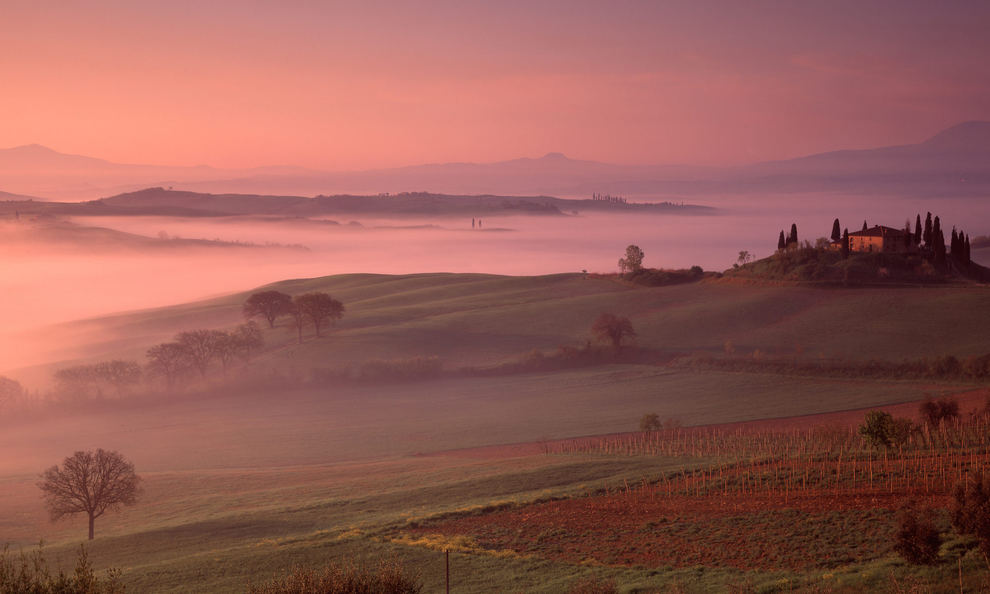
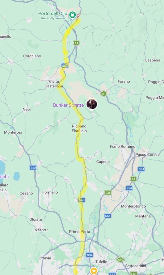
Over time I started to think about the possibility of a post describing the entire 300km or so, from Rome to Rimini, and I think I have enough material now to give it a try. Obviously this can by no means cover every part of it – that would take a substantial book. Nor did I take all of these photographs in sequence, but I have assembled them in order, from south to north, to give an idea of the journey that those marching legions took.
There is more detail on the parts where the road passes through Umbria, because that’s where I live when I am in Italy, and a bit lighter on the later parts where it heads up the Adriatic coast, but I don’t think that is inappropriate; the history of the region and the history of the road are very much intertwined, and there do seem to be more remnants of the ancient road in its central sections in Umbria and Marche. I really don’t know how interesting people will find this, but I have to say that I had a lot of fun researching it, taking the photographs for it, and writing it.
This article grew in the writing, partly because researching it alerted me to new places to visit and photograph, so it became clear that I would need to split it into three parts. This is the first.
But first, a brief historical recap.
A Consular Road
The Via Flaminia is what is known as a “consular road”, built around 220 BC. These were military roads that were built during Rome’s expansion in Italy, in the period of the Republic (509-27 BC). Their purpose was power projection – the ability to get an armed force quickly to where it was needed.

Under the Roman Republic, the Senate made the laws, but administration was undertaken by various types of elected magistrates, of whom the most important were the consuls. These were elected in pairs, and each could veto the other. They led both the civil administration and the army, and were expected to take the field and lead the army in time of war.
The consular roads were an important part of how Rome projected power; the Via Appia, the Via Flaminia, the Via Cassia, the Via Emilia, these main ones took their names from the consuls who commissioned them – in this case Gaius Flaminius – and each had a dedicated office in the Roman bureaucracy responsible for its maintenance.
Posterity remembers Gaius Flaminius for another reason as well – he fell in battle leading the Roman Army at Lake Trasimene against Hannibal of Carthage. But while historians remember his defeat and death, each year millions of drivers still take some part of the Via Flaminia, which is a more positive sort of immortality, I suppose.
Gaius Flaminius’s road heads due north from Rome, a direction it mostly maintains except where it has to get through or around mountains. Where the topology allows, it is as straight as Roman Roads famously were, and that is in fact a good clue that you are on it, when a country road suddenly becomes dead straight for a while. It seems that a Roman surveyor’s most useful tool was a ruler.
The original route of the Flaminia took it to the west of the Martani Mountains in Umbria, through Carsulae. Later, an alternative route was opened to the east of the mountains, joining the towns of Interamna (modern Terni), Spoletium (Spoleto) and Trebiae (Trevi), as well as the sacred springs of Clitumnus. The two branches rejoined at a place called Forum Flaminii, just north of Fulginiae (Foligno) before leaving the Umbrian valleys and heading into the mountains.
A couple of centuries after Gaius Flaminius, the road received a major upgrade during the rule of the new emperor, Augustus. Most of the remains we can see today probably date from that Augustan restoration.
A couple of millennia after Gaius Flaminius, the Fascist government of Italy regularised the road system, introducing the categories of strada provinciale (SP), strada regionale (SR) and strada statale (SS) that are still used today, based on who pays for their upkeep (or in Umbria, the lack thereof). In their enthusiasm for ancient glories, when a route largely followed an ancient consular road, the Fascist government gave it that name, so in 1928 the road officially became the “SS3 Via Flaminia”, as it remains. I love the fact that the modern road system preserves the ancient names, so I am prepared to forgive the Fascists for that – as I also do when seeing “SPQR” on a manhole cover in Rome.
Leaving Rome
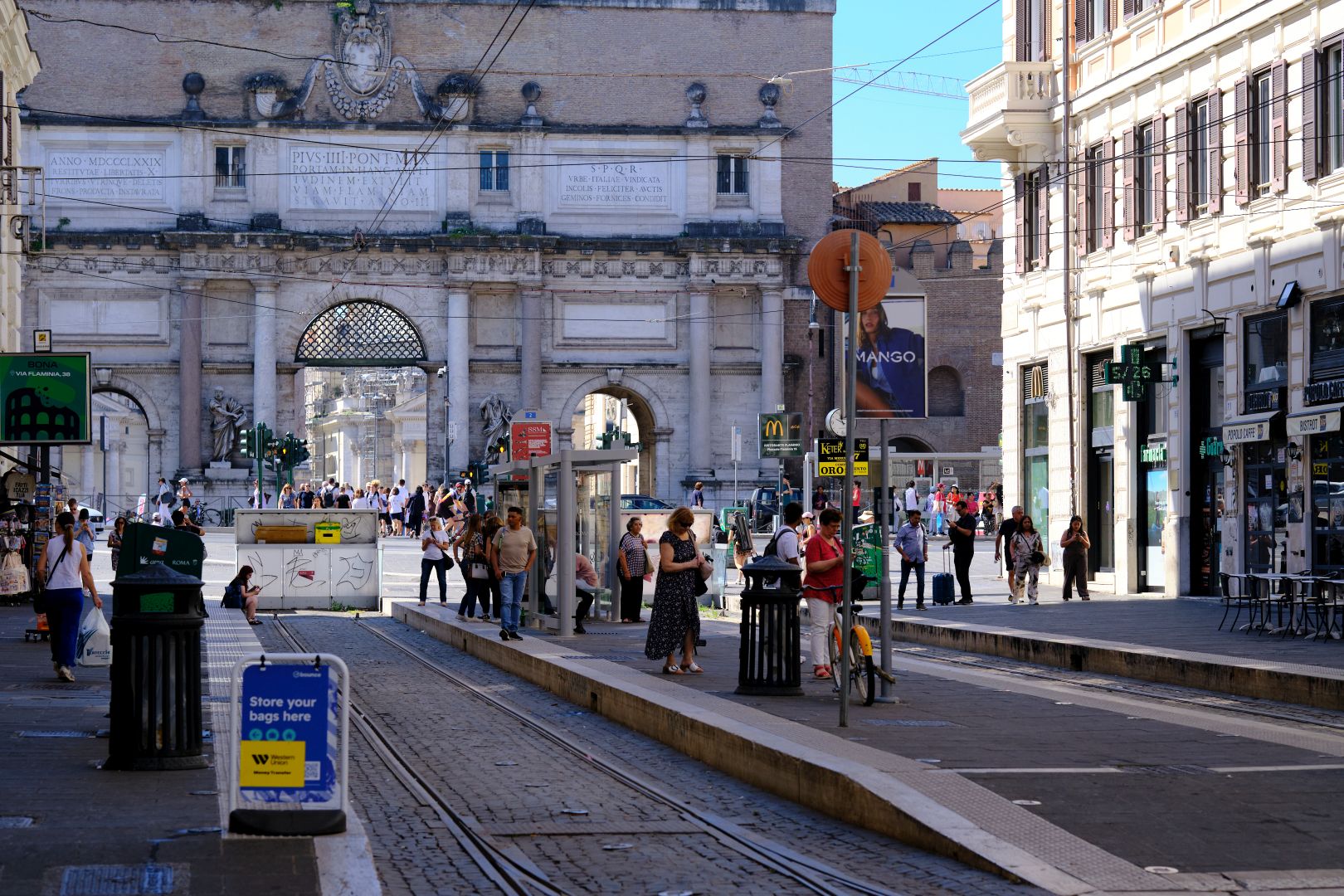
The traditional start of the Via Flaminia is at the gate in the Aurelian Walls known as the Porta Flaminia, still standing next to the Piazza del Popolo, although now much altered since the Renaissance and known as the Porta del Popolo. But the Aurelian Walls were built four centuries after the Flaminia, so as far as its builders were concerned, it probably started at the Capitoline Hill, on the road called the Via Lata (now the Via del Corso).
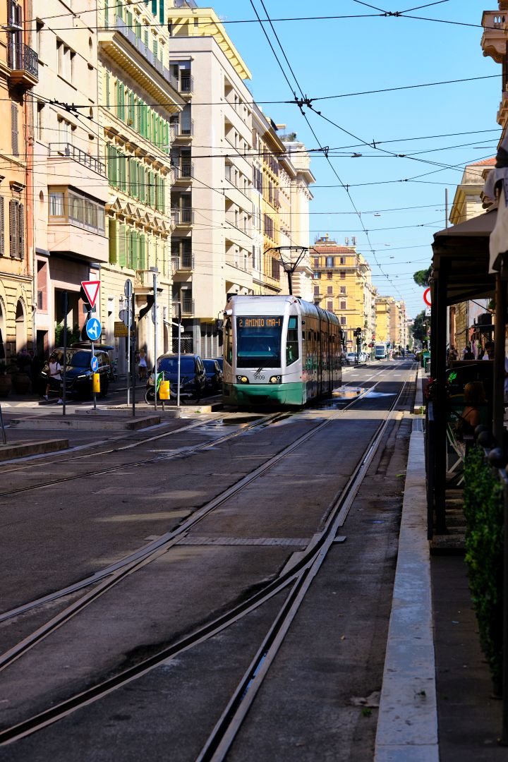
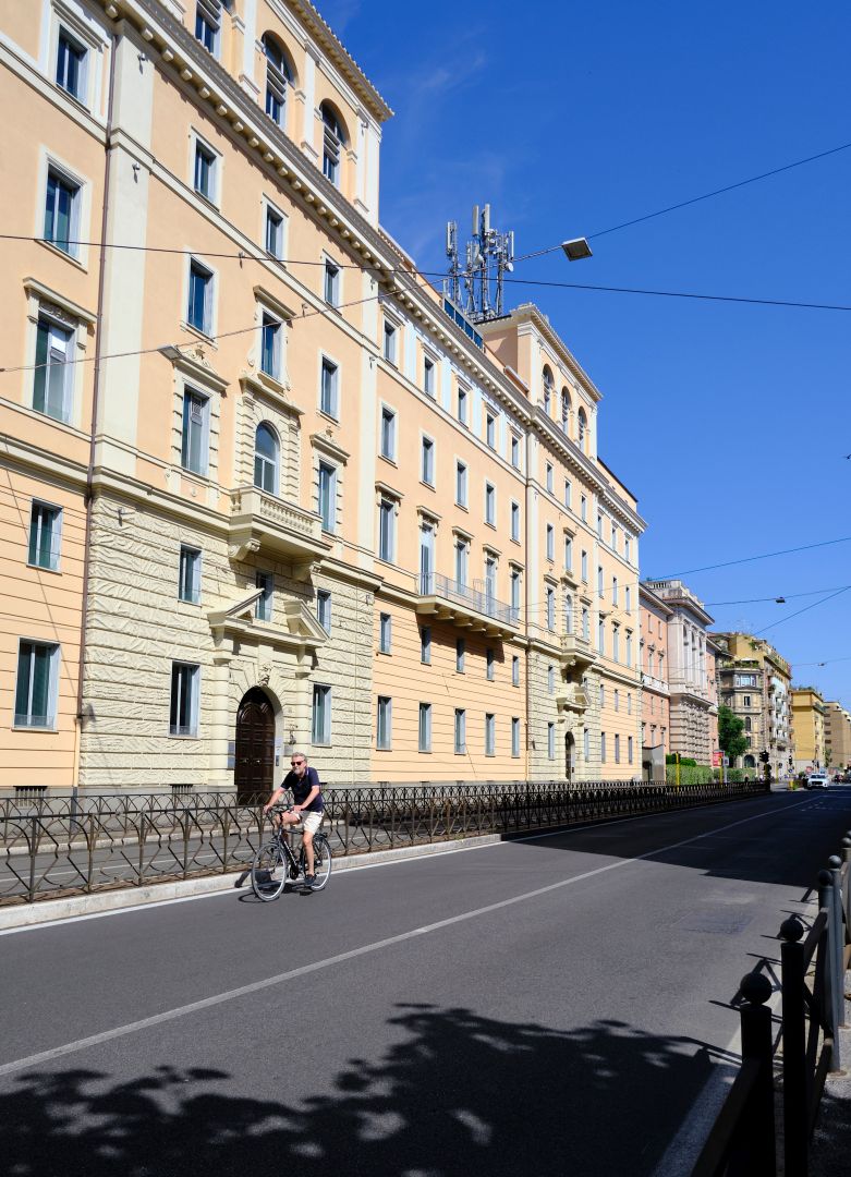
From the Porta Flaminia the road heads straight northwards, now a major urban thoroughfare passing fancy apartment blocks and buildings housing Italian government ministries, towards the Milvian bridge (Ponte Milvio).
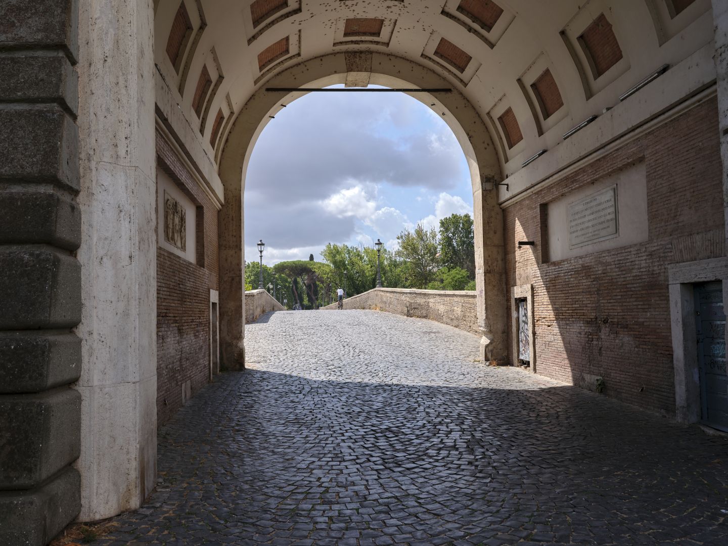
The Milvian bridge is remembered for the pivotal battle which saw the pagan emperor Maxentius defeated by Constantine, leading to the establishment of Christianity as the state religion. At least, that’s the story that Constantine and the Church told afterwards – I’m of the view that this was one of the most Stalin-like rewritings of history in, well, history.
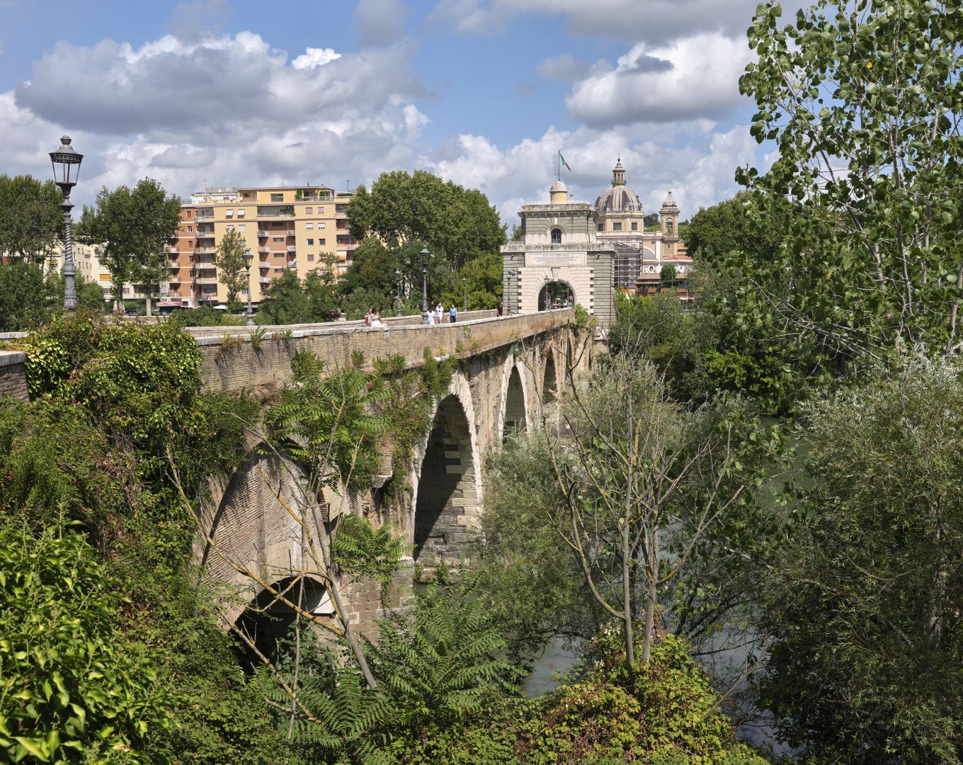
The bridge itself has been damaged and repaired many times since – at one point one of the thuggish noble families of Rome destroyed it in order to force traffic to use the Ponte Sant’Angelo – a bridge they controlled (and for which they charged tolls). However some of the surviving stonework looks as if it might have been Roman.
When driving out of central Rome to return to Umbria I generally start the journey on the SS4 (Via Salaria – not named after a consul but so-called because it was the ancient salt-trading road to the Adriatic coast near Ascoli Piceno). However on the occasions I took the SS3 through the northern suburbs I can say that I saw no traces at all of ancient remains – except that the route itself is a sort of ancient artefact, of course.
North of Rome
A famous location near the Flaminia on the northern outskirts of Rome is the “Villa of Livia”, which I have yet to visit, although we have seen the frescoes that were recovered from that site and are now displayed at the Museum of the Palazzo Massimo alle Terme, as I described in my post on The Garden of Livia Drusilla.
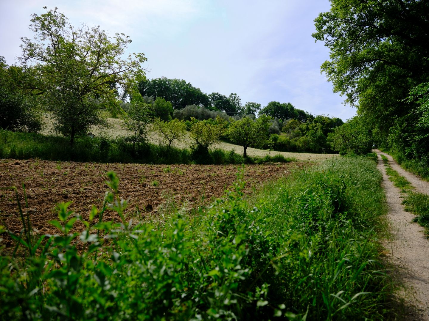
I thought I had an opportunity to visit the Villa of Livia recently, but alas as so often happens in Italy, it was temporarily closed. So instead, when returning to Umbria after dropping visitors at the airport in Fiumicino, rather than taking the A1 motorway I took an earlier exit from the Rome Ring Road and headed north on the modern SS3 Flaminia. Online searches had suggested that there were several places on the SS3 north of Rome where I might find remnants of the ancient road, but I didn’t really find anything apart from the remains of one monumental tomb in a field by the road, and small sections of country lanes with signs saying “Via Flaminia Antica”. Such roads look like modern dirt roads, and there is a good reason for that – that’s pretty much what they are. I was keeping my eyes peeled for the brown roadside signs that the Italian authorities use for historic and cultural sights, but these all pointed to medieval attractions like monasteries and castles.
Despite failing to find any interesting archaeology, it was an opportunity to take note of the route that the Roman military engineers chose, and speculate as to why. The obvious reason is that it was the famous Roman straight line, but I also noted that the road follows the ridge-line of a low range of hills, with the Tiber Valley down to the right. In antiquity the lower Tiber Valley was a marshy floodplain, so the engineers would have taken advantage of the high ground when available, and when forced down to the river, would have needed to spend time and money building and maintaining causeways and drains.
The elevated route made for a pleasant drive, at first in dormitory suburbs of Rome where modern housing developments sit next to ancient farms, but becoming increasingly rural as I continued northwards, with pockets of woodland separated by fields of green young barley edged by bright red poppies. I know they grew barley and similar grains in Roman times, so would the scene have been all that different for our marching legionaries?
As I mentioned in my post on Carsulae, Roman Legions famously marched a predictable distance a day (although not quite as predictable as Kipling said), and on a good road like the Flaminia, this would have been about 20-30 kilometres, so our legionaries would have stopped for the night at somewhere like Morlupo, after leaving Rome at the Porta Flaminia. I had assumed that on the Via Flaminia there would have been barracks for the troops to sleep in overnight, but online sources suggest that they might have been expected to pitch tents outside towns, even those which had a mansio or road station. I suppose it would have been good training for when they eventually found themselves beyond the frontier.
Crossing the Tiber Again at Ocriculum
After leaving Rome and crossing the Tiber at the Milvian Bridge, our legionaries, like me in the car, would have had been on the western side of the Tiber as they headed north, and the builders of the Via Flaminia would have had to find a place to get them back across to the other side. As I descended down towards the Tiber, I wondered just where that was.
This, it seems, was near a place called Ocriculum (modern Otricoli), just across the present-day border between Lazio and Umbria. Apparently the piles of a stone bridge were still visible in the river until the 18th or 19th Centuries, but I gather that few traces remain today. These days the Tiber near Otricoli has seen canalisation and hydro-electric dams, and the river will also have changed course many times for natural reasons like flooding, so the disappearance of the bridge remnants is not that surprising. Looking at the area of the supposed crossing point on Google Earth, I see a truck parking area on the A1 motorway, something that looks like a quarry, and a depot for the regional bus service.
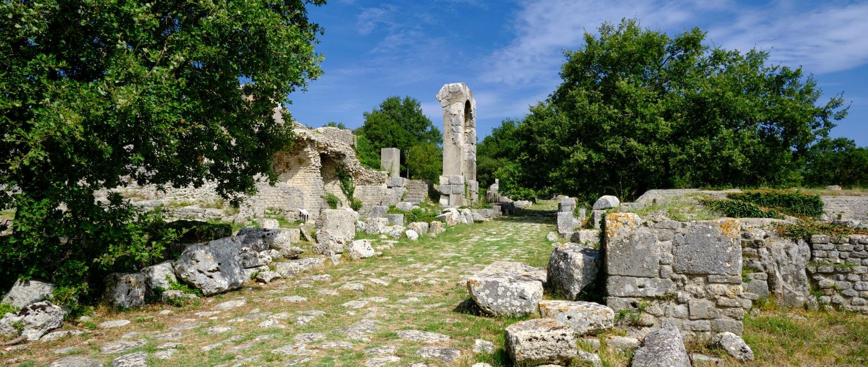
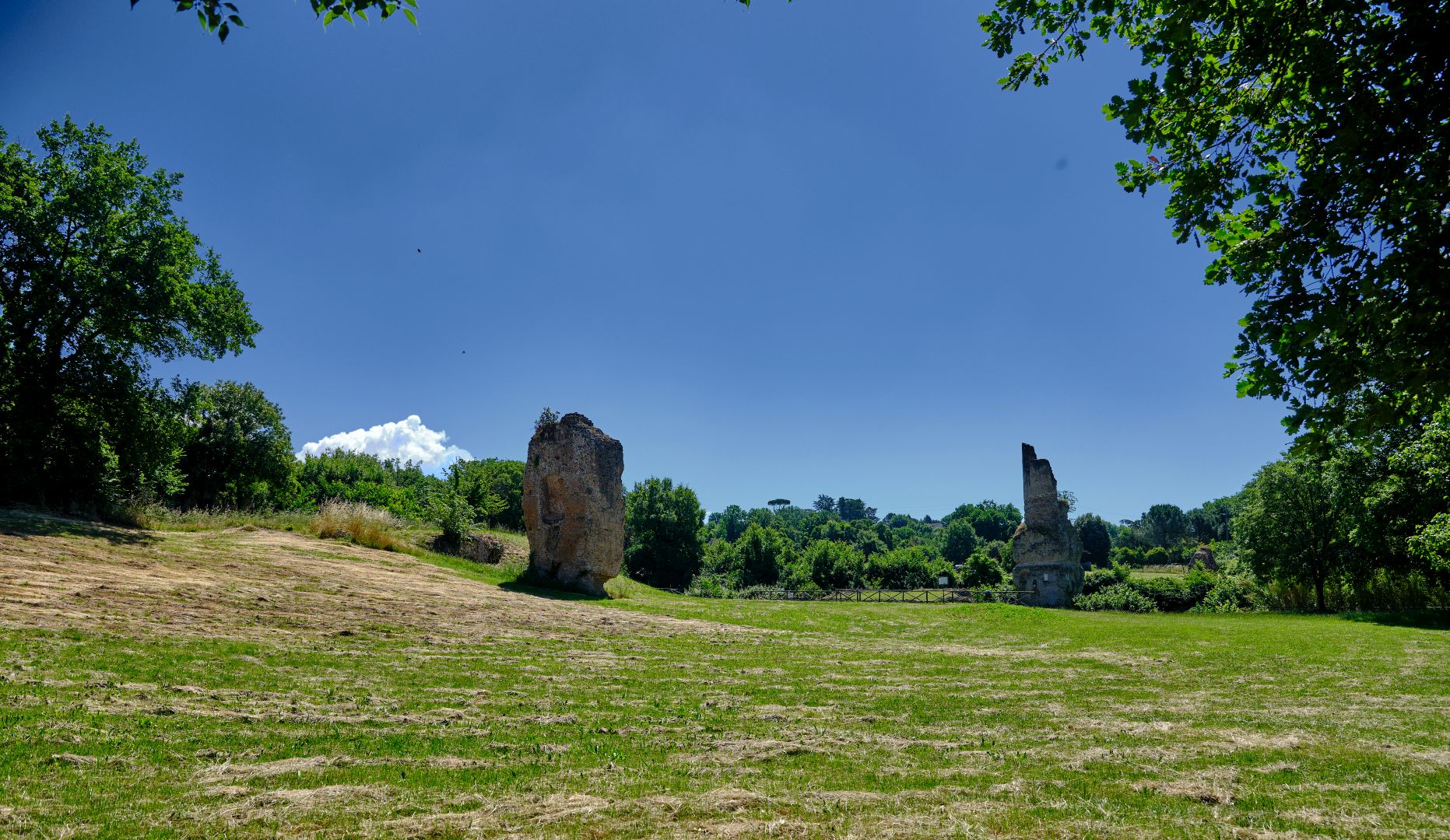
But I did visit the archaeological area at Otricoli, and it was well worth it.
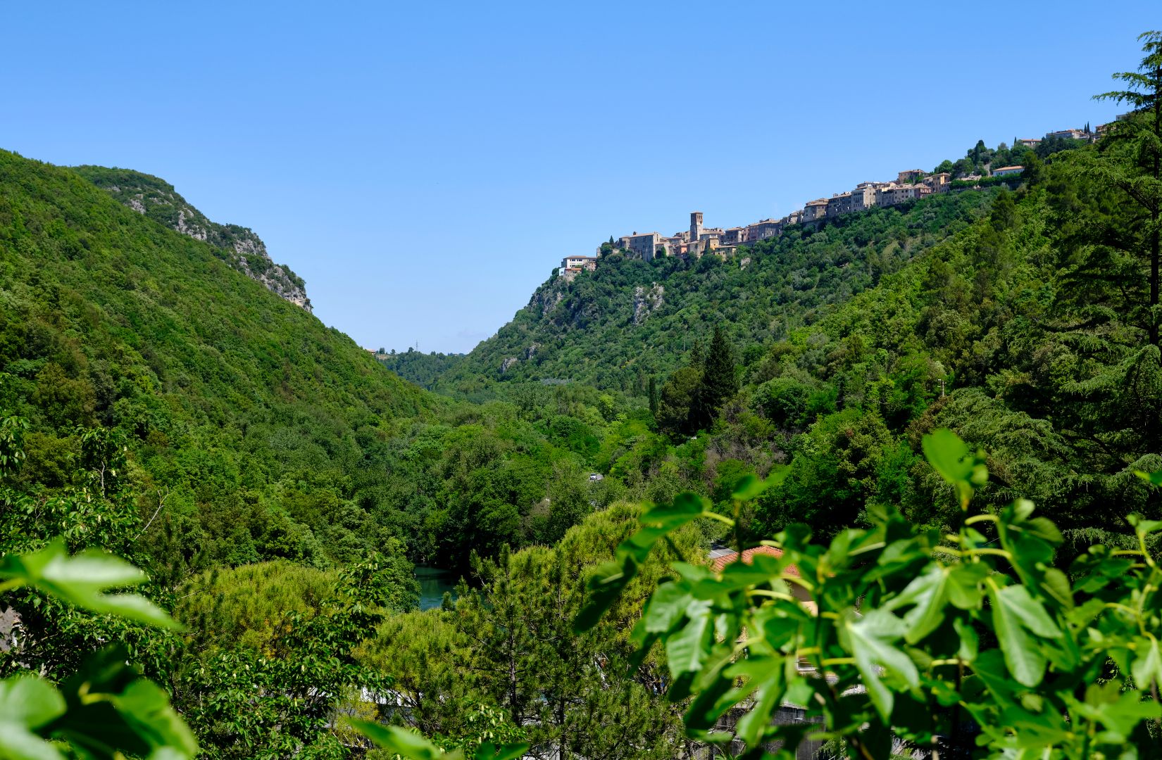
As is so often the case, the modern (ie medieval) town is up on a hill, for defence and to reduce the risk from malaria, while the ancient town is in the valley, because in antiquity the risks of invasion and infection were both much lower.
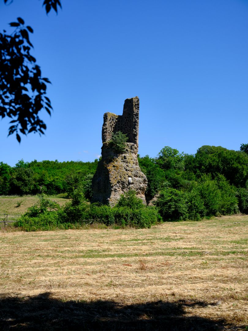
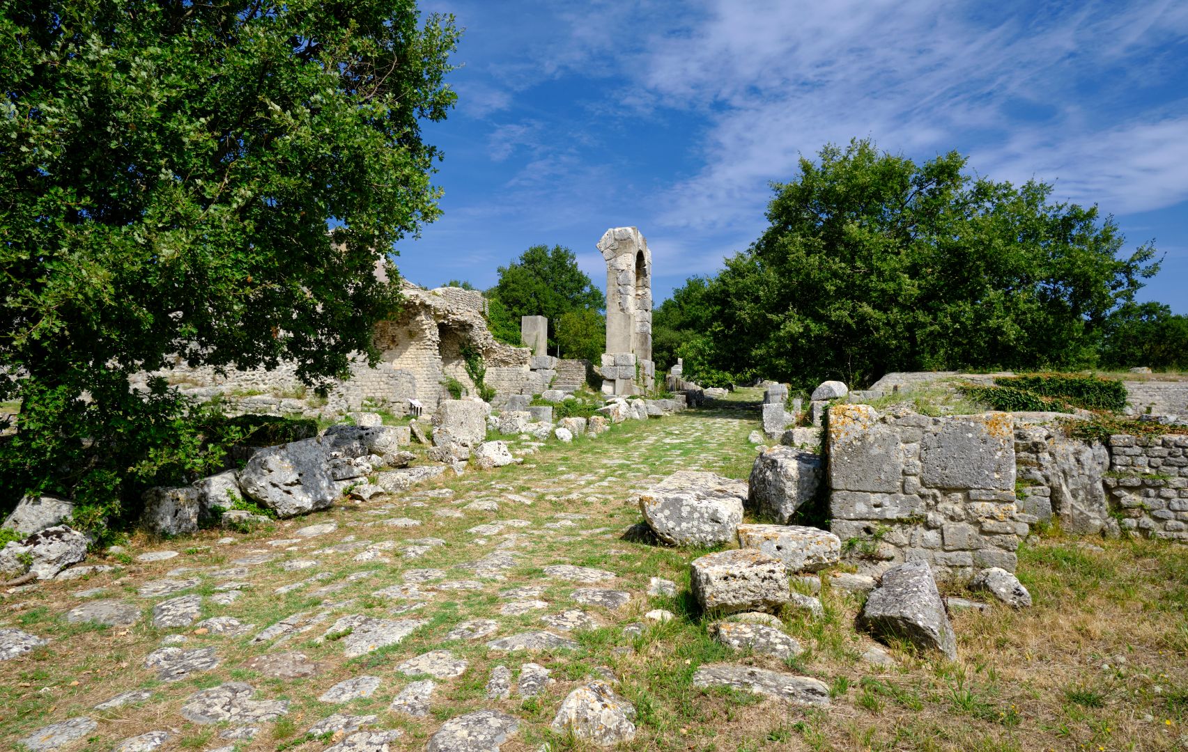
Ancient Ocriculum was an established Umbrian settlement before the Roman road builders appeared on the other side of the Tiber, but its location on the new highway must have accelerated the process of Romanisation. Certainly the traces remaining today – all from later periods than the building of the Flaminia – suggest a substantial and prosperous place.

It was a sunny weekday morning in late spring. There were a few other visitors on a guided tour but they were some distance off and it felt as if I had the place to myself. I had parked the car near the main road, and walked several hundred metres to the site, which was a good opportunity to try and get a feel for the lie of the land. The first structures I came across were the remains of tombs. The ancients had a very sensible ban on burying the dead inside town boundaries, so time and again, one finds that there were monumental tombs belonging to wealthy families lining the roads just outside the city walls – some of the best examples are in Pompeii, and in Rome itself, along the Via Appia Antica (to be the subject of a future post).
Modern Italians also maintain municipal cemeteries outside towns and villages, and some of the family tombs therein look quite monumental. It would be nice to think that this was a survival from antiquity, but not really – the practice dates from public health reforms during the period of Napoleonic rule. However it is very likely that the architects of those laws were aware of classical models.
Except in special cases like Pompeii, when one sees a Roman tomb the original monumental marble or travertine facades have long since been robbed away, and what remains is the internal brick and concrete. So it takes a bit of imagination to try and visualise what the originals may have been like.
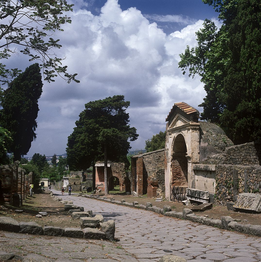
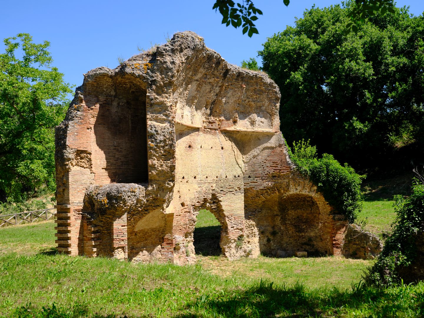
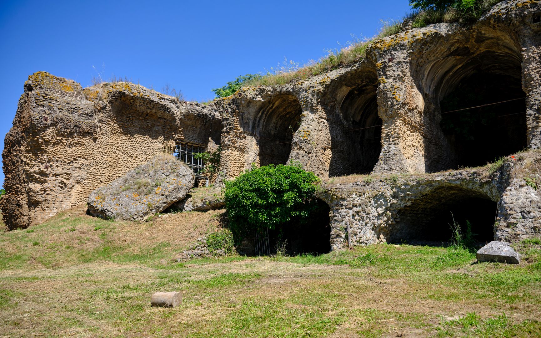
Ocriculum was located near some hot springs, and the Romans certainly knew what to do with those – the archaeological site contains some impressive remains of a bath complex. No doubt weary travellers on the Flaminia would be glad to soak away the aches of the journey.
Narnia and The Bridge of Augustus
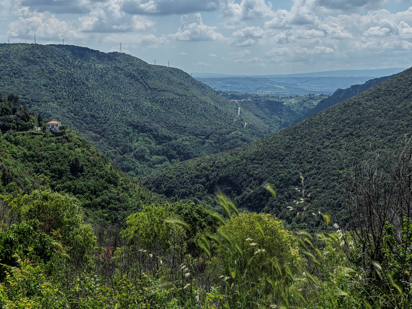
Having crossed the Tiber and left Ocriculum, our legionaries would have left the river valley quite soon, and climbed into rolling hilly country much like that coming out of Rome. The difference here is that up ahead were looming the mountains of Umbria, and some serious uphill marching.
The natural and obvious place for the road to get through the first of these obstacles was the gorge of the River Nera, below the town of Narnia (modern Narni). Also an ancient Umbrian town, Narnia’s position on a choke-point made it strategically important, and its absorption into the Roman imperium was not peaceful. Its original Umbrian name was Nequinum, but the Roman Senate renamed it Narnia from the River Nera (ancient Nar).
C.S. Lewis almost certainly chose the name of the town for his fictional world – among his effects is a classical atlas with the name circled. There is no reason to assume he did so for any reason other than that he liked the sound of it, but that has not stopped the locals from claiming to have been Lewis’s inspiration and laying on some dubiously appropriate Narnia-themed tourism.
In 2019 I wrote about Narni in my post A Visit to Narnia.
Below the gorge the river was navigable, and in recent years the remains of a shipyard (probably for building barges to take grain down to Rome) has been discovered next to an artificial channel, now dry, cut next to the river.
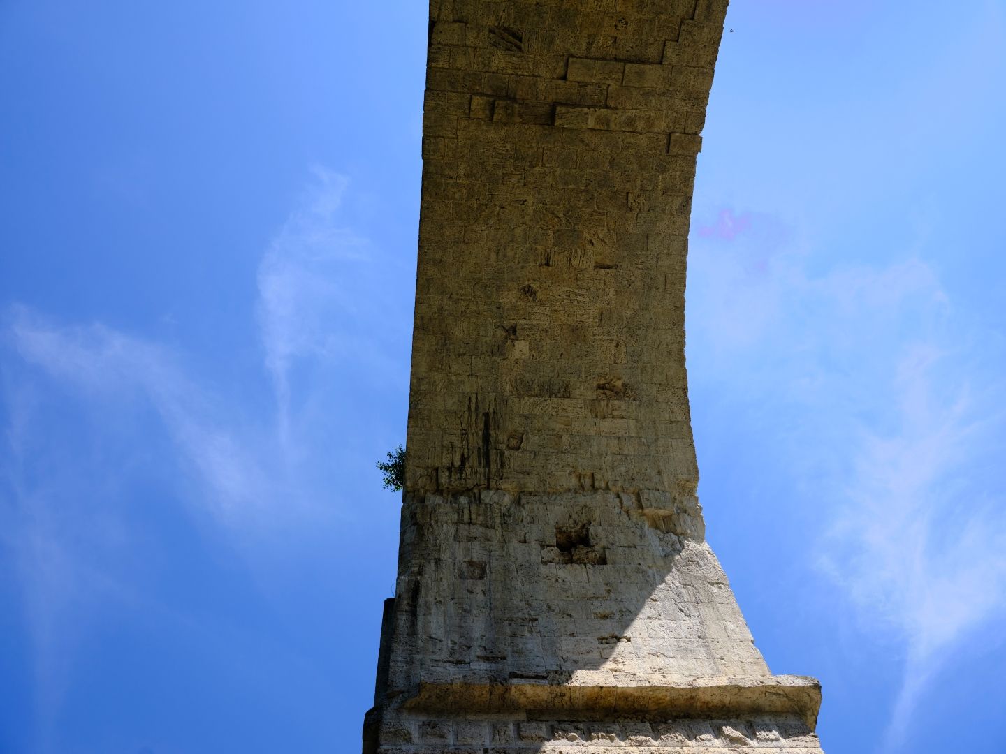
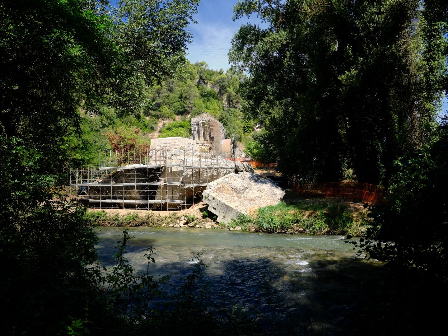
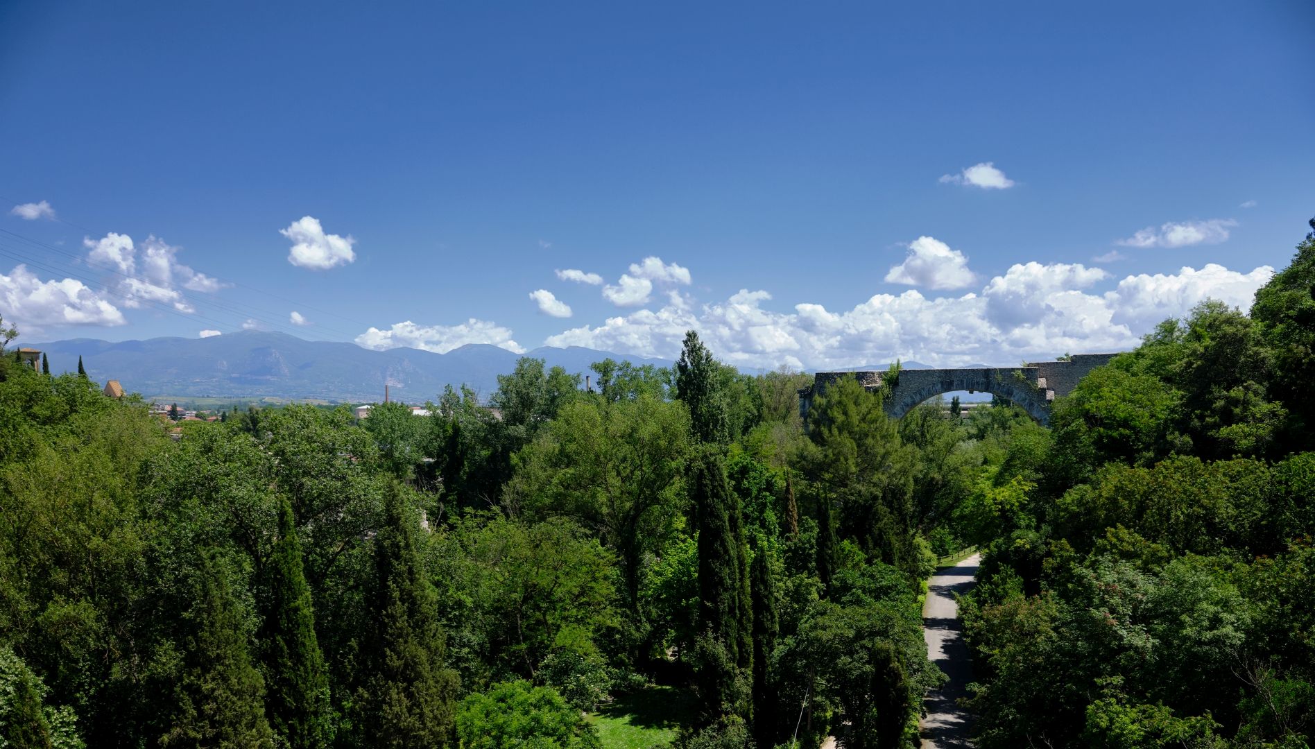
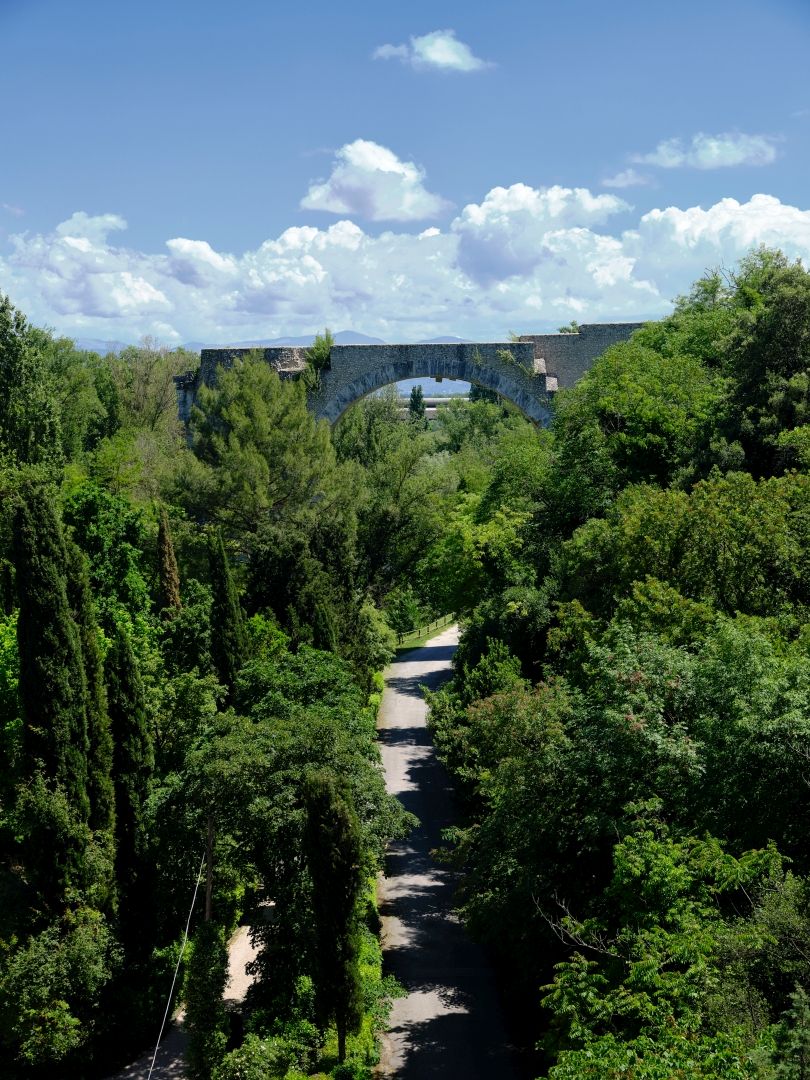
The big challenge for the Roman engineers was to get the road across the Nera here. I assume that a bridge of some sort was built during the construction of the original road in the 3rd Century BC, but it was during the Augustan upgrades that they built the massive bridge – one of the largest such structures known – called appropriately, the Bridge of Augustus (Ponte di Augusto).
Bits of it have been collapsing since the Middle Ages, and the most recent serious damage was during the 2000 earthquake, so a lot of work is going into strengthening what remains. But what does remain is very impressive.
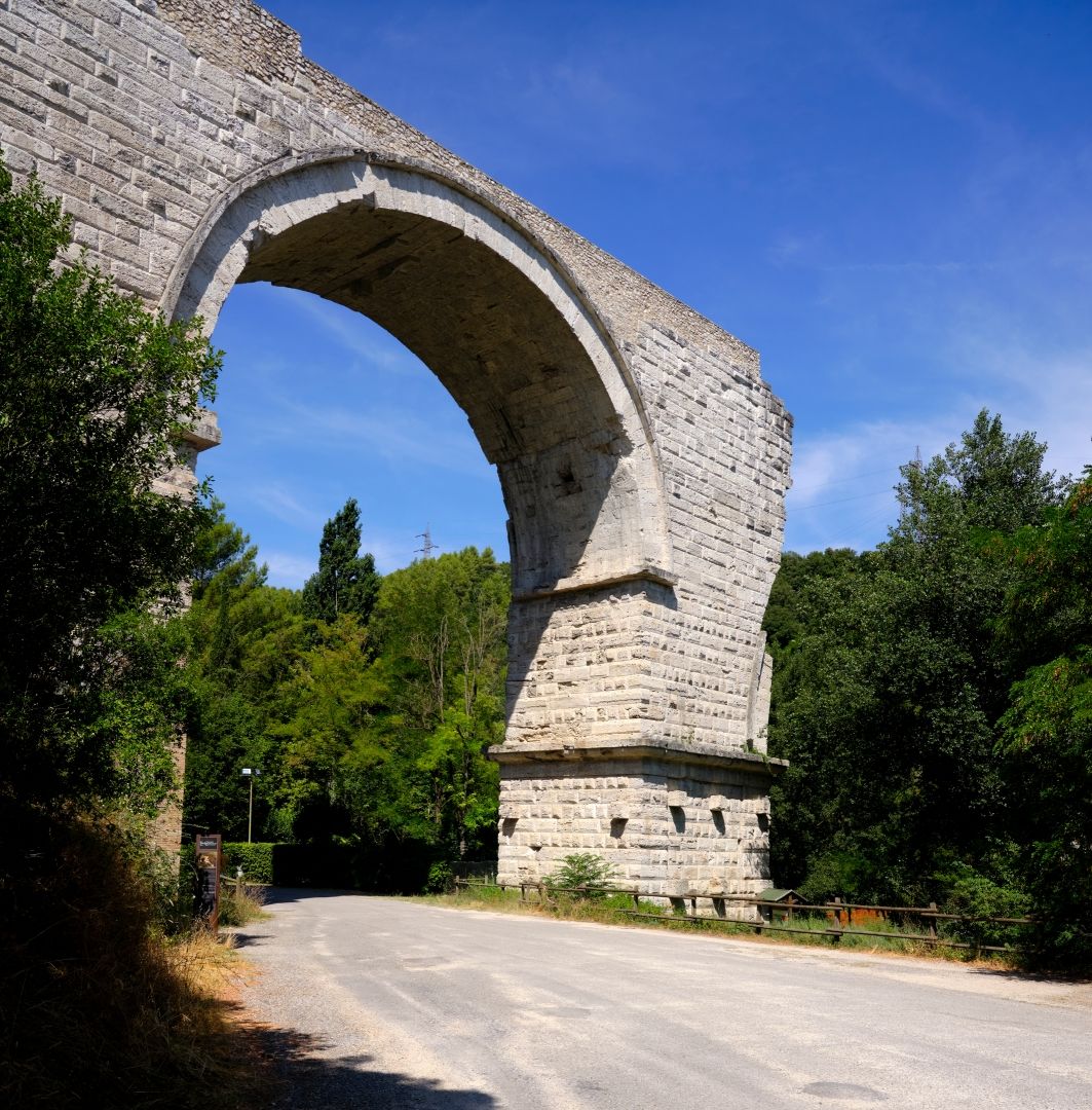
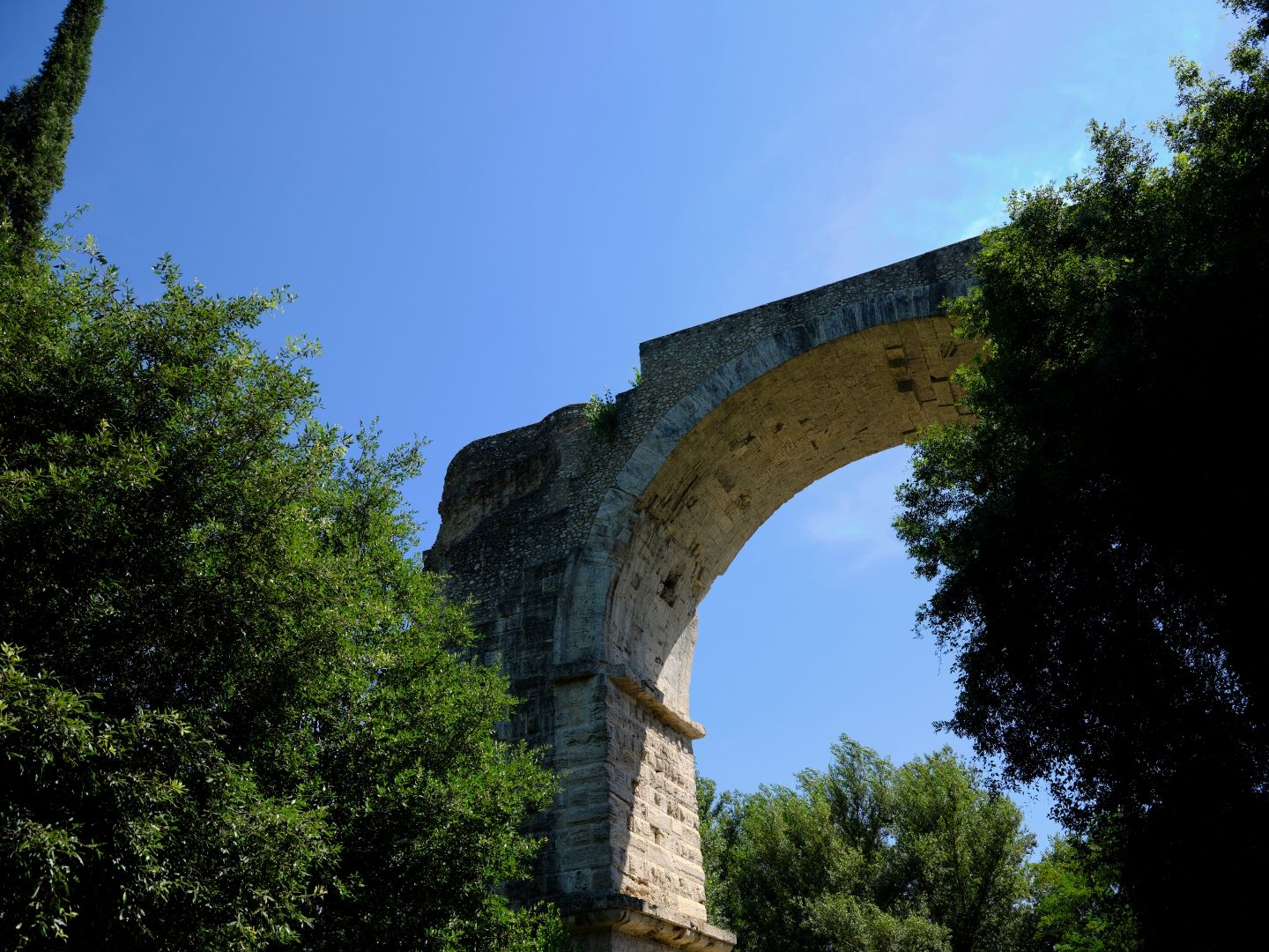
Millions of people who have never been to Narni are familiar with the bridge, thanks to the famous 1826 painting The Bridge at Narni by Jean-Baptiste-Camille Corot, now in The Louvre.
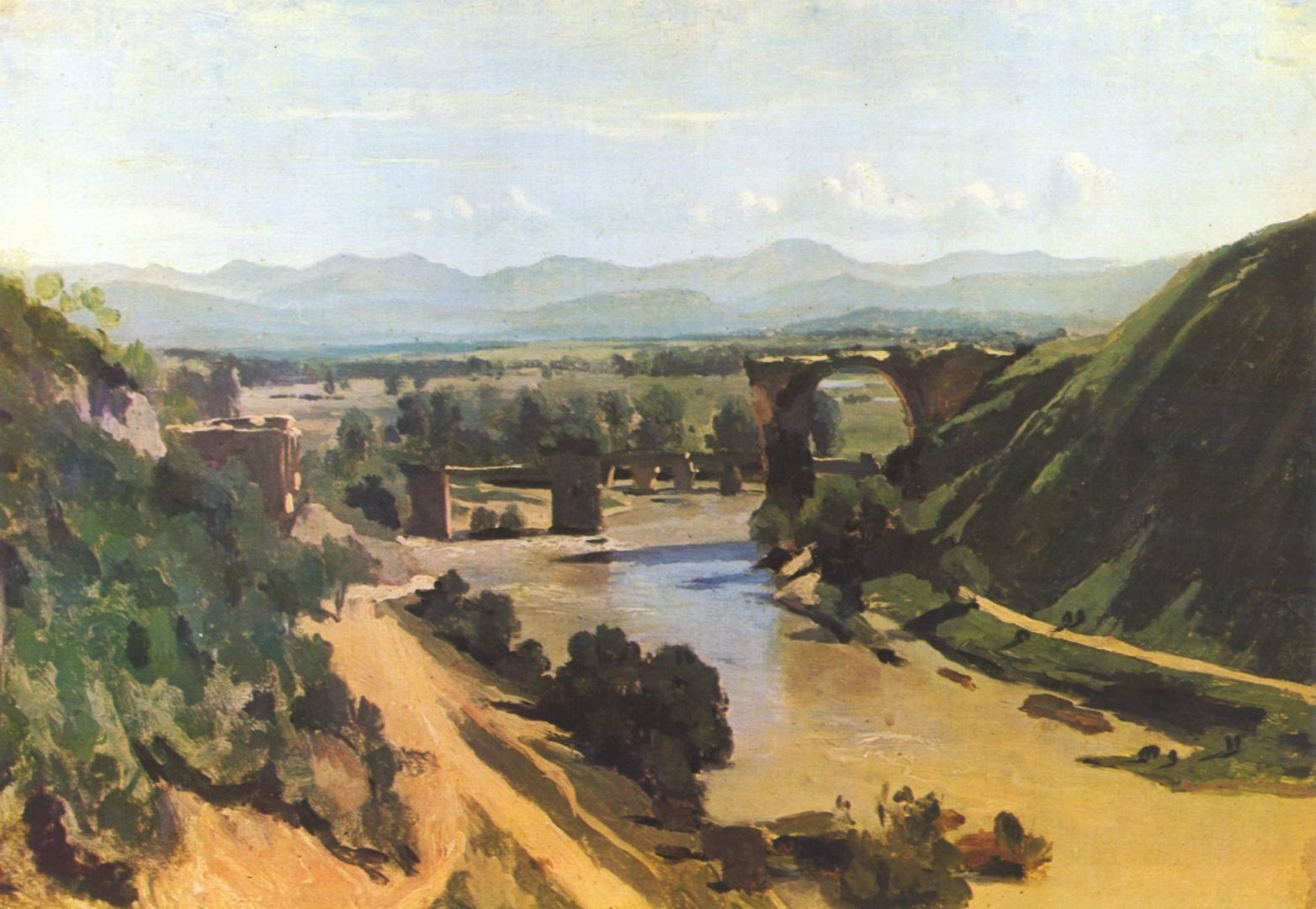
Getting a picture of the bridge now from anything close to Corot’s angle is challenging. There are no parking spots anywhere nearby, and what was once a viewing area is fenced off and choked in undergrowth. Eventually I parked in a supermarket car park in the modern industrial town of Narni Scalo and walked a kilometre or so back, passing through a short tunnel and hoping that the drivers could see me as they whizzed past.
The first thing you notice about the bridge is that the smaller western arch (on the left in Corot’s painting) has been repurposed as a short tunnel for the Rome-Terni railway, which also follows the gorge.
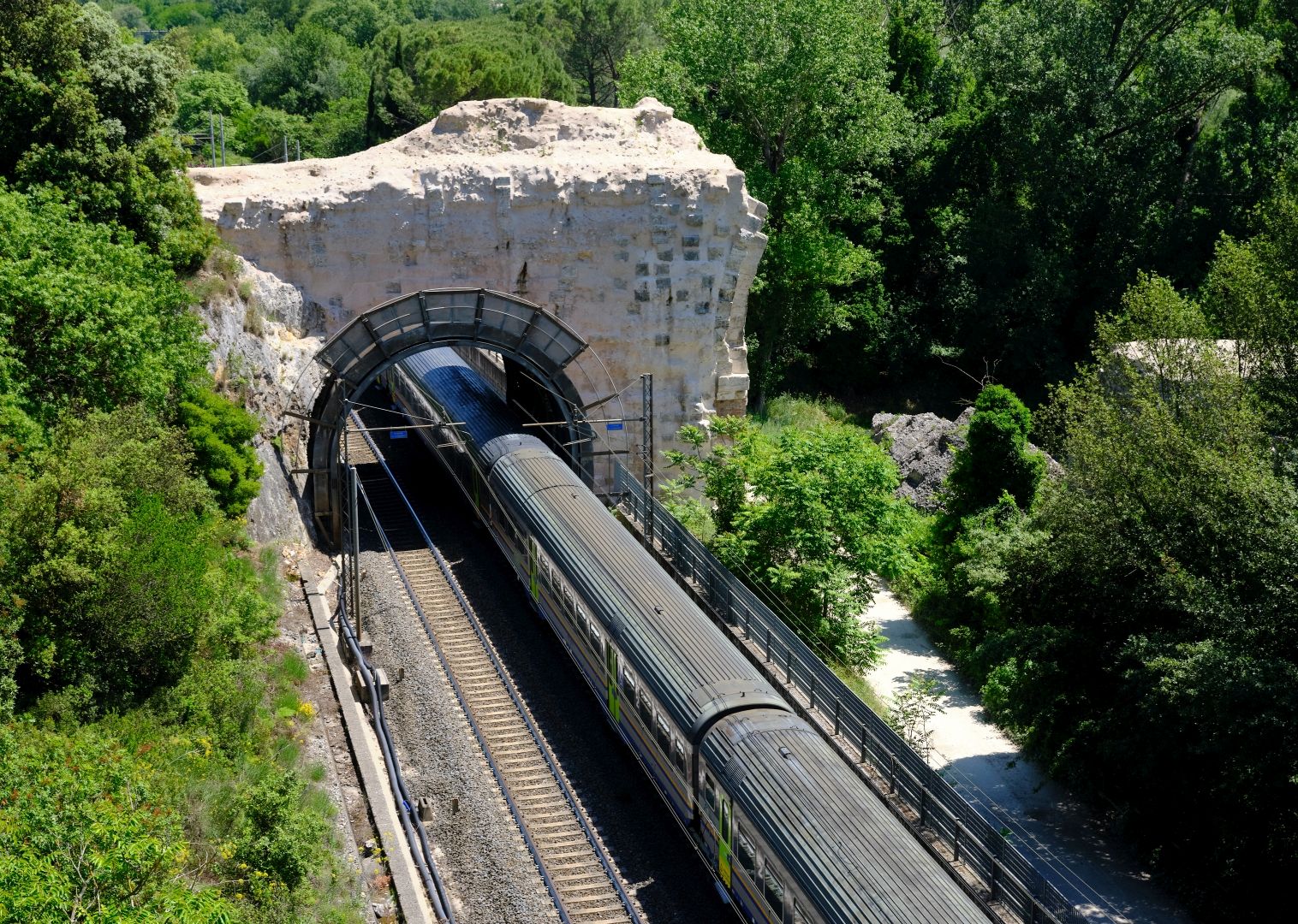
It is also a bit harder than in Corot’s day to pick out the massive eastern arch from all the trees that have grown up around it. But it is still very impressive.
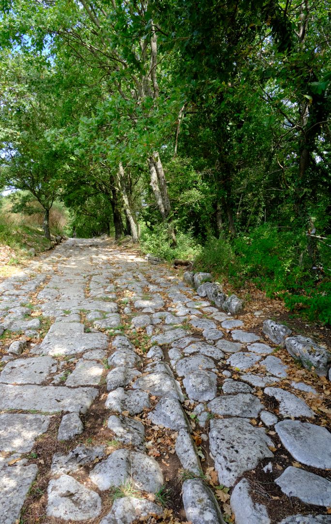
Carsulae and the Western Branch
The next stop for our military, government or commercial travellers would be Carsulae, if taking the original western branch of the Flaminia, or Interamna (Terni) if on the newer eastern branch. We will take the western.
I have already published a separate quite detailed article on Carsulae so I will restrict myself to publishing a few more pictures, and noting that it was obviously a substantial and prosperous town, and that its decline was either because it was not situated in a defensible position, or that its reason for existence disappeared with the decline of road traffic after the fall of the Empire.
At this point, with our legionaries ready to head north beside the Martani Mountains, I will draw this first chapter of the story to a close. It will shortly be continued in Part Two.
Edit: here is Part Two.
5 Replies to “Via Flaminia – All The Way (Part 1)”