Welcome to the second of three articles following the ancient Roman road called the Via Flaminia from its start in Rome to its finish in Rimini. If a web search has led you directly to this article, I do recommend you read them in order. You can find the first one here.
The first article discussed the origins of the Roman military roads called “consular roads”, and followed the Via Flaminia from its start in Rome, as far as the ancient town of Carsulae in Umbria.
A Note on Road Construction
Before rejoining the Flaminia at Carsulae, let us pause for a moment to think about how these roads were built, and what that means for us looking for the remnants a couple of millennia later.
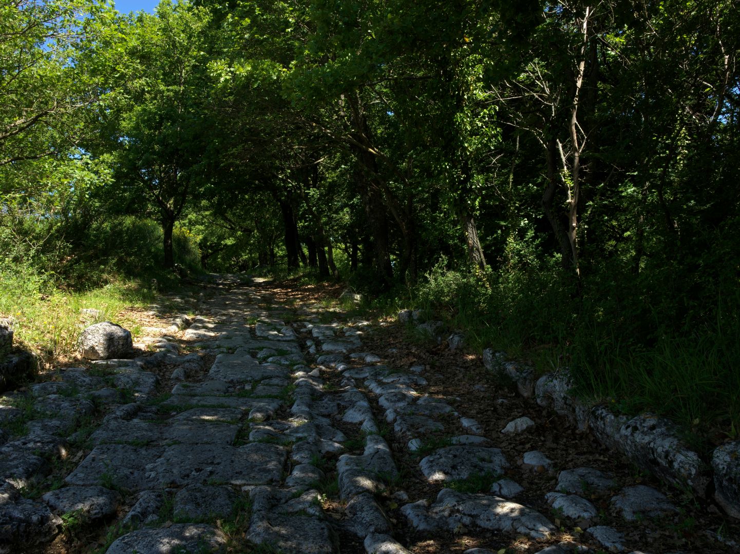
My first detailed look at a Roman road was during a visit to Pompeii, and like many visitors I was impressed by the advanced construction, with pedestrian pavements at the sides, gutters and drains, and raised flat blocks at the intersections to allow pedestrians to cross with dry feet while leaving gaps for cart and chariot wheels. I was also struck by the ruts worn by those wheels in the basalt paving stones. (It is, unfortunately, a myth that the standard railway gauge of 4’ 8½” is based on the spacing of those Roman chariot wheels).
So road construction in urban areas was quite sophisticated. I had not given much thought to how the roads were made in rural areas, but had I done so it would have been obvious that it would be unnecessary and uneconomical to put the same amount of effort into them as in the towns.
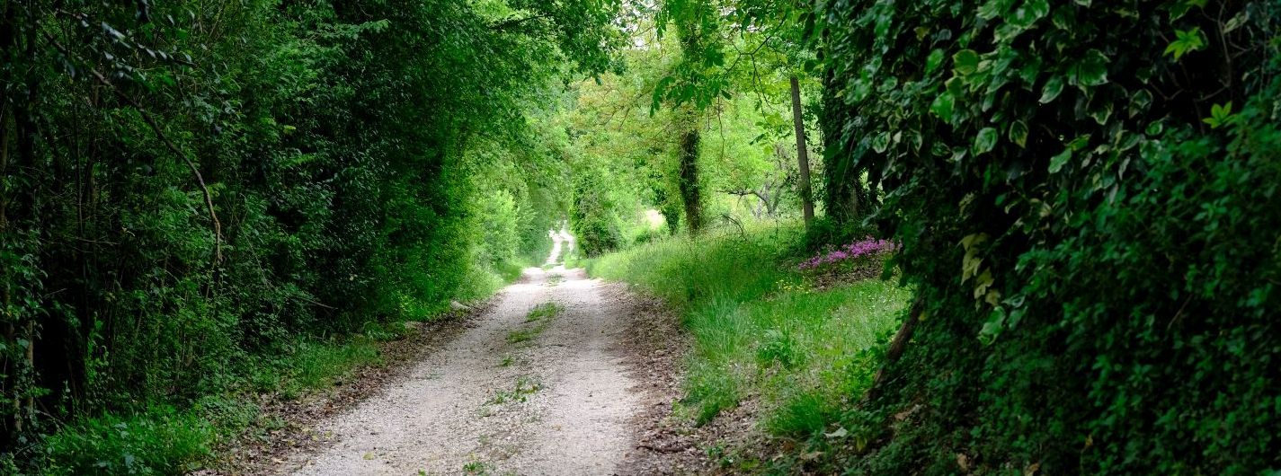
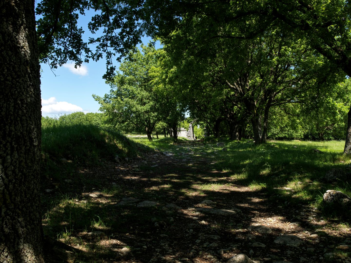
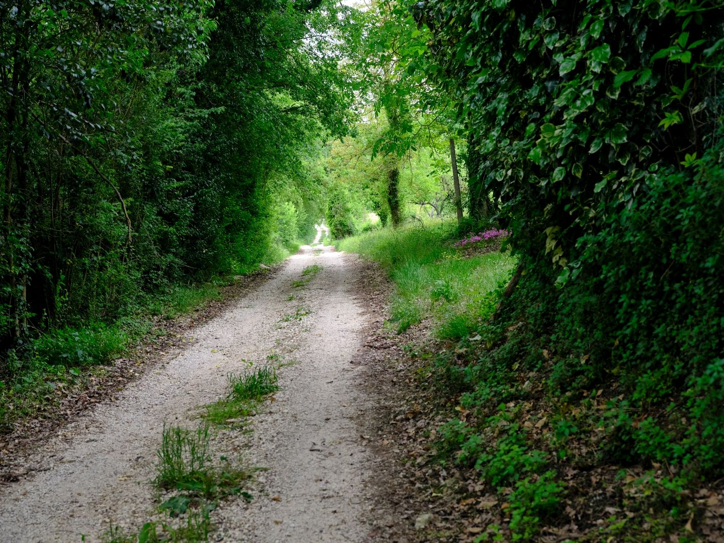
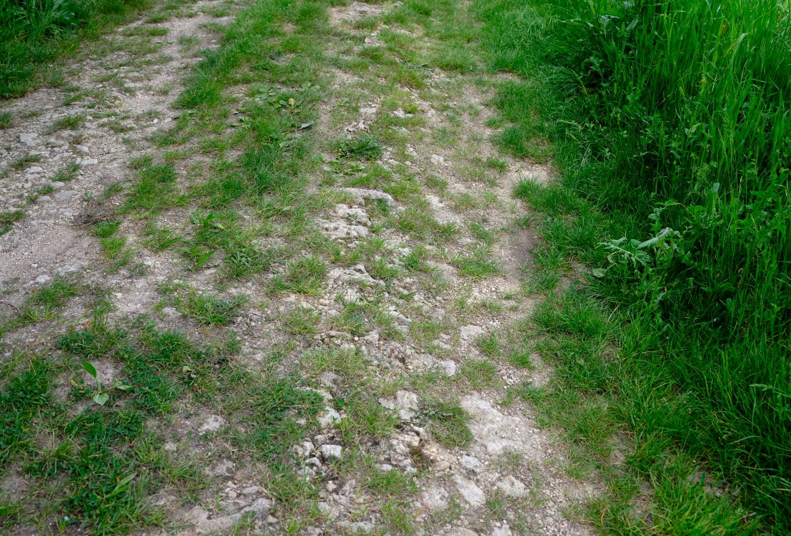
Instead it seems that the rural roads were constructed like a modern well-made rural gravel road. First they would have dug down to get to rock or solid earth, then they would have filled it with rubble or coarse gravel to provide both firmness and drainage, then covered it with a top layer of finer gravel and compacted earth, raised in the centre, again to aid drainage. The result, as a sign at the bridge at Ponte Fonnaia explained, would have been something that looked very much like a modern Italian unmetalled strada bianca. This was great news for a history nerd, as it meant that when walking along such a road it would be much easier to imagine what it would have been like for our legionaries.
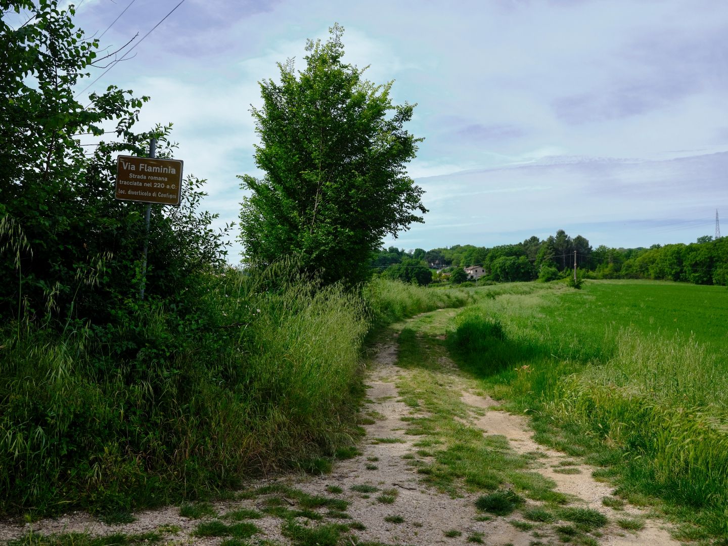
Between Acquasparta and the Ponte Fonnaia
And with that in mind, a month or so ago two friends and I decided to walk along the surviving stretch of the Flaminia between the town of Acquasparta and the Ponte Fonnaia, the Augustan bridge which I wrote about in my post on The Ponte Fonnaia on the Via Flaminia.
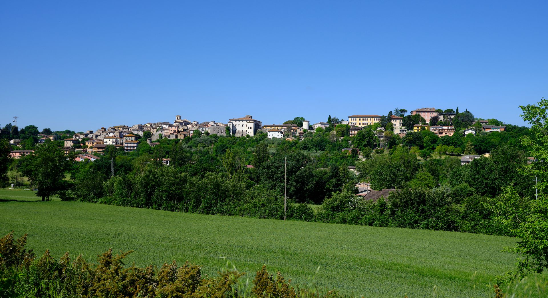
At the tourist office in Acquasparta a couple of years ago I acquired a map of the route of the Flaminia as it passes through the area of Massa Martana and Acquasparta, and a sunny Umbrian spring day seemed a very good reason to get out and see the Flaminia on foot, as the legions did.
Actually, we did it the other way round, parking the car at the Ponte Fonnaia and walking down to Acquasparta, but for consistency with the rest of the article I will describe it on our way back, from south to north.
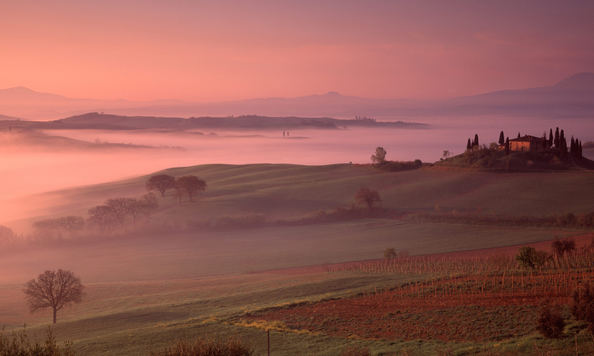
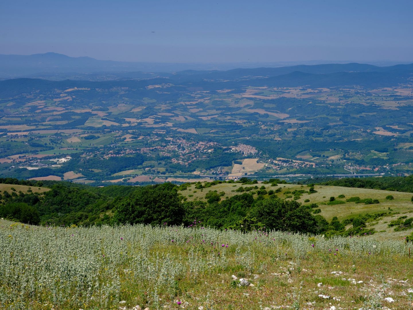
The Flaminia’s route was determined by topography and the need to get military force north from Rome as efficiently as possible, and around here that meant following the lower slopes of the Monti Martani. That took it through a region where there are plenty of warm springs coming out of the limestone, and so a chain of towns sprang up along the road servicing the spa trade.
These springs still exist, but although it is still apparently possible to bathe in some of them, the principal economic activity is bottling and selling the water, before anyone has bathed in it. The largest such operation is at San Gemini, and having tried their stuff, I have to say that it manages the difficult job of making Umbrian tap water taste decent by comparison. Their business model must be based on the assumption that anything which tastes so horrible must be good for you. We have a book on Umbria from the 1930s that even claims that the stuff is radioactive! Presumably the modern bottlers avoid those sources; at any rate the two unopened bottles I have had downstairs for six years do not glow in the dark.
Our route north from Acquasparta took us at first along paved urban roads, but before long there was a sign saying “Via Flaminia Antica” which led us onto roads which became progressively narrower, and eventually unmetalled.
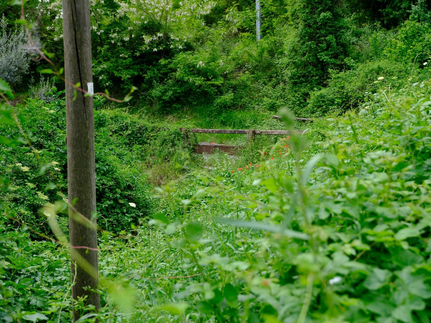
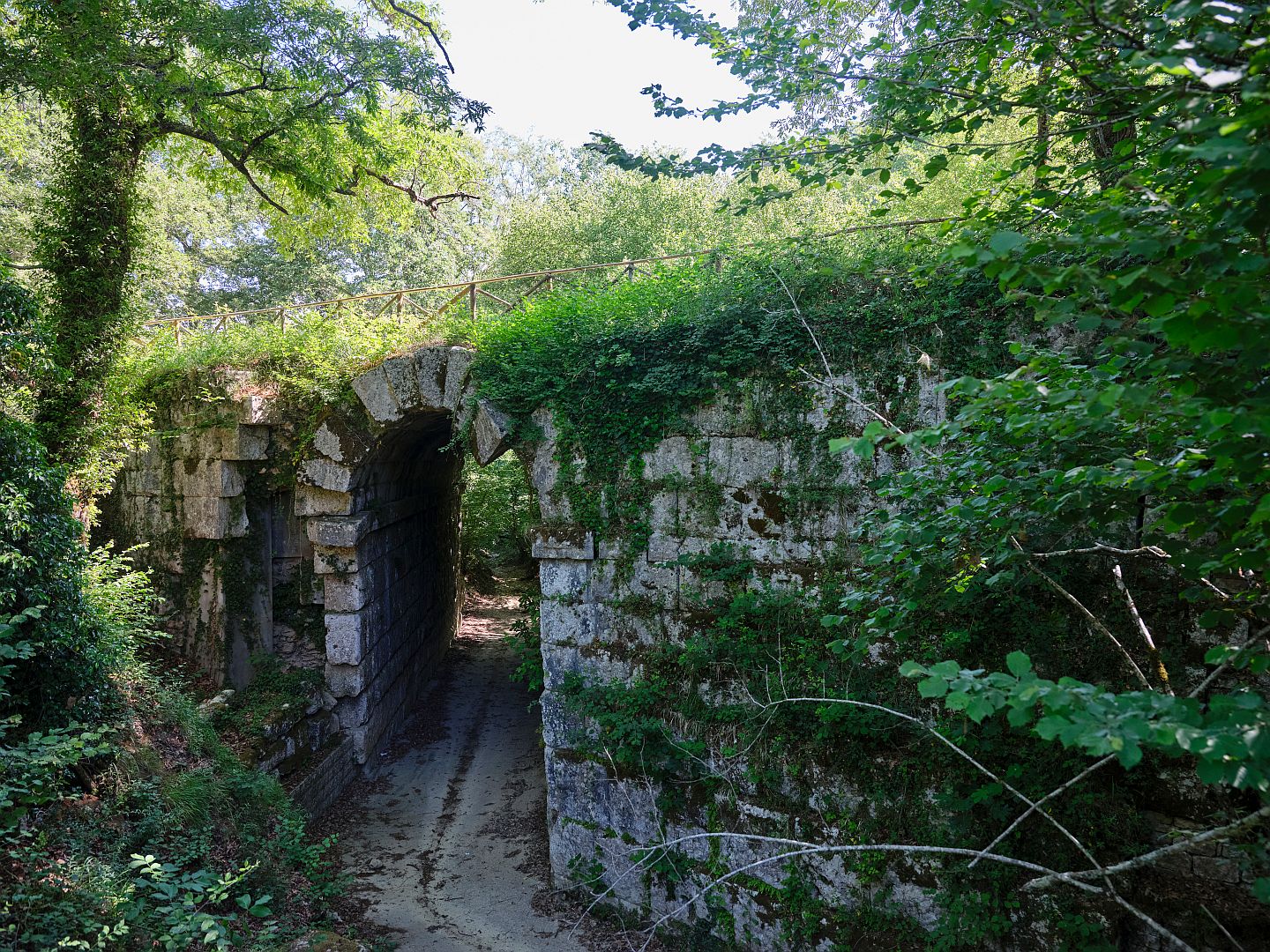
According to the map the road took us over another ancient bridge, but we didn’t notice it on the way down and it took a bit of finding on the way back, due to its being very overgrown. The Wikipedia article on the Via Flaminia says that this bridge is rare in preserving construction techniques from the original 3rd-Century-BC road rather than from the Augustan rebuilding, but under all those blackberry bushes, your guess is as good as mine.
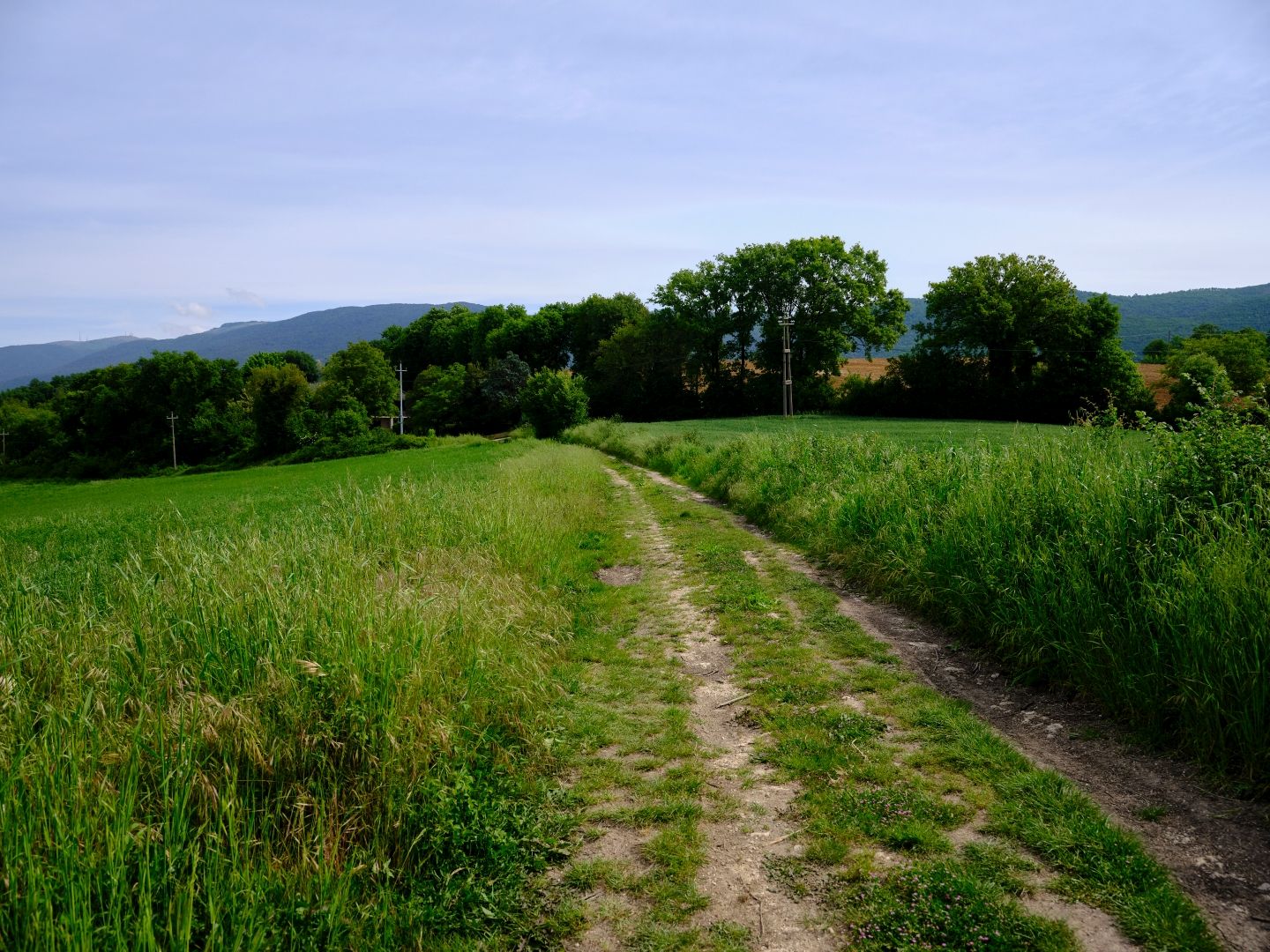
Once onto the gravel section of the road it became possible, with a bit of imagination, to see traces of that Roman substructure where bits of the rubble layer had been exposed by erosion. Like elsewhere, where possible the road builders had kept to the ridgeline where it would be passable in all seasons. That in turn meant that we often had good views of the surrounding country.
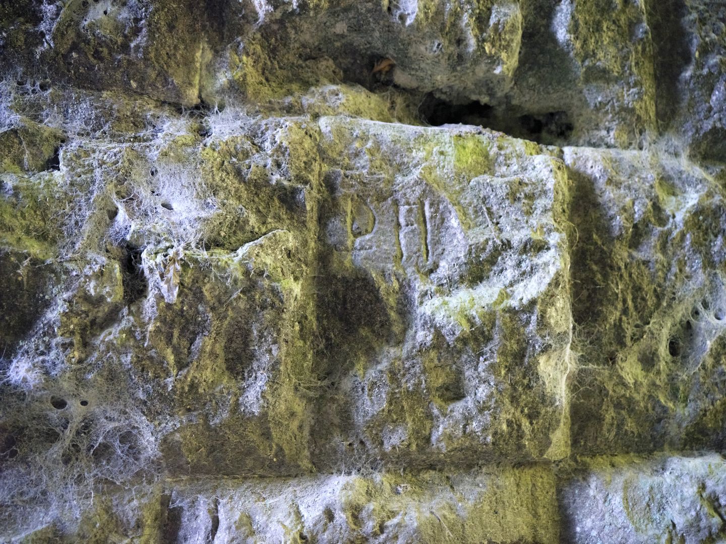
Somewhat relieved to find that the car was still parked at the Ponte Fonnaia, we had a look at the bridge. As I mentioned in the original article, it dates from the 1st Century AD Augustan reconstruction of the Flaminia, and you can make out letters and Roman numerals on some of the stones. This, supposedly, is because they were made to a standard pattern and the blocks would be labelled at the quarry, so that when they arrived at the site they could be more easily assembled according to the intended design, like an IKEA bookcase. I don’t know if that is really true.
From the Ponte Fonnaia to Bastardo
Continuing north from the Ponte Fonnaia, the road continued due north at the foot of the Martani Mountains, to a place called Vicus Martis Tudertium (the Village of Mars of Todi). This was where another road from Tuder (Todi) came in from the west and joined the Flaminia, and it seems from the name that there was a temple of Mars here. Sources suggest that this is the origin of the name “Monti Martani” (mountains of Mars) but I wonder about that. Could it have been the other way round? Were the mountains already sacred to Mars?
In my post on The Temple on the Mountain I described the pre-Roman temple there, and also how it was standard Roman practice to appropriate local deities into their own pantheon. The Umbri were a warlike people: was that forgotten Umbrian deity a god of war like Mars, and did he continue to be worshipped beside his mountains in his new guise?
Such amateur speculation aside, we can say that virtually nothing remains of Vicus Martis Tudertium today, it having been abandoned after major earthquake damage in 306 AD. The stone of which it was built was all scavenged for reuse in other buildings including a local church, which certainly looks as if it contains older material.

The nearest modern town is Massa Martana, which was not there in antiquity – originating as a 7th-Century Lombard frontier post, it is a comparative newcomer. It was originally called just “Massa” but the new Italian government renamed it Massa Martana in 1863 in an explicit reference to Vicus Martis Tudernum (although the locals still call it “Massa”).
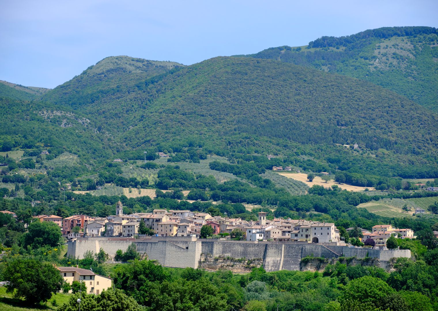
Beyond what would one day be Massa Martana, the route of the Flaminia is a bit unclear for a while, but eventually it gets to a point where the mountains, now descending into hills, were low enough to allow the road to cross from west to east.
As I described in my post on A Town Called Bastard, the modern town of Bastardo is only three or four hundred years old, but it too grew up on what had been the Via Flaminia. Just before you get to Bastardo there are the remains of a Roman villa, and somewhere nearby are the remains of another bridge, which I have yet to find.
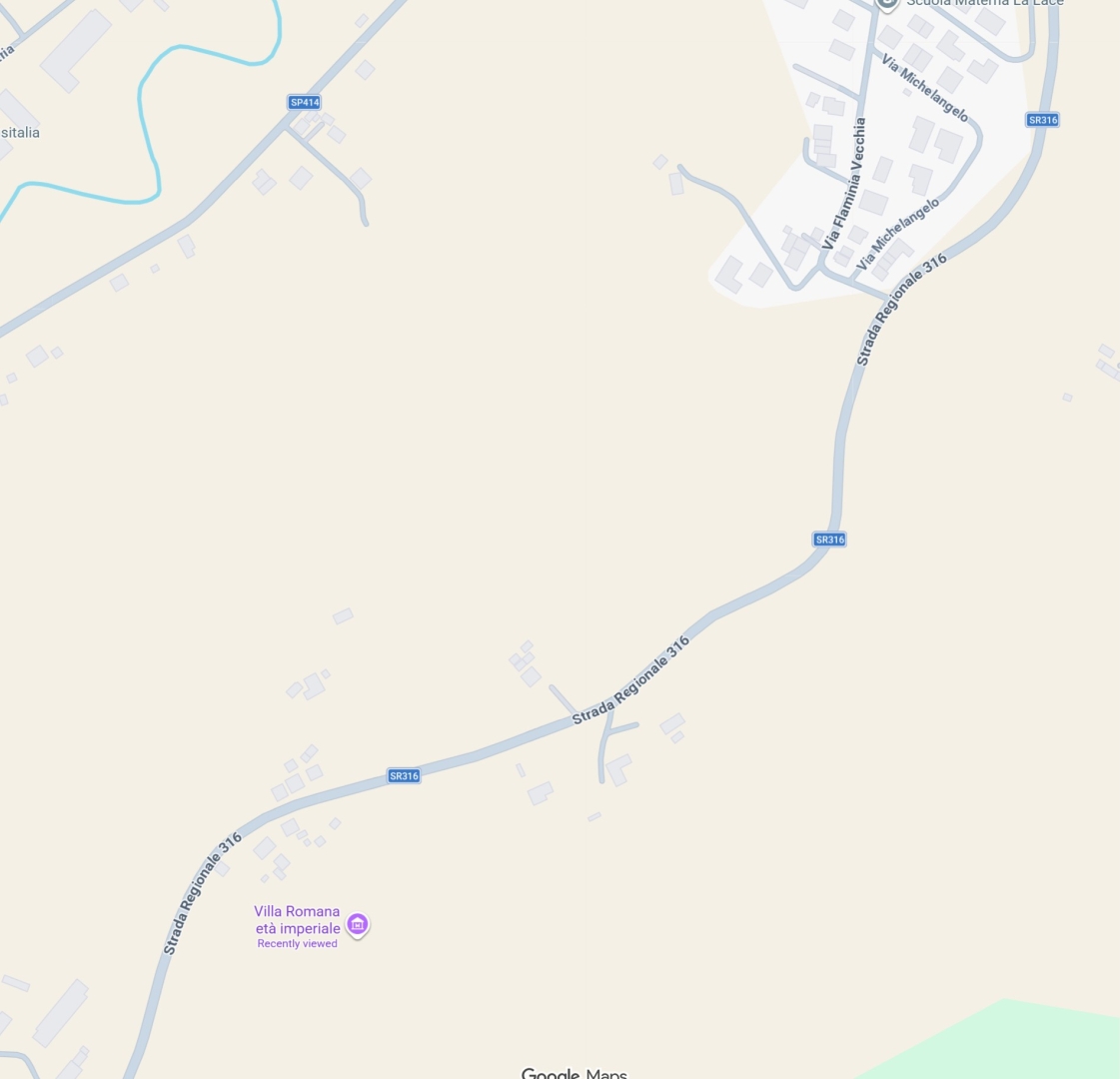
Now for some extremely amateurish amateur archaeology. The two screenshots that follow are from Google Maps, of the area just south of Bastardo where the Roman villa is located. In the first, the “Roman Villa from the Imperial Age” is at the lower left, while the “Old Via Flaminia” comes in from the upper right, but then just seems to peter out.
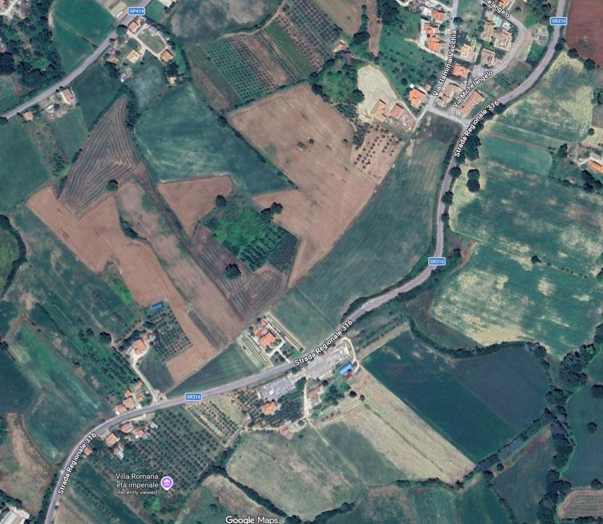
Now let us look at the same area in Google Maps, but with satellite view enabled. The “Via Flaminia Vecchia” comes in from the top right again, but this time you can clearly see that it continues, marked by the long curving field boundary. No doubt this is already well-known to experts, but I felt quite pleased to have noticed it. And the Roman villa can be seen to be at the back of an olive grove, which explains why I didn’t find it when I came looking for it.
A friend who lives nearby tells me that recent excavations suggest that the “villa” was actually a mansio or road station for troops on the march, with a kitchen, mess hall and so forth. As far as I know the name of that place is lost. Every now and then civic-minded locals talk about changing the name of Bastardo to something a bit more dignified, but it never quite takes off. I’m sure that if they knew the name of the ancient predecessor they might have picked that.
I like the idea that there was a kind of ancient Autogrill there – after all, Bastardo started out as a coaching inn and stables to cater to the needs of travellers, but it seems that the “bastard” who opened that establishment was by no means the first to do so.
To Bevagna and Across the Valley
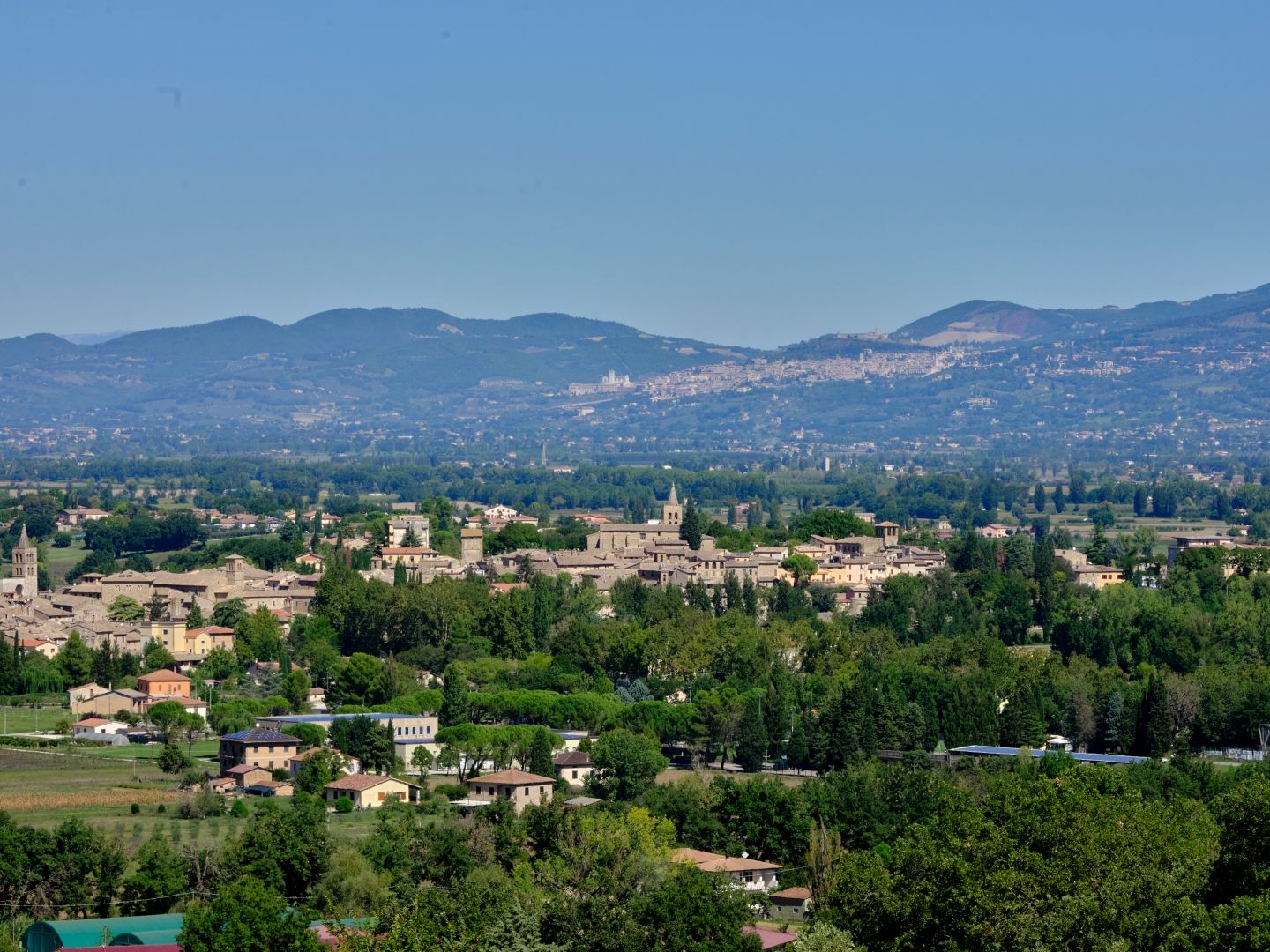
Heading away from the place whose ancient name we don’t know and which is now called “Bastard”, our legionaries would have descended slowly through rolling hills towards the plain now known as the Valle Umbra, and the town of Mevania (modern Bevagna).
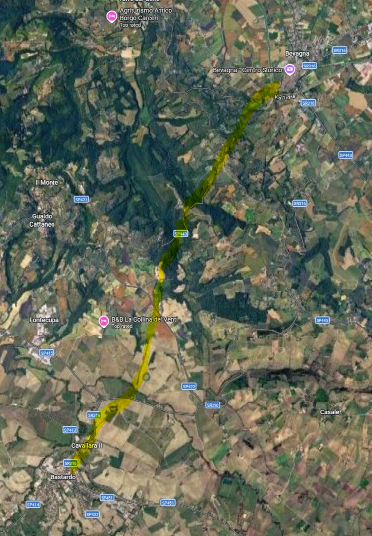
I haven’t been able to track down any maps of where the Flaminia ran here, but looking again at the satellite view of Google Maps, I see a few straight stretches of road that don’t seem to start or end anywhere in particular, so here is a highly speculative possible route.
Mevania was an important Umbrian town in pre-Roman days, but after its incorporation into the Roman imperium it thrived even more due to its position on the Flaminia, where it too hosted a mansio, and on a river which was navigable down to the Tiber near Perugia.
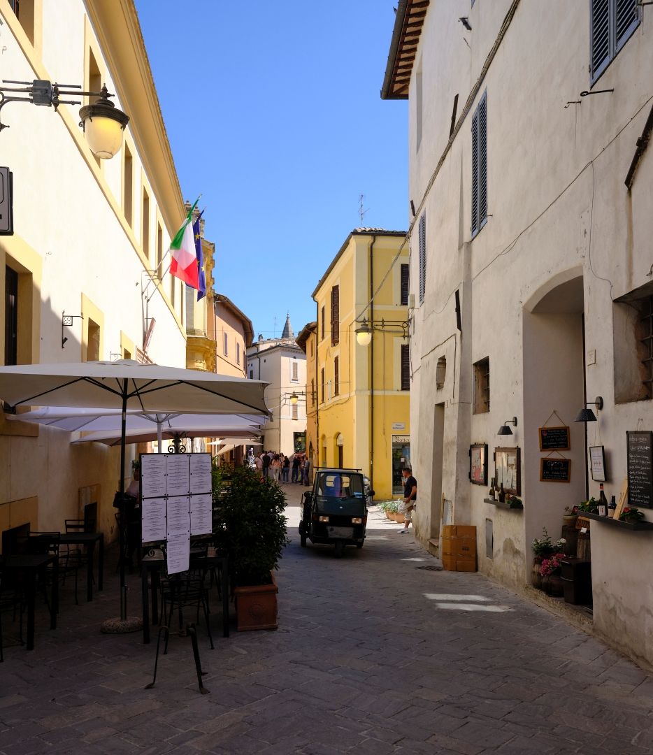
Although the Bevagna we see today is mostly medieval, it nonetheless preserves its ancient past authentically in its road map, and the Flaminia runs the length of the town.
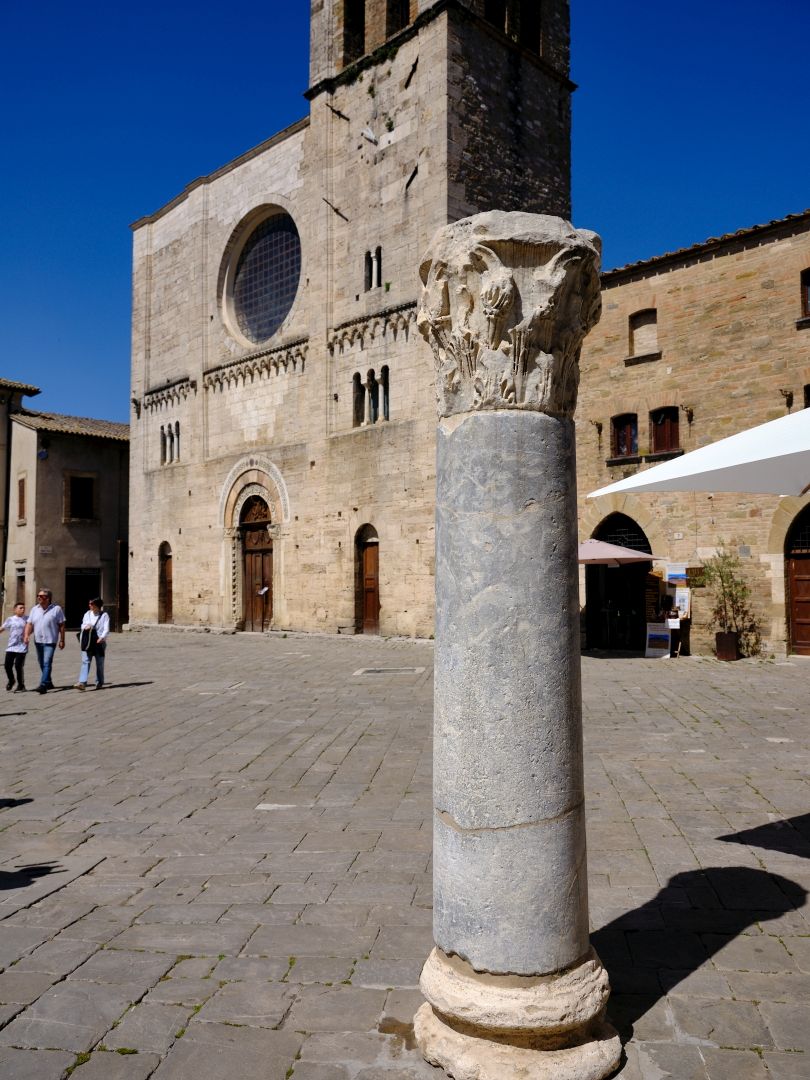
Bevagna preserves other ancient remains as well. On a side street which leads to the medieval gate at Piazza Garibaldi, you can see substantial parts of a 2nd-Century temple (to which deity it was dedicated is unknown). It survived through being incorporated into a Christian church.
There was a theatre, the shape of which is preserved in the medieval houses built on its remnants.
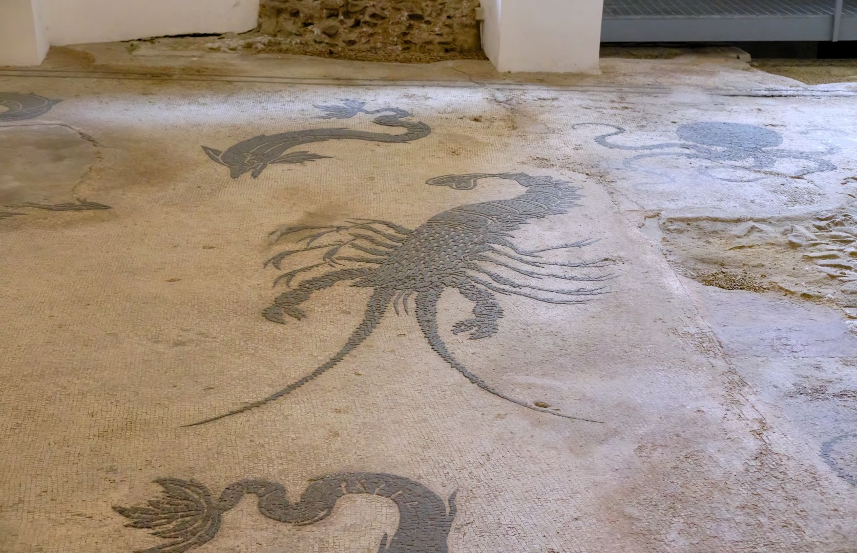
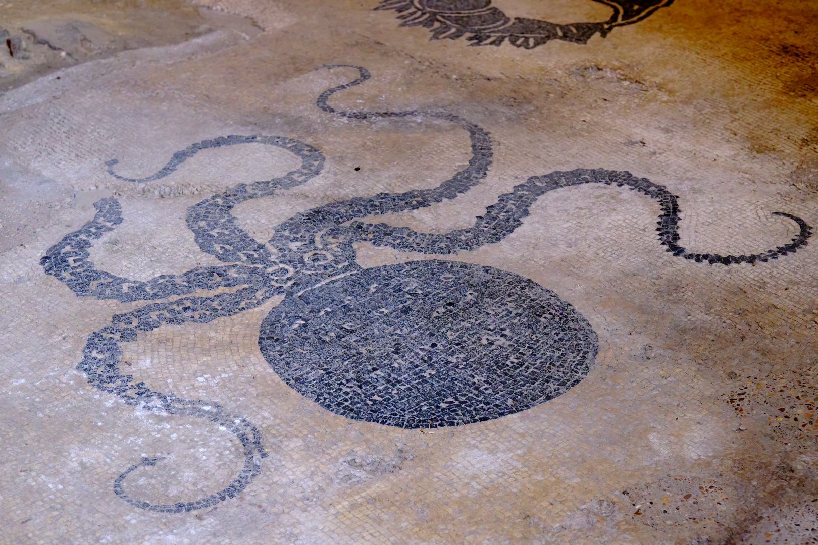
There are also the mosaic remains of part of a bath complex from the Second Century AD, which came to light during the 1600s. They are just down a street next to the remains of the temple described above. The mosaics – on a marine theme as befits a bath – are very well-executed. You can gain entry by booking a time at the town hall. Or you can peer through the dirty windows, which is what most people seem to do.
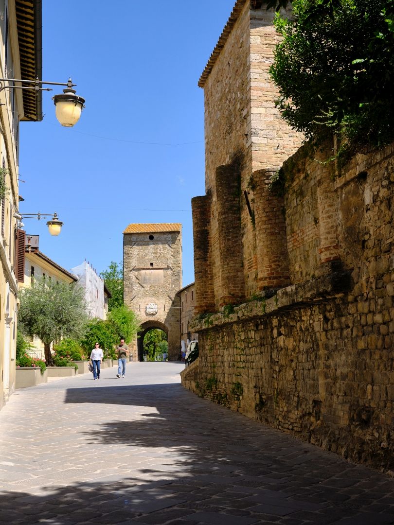
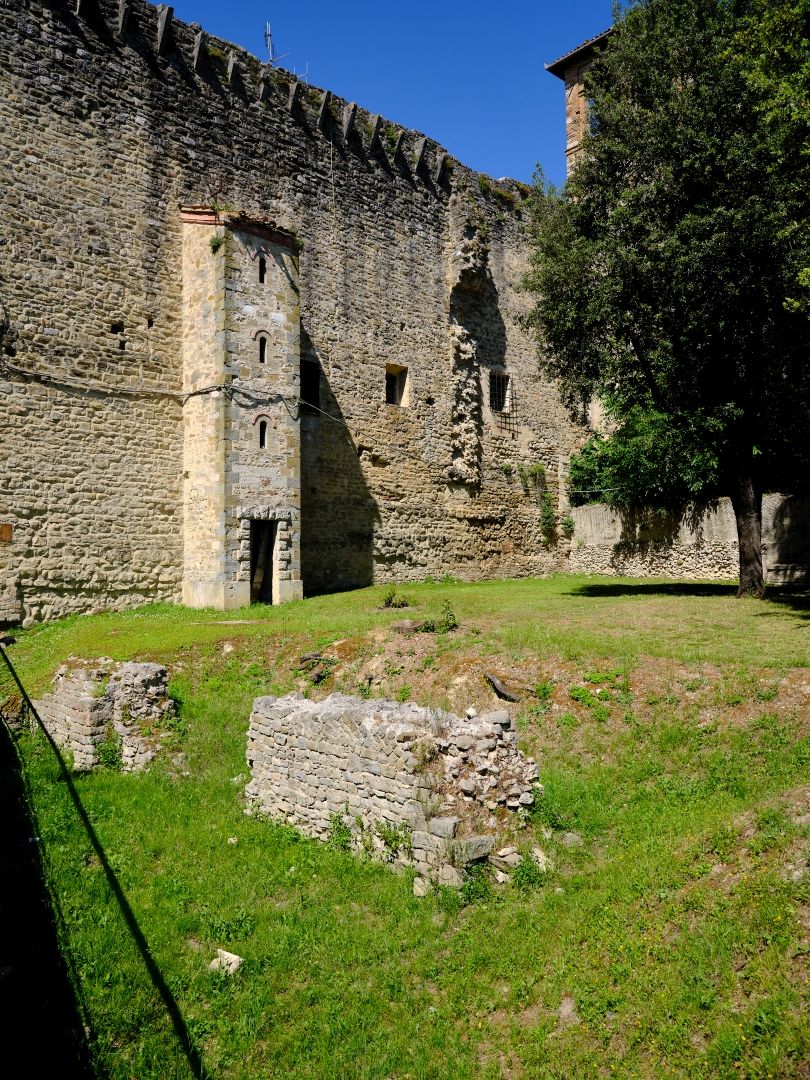
Leaving Bevagna by the medieval Porta Foligno, you can see the remains of Roman walls in a small park.
Down in the valley now known as the Valle Umbra, the Via Flaminia headed northeast in its habitual straight line. It did not lead to either of the nearby towns of Hispellum (Spello) or Fulginiae (Foligno) but to a spot between the two called Forum Flaminii, where it was rejoined by the eastern branch, coming up from Spoletium (Spoleto).
These days the valley is dead flat, and very fertile (the onions of nearby Cannara are prized locally) but when the road was first built in the 3rd Century BC, the valley was swampy and flood-prone. The Roman engineers would therefore have had to build a causeway of sufficient height to allow the road to be usable in all weathers.
During the Roman period, the valley was drained and turned into productive farmland. Then after the fall of the empire the constant work needed to maintain the drainage system ceased, and nature reasserted itself. Before long it was once again mostly swamp. Small-scale and uncoordinated efforts were made in the Middle Ages, but the canals and dykes we see today mostly date from the 19th Century.
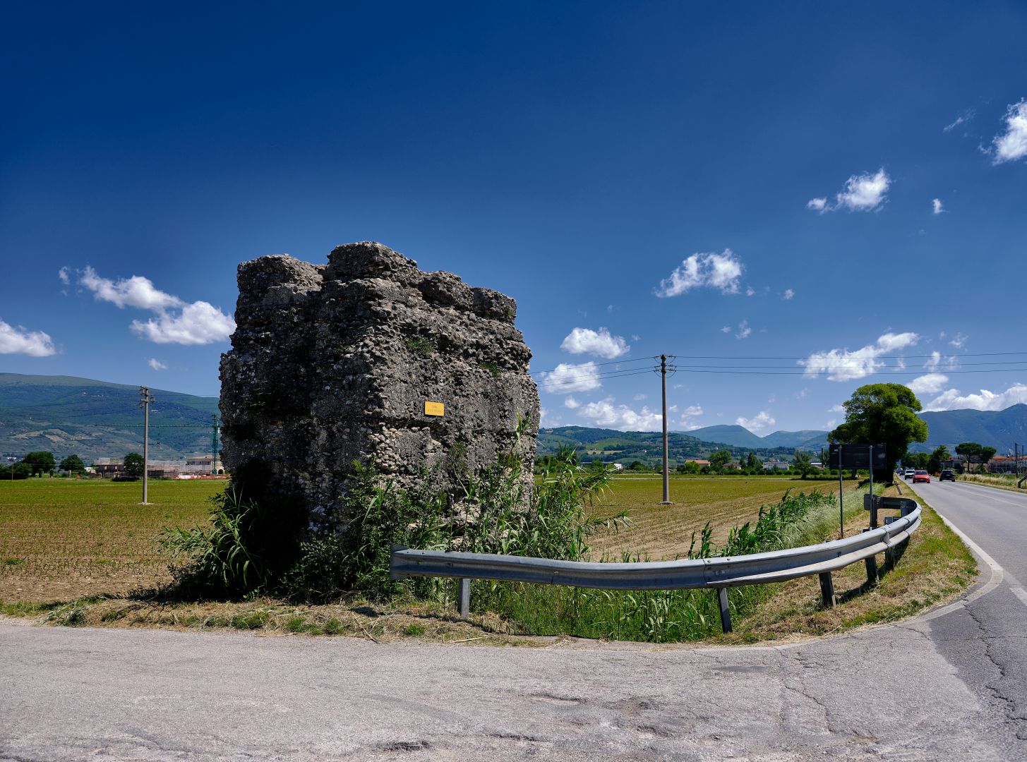
Despite the rising and falling water levels over the centuries, the modern Flaminia (here called the SR316) still follows the old route across the valley, on a causeway which, no matter how many times it has been repaired, must sit on the original Roman foundations somewhere beneath the surface. As elsewhere on the road, on the outskirts of towns our legionaries would have marched past large monumental tombs, the remains of a couple of which can still be seen.
I frequently take this road when heading to Foligno, Spello or Assisi from Bevagna, and enjoy pointing out to passengers that we are travelling on the Flaminia, possibly with a bonus lecture on the consular road system or ancient water management. There is nothing like a captive audience.
That is the end of the second article in this series on the Via Flaminia. It will shortly be joined by the final instalment, in which we cross the Apennines and head up the Adriatic coast to the end of the road in Ariminium (Rimini).
2 Replies to “Via Flaminia – All the Way (Part 2)”