The Lombard Invasion and the Byzantine Corridor

The late Sixth Century saw some extraordinary developments in Italy. Almost the entire country was overrun by the Lombards, except for a narrow strip of territory – the “Byzantine Corridor” between Rome and Ravenna. You can still see where, in the modern landscape, the “Corridor” ran.

In my post about Ravenna at the Fall of the Empire I wrote of the invasion of Italy by the Goths, the partial reconquest by Byzantine forces, and briefly mentioned the subsequent invasion by the Lombards. This post picks up the story, and looks at how it played out in central Italy.

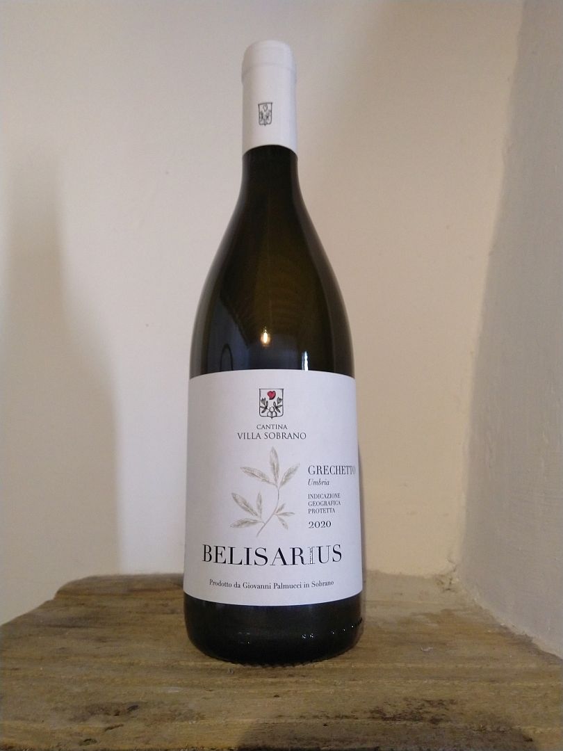
The Byzantine forces under Belisarius and Narses had successfully regained much of Italy from the Goths for the Byzantine Emperor Justinian. Obviously the conflict is not entirely forgotten in Umbria, going by this wine label I found:

Belisarius Grechetto
A bottle of Grechetto wine named after the Byzantine General Belisarius. The wine was very nice. Nokia 6.1 phone camera (click to enlarge).

But the period of the Gothic War of 535-554 was absolutely ruinous for Italy – not just due to military action. In 536 the Earth suffered the worst climate event in recorded history when a volcanic eruption (the location is uncertain) caused two years of severe global cooling followed by drought. Crops failed and famine was widespread. Then came the so-called “Justinian Plague” in 540-541 (probably bubonic plague). All that was on top of the spread of malaria from the south. Deliberate debasement of the currency (these days they call it “quantitative easing”) which had been going on for many years, reduced people’s purchasing power. Depopulation, impoverishment and a general breakdown in administration were inevitable. The population shrank, education almost ceased, technologies were forgotten, the great cities emptied, productive agricultural land reverted to swamp or woodland, health and life expectancy declined, and things were generally horrible. Revisionist modern historians avoid using the term “Dark Ages” to refer to the centuries after the fall of the empire (presumably to avoid offending people who identify as Visigoths and Vandals) but the Dark Ages sound pretty dark to me.

And while the war left the “Roman” Byzantines nominally in charge, it was a pyrrhic victory. The attenuated power of the local representatives of distant Byzantium – the Exarchs of Ravenna – was not up to the task of resisting the next threat.

The Lombards

And the next threat was the Lombards, or in their own language, Langobards or Longobards. If you agree with me that it sounds a little bit like the English words “long beards”, you are absolutely right. The Langobards came to the notice of history in what is now southern Sweden, Denmark and northern Germany, where they were speaking a language closely related to Anglo-Saxon. And it seems that they did indeed have long beards, or at least the men did, so that is what they called themselves.

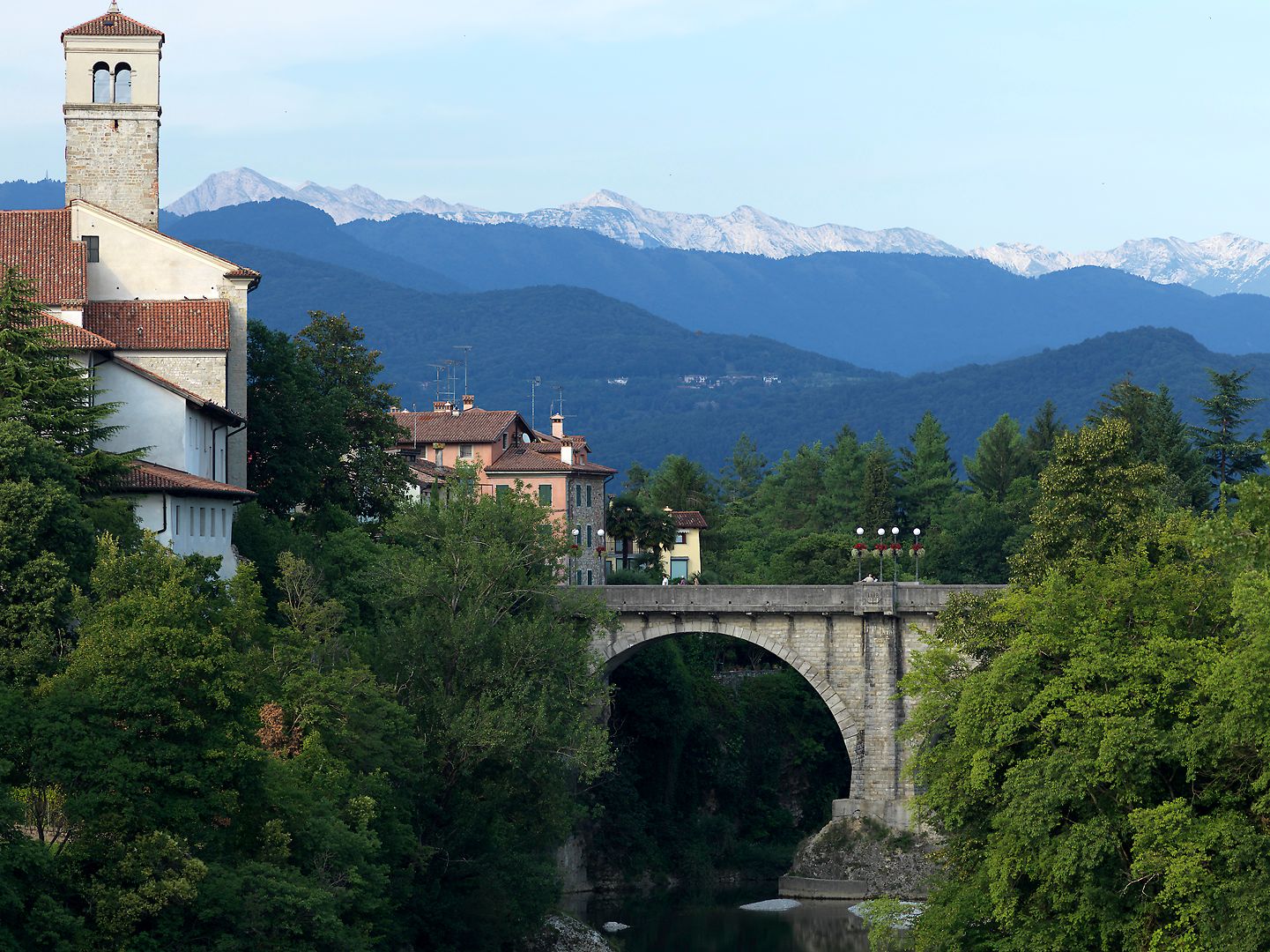
After a few hundred years of drifting southwards, and under pressure from other aggressive populations to the east, the Lombards (as I will now refer to them with their Italianised name), found themselves in what is now Austria and Slovakia around 568 AD. They entered devastated and depopulated Italy across the Julian Alps (in modern Slovenia) and were virtually unopposed. A modern town close to where they entered Italy is Cividale del Friuli in the far northeast, which has some Lombard archaeological remains and an excellent museum of Lombard culture which I highly recommend.

Cividale del Friuli
The “Ponte del Diavolo” in Cividale del Friuli, with the Julian Alps (in Slovenia) visible in the distance. Hasselblad 501 C/M camera, CFV-50c digital back, Zeiss Sonnar 250mm lens (click to enlarge).
Lombard Jewellery
Lombard Jewellery in the National Archaeological Museum, Cividale del Friuli. Nexus 6P phone camera (click to enlarge).
Lombard Jewellery
Lombard Jewellery in the National Archaeological Museum, Cividale del Friuli. Nexus 6P phone camera (click to enlarge).
Lombard Jewellery
Lombard Jewellery in the National Archaeological Museum, Cividale del Friuli. Nexus 6P phone camera (click to enlarge).

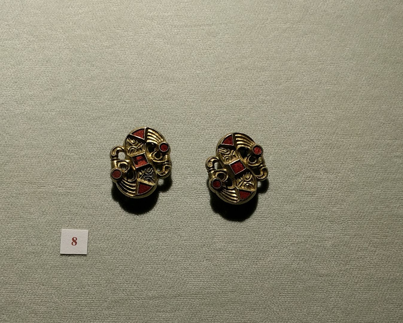
As we saw earlier, thanks to the devastation caused by the Gothic Wars, the Lombards were pretty much pushing at an open door. But nevertheless the speed of their expansion through Italy was extraordinary. Only two or three years later almost all of northern Italy was under their control (a much larger region than the modern “Lombardy”) and Lombard duchies had been established further south in Tuscany, Spoleto and Benevento.

Here is a map of Italy after these duchies were established.

Byzantine and Lombard Italy
Byzantine and Lombard Italy (Wikimedia Commons; click to enlarge).

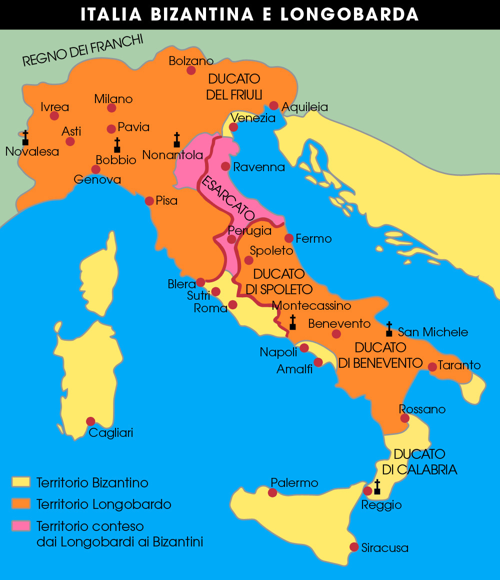
You will see that the nominally Byzantine control of Rome continued, that the Exarchate of Ravenna was threatened, and that they were connected by a narrow strip of territory. Italian historians call this the Corridoio Bizantino or “Byzantine Corridor”.

Conflict and Truce

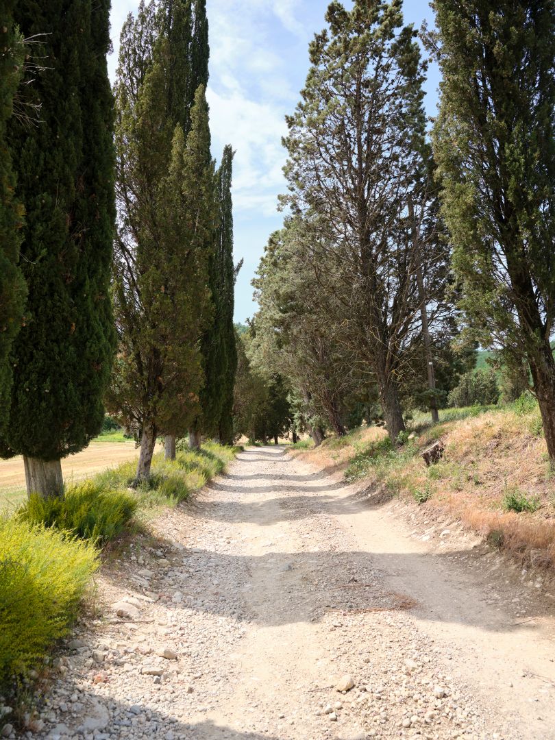
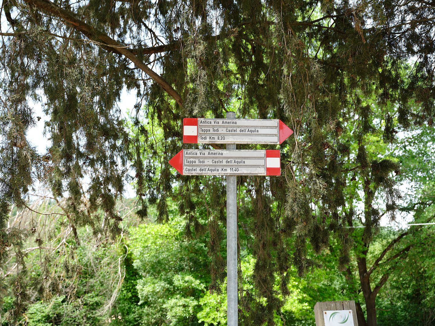
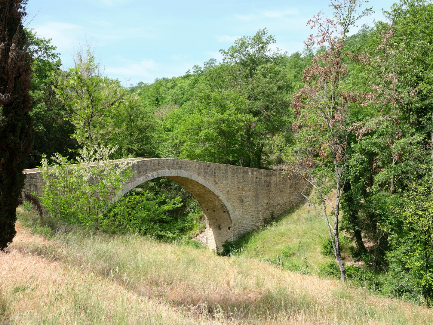
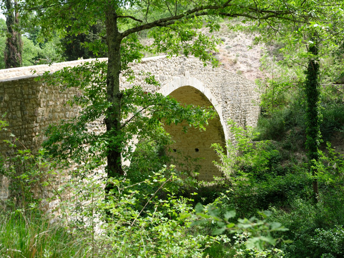
In Umbria, as the Lombards extended their territory westwards from Spoleto, they captured the Via Flaminia, cutting the Byzantines off from the historic military route between Ravenna and Rome. But somewhere in the Martani Hills the Lombards stopped, and the Via Amerina, not far to the west in the Tiber Valley, remained under Byzantine control. It was this road, originally a series of pre-Roman provincial roads between towns, that became the narrow thread linking Ravenna and Rome through hostile country: the Byzantine Corridor.

At first the corridor was created and defended by force of arms. Later, a truce between Lombard and Byzantine/Papal authorities regularised the borders, but there were probably a few skirmishes from time to time.

So how narrow was the corridor? In places very narrow indeed, it would seem.

Linguistic Evidence

Working out where the edges of the Byzantine Corridor lay is difficult; they didn’t put up signs beside the roads. But as with Anglo-Saxon and Celtic place-names in Britain, one form of evidence for boundaries, and hence the extent of Lombard dominion in Italy, is linguistic.

A few years ago it occurred to me to wonder about the origin of the word borgo, common in Italy and meaning a small town, or an area on the edge of a larger town. This is clearly not of Latin origin, but the same Germanic word that you find in Hamburg, Gothenburg, Peterborough, Canterbury and Edinburgh. And lots of other burgs, borgs, boroughs and burys. What was such an obviously Germanic word doing in Italian?

It turns out that borgo and several other Italian words associated with locations are indeed Germanic. Some might have been derived from Gothic or Frankish, but most are probably Lombard.

Another such word is gualdo. The letters “gu” in Italian were used in Italian to render the initial “w” sound in Germanic languages, such as “Gualtiero” for “Walter”. So if you see an Italian word beginning in “gu”, it probably has a Germanic origin. Gualdo comes from the same origin as the German wald meaning wood or forest, as in Schwartzwald for “Black Forest”.

There are a number of places in Italy either called Gualdo, or with names containing that word. They all seem to be in areas that were once part of Lombard dominions. While such places were presumably named for being in or near woodland, the term is also associated with military outposts, suggesting that they would have been on the borders of Lombard territory.

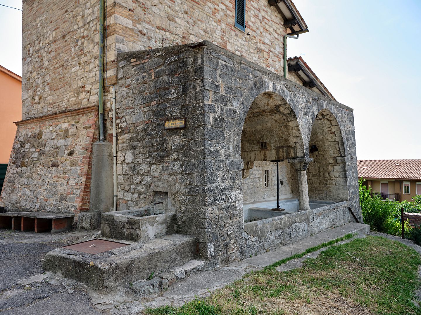
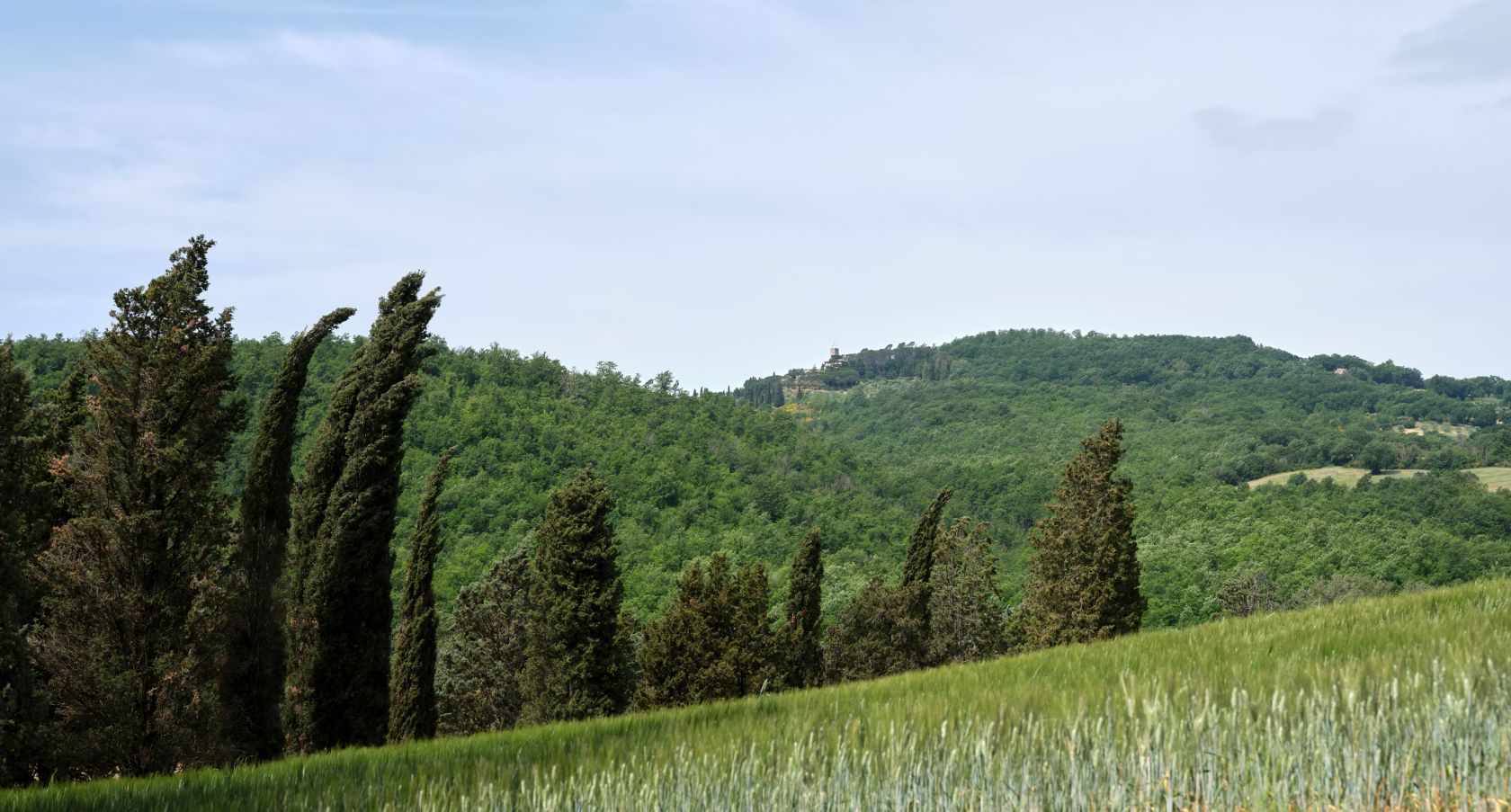
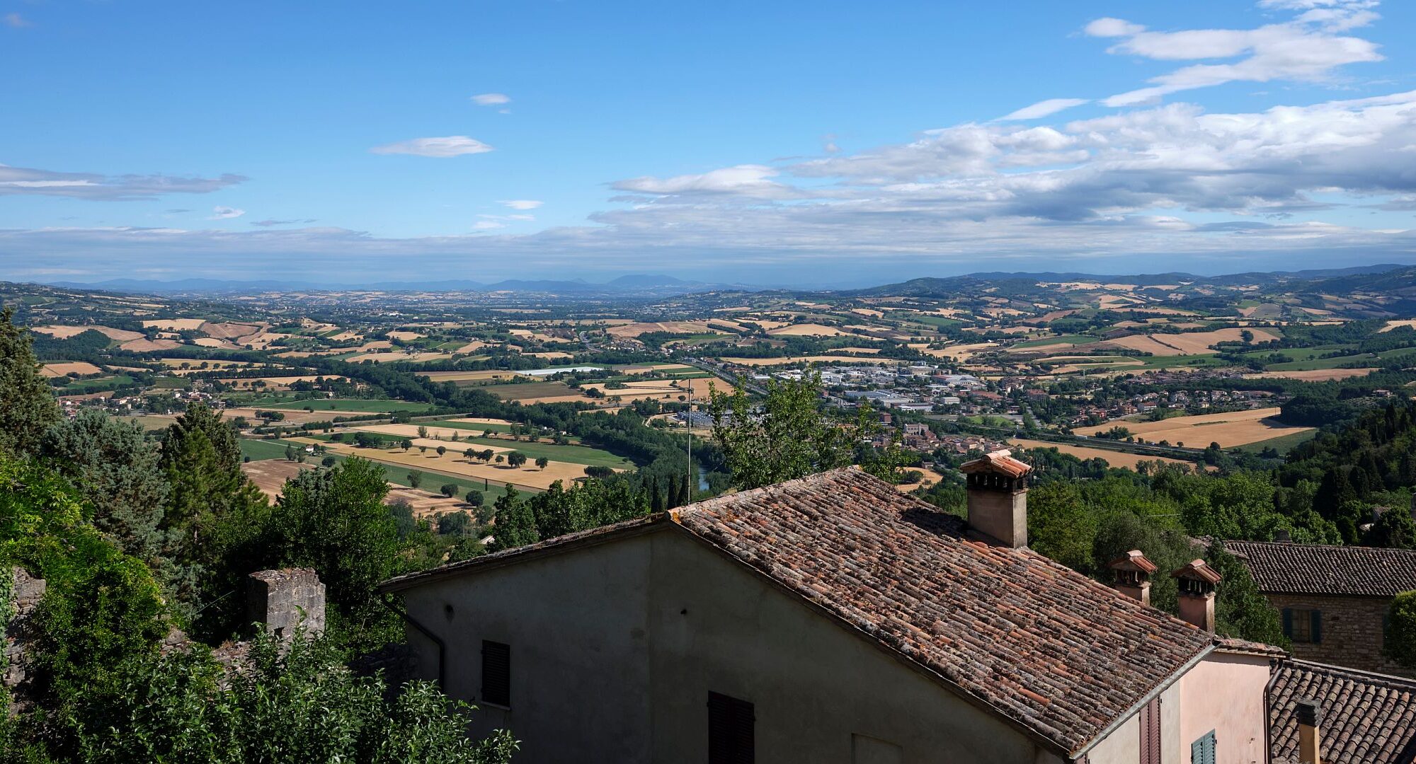
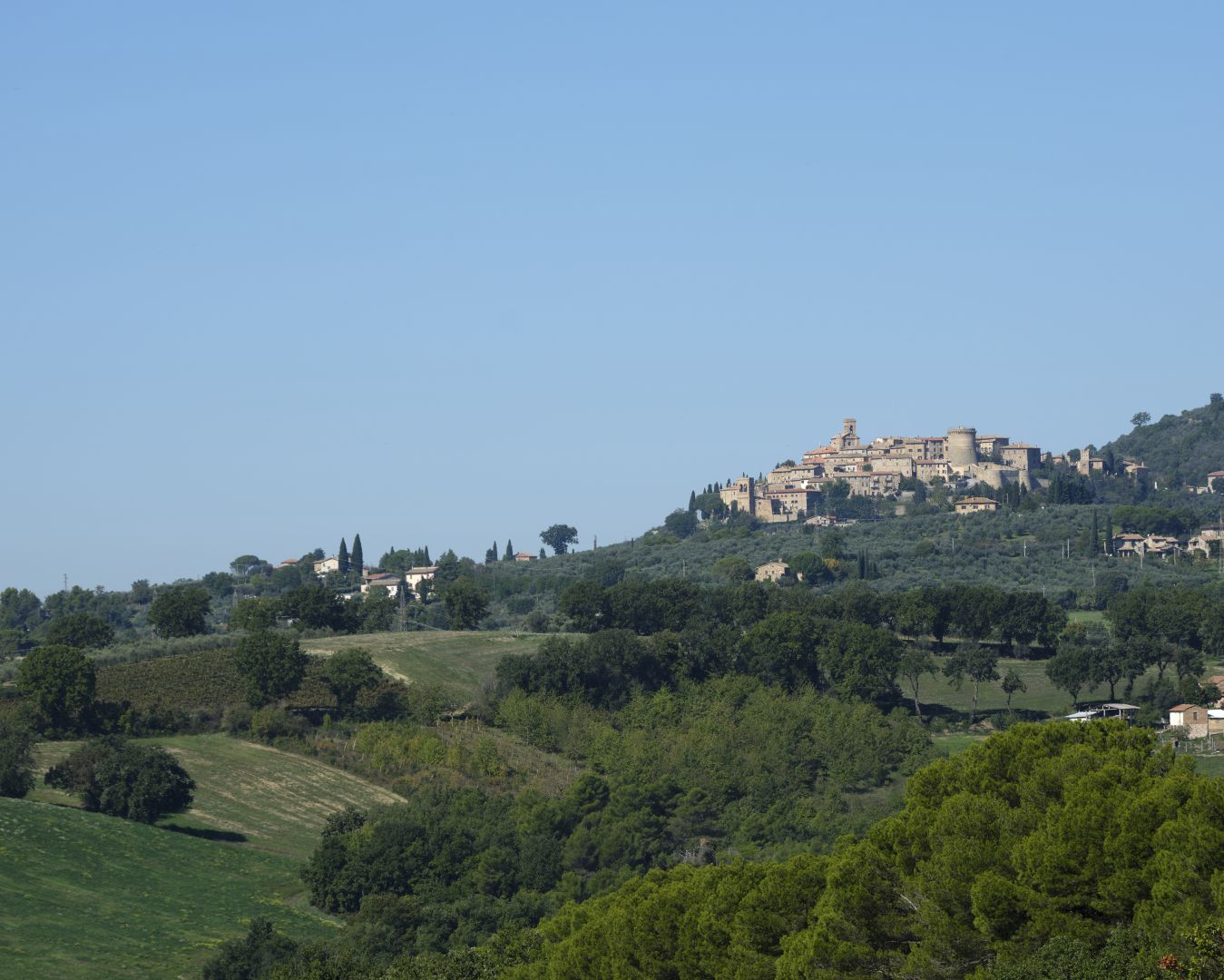
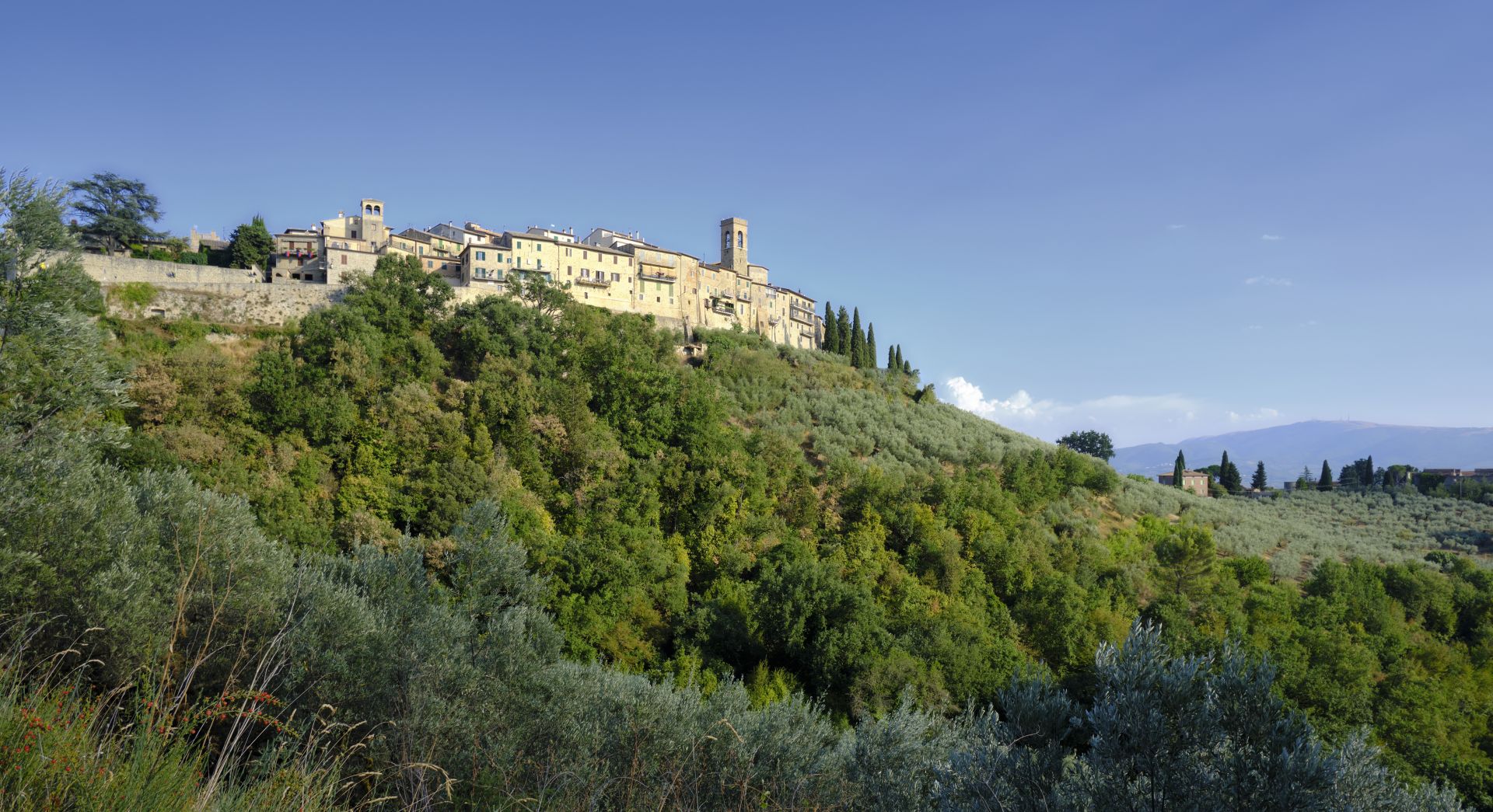
In the Martani Hills in Umbria is a pretty little town called Gualdo Cattaneo. From the linguistic evidence just discussed, this may well have been an outpost in wooded country on the edge of Lombard territory, in this case the Duchy of Spoleto. I understand that the earliest surviving records are from after the period of the Byzantine Corridor, but the name tells you that the area was certainly Lombard, so the idea that this was originally a border outpost is appealing. The photograph below, taken from the south, shows that it was on elevated ground facing west into Byzantine territory – exactly what you would expect of such an outpost.

Distant view of Gualdo Cattaneo. Fujifilm GFX 50R camera, Fujifilm GF100-200mm R LM OIS WR lens (click to enlarge).

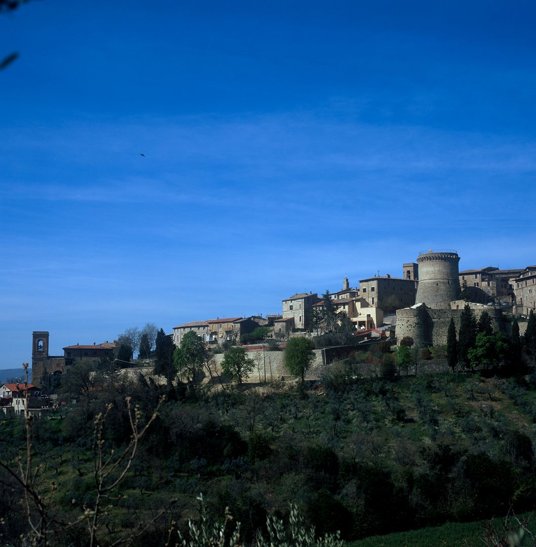
The picture below, taken from a bit closer, shows the defensive situation of the town, even if the current fortifications are clearly from the 14th Century or later (rounded fortifications generally post-date the introduction of cannon to warfare; cannon balls are more likely to bounce off them).
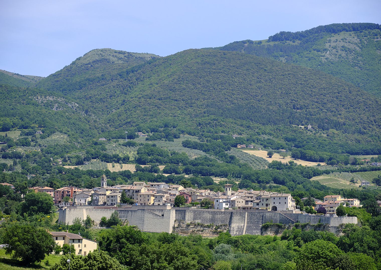
Gualdo Cattaneo
Gualdo Cattaneo from closer up. Hasselblad 501 C/M camera, Zeiss Planar C 80mm lens, 6×6 cm film back, Fujichrome Velvia film (click to enlarge).

The Byzantine Corridor Today

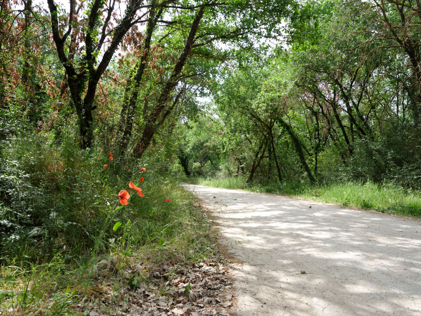
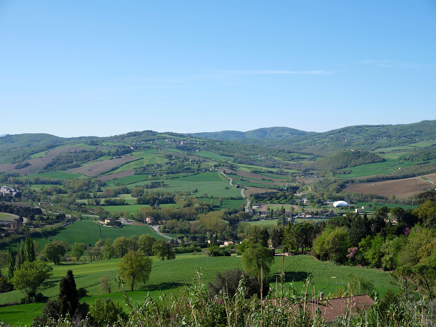
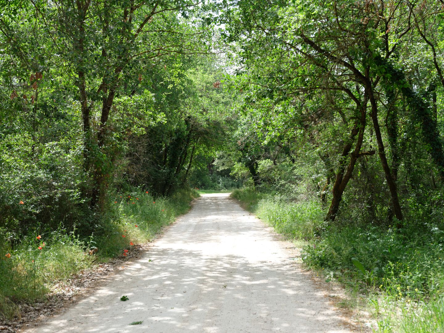
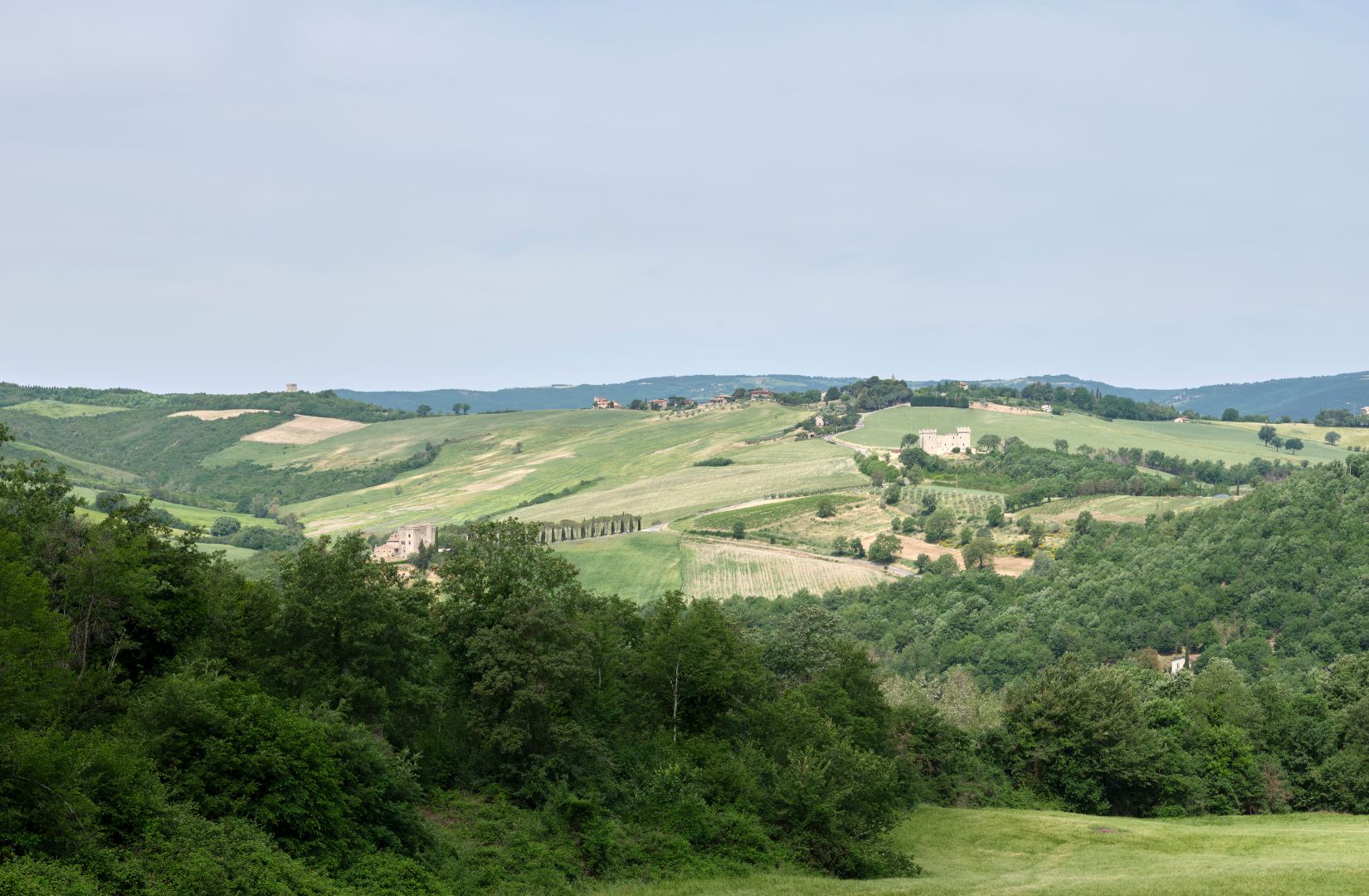
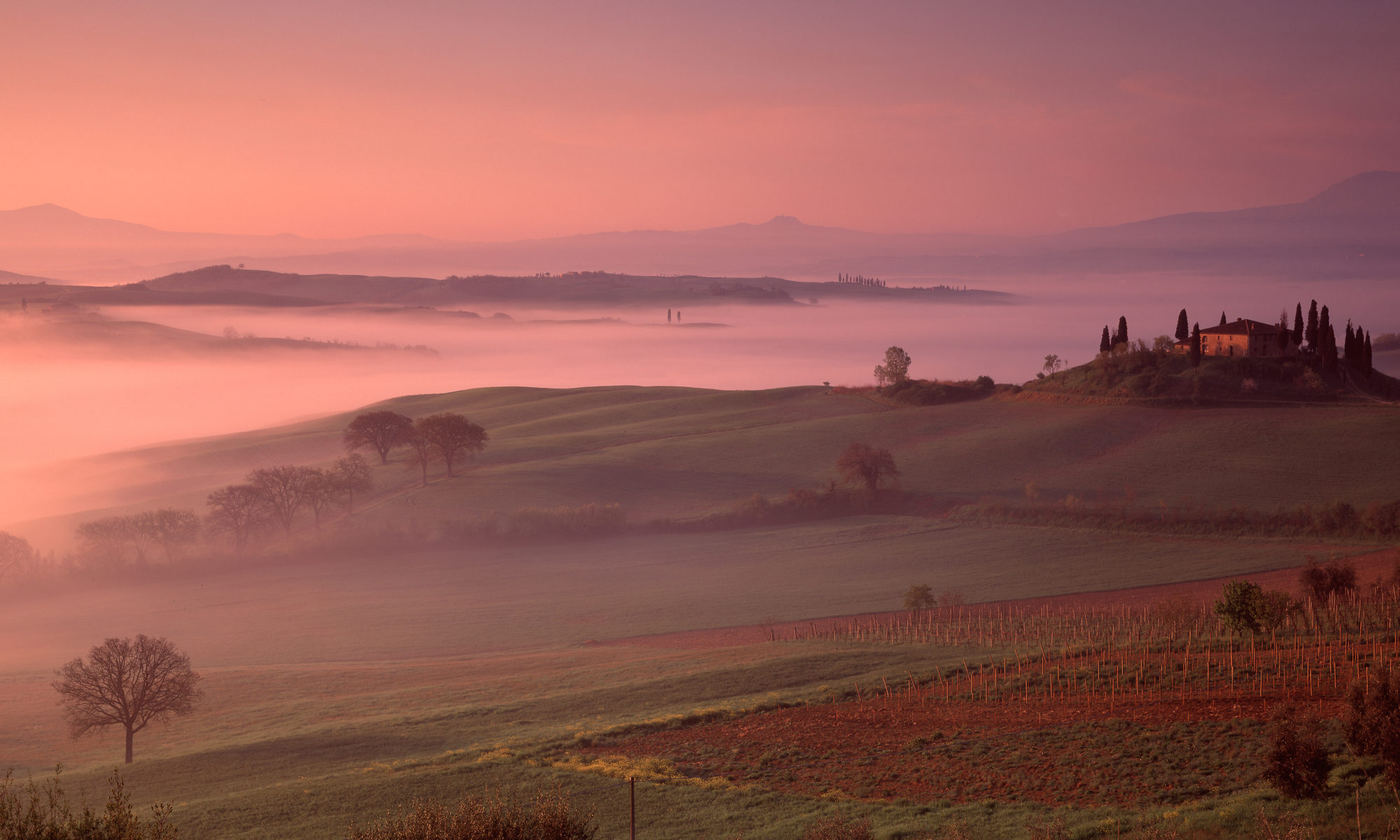
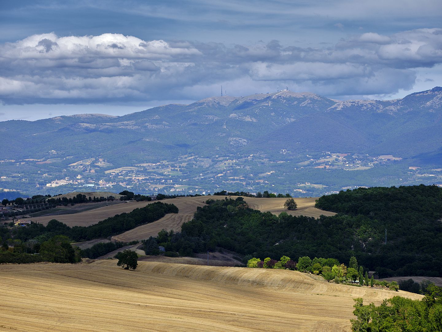
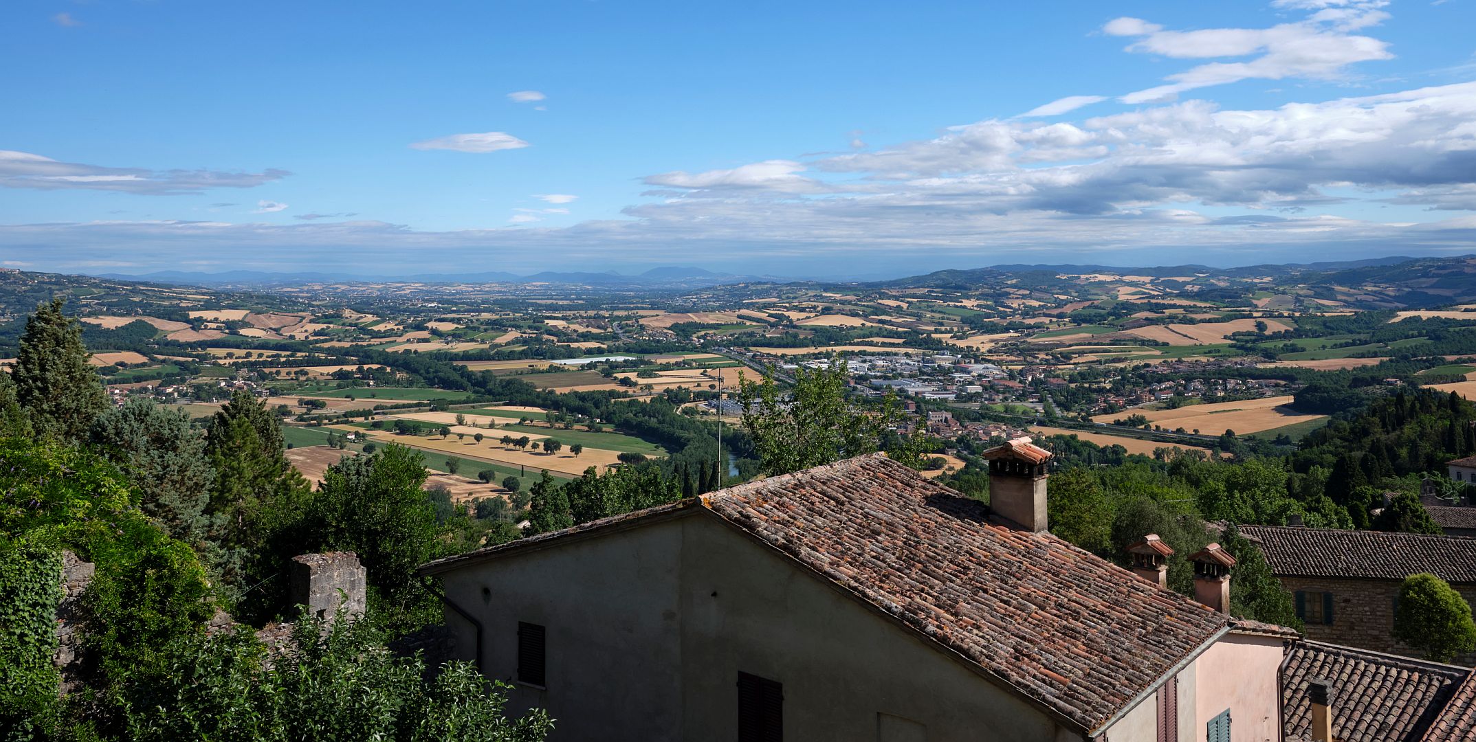
The photograph below shows the Middle Tiber Valley, looking north from Todi towards Perugia (I recommend you click on it to open a larger version in a new window). It is up this valley that the Via Amerina ran, and so you are looking at the actual Byzantine Corridor. Today’s pretty agricultural landscape must look very different from the semi-wilderness of the 6th Century though. The Via Amerina more or less followed the route now taken by the E45 motorway, clearly visible on the eastern side of the river, but back then it would have threaded between swamps and woodland, and passed through the ruins of Roman-era towns by then abandoned.

Middle Tiber Valley
The Middle Tiber Valley north of Todi. Fujifilm GFX 50R camera, Fujifilm GF32-64mm R LM WR lens (click to enlarge).

This photograph really helps one envisage just how narrow the “Byzantine Corridor” was, here in central Umbria. Gualdo Cattaneo, on the edge of the Lombard Duchy of Spoleto, is in the hills at the right of the photograph, about 12 kilometres from the motorway. To the left of the Via Amerina is the Tiber (marked by a double line of trees), and beyond it steep hilly country. Further west still was the Lombard Duchy of Tuscia, or Tuscany.

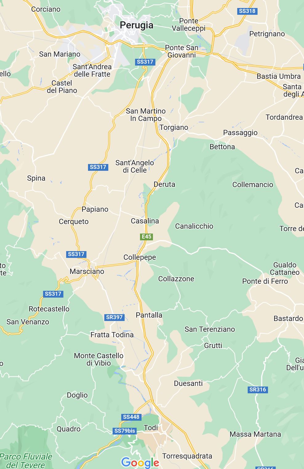
Here is the same area on a map. The E45 motorway runs down the middle, following approximately the same route as the ancient Via Amerina. Gualdo Cattaneo is on the right. The town of Deruta through which the road passed had been completely destroyed in the Gothic Wars and Lombard invasion – indeed its very name derives from Latin words implying ruin.

Middle Tiber Valley
Map of the Middle Tiber Valley (source: Google Maps).

That puts it all in perspective. Up and down this valley would have come Byzantine troops, and Imperial and church officials, trying to maintain contact between Ravenna and Rome. They would have hurried from the protection of one fortified town to the next, keeping an eye on the nearby woodlands for signs of an ambush by Lombard troops, or maybe a party of leftover Goths.

South of Todi there seems to be some uncertainty over exactly where the Corridor ran. I’ve done a bit of poking about in the hills there, and I’ll make that the subject of a separate post in due course.

The Via Amerina in Umbria

The Via Amerina was originally formed out of pre-Roman provincial roads, then it became an important local artery. For years it lay forgotten in the central Italian countryside, before being reinvented as a route for modern “pilgrims”.

This is the first of two or three articles I have in mind about the Via Amerina, a road which in antiquity led north from Rome to the town of Amelia in Umbria (ancient Ameria, from which the road took its name). From there it continued northward to Todi and Perugia, then ran westward to Chiusi.

What was the Via Amerina?

I’ve written a few times about the mighty military road called the Via Flaminia where it passes through Umbria. The Via Amerina is of a lesser order, and I ought to explain the difference.

The great consular roads like the Via Flaminia, the Via Appia, the Via Cassia and the Via Emilia were a means to deliver military force anywhere in the empire or on its boundaries. A capability a bit like – sort of – a modern aircraft carrier task group. They were planned, built and maintained with power projection in mind, and they famously ran as straight as topography would allow. They are called “consular” roads because they were named after the consul in whose administration each was started. The consuls were the chairmen of the Senate and also army commanders, so they could be expected to think and plan strategically.

A road like the Via Amerina, by contrast, would not have been centrally planned. Instead it grew out of existing roads between towns, which would already have been old when Rome rose to power. Since it served the needs of commerce and administration its importance was recognised by its being given an official name, and being maintained and upgraded at public expense.

When complete, each consular road had a separate public office solely responsible for its maintenance, while lesser roads like the Via Amerina were grouped together with other roads for maintenance purposes under different officials. And they were not straight; they meandered from town to town just like the ancient trackways on which they were based.

Despite its originally non-military status, after the end of the Roman Empire the Via Amerina had a period of great strategic importance as part of the so-called “Byzantine Corridor”; that is a subject for a later post. Update: here is that later post.

The Via Amerina in Central Umbria

Here in central Umbria, the Via Amerina ran north from Todi, along the eastern bank of the Tiber to Perugia. These days that part of the route seems to be mostly covered by modern roads and I have not found many references to its northern remnants. But to the south, between Todi and Amelia and beyond into Lazio it wanders through places that later main roads did not follow, so traces of it remain – in some cases even the original basalt flagstones.

A scholarly type has gone to the effort of creating an Umbrian Via Amerina route for the ArcGIS geographical information system – you can find it here.

In the photograph below, taken towards the south from Todi, the wide road that runs up the hill is not the Via Amerina. In post-imperial times towns and villages migrated to the high ground for defensive purposes and to reduce the threat from malaria, and so new roads followed them, but in Roman times settlements were more likely to be in the valleys. The Via Amerina followed the wooded valley of the little river Arnata, to the right.

Looking south from Todi to the route of the Via Amerina, which followed the wooded valley to the right. Fujifilm GFX 50R camera, GF32-64mm R LM WR lens (click to enlarge).

These days identifiable sections of the Via Amerina form part of a “pilgrim” walking trail between Assisi and Rome. I’m not sure why St Francis or any of his followers would have needed to come this way, and wonder whether it has been chosen because of its beauty, and because following a more strictly historically accurate route that is now shared by a motorway would be less enjoyable. In any case, a tourist industry has grown up to cater for people who want to feel that they are retracing the steps of medieval pilgrims, and that is a very good thing. An example of a travel blog written by someone who did one of these excursions (with some nice photos) can be found here.

If you decide to head south from Todi, along the route that a Roman traveller would have taken, one of the first things you encounter (with a bit of searching), is a fontana or spring that would always have been here, but in its current form dates from 1201 AD. Todi sits on a plug of permeable rock up through which water that originally falls on the Monti Martani is forced, creating multiple freshwater springs that emerge high above the level of the valley. I’m sure that much of the traditionally healthy properties of such springs are due to the fact that coming up from far below the ground and being filtered through the rocks meant that the water was less likely to give you a fatal dose of dysentery. On the way up through the limestone the water picks up quite a lot of calcium, and a rather pronounced taste.

Fontana di Sant'Arcangelo
Fontana di Sant’Arcangelo. Fujifilm GFX 50R camera, GF32-64mm R LM WR lens (click to enlarge).

The Fontana di Sant’Arcangelo is very pretty, despite being hidden away in a suburban area full of 1970s apartment blocks. Of course, if it were still in its original surroundings in farmland it would be even more attractive, but the fact that you have to hunt for it (and in my case, ask directions from a lady going for a walk with her daughter) adds a certain attraction.

Down in the valley the route of the Via Amerina is quite clearly marked, and we followed smaller and smaller roads until we were driving along the valley floor on a pleasant unmade road through oak woods and with wildflowers along the edges.

Via Amerina
Via Amerina in the valley of the River Arnata. Fujifilm GFX 50R camera, GF32-64mm R LM WR lens (click to enlarge).
Via Amerina
Via Amerina in the valley of the River Arnata. Fujifilm GFX 50R camera, GF32-64mm R LM WR lens (click to enlarge).

There are a few chapels and other buildings from the early Middle Ages along the route, but they are either ruined or have been heavily renovated. There are also castles on many high points around, showing that the road continued to see enough use to make it worth defending. Many of them look habitable – I read that some of these castles were bought and renovated in the 19th Century by wealthy local families, and some of them are clearly undergoing a new series of renovations, presumably with the intent of using them as hotels, convention centres or spas. Some of the smaller castles round here have been bought and renovated by wealthy foreigners either as private dwellings or as AirBNBs.

Castello di Fiore and Castello di Belfiore
Castello di Fiore (right) and Castello di Belfiore (left), above the route of the Via Amerina. Fujifilm GFX 50R camera, GF32-64mm R LM WR lens (click to enlarge).
Torre Olivola
Torre Olivola on the skyline above the route of the Via Amerina. Fujifilm GFX 50R camera, GF32-64mm R LM WR lens (click to enlarge).

The Roman Bridge at Pesciano

I was hoping to find a bridge dating from the late Roman period, where the Via Amerina crosses over the River Arnata near the village of Pesciano. I had made a couple of attempts to get to it since I first read about it in 2018, but had been defeated by atrocious roads and ambiguous maps. This time I approached from the Pesciano Road, drove as far as I dared, then parked the car in a clearing and continued on foot for a couple of kilometres.

The road descended through oak woods and between newly-mown fields to the river, where I came to a junction with the Via Amerina.

Road to the bridge at Pesciano
Road to the bridge at Pesciano. Fujifilm GFX 50R camera, GF32-64mm R LM WR lens (click to enlarge).
Antica Via Amerina
Antica Via Amerina signposts. Fujifilm GFX 50R camera, GF32-64mm R LM WR lens (click to enlarge).

Turning left I continued for a few hundred metres to where there was a ford across the river, obviously used by farm vehicles, then a bit further on I found the bridge.

Roman bridge at Pesciano
Roman bridge at Pesciano. Fujifilm GFX 50R camera, GF32-64mm R LM WR lens (click to enlarge).
Roman bridge at Pesciano
Roman bridge at Pesciano. Fujifilm GFX 50R camera, GF32-64mm R LM WR lens (click to enlarge).

Between 2007 and 2013 the local authorities repaired the bridge, and it must be said that it still looks rather starkly new, especially from downstream. I managed to find a photograph of the bridge before renovation on this website and I have to confess mixed feelings. The romantic in me warms to the old ivy-covered partial ruin, like something out of an 18th-century veduta painting.

On the other hand, this is surely not the first time since antiquity that the local authorities have repaired the bridge, so there would have been nothing particularly “authentic” about the bridge in its pre-2007 state. And in due course it is certain that the ivy, the weather and the occasional earthquake would have converted the partial ruin into a complete ruin. In another ten or twenty years no doubt the elements will have weathered the new stonework, and the bridge will continue to carry modern-day pilgrims over the waters of the Arnata for a few hundred years before the next repairs are due.