
My earlier post on Roman Todi discussed the process by which this independent Umbrian city beside the Tiber, on the boundary with Etruscan territory, came under Roman rule. I will now look at some Roman architecture and civil engineering, remains of which can still be seen in Todi today.
Gates, Tombs and Temples
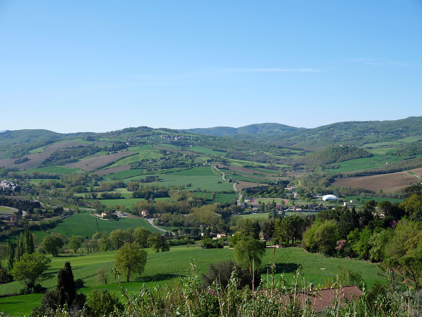
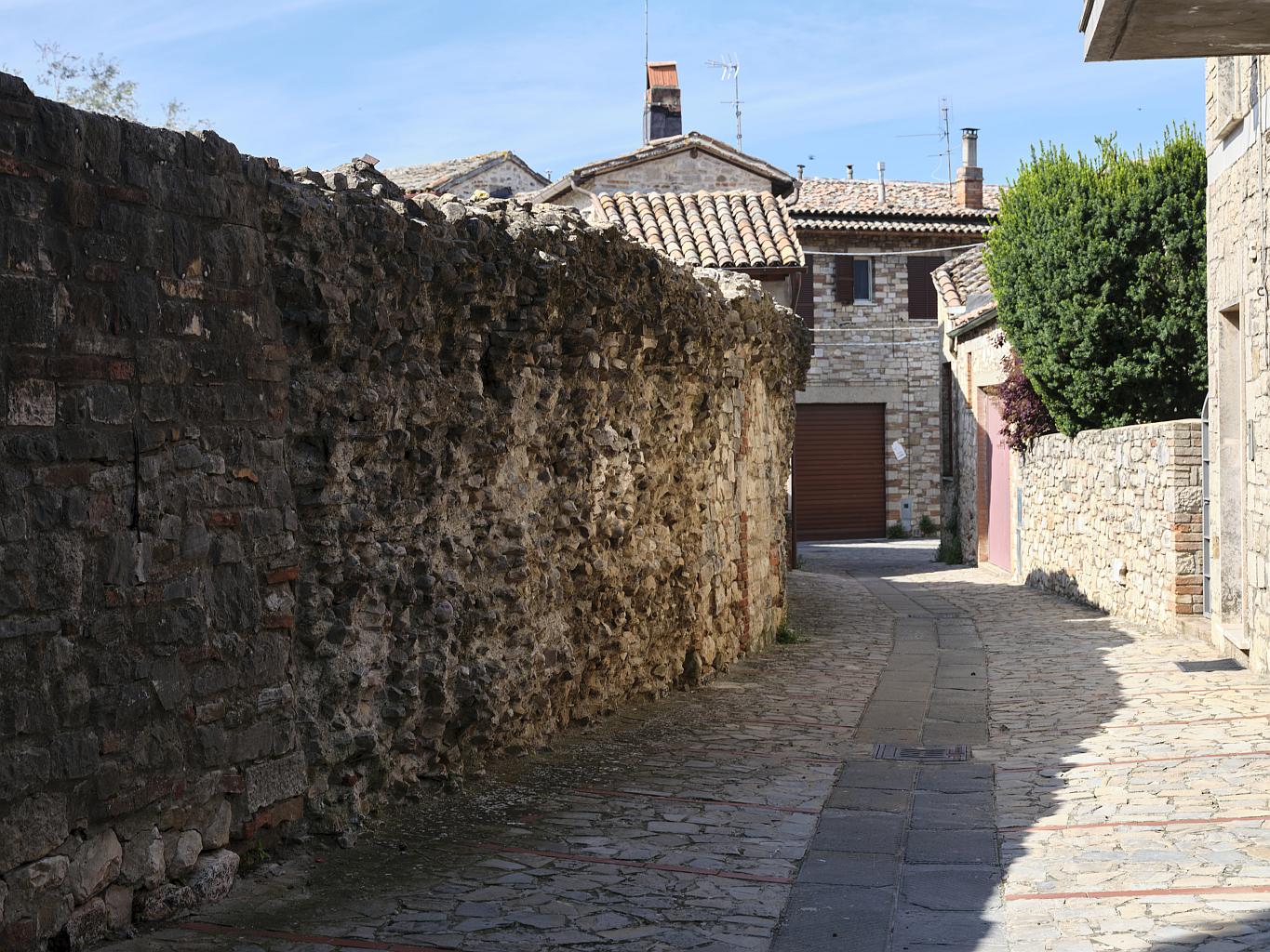
Let us start by assuming that we are approaching Roman Todi from the south, along the Via Amerina. I wrote about the Via Amerina in this article, but here again is a view south from Todi. Note that the road that goes up the hill is a later medieval road – the Roman-era road runs along the floor of the valley to the right, beside the little river Arnata.
The picture below is an illustration in Todi e I Suoi Castelli by Franco Mancini, published in 1960 but still in print (the illustration is attributed to one G. Tenneroni). It shows an elevated view of Todi from the south, and I will be referring to it in this article. The photograph above was taken from roughly the position marked by the figure 5 in the drawing, with the Via Amerina the road that comes up towards the town at the bottom.
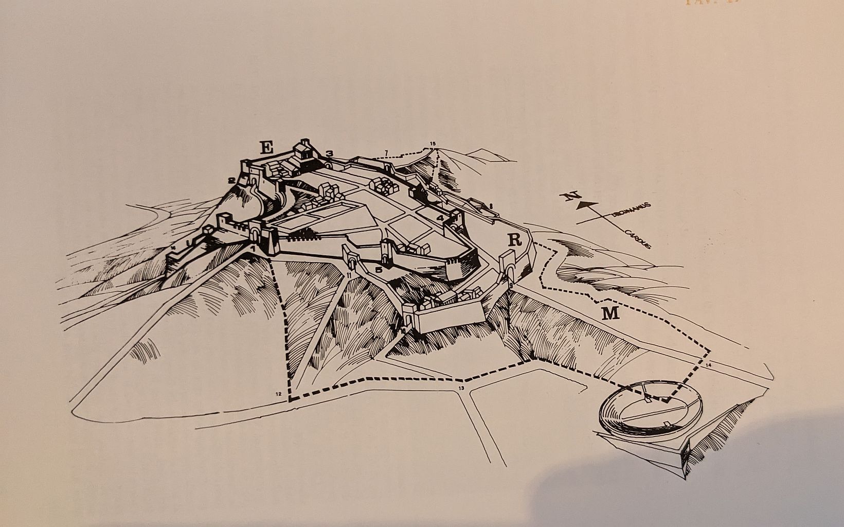
The map labels the three circles of the city walls as E for Etruscan (obviously in 1960 people still referred to the pre-Roman Umbrian period in Todi as Etruscan), R for Roman, and a dotted line marked M for Medieval. Frustratingly, it is hard to find agreement on when the “Roman” walls were built. Some date them to the time when Todi first became part of the Roman world in the 2nd Century BC, others to after Todi became a colonia in the 1st Century BC. The first ever source I encountered called them tardo-Romano, that is from the late Roman period when they would have been needed for defence against the invading Goths, in the 6th Century AD. Even if the walls were already in existence then, a hasty program of repairs seems plausible.
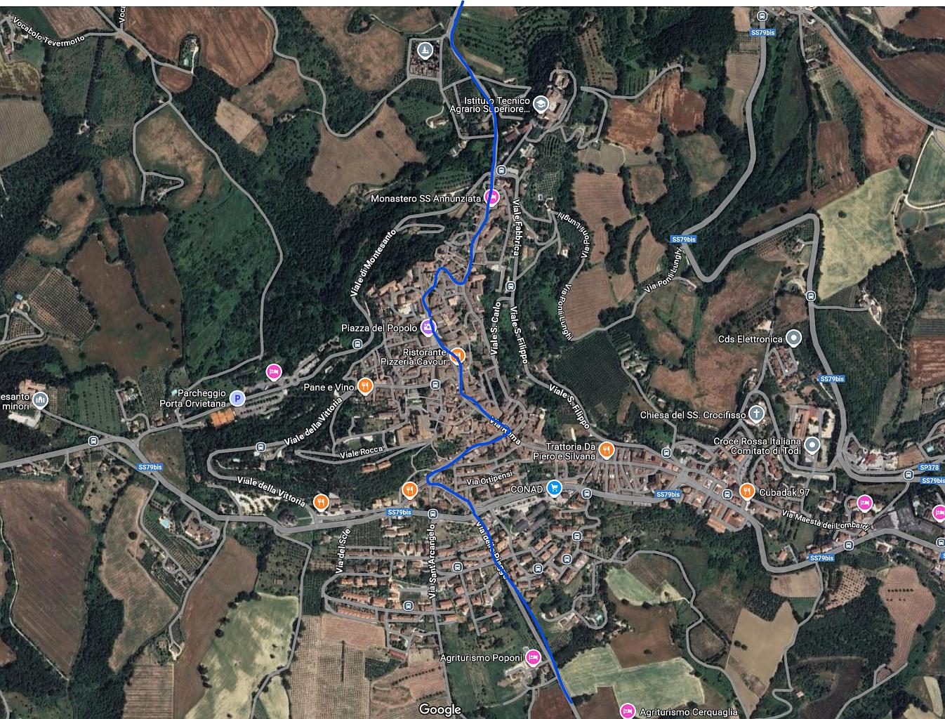
The route of the Via Amerina through the town is unchanged from antiquity. Here is a picture taken from Google Maps, on which I have marked its route.
It is a long straight climb from the valley floor up to the town. As we saw in the first post in this series – Ancient Todi – Before the Romans, the southern slope of Todi’s hill was the site of a pre-Roman necropolis. In my mind’s eye I see this as a bit like the Etruscan necropolis we visited at Sarteano in 2018, where the tomb entrances take the form of long passages cut into the hillsides, giving the dead a nice view, as it were. If the pre-Roman tombs in Todi were like this, the passages would presumably have been clearly visible on either side as we ascended the hill.
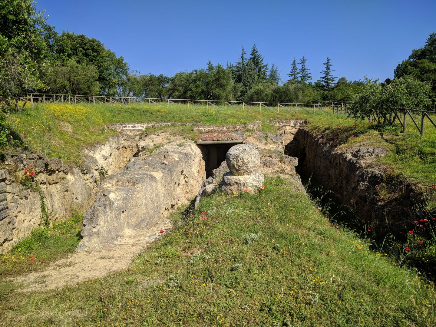
It is likely that the area continued to be used for tombs, as the Romans also had the sensible rule that forbade burials inside city limits,. But their tombs looked different. Going by what we have seen on the Via Appia outside Rome, at Pompeii and close to Todi at Carsulae, they built monumental tombs above the ground. During the Republican and early Imperial periods, these were usually to hold the ashes of the deceased rather than the body, with inhumation becoming common later under the influence of eastern religions, including Christianity.
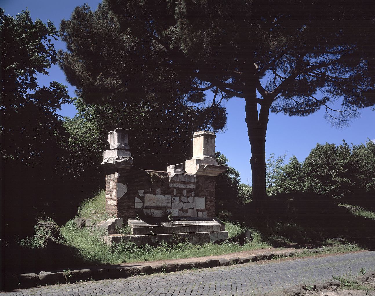
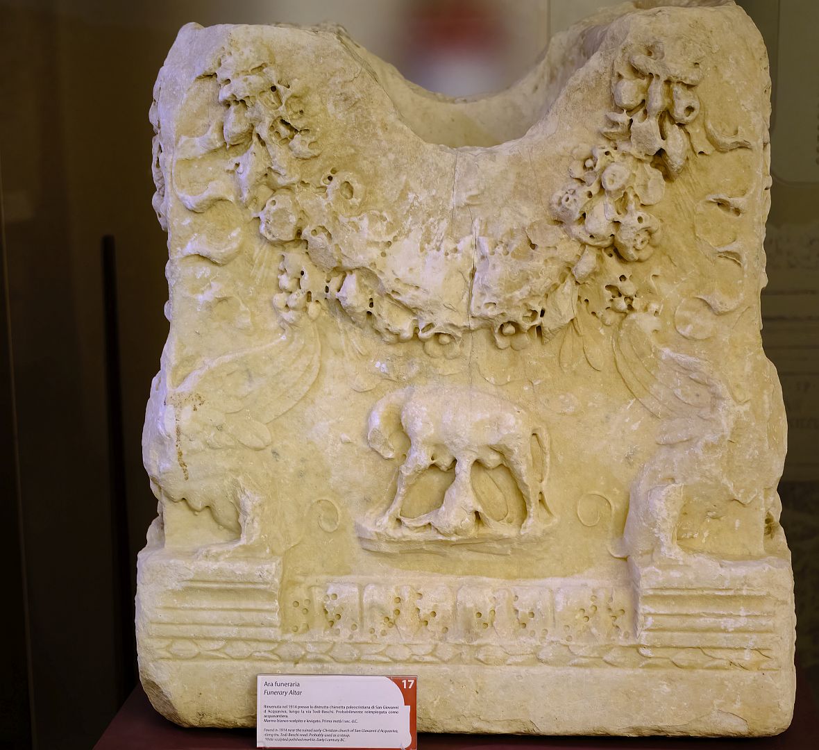
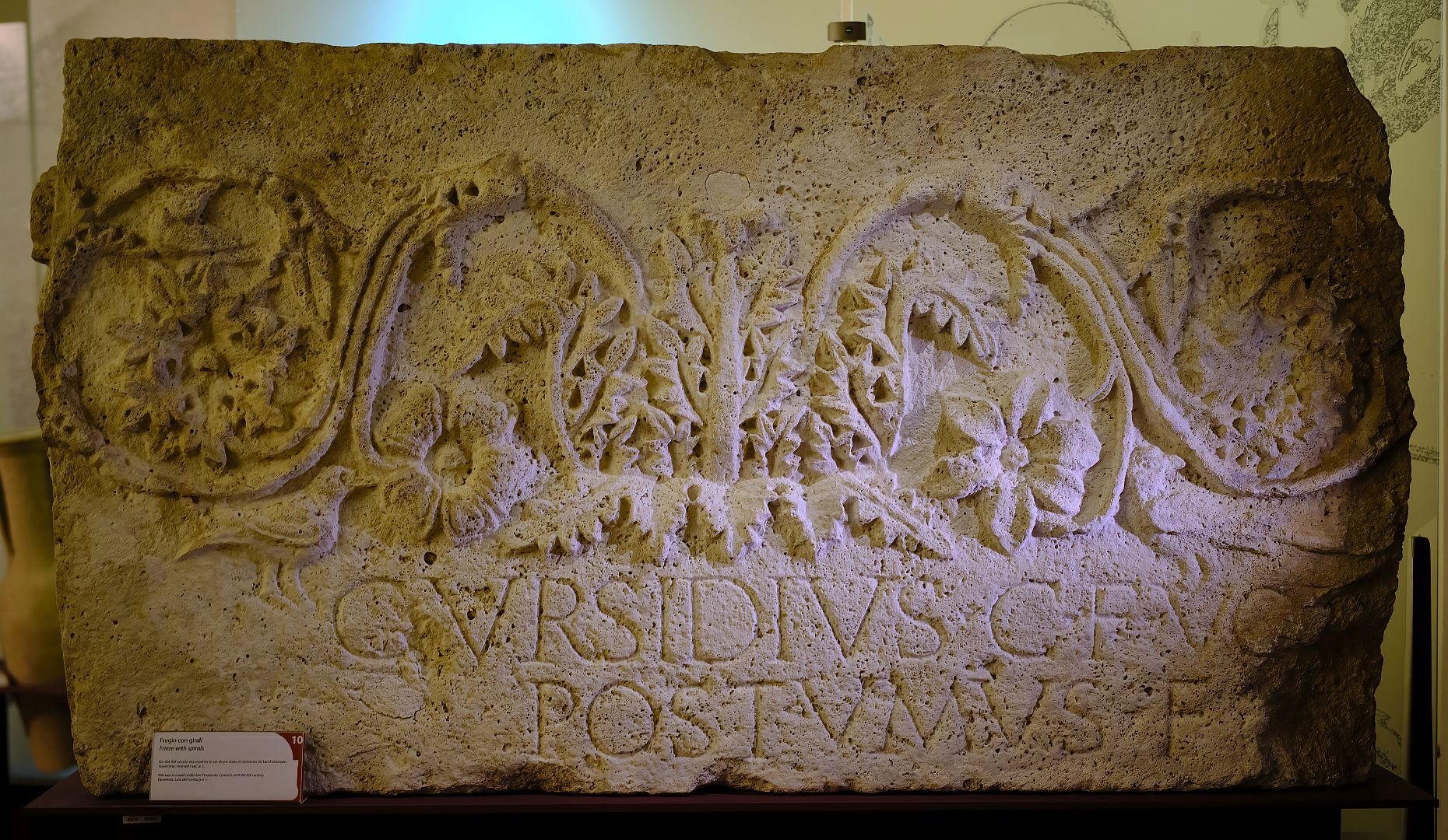
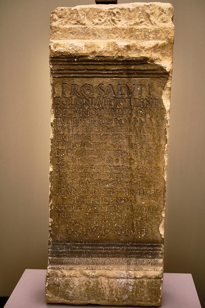
The remains of funerary monuments have also been found along the Via Amerina on the northern side of Todi, near the present Porta Perugina on the road towards Perugia. There are no standing remains of Roman above-ground tombs around Todi of which I am aware, but several fragments have come to light over the years and are preserved in the Civic Museum or the Lapidarium (of which more later).
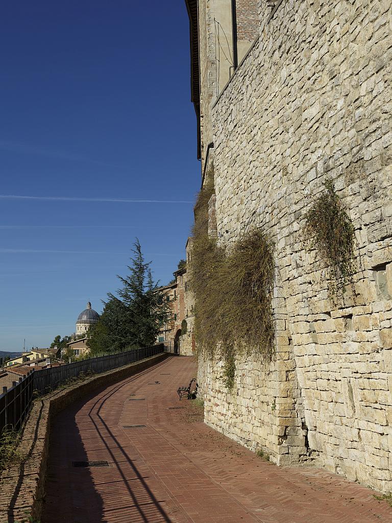
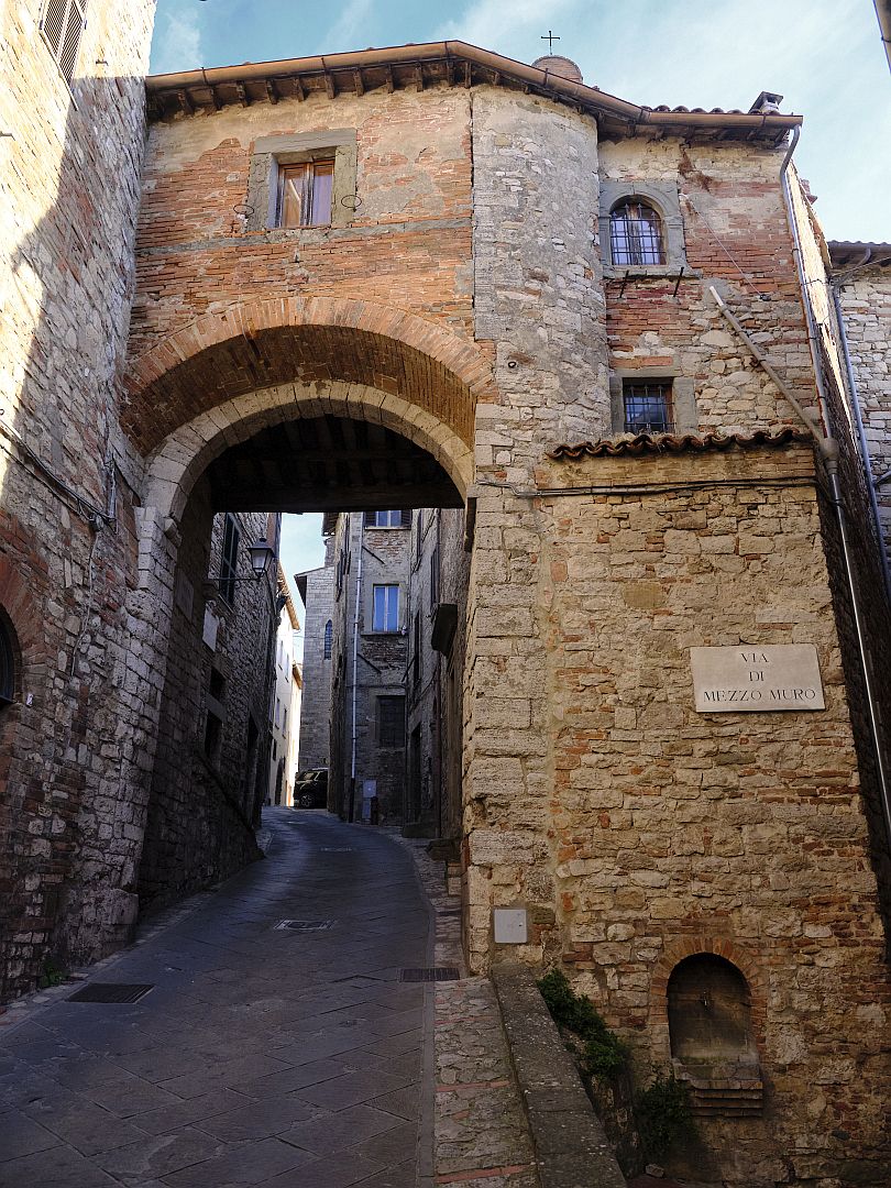
Let us continue our imaginary approach to Todi. We would enter the town through the Porta Aurea, in the second circle of walls. The gate still exists, although like all of Todi’s gates, the upper parts are medieval or later, reflecting the need to keep them in good defensive repair.
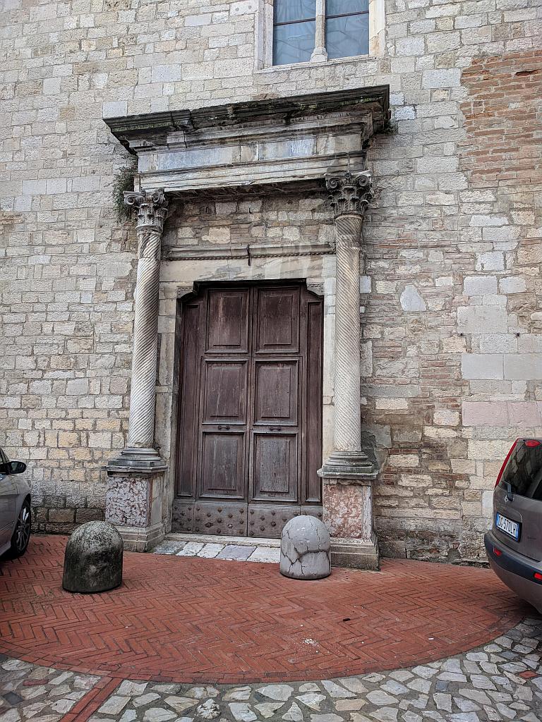
Once through the Porta Aurea, on our right we would pass a temple on the site of the present church of Santa Maria in Cammuccia (sometimes spelled Camuccia; no one knows what it means), which was dedicated either to Venus or Minerva, depending on which local tradition you follow. That there was a Roman temple there seems clear enough – part of it has been incorporated into the façade of the medieval church, and re-dedication to the Virgin Mary of temples of both Venus and Minerva seems to have been fairly common. But I have not been able to find an authoritative source – I asked ChatGPT for one but it directed me to one of my own blog posts, which is not exactly a peer-reviewed publication. Moreover, while I agree that I am not an authority, I thought ChatGPT’s tone was a little condescending (only a photo blog, after all).
The Gate of Mars
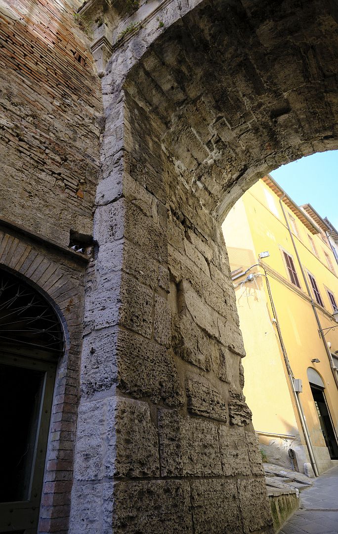
Continuing, both the ancient and the modern road then take a sharp left turn uphill and pass under a gate which was here before the Romans – the Porta Marzia, or Gate of Mars, in the pre-Roman walls (number 4 in the Mancini/Tenneroni drawing).
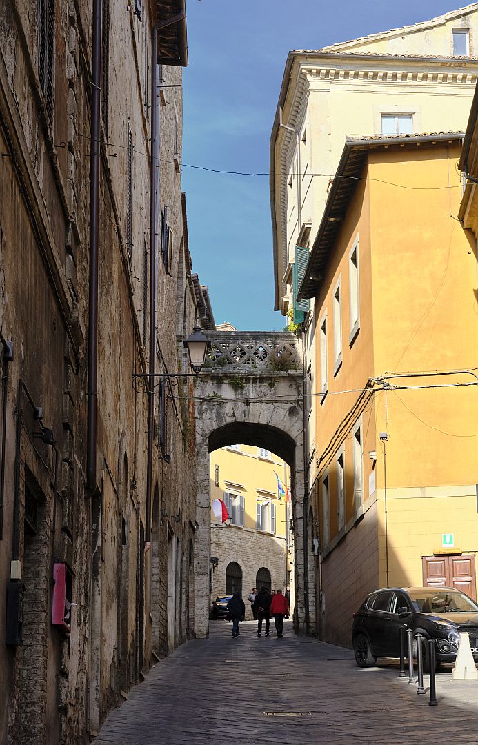
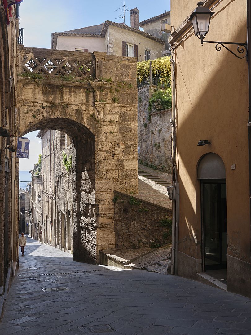
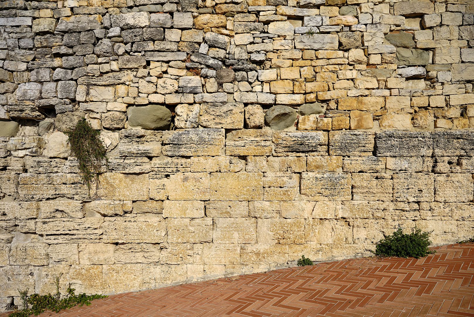
In the photograph below, you can see that the lower two courses of stones are of a size and regularity that one associates with pre-Roman work. In their book Todi: Storia ed Artistica, Carlo and Marco Grondona record that the stones were a source of wonder to the medieval inhabitants of the town. But I have been puzzled by them; closer inspection reveals that they look modern and are laid with mortar. The mystery was explained in the same book – apparently during work to re-pave the city streets the original stonework was damaged and had to be refaced. What a terrible shame – hundreds of cars pass through the gate every day and it would be very cool if they were passing authentic stonework from 2,400 years ago.
The Nicchioni
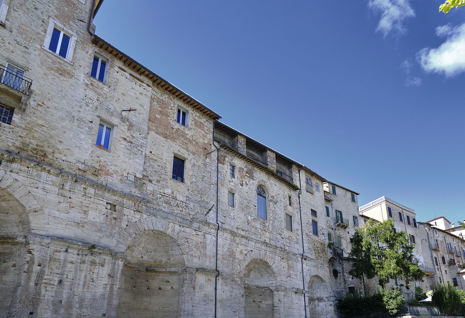
Now inside the very oldest boundaries of the city, to our right we pass a road that leads down to the old town marketplace, now a car park. Beside the Mercato Vecchio is one of the largest and most complete Roman structures in Todi – the Nicchioni (“big niches”).
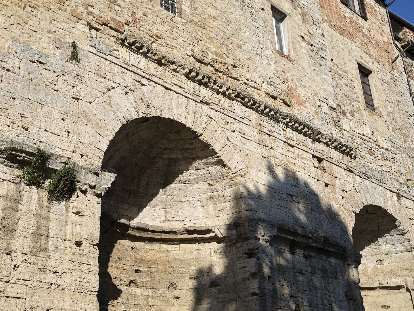
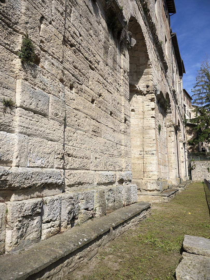
Local tradition once had it that the Nicchioni were part of a temple of Mars, but the modern view of their function is more prosaic, yet in a way more impressive. They are thought to be nothing more than compression arches, supporting the immense weight of the buildings above. Through a couple of millennia of earthquakes and fears of subsidence they have stood there holding up people’s houses and shops, and they still do today.
The Forum and the Temple of Jupiter
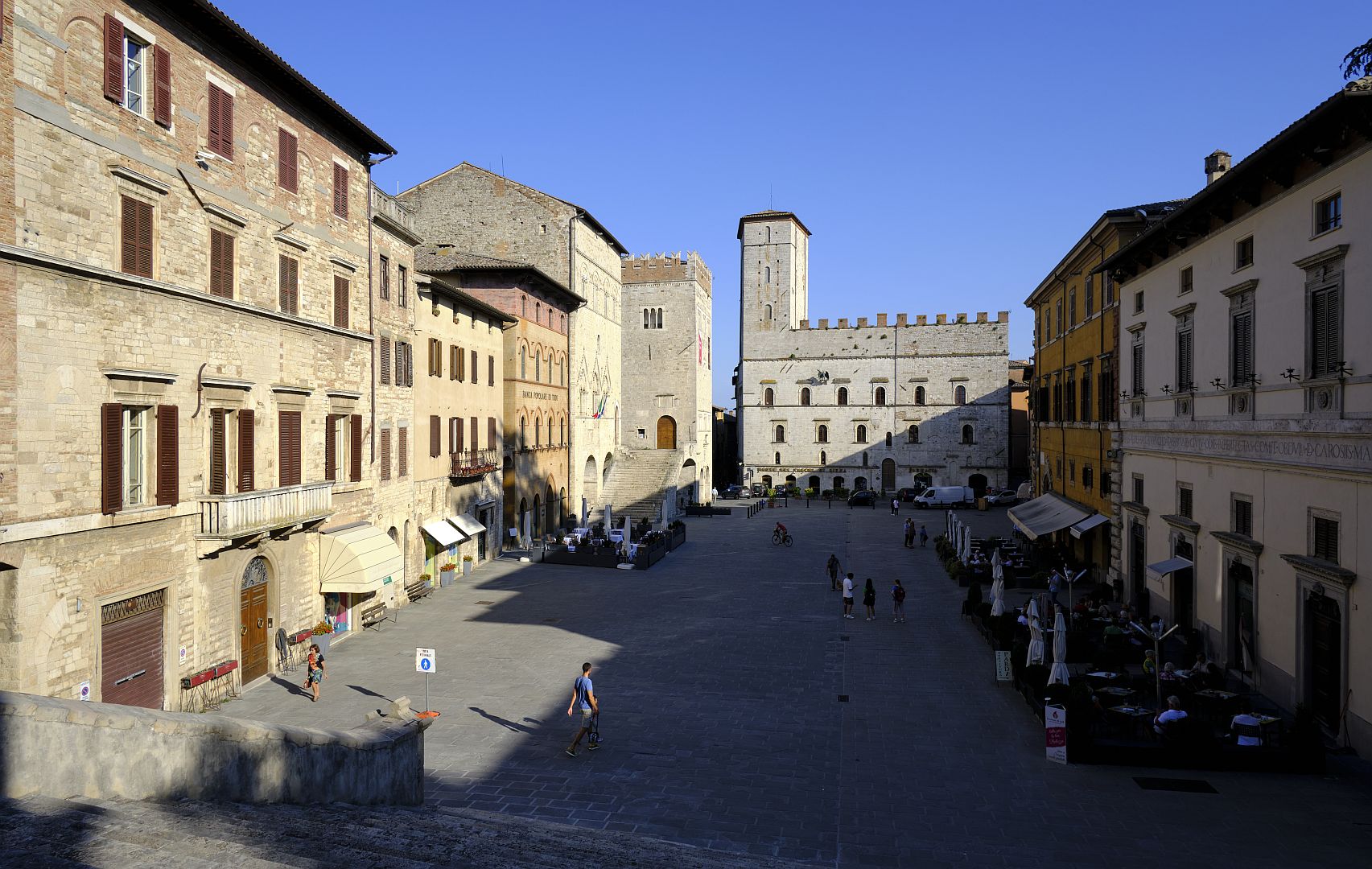
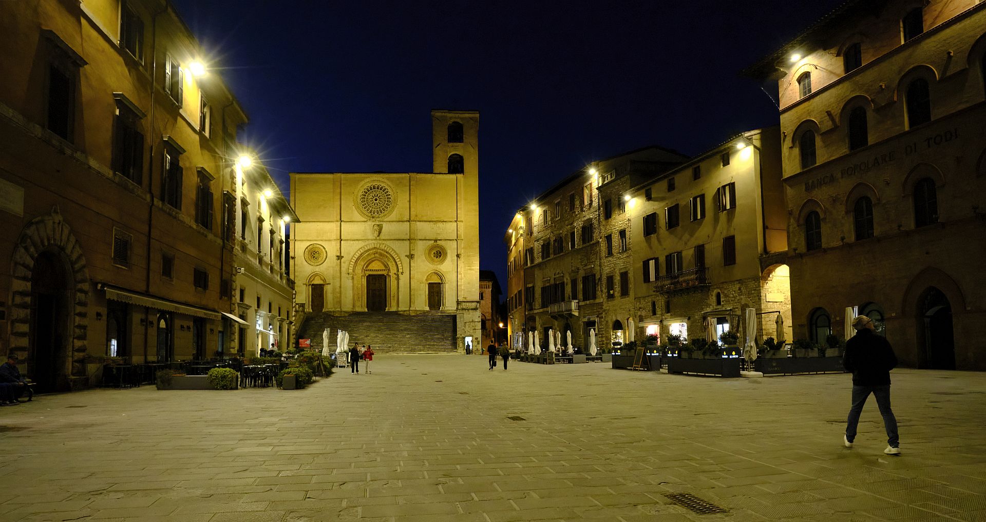
Now we are at the highest point on the road, where it opened out into the forum. The modern Piazza del Popolo is in the same location, but is a good deal smaller than was the forum, as Renaissance palaces have encroached on the western side, and the duomo on the northern side.
The picture below, of a panel on display in the piazza, shows the Roman forum as a rectangular dotted line, with the medieval and renaissance buildings superimposed (NB: north is on the left).
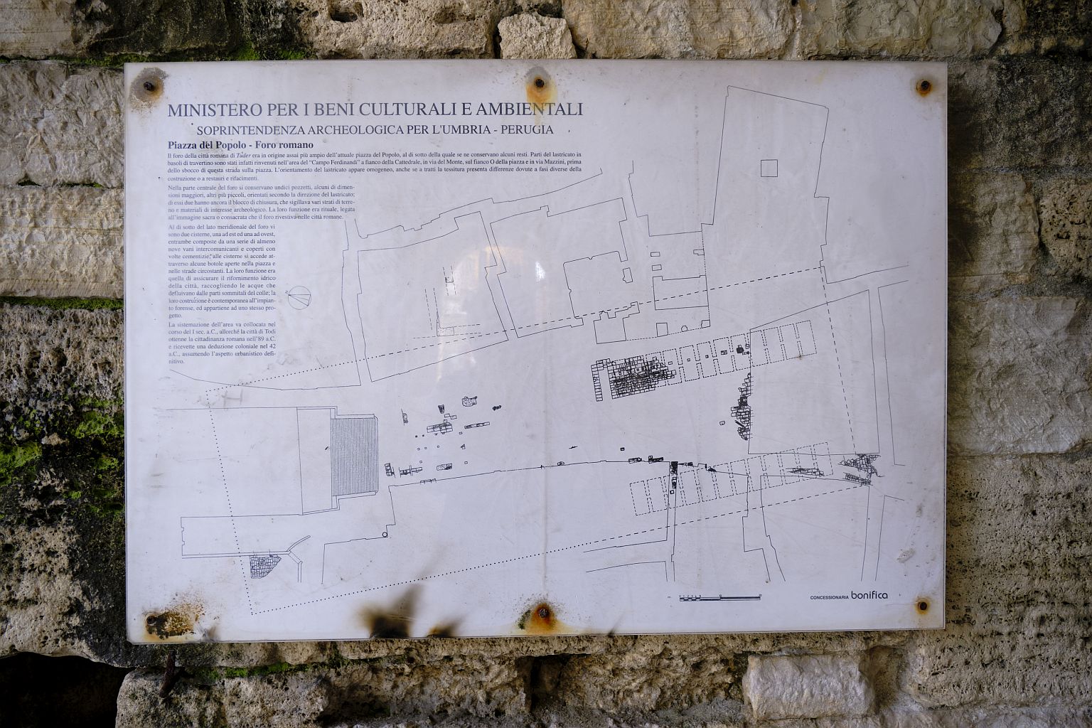
The main temple in Roman Todi is always described as having been a temple of Jupiter – I don’t know whether there is evidence for this or whether it is assumed that the principal temple would always have been dedicated to the chief of the gods. In the drawing near the top of this article, it is shown at the top, next to the letter E.
These days the approximate site is occupied by the duomo, and if you go down into the crypt you can see a few bits of stone dating from the late-Roman period. However to the non-expert eye any remains of the Roman temple, and indeed of the Lombard-era church that replaced it, have been obliterated by the medieval Romanesque building that was begun around 1100 and largely completed by around 1300. A bit further up the hill behind the duomo there are some Roman remains but they are only partly visible in an overgrown pit covered by a thick glass plate.
The Cisterns
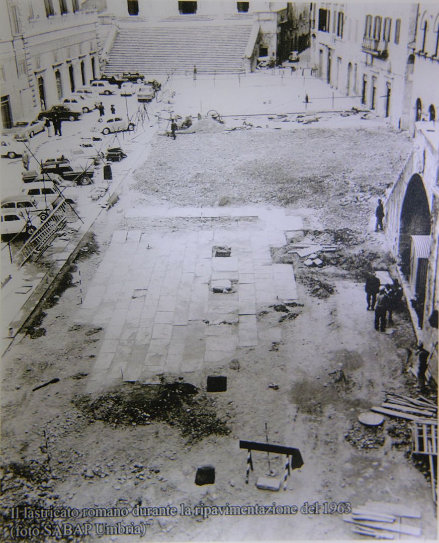
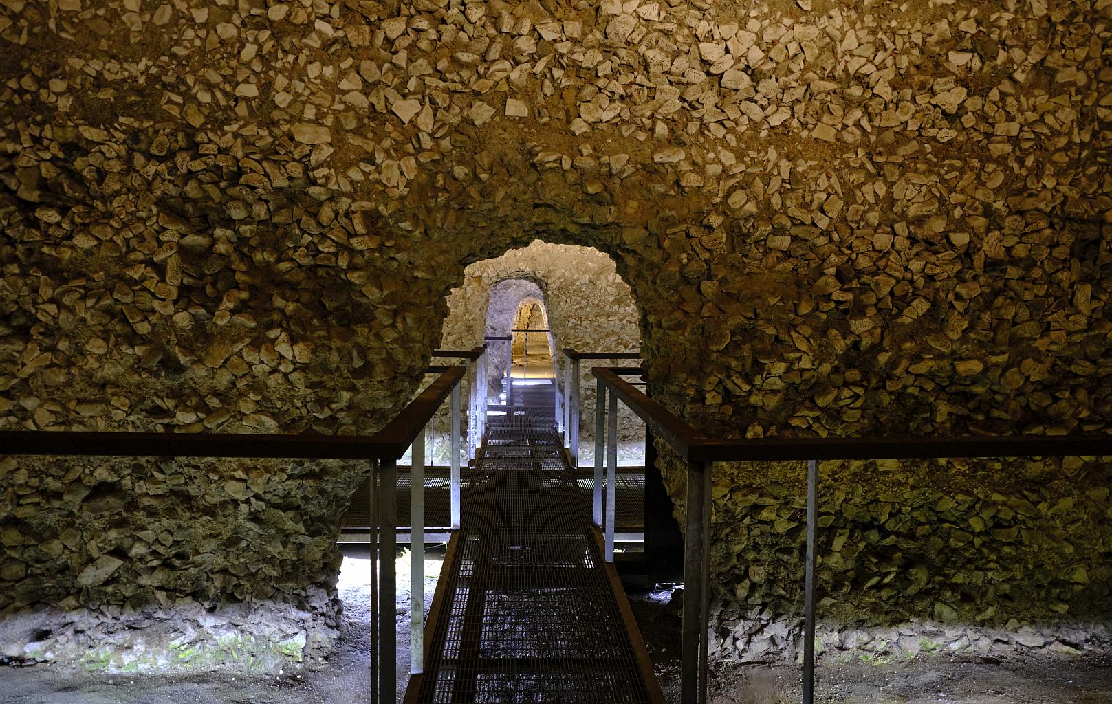
The most remarkable Roman remains in Todi are not immediately visible – they are the cisterns that lie underneath the Piazza del Popolo. You see, the flat expanse that was the forum and is now the piazza, and which carries the weight of buildings, cars, concert stages and the occasional baffling modern sculpture, is not only entirely artificial, but also partly hollow. The original space was a saddle between two hills – the Romans excavated it further, built two rows of giant concrete cisterns, then filled it all in and paved over the top. The Roman paving is still there, only a few inches beneath the modern surface.
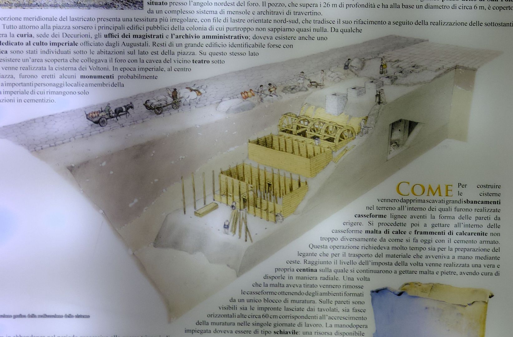
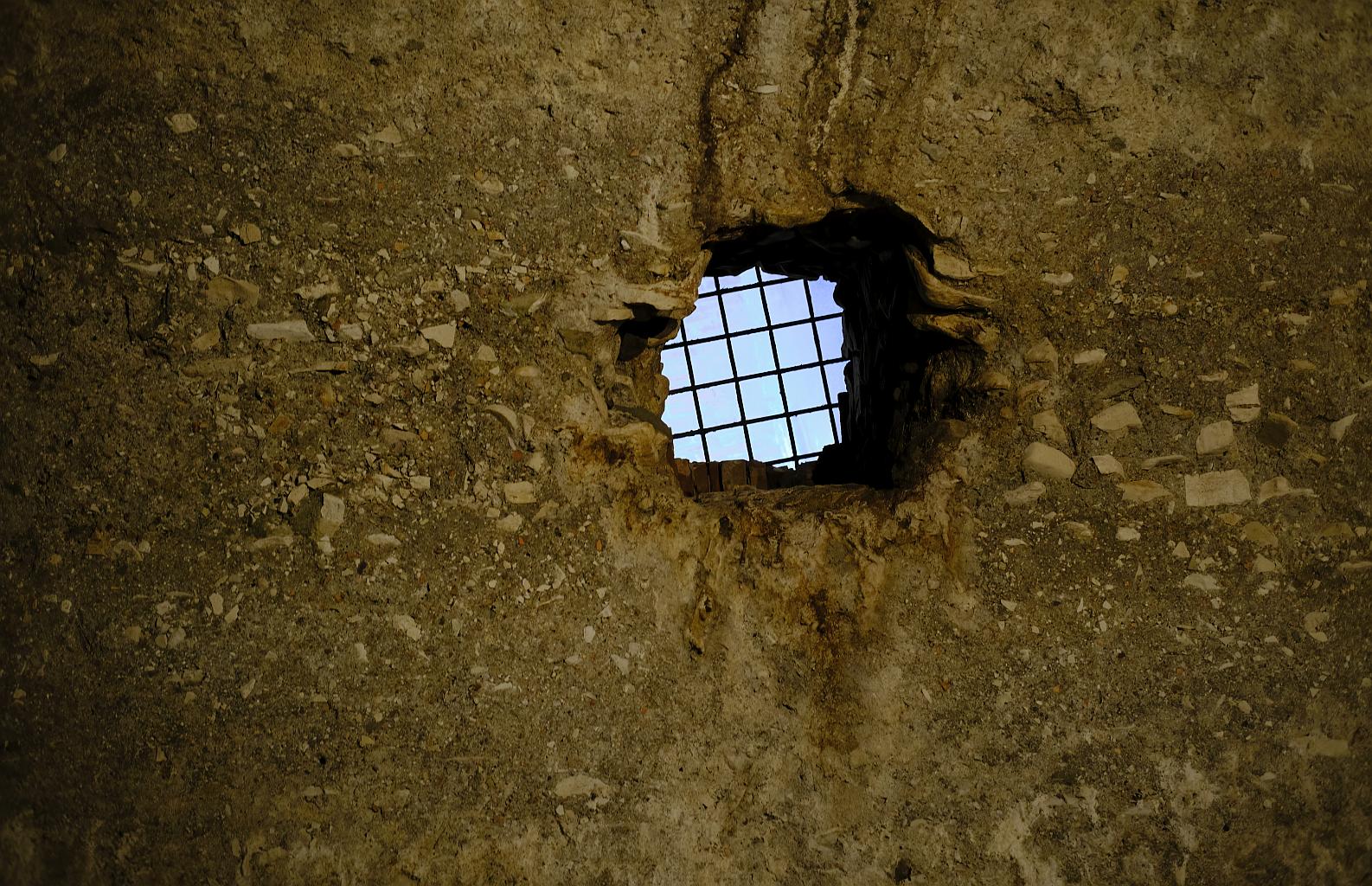
If you look back at the diagram of the forum further up, you can see two lines of twelve connected rectangles – these are the cisterns. If you go into the tourist office and pay a few euros, you can visit them. The picture below, taken from an illuminated information panel in the cisterns themselves, shows the method of construction: wooden formwork created a space into which concrete could be poured to make the lower walls, then the formwork was raised, allowing concrete to fill the space between the cisterns, then finally a barrel vault was constructed, over which more concrete was poured, with stone wells at the top through which water could drain into the cisterns, or be drawn up from above. The timber must then have been removed from within, and the cisterns allowed to fill with rainwater, or from aqueducts fed by springs.
The two sets of twelve cisterns were not connected – according to one of the guides this was to prevent any contamination of one set affecting the other.
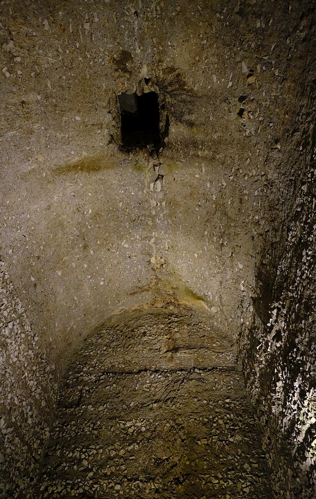
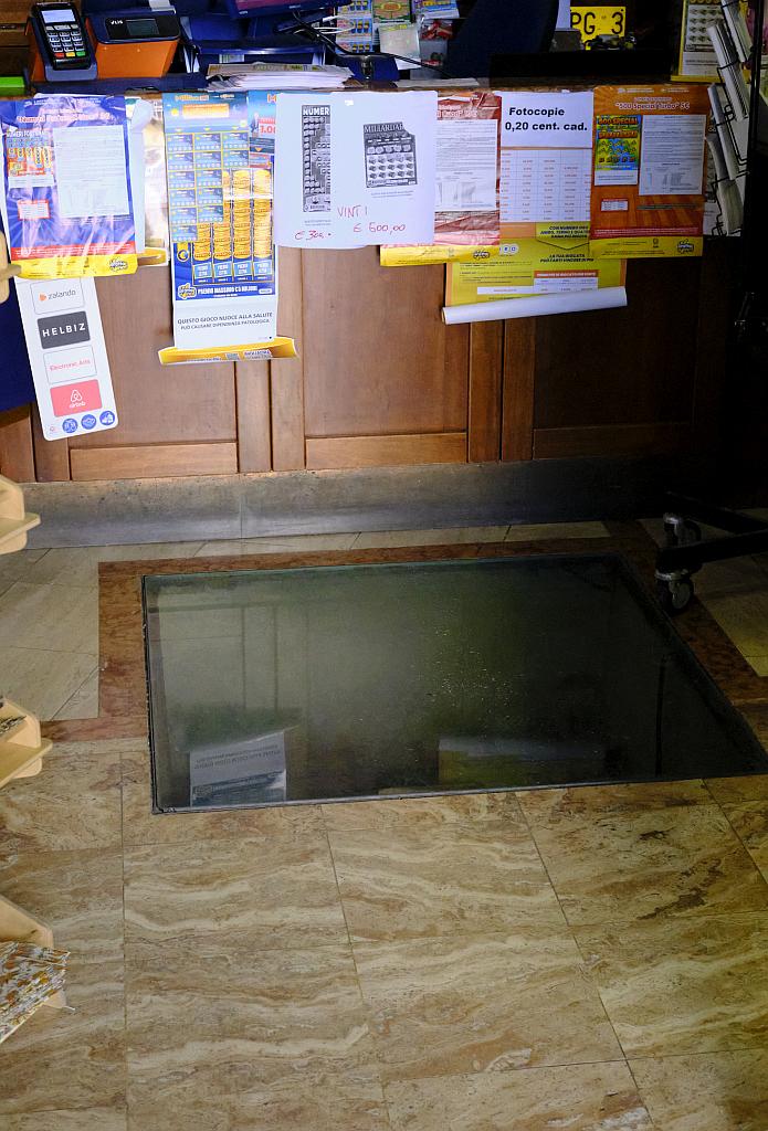
At some point after the fall of Rome, the cisterns were forgotten. The eastern line (the line that runs down the middle of the modern piazza) was rediscovered some time before the mid-13th Century, but – remarkably – the western line was not rediscovered until the 1990s, during renovations to the tobacconist’s shop in the corner of the piazza. Today there is a thick glass tile in the floor of the tobacconist, through which you can look down. And from below in the cisterns, you can look up and see the feet of customers in the shop.
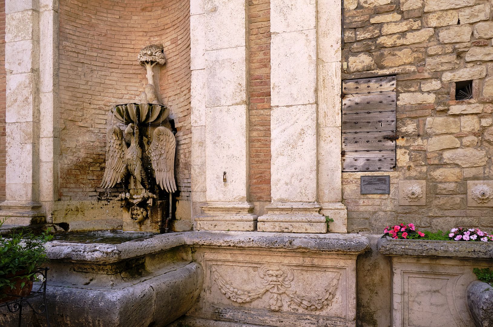
After the fall of the Western Empire, the aqueducts that the Romans built inside the hill fell into disrepair (which later created significant subsidence problems as the hill became waterlogged). But in the early 1600s Bishop Angelo Cesi commissioned an elegant fountain, the Fonte Cesia, featuring the legendary eagle of Todi and fed by water from one of the Roman aqueducts. If you go and have a gelato or an aperitivo at the excellent Bar Pianegiani, you will be sitting in front of the fountain, and in the wall beside it you will see a wooden access door. Behind it is the tunnel built in the 17th Century to divert the water to the fountain from the Roman aqueduct.
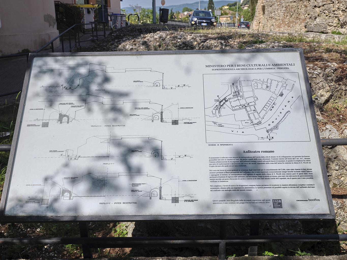
The Theatre and Amphitheatre
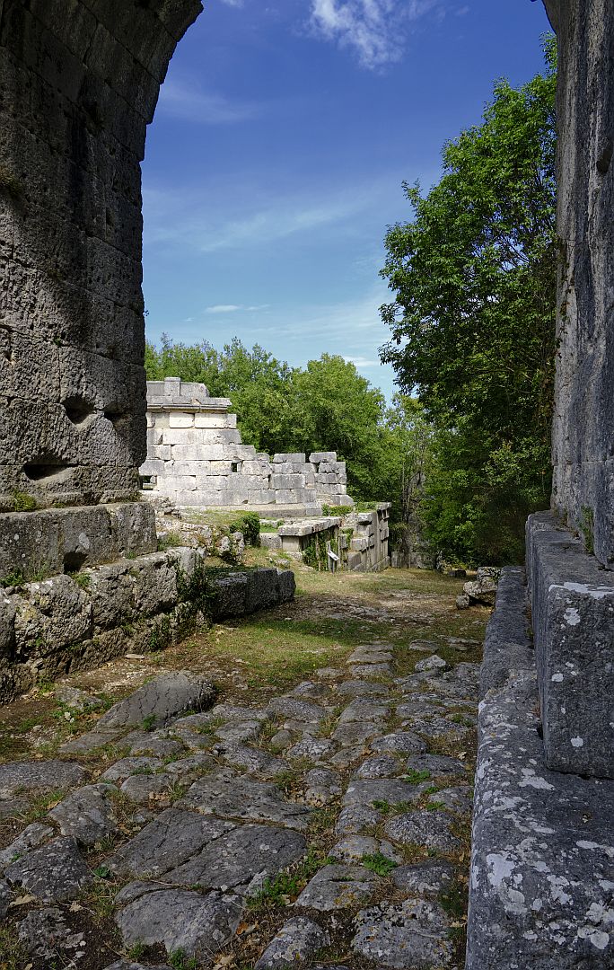
Like any Roman town, Todi had places of public entertainment. A theatre was located near the forum, just below the modern Piazza Garibaldi – and like the Piazza Garibaldi it would have had magnificent views across to the Martani Hills. Very little of it remains now, at least that can be seen by the public. Apparently there are a few more bits in someone’s garden.
The remains of Todi’s amphitheatre, on the other hand, are comparatively substantial. Parts of it stick out of the medieval walls near the Porta Romana, and some modern streets and buildings trace its outline. It can be clearly seen at the lower right of the Mancini/Tenneroni drawing. The remains of both the theatre and the amphitheatre are easily distinguished from the medieval stone, because they are of concrete, which was not used in the Middle Ages. The Romans were great users of concrete, as we saw with the cisterns, but by the time the medieval walls came to be built the recipe had been forgotten, and a satisfactory new recipe was not found until the 18th Century.
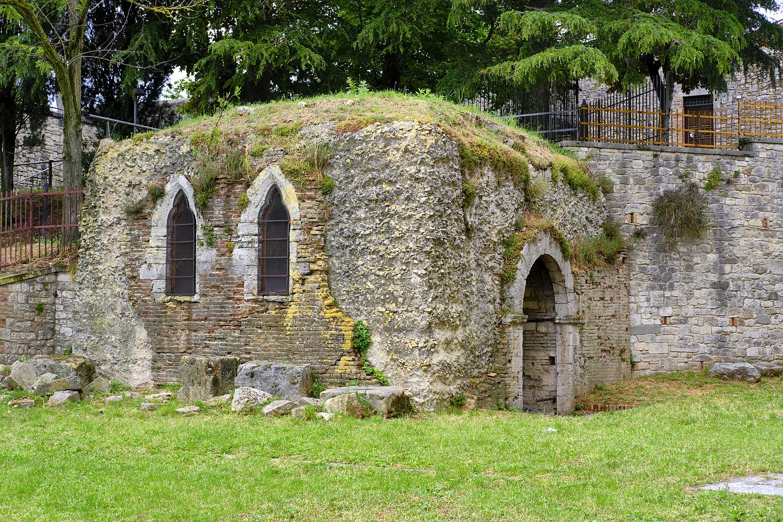
Another substantial bit of concrete work is the so-called Carcere di San Cassiano (prison of St Cassianus) which is in the grounds of the Franciscan monastery that is now a high school. The Cassianus in question, of whom little is known, is said to have been an early Christian martyr in Todi and is one of the town’s patron saints. Archaeologists tell us that the “prison” was actually a building over a well, but as the traditional site of the saint’s imprisonment before martyrdom, it was converted into a chapel dedicated to him, and thus preserved.
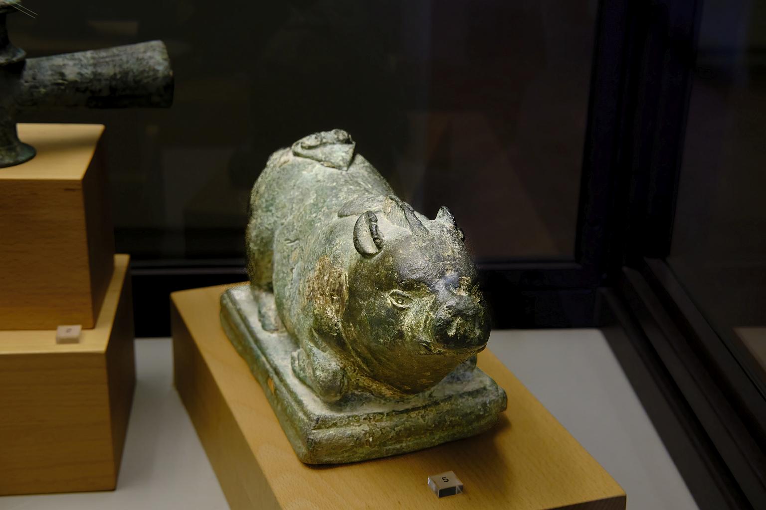
Odd Bits of Stone and Bronze
There are two other places in town worth visiting for the seeker after ancient things. They are the civic museum in the Palazzo del Popolo and the Lapidarium in the Convent of the Lucrezie. The former holds an eclectic collection, including the replica of the “Mars of Todi” that I mentioned in the article on pre-Roman Todi and also a saddle which belonged to Anita Garibaldi. The citizens of Todi gave her a new one as she, her husband and their small band of troops passed through while escaping northward from Rome in 1849.
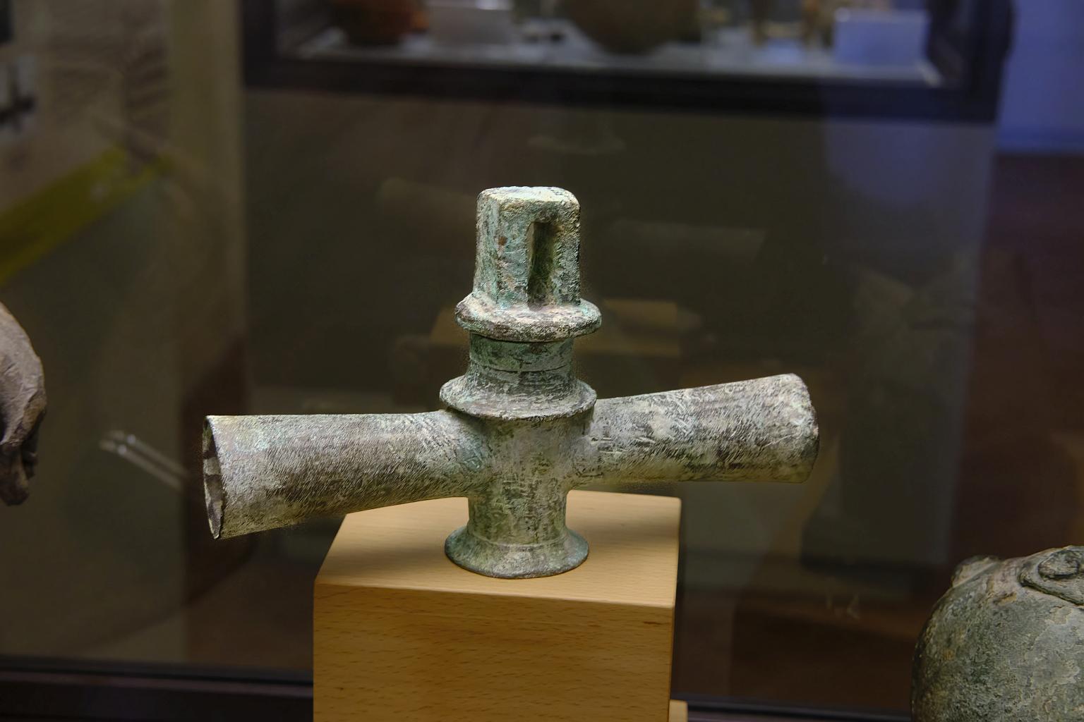
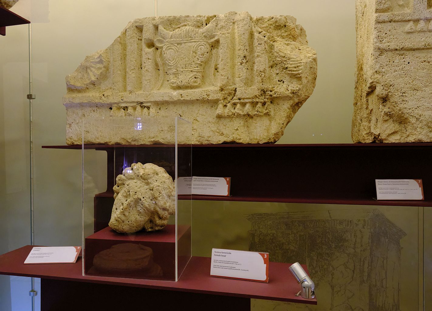
The Lapidarium is not always open at the advertised times, but if it isn’t you can always go and enquire at the tourist office; they might send someone round to open it up.
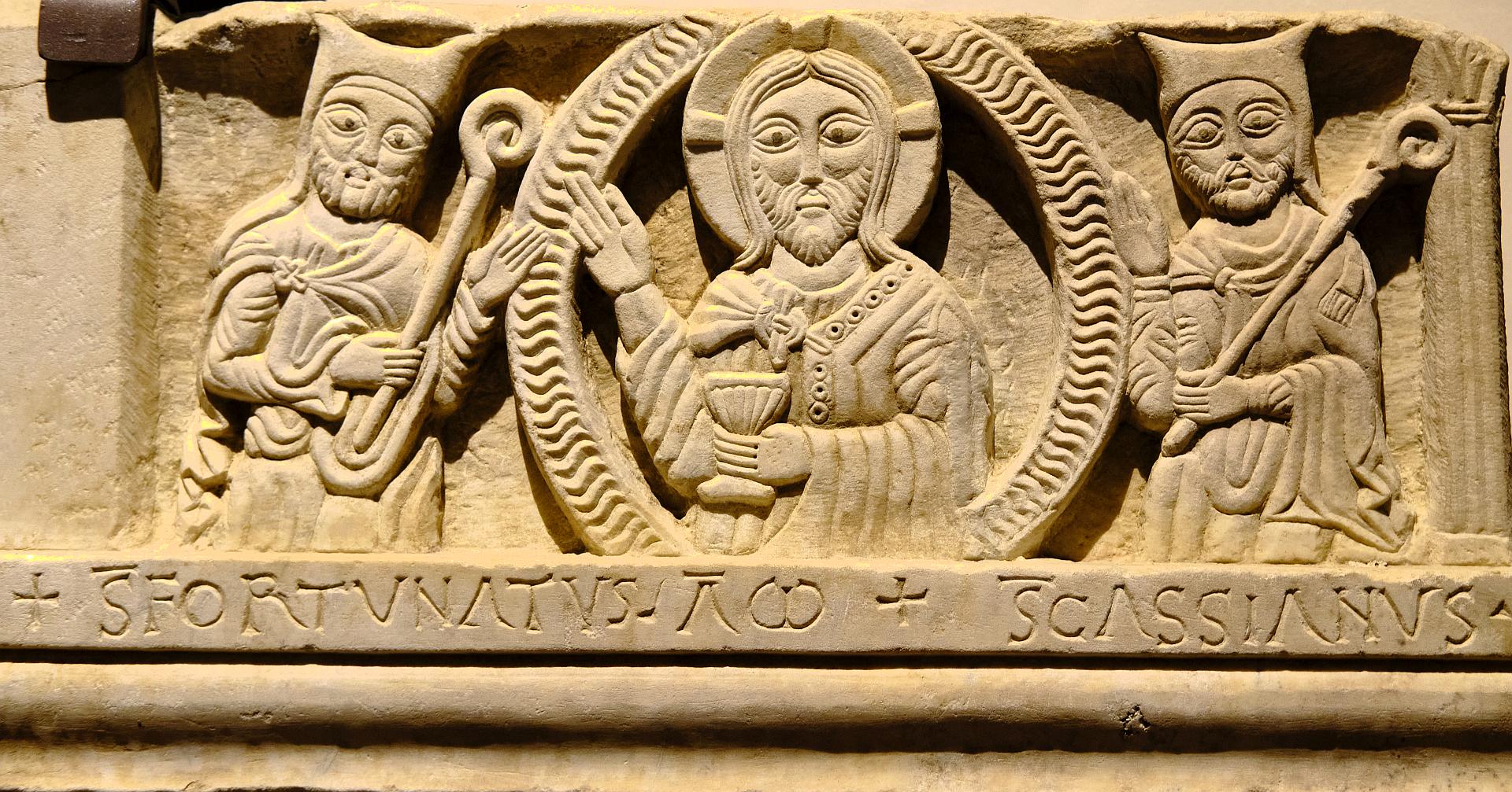
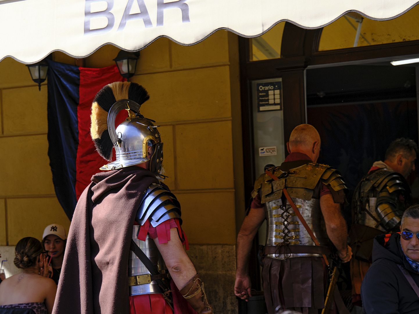
Update: If you pay close attention, you may spot other signs of the Roman presence in Todi. The picture below was taken at the annual festival of San Fortunato in 2025.
One Reply to “Roman Todi 2 – Architecture and Engineering”