I’d been meaning to visit the ruins of the ancient town of Carsulae for almost a year. It is mentioned in all the historical guides to Umbria, and every time we drive up or down the E45 motorway we see the signs to it. After an unusually cold and wet May, last Friday finally promised some fine weather, and we determined to go there.
We (that is, Lou and I and you, gentle reader) had our last good look at the Via Flaminia where it passes through the gorge of the River Nera below the town of Narni, still called the Via Flaminia, but also the Strada Statale 3 (SS3), carrying heavy goods traffic. As I have said in other posts, this was the major Roman military road in central Italy. It was built in 220 BC during the consulship of Gaius Flaminius, from whom it took its name. It went north from Rome through Umbria and crossed the Apennines near Iguvium (modern Gubbio), finishing at Ariminum (Rimini). From there the roads led north, towards the frontiers of the empire.

‘When I left Rome for Lalage’s sake
By the Legions’ Road to Rimini,
She vowed her heart was mine to take
With me and my shield to Rimini—
(Till the Eagles flew from Rimini!)
And I’ve tramped Britain, and I’ve tramped Gaul,
And the Pontic shore where the snow-flakes fall
As white as the neck of Lalage—
(As cold as the heart of Lalage!)
And I’ve lost Britain, and I’ve lost Gaul,
And I’ve lost Rome, and worst of all,
I’ve lost Lalage!’
That is an excerpt from a marching song of the Roman legions – at least as imagined by Rudyard Kipling in Puck of Pook’s Hill. It is overheard by the two children in the story as it is sung by Parnesius, the centurion of the Seventh Cohort of the Thirtieth Legion – the Ulpia Victrix.
I’ve just done a bit of googling on these chapters of Puck of Pook’s Hill, and needless to say various po-faced modern scholars have written papers on the bits that Kipling got wrong – apparently he overstated the height of Hadrian’s Wall by several feet. But there is something about the books you read as a child that penetrates deeply, and when it dawned on me that the Via Flaminia was in fact the “Legions’ Road to Rimini” of my childhood, the memories came straight back. I realised that when I imagine a legion swinging along on the march – the tramp of sandalled feet, the sound of metal armour on leather, the smell of sweat and dust – it is not some academically impeccable history that created those impressions for me, but Kipling. And I’ve always remembered that a legion marched a set distance each day. As Parnesius explains to the children:
“A Legion’s pace is altogether different. It is a long, slow stride, that never varies from sunrise to sunset. “Rome’s Race—Rome’s Pace,” as the proverb says. Twenty-four miles in eight hours, neither more nor less. Head and spear up, shield on your back, cuirass-collar open one handsbreadth—and that’s how you take the Eagles through Britain.”
And through Italy too, of course.
The original route of the Via Flaminia led due north from Narni. Later, a more easterly alternative route was added which took in Interamna (Terni) and Spoletum (Spoleto), rejoining the original route a bit further north, but for now we will follow the original route. After crossing the plain of the lower Nera, the road starts to rise and runs over pleasant rolling country on the western side of the steep Martani Hills. There, about half a day’s march from Narni by Kipling’s reckoning, the legionaries would have come up a long hill and found themselves in the town of Carsulae. If it was on a warm day I hope that they got an early break and that there was some cool white wine available, made then as today from the local Grechetto grape variety – described by Pliny the Elder as “typical of the area”, and still available in the local supermarkets!
For much of this part of the Via Flaminia, it is followed closely or even covered over by modern roads such as the SS3 and the E45 motorway. It makes sense that they should all follow the same route in hilly country – after all, the topology imposes the same sort of constraints on modern engineers as it did on ancient ones.
However just before you get to Carsulae the old and new roads separate. The old road runs along by itself for a couple of kilometres through oak woods, and it is here that you can find the ruins of the old town.
Parking beside the modern road we walked to the archaeological site along a path through fields of young green barley, with poppies and wild orchids lining the path, and wild roses in the hedgerows.
It took some effort for me to try and mentally superimpose an image of bustling Roman Carsulae on what is now a sleepy rural scene. An oak wood has grown up within the northern boundary of the town, and a small flock of sheep and goats was grazing under the trees.
For me the best way to try and visualise it was to walk along the Via Flaminia as it goes through the middle of the town from south to north. You start by coming up a hill and then encounter the first ruins. If you turn around and look back down the hill, you are looking at the road from Rome.
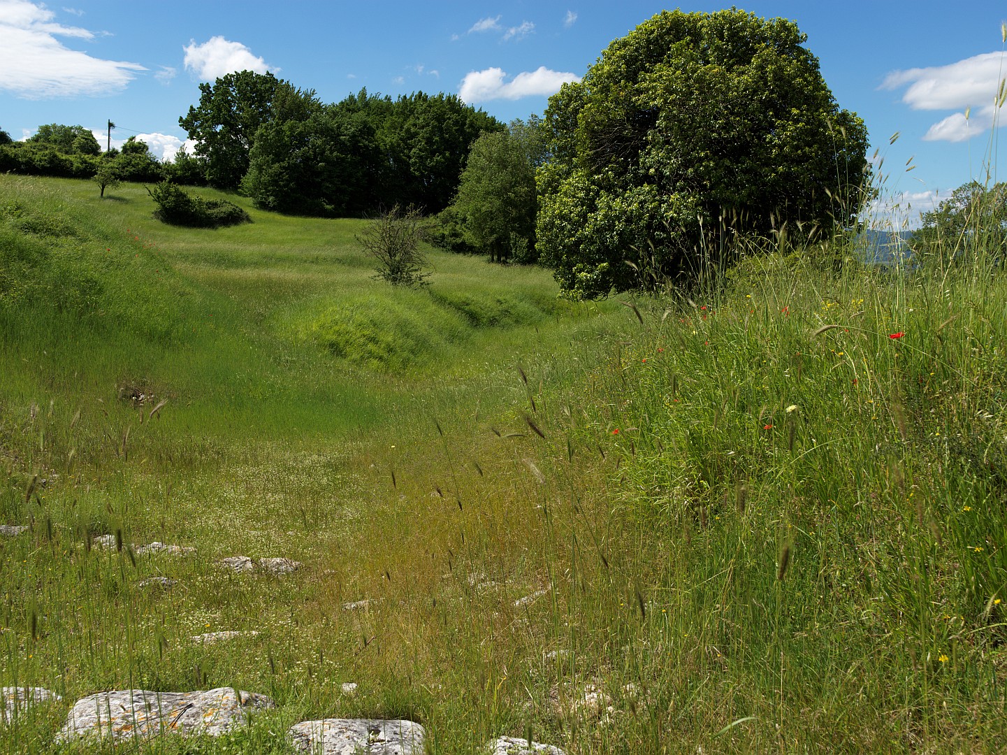
Turn around again, and up to the left there are the remains of baths, built over natural springs. Away to the right is some slightly more modern architecture – the church of Saints Cosmas and Damiano, built in early Christian times on the foundations of an existing building, then extended in the 11th Century using material scavenged from elsewhere on the site. Passing that, we get to the site of the forum, on raised ground to the left. Parts of it, including the entry arch, have been re-erected, which purists might object to but I don’t mind.
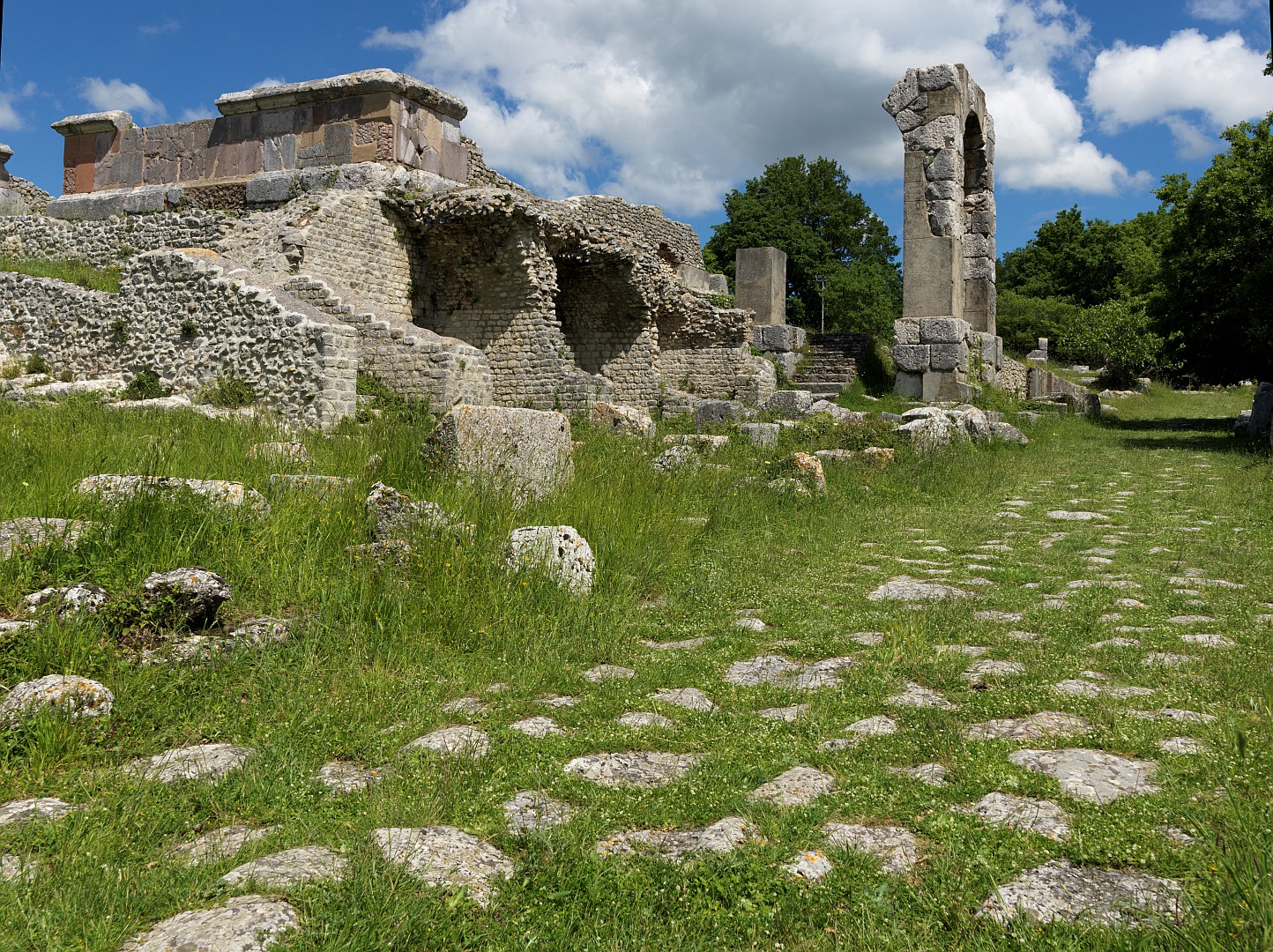
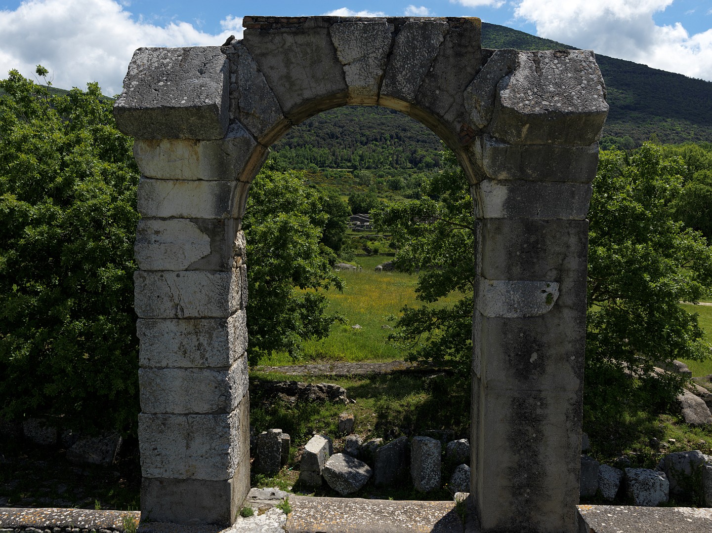
Continuing uphill along the road you can see the remains of a theatre and amphitheatre off to the right, and then the road runs into the oak wood. Looking down you can see that the paving stones in the road are grooved by chariot and cart wheels, as they are at Pompeii.
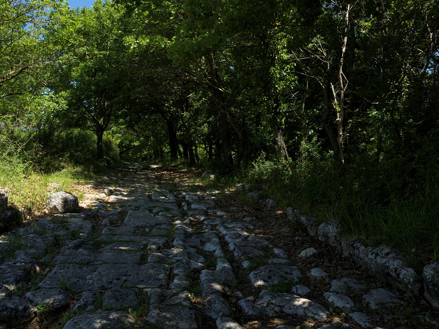
The road starts to run downhill again and you reach the remains of a substantial town gate, beyond which the road bears left into more oak woods. This is where the northbound legions would have passed on their way to Rimini and beyond. I have no idea whether the land was wooded or cleared in ancient times, but in my imagination I saw the legionaries marching away through the gate into the cool shade of the wood, to be lost from view.
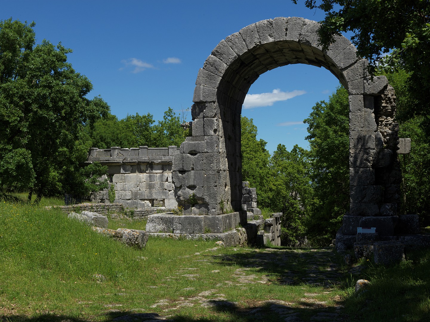
Carsulae was abandoned by the 5th Century. The Wikipedia article says that the reason is unknown, but that it could have been destroyed by an earthquake, or during the wars and invasions at the end of the Roman era, or that it may have become impoverished after road traffic dwindled. Signs at the site say that the town was abandoned because its position in relatively open country meant that it could not be defended in troubled times.
Note, added January 2022: I am currently reading Tim Parks’ latest book The Hero’s Way in which he and a companion walk the route taken by Garibaldi and his men after escaping from Rome in 1849. It turns out that they came through Carsulae, so while my mental image of the legionaries marching away into the wood might have been a bit fanciful, the oak trees were probably there in 1849. So Garibaldi would have ridden under that arch, and led his force off into the shadows.
6 Replies to “Carsulae: On the Legions’ Road to Rimini”